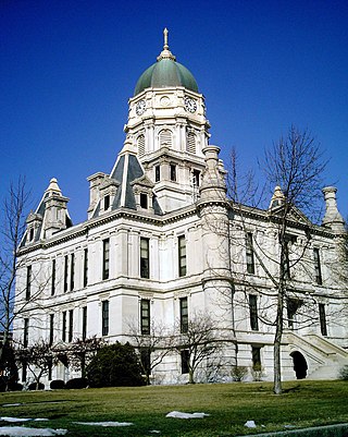
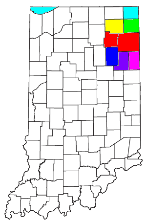
Whitley County is a rural county in the U.S. state of Indiana. As of the 2020 United States census, the population was 34,191. Whitley County is the 49th largest county in Indiana. The county seat is Columbia City. The county has the highest county number (92) on Indiana license plates, as it is alphabetically the last in the state's list of counties. It is part of the Fort Wayne Metropolitan Statistical Area and the Fort Wayne–Huntington–Auburn Combined Statistical Area.
New Washington is a census-designated place (CDP) in Clark County, Indiana, United States. As of the 2010 census, the population was 566.
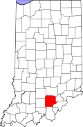
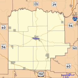
Fredericksburg is an unincorporated community in Posey Township, Washington County, in the U.S. state of Indiana. The population was 85 at the 2010 census, at the time it was a town.

The Louisville metropolitan area is the 43rd largest metropolitan statistical area (MSA) in the United States. It had a population of 1,395,855 in 2020 according to the latest official census, and its principal city is Louisville, Kentucky.
As of March 2020, the Fort Wayne–Huntington–Auburn Combined Statistical Area (CSA), or Fort Wayne Metropolitan Area, or Northeast Indiana is a federally designated metropolitan area consisting of eight counties in northeast Indiana, anchored by the city of Fort Wayne.

Franklin Township is one of thirteen townships in Washington County, Indiana, United States. As of the 2010 census, its population was 2,301 and it contained 874 housing units.

Pierce Township is one of thirteen townships in Washington County, Indiana, United States. As of the 2010 census, its population was 2,666 and it contained 1,146 housing units.

Polk Township is one of thirteen townships in Washington County, Indiana, United States. As of the 2010 census, its population was 2,626 and it contained 1,131 housing units.

South Boston is an unincorporated community in Franklin Township, Washington County, in the U.S. state of Indiana.

Blue Lick is an unincorporated community in Monroe Township, Clark County, Indiana, United States.
Owen is an unincorporated community in Owen Township, Clark County, Indiana.
Kent is an unincorporated community and census-designated place (CDP) in Republican Township, Jefferson County, Indiana, United States. As of the 2010 census it had a population of 70.
Needmore is an unincorporated community in Marshall Township, Lawrence County, Indiana.
New Philadelphia is an unincorporated community in Franklin Township, Washington County, in the U.S. state of Indiana.
Jaybird is an unincorporated community in Adams County, in the U.S. state of Ohio.
New Salem is an unincorporated community in Franklin Township, Washington County, in the U.S. state of Indiana.
Pumpkin Center is an unincorporated community in Gibson Township, Washington County, in the U.S. state of Indiana.
Georgetown is an unincorporated community in Gibson Township, Washington County, in the U.S. state of Indiana.
Bartle is an unincorporated community in Polk Township, Washington County, in the U.S. state of Indiana.

New Lebanon is an unincorporated community in Cooper County, in the U.S. state of Missouri. The community is on Missouri Route A between Otterville seven miles to the south and Pilot Grove seven miles to the north. The Lamine River flows past about two miles west of the community.