In 1787, the fledgling United States defined the Northwest Territory, which included the area of present-day Indiana. In 1800, Congress separated Ohio from the Northwest Territory, designating the rest of the land as the Indiana Territory.[3] President Thomas Jefferson chose William Henry Harrison as the territory's first governor, and Vincennes was established as the territorial capital.[4] After the Michigan Territory was separated and the Illinois Territory was formed, Indiana was reduced to its current size and geography.[3]
Starting in 1794, Native American titles to Indiana lands were extinguished by usurpation, purchase, or war and treaty. The United States acquired land from the Native Americans in the Treaty of Grouseland (1805), by which a large portion of the southern Indiana Territory became property of the government. This included the future Washington County. As early as 1802, a man named Frederick Royce lived among the Ox Indians at a place known as the Lick, two miles east of Salem and is probably the first white man to inhabit this county. He was a hunter-trader and salt manufacturer. In 1803, Thomas Hopper settled in this county near Hardinsburg. Washington County was created by act of the Territorial legislature dated December 21, 1813, taking territory from Harrison and Clark counties. Interim commissioners were named and directed to determine the proper choice of the seat of government. Accordingly, they began deliberating in January 1814, and by February 2 had selected an uninhabited site near the center, naming it 'Salem'.[5] In the territorial act creating the county, it was named for U.S. PresidentGeorge Washington,[6] who had died fourteen years earlier.
On September 1, 1814, the original boundary of Washington County was increased, by act of the Territorial legislature, but on December 26, 1815, much of this added territory was partitioned off to create Orange and Jackson counties.[7] In December 1816 the Indiana Territory was admitted to the Union as a state. On January 12, 1820, the state partitioned a further portion of Washington County to create Scott County.[8] In 1842, and again in 1873, the border between Scott and Washington counties was adjusted.
In 1808, the first Black settlers arrived in the area along with white Quakers. In 1815 they established the Blue River Meeting House northeast of Salem.[9][10] By 1850, 252 Black people had settled in the county, mainly living in Posey and Washington townships.[10] The passing into law in 1851 of a new state constitution, in which, Article 13 excluded further settlement of Black and mixed-race persons was indicative of increasing hostility towards this population and saw a decline in Black residents of the county to 187 by 1860.[10] In Posey Township, the population of 90 Black people in 1850 had decreased to zero by 1860.[10]
Whitecapping, the process by which rural citizens used threats or extralegal violence to force Black people out of the region, continued in Washington County during the Civil War. In December 1864, John Williams, a prosperous Black farmer in the county, was shot dead in the doorway of his home.[10][11] In 1867, Alexander White, an elderly man, was stabbed to death in Salem after repeatedly ignoring the threats of white attendees to quit coming to their church.[10][12][13] These lynchings convinced people the county was not safe and contributed to a continual exodus of Black people from the county.[14][10][15][16] In 1870, 18 Black people remained in the county, and by 1880 only three remained.[10]
Salem, the county seat, had become a sundown town by 1898 at the latest.[17] By the 20th century the entire county was officially sundown.[18] A county history from 1916 declared that, “Washington County has for several decades boasted that no colored man or woman lived within her borders.”[10][19] Sundown signs existed in the county, with one located near Canton, east of Salem.[16] Law enforcement would not allow Black people to stop in Salem, and would escort them to the county line.[20] Washington County remained sundown until 1990 at the latest, when 15 Black people were recorded living in Salem on that year's census.[20][16]
Geography
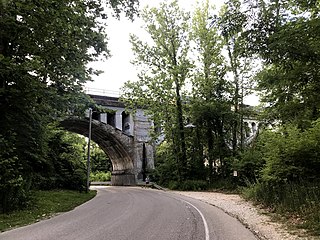
The low rolling hills of Washington County were tree-covered before settlement, but have been largely cleared and devoted to agriculture, although drainage areas are still wooded.[21] The north portion of the county is drained by the Muscatatuck River, which forms the eastern portion of the county's north border. The East Fork of the White River joins the Muscatatuck near the center of the county's north line. The south part of the county is drained by the Blue River, which rises in the county and flows southwestward into Harrison County on its way to the Ohio River. The highest point on the terrain (1,050 feet (320 meters) ASL) is an isolated rise two miles (3.2km) NNW from New Philadelphia in the eastern part.[22]
According to the 2010 census, the county has a total area of 516.60 square miles (1,338.0km2), of which 513.72 square miles (1,330.5km2) (or 99.44%) is land and 2.87 square miles (7.4km2) (or 0.56%) is water.[23]
In recent years, average temperatures in Salem have ranged from a low of 21°F (−6°C) in January to a high of 87°F (31°C) in July, although a record low of −32°F (−36°C) was recorded in February 1951 and a record high of 105°F (41°C) was recorded in July 1954. Average monthly precipitation ranged from 2.87 inches (73mm) in October to 4.86 inches (123mm) in May.[24]
Five people were reported killed in Washington County during the tornado outbreak of March 2–3, 2012.[25] Four were found dead in a home on Old Pekin Road according to Washington County officials.[citation needed] The fifth, a 15-month-old from the same family, had been found in a field, and died later in hospital.[26]
Government
United States presidential election results for Washington County, Indiana[27]
County Council: The legislative branch of the county government; controls spending and revenue collection in the county. Representatives are elected to four-year terms from county districts. They set salaries, the annual budget, and special spending. The council has limited authority to impose local taxes, in the form of an income and property tax that is subject to state level approval, excise taxes, and service taxes.[28][29]
Board of Commissioners: The executive body of the county; commissioners are elected county-wide, to staggered four-year terms. One commissioner serves as president. The commissioners execute the acts legislated by the council, collect revenue, and manage the county government.[28][29]
Court: There are two judges in Washington County. The Judge of the Circuit Court is the Hon. Robert L. Bennett (D). The Judge of the Superior Court is the Hon. Frank E. Newkirk Jr. (R). Case distribution is determined by local court rules. Each judge serves a six-year term.
County Officials: The county has other elected offices, including sheriff, coroner, auditor, treasurer, recorder, surveyor, and circuit court clerk. These officers are elected to four-year terms. Members elected to county government positions are required to declare party affiliations and to be residents of the county.[29]
As of the 2010 United States Census, there were 28,262 people, 10,850 households, and 7,799 families in the county.[36] The population density was 55.0 inhabitants per square mile (21.2/km2). There were 12,220 housing units at an average density of 23.8 per square mile (9.2/km2).[23] The racial makeup of the county was 98.1% white, 0.3% Asian, 0.2% American Indian, 0.2% black or African American, 0.3% from other races, and 0.9% from two or more races. Those of Hispanic or Latino origin made up 1.1% of the population.[36] In terms of ancestry, 25.2% were German, 14.3% were American, 13.7% were Irish, and 9.6% were English.[37]
Of the 10,850 households, 34.7% had children under the age of 18 living with them, 54.8% were married couples living together, 11.1% had a female householder with no husband present, 28.1% were non-families, and 23.7% of all households were made up of individuals. The average household size was 2.58 and the average family size was 3.02. The median age was 39.2 years.[36]
The median income for a household in the county was $47,697 and the median income for a family was $45,500. Males had a median income of $38,100 versus $28,092 for females. The per capita income for the county was $19,278. About 12.2% of families and 16.9% of the population were below the poverty line, including 24.7% of those under age 18 and 14.9% of those age 65 or over.[38]
Salem is a city in and the county seat of Marion County, Illinois, United States. The population was 7,282 at the 2020 census.
Tippecanoe County is located in the west-central portion of the U.S. state of Indiana about 22 miles east of the Illinois state line and less than 50 miles from the Chicago and the Indianapolis metro areas. As of the 2020 census, the population was 186,251. The county seat and largest city is Lafayette. It was created in 1826 from Wabash County portion of New Purchase and unorganized territory.
Steuben County is a county in the northeast corner of the U.S. state of Indiana. As of the 2020 United States Census the county population was 34,435. The county seat is Angola. Steuben County comprises the Angola, IN Micropolitan Statistical Area.
Randolph County is a county located in the central section of U.S. state of Indiana, on its eastern border with Ohio. As of 2020, the population was 24,502. The county seat is Winchester.
Pulaski County is a county located in the U.S. state of Indiana. According to the 2020 U.S. census, the population was 12,514. The county seat is Winamac.
Porter County is a county in the U.S. state of Indiana. As of 2020, the population was 173,215, making it the 10th most populous county in Indiana. The county seat is Valparaiso. The county is part of Northwest Indiana, as well as the Chicago metropolitan area. Porter County is the site of much of the Indiana Dunes, an area of ecological significance. The Hour Glass Museum in Ogden Dunes documents the region's ecological significance.
Owen County is a county in the U.S. state of Indiana. In 1920 the United States Census Bureau calculated the mean center of U.S. population to fall within this county. As of the 2020 United States Census, it had a population of 21,321. Its county seat is Spencer.
Orange County is located in southern Indiana in the United States. As of 2020, its population was 19,867. The county seat is Paoli. The county has four incorporated settlements with a total population of about 8,600, as well as several small unincorporated communities. It is divided into 10 townships which provide local services. One U.S. route and five Indiana state roads pass through or into the county.
Ohio County is a county located in southeastern Indiana. With a 2020 population of 5,940, and an area of just 87 square miles, Ohio County is the smallest county in Indiana by area and the least populous. The county seat and only incorporated municipality is Rising Sun. The county was officially established in 1844 and was one of the last Indiana counties to be created. Ohio County borders the state of Kentucky across the Ohio River for which it was named. It is part of the Cincinnati, OH-KY-IN Metropolitan Statistical Area. The county is divided into four townships which provide local services. Three state roads pass through or into the county.
Newton County is a county located near the northwestern corner of the U.S. state of Indiana. As of 2020, the population was 13,830. This county is part of Northwest Indiana as well as the Chicago metropolitan area. The county seat is Kentland. The county is divided into 10 townships which provide local services.
Madison County is a county in the U.S. state of Indiana. The 2020 census states the population is standing at 130,129. The county seat since 1836 has been Anderson, one of three incorporated cities within the county.
Harrison County is located in the far southern part of the U.S. state of Indiana along the Ohio River. The county was officially established in 1808. Its population was 39,654 as of the 2020 United States Census. Its county seat is Corydon, the former capital of Indiana.
Hancock County is a county in the U.S. state of Indiana. The 2020 United States Census recorded a population of 79,840. The county seat is Greenfield.
Carroll County is a county located in the U.S. state of Indiana. As of the 2020 United States Census, the population was 20,306. The county seat is Delphi.
Boone County is a county in the U.S. state of Indiana. As of 2020, the population was 70,812. The county seat is Lebanon.
Decatur is a city in Root and Washington townships, Adams County, Indiana, United States. It is the county seat of Adams County. Decatur is home to Adams Memorial Hospital, which was designated as one of the "Top 100" Critical Access Hospitals in the United States. The population of Decatur was 9,913 at the 2020 census, up from 9,405 at the 2010 census.
Avon is a town in Washington Township, Hendricks County, Indiana, United States. The population was 21,474 at the 2020 census. It is part of the Indianapolis metropolitan area.
Elwood is a city in Madison and Tipton counties in the U.S. state of Indiana. The Madison County portion, which is nearly all of the city, is part of the Indianapolis–Carmel–Anderson metropolitan statistical area. The population of Elwood was 8,410 at the 2020 census.
Salem is a city in and the county seat of Washington Township, Washington County, in the U.S. state of Indiana. The population was 6,319 at the 2010 census.
Salem is a census-designated place (CDP) in Burke County, North Carolina, United States. The population was 2,218 at the 2010 census. It is part of the Hickory–Lenoir–Morganton Metropolitan Statistical Area.
↑ Campney, Brent M.S. (2019). Hostile Heartland: Racism, Repression, and Resistance in the Midwest. Urbana: University of Illinois. ISBN978-0252042492.
1 2 3 Loewen, James W. (2005). Sundown Towns: A Hidden Dimension of American Racism. New York: New Press. ISBN9781565848870.
↑ "Singular Isolation". The Evening Item. Richmond, Indiana. October 24, 1903. p.6 – via Newspapers.com. She had seen many Indians in the pioneer days, but until she reached this city had never seen any person of African descent, as negroes are not allowed to live in Washington county.
↑ "Removal". Richmond Item. October 24, 1903. p.10. Retrieved April 28, 2022.
American Legion Pekin Post 203, The. History of Pekin, Indiana (1959). The American Legion Pekin Post 203
Everton Publishers, Inc, The. Handy book for Genealogists (1971). Everton Publishers, Inc.
History of Washington County 1884 (1884).
Indiana Historical Commission. Indiana History Bulletin (August 1924). Wm. B. Burford
B. F. Bowen & Co., Indianapolis, Indiana. Centennial History of Washington County, Indiana: Its People, Industries and Institution (1916). Warder W. Stevens
This page is based on this Wikipedia article Text is available under the CC BY-SA 4.0 license; additional terms may apply. Images, videos and audio are available under their respective licenses.