Noble County, Indiana

Last updated

Noble County
Noble County Indiana Courthouse.jpg
Noble County Courthouse in Albion
Map of Indiana highlighting Noble County.svg
Location within the U.S. state of Indiana
Indiana in United States.svg
Indiana's location within the U.S.
Coordinates: 41°24′N85°25′W / 41.4°N 85.42°W / 41.4; -85.42
CountryFlag of the United States.svg United States
StateFlag of Indiana.svg  Indiana
FoundedFebruary 7, 1835 (authorized)
1836 (organized)
Named for Governor Noah Noble
Seat Albion
Largest city Kendallville
Area
  Total417.43 sq mi (1,081.1 km2)
  Land410.84 sq mi (1,064.1 km2)
  Water6.59 sq mi (17.1 km2)  1.58%
Population
 (2020)
  Total47,457
  Density115.7/sq mi (44.7/km2)
Time zone UTC−5 (Eastern)
  Summer (DST) UTC−4 (EDT)
Congressional district 3rd
Website nobleco.squarespace.com
Indiana county number 57

Noble County is a county in the U.S. state of Indiana. As of the 2020 United States Census, the population was 47,457. [1] The county seat is Albion. [2] The county is divided into 13 townships which provide local services. [3] [4]

Contents

Noble County comprises the Kendallville, IN Micropolitan Statistical Area and is included in the Fort Wayne-Huntington-Auburn, IN Combined Statistical Area.

History

Noble County's government was organized beginning in 1836. The county was named for a family that was influential in Indiana politics at the time, including the Indiana governor at the time (1831-1837) Noah Noble and his brother, James, who served as the state's first senator after it gained statehood. [5]

Noble County's first homesteaders came from New England, known as "Yankees"; people descended from the English Puritans who settled New England in the 1600s. They were part of a wave of New Englanders who migrated west to what was then the Northwest Territory during the early 1800s. This migration was sparked as a result of the completion of the Erie Canal and conclusion of the Black Hawk War. They founded the towns of Kendallville and Albion. [6]

Geography

Noble County is in the state's northeast corner. Its low, rolling terrain is dotted with lakes and wetlands, but is otherwise entirely devoted to agriculture or urban development. [7] Its highest point (1,073 feet/327 meters ASL), Sand Hill in Wayne Township, near the county's north line with LaGrange County, [8] is the state's second-highest named point. [9] The Elkhart River flows from the NW part of the county into Elkhart County.

According to the 2010 United States Census, Noble County has a total area of 417.43 square miles (1,081.1 km2), of which 410.84 square miles (1,064.1 km2) (or 98.42%) is land and 6.59 square miles (17.1 km2) (or 1.58%) is water. [10]

Adjacent counties

Cities

Towns

Unincorporated communities

Townships

Major highways

Major lakes

  • Axel Lake
  • Bartley Lake
  • Big Lake
  • Bixler Lake
  • Bristol Lake
  • Cree Lake
  • Crooked Lake (part)
  • Diamond Lake
  • Eagle Lake
  • Engle Lake
  • Gordy Lake
  • Grannis Lake
  • Jones Lake
  • Knapp Lake
  • Latta Lake
  • Lindsey Lake
  • Little Long Lake
  • Loon Lake (part)
  • Lower Long Lake
  • Marl Lake
  • Millers Lake
  • Moore Lake
  • Moss Lake
  • Mud
  • Pleasant Lake
  • Port Mitchell Lake
  • Roudy Lake
  • Round Lake
  • Schockopee Lake
  • Skinner Lake
  • Sparta Lake
  • Summit Lake
  • Sylvan Lake
  • Upper Long Lake
  • Waldron Lake
  • West Lakes
  • Wible Lake [7]

Protected areas

  • Chain O'Lakes State Park
  • Eagle Lake Wetland Conservation Area
  • Hammer Wetland Nature Preserve
  • Mallard Roost Wetland Conservation Area
  • Mendenhall Wetland Conservation Area
  • Pioneer Trails Camp
  • Rome City Wetland Conservation Area
  • West Lakes Conservation Inc Tract [7]

Climate and weather

Albion, Indiana
Climate chart (explanation)
J
F
M
A
M
J
J
A
S
O
N
D
 
 
2.1
 
 
31
14
 
 
1.8
 
 
35
18
 
 
2.9
 
 
46
27
 
 
3.7
 
 
58
37
 
 
3.7
 
 
70
48
 
 
4.4
 
 
79
58
 
 
3.8
 
 
83
62
 
 
3.6
 
 
81
59
 
 
3.5
 
 
74
51
 
 
2.8
 
 
62
40
 
 
3.3
 
 
48
31
 
 
2.9
 
 
36
21
Average max. and min. temperatures in °F
Precipitation totals in inches
Source: The Weather Channel [11]
Metric conversion
J
F
M
A
M
J
J
A
S
O
N
D
 
 
54
 
 
−1
−10
 
 
46
 
 
2
−8
 
 
74
 
 
8
−3
 
 
93
 
 
14
3
 
 
94
 
 
21
9
 
 
113
 
 
26
14
 
 
97
 
 
28
17
 
 
91
 
 
27
15
 
 
89
 
 
23
11
 
 
71
 
 
17
4
 
 
84
 
 
9
−1
 
 
73
 
 
2
−6
Average max. and min. temperatures in °C
Precipitation totals in mm

In recent years, average temperatures in Albion have ranged from a low of 14 °F (−10 °C) in January to a high of 83 °F (28 °C) in July, although a record low of −24 °F (−31 °C) was recorded in January 1994 and a record high of 103 °F (39 °C) was recorded in June 1988. Average monthly precipitation ranged from 1.80 inches (46 mm) in February to 4.44 inches (113 mm) in June. [11]

Government

The county government is a constitutional body granted specific powers by the Constitution of Indiana and the Indiana Code. The county council is the legislative branch of the county government, controlling spending and revenue collection. Representatives are elected to four-year terms from county districts. The council members are responsible for setting salaries, the annual budget and special spending. The council has limited authority to impose local taxes, in the form of an income and property tax that is subject to state level approval, excise taxes and service taxes. [12] [13]

The executive body of the county is the board of commissioners. The commissioners are elected county-wide to staggered four-year terms. One commissioner serves as president. The commissioners execute the acts legislated by the council, collect revenue and manage the county government. [12] [13]

The county maintains a small claims court that handles civil cases. The judge on the court is elected to a term of four years and must be a member of the Indiana Bar Association. The judge is assisted by a constable who is elected to a four-year term. In some cases, court decisions can be appealed to the state level circuit court. [13]

The county has other elected offices, including sheriff, coroner, auditor, treasurer, recorder, surveyor and circuit court clerk. Each officer serves a term of four years and oversees a different part of county government. Members elected to county government positions are required to declare party affiliations and be residents of the county. [13]

Each township has a trustee who administers rural fire protection and ambulance service, provides poor relief and manages cemetery care, among other duties. [4] The trustee is assisted in these duties by a three-member township board. The trustees and board members are elected to four-year terms. [14]

Noble County is part of Indiana's 3rd congressional district and is represented by Jim Banks in the United States Congress. [15] It is part of Indiana Senate district 13 [16] and Indiana House of Representatives district 82. [17]

United States presidential election results for Noble County, Indiana [18]
Year Republican Democratic Third party
No.%No.%No.%
2020 14,19573.87%4,66024.25%3621.88%
2016 12,19871.32%3,90422.83%1,0025.86%
2012 10,68065.63%5,22932.13%3642.24%
2008 9,67356.88%7,06441.54%2701.59%
2004 10,85969.26%4,70330.00%1170.75%
2000 9,10364.03%4,82233.92%2912.05%
1996 6,78250.17%5,10137.73%1,63612.10%
1992 5,88342.90%4,41132.17%3,41924.93%
1988 7,88965.26%4,14334.27%570.47%
1984 8,45965.74%4,23732.93%1711.33%
1980 7,62457.40%4,72135.54%9377.05%
1976 6,88552.91%5,87545.15%2531.94%
1972 7,91664.75%4,25034.76%600.49%
1968 6,69951.35%5,07538.90%1,2729.75%
1964 5,68242.52%7,62157.03%600.45%
1960 8,06960.27%5,26439.32%540.40%
1956 8,17566.64%4,02832.84%640.52%
1952 8,20365.39%4,15133.09%1901.51%
1948 6,50357.33%4,67641.22%1651.45%
1944 7,20062.89%4,17436.46%740.65%
1940 7,44359.46%5,01440.06%600.48%
1936 5,76048.26%5,99050.18%1861.56%
1932 5,30444.32%6,53854.63%1261.05%
1928 6,33859.76%4,20739.67%600.57%
1924 5,79355.72%4,16340.04%4414.24%
1920 6,82060.82%4,14836.99%2452.18%
1916 3,41751.33%3,06946.10%1712.57%
1912 1,44322.89%2,88845.81%1,97331.30%
1908 3,50750.72%3,24946.99%1582.29%
1904 3,68355.57%2,78542.02%1602.41%
1900 3,10049.18%3,07748.82%1262.00%
1896 3,37251.78%3,07147.16%691.06%
1892 2,82347.09%2,87948.02%2934.89%
1888 3,02649.16%2,97948.39%1512.45%

Demographics

Historical population
CensusPop.Note
1840 2,702
1850 7,946194.1%
1860 14,91587.7%
1870 20,38936.7%
1880 22,95612.6%
1890 23,3591.8%
1900 23,5330.7%
1910 24,0092.0%
1920 22,470−6.4%
1930 22,404−0.3%
1940 22,7761.7%
1950 25,07510.1%
1960 28,16212.3%
1970 31,38211.4%
1980 35,44312.9%
1990 37,8776.9%
2000 46,27522.2%
2010 47,5362.7%
2020 47,457−0.2%
2023 (est.)47,430 [19] −0.1%
US Decennial Census [20]
1790-1960 [21] 1900-1990 [22]
1990-2000 [23] 2010-2013 [24] 2018 [25]

As of the 2010 United States Census, there were 47,536 people, 17,355 households, and 12,591 families in the county. [26] The population density was 115.7 inhabitants per square mile (44.7/km2). There were 20,109 housing units at an average density of 48.9 per square mile (18.9/km2). [10] The racial makeup of the county was 92.5% white, 0.4% black or African American, 0.4% Asian, 0.2% American Indian, 5.2% from other races, and 1.3% from two or more races. Those of Hispanic or Latino origin made up 9.6% of the population. [26] In terms of ancestry, 32.2% claimed German, 11.1% claimed American, 9.8% claimed Irish, and 8.5% claimed English. [27]

Of the 17,355 households, 35.9% had children under the age of 18 living with them, 57.2% were married couples living together, 10.0% had a female householder with no husband present, 27.5% were non-families, and 22.9% of all households were made up of individuals. The average household size was 2.69 and the average family size was 3.16. The median age was 37.1 years. [26]

The median income for a household in the county was $47,697 and the median income for a family was $53,959. Males had a median income of $40,335 versus $29,887 for females. The per capita income for the county was $19,783. About 7.6% of families and 11.4% of the population were below the poverty line, including 16.4% of those under age 18 and 6.5% of those age 65 or over. [28]

Education

School districts

See also

Related Research Articles

<span class="mw-page-title-main">Whitley County, Indiana</span> County in Indiana, United States

Whitley County is a rural county in the U.S. state of Indiana. As of the 2020 United States census, the population was 36,825. Whitley County is the 49th largest county in Indiana. The county seat is Columbia City. The county has the highest county number (92) on Indiana license plates, as it is alphabetically the last in the state's list of counties. It is part of the Fort Wayne Metropolitan Statistical Area and the Fort Wayne–Huntington–Auburn Combined Statistical Area.

<span class="mw-page-title-main">Steuben County, Indiana</span> County in Indiana, United States

Steuben County is a county in the northeast corner of the U.S. state of Indiana. As of the 2020 United States Census the county population was 34,435. The county seat is Angola. Steuben County comprises the Angola, IN Micropolitan Statistical Area.

<span class="mw-page-title-main">Owen County, Indiana</span> County in Indiana, United States

Owen County is a county in the U.S. state of Indiana. In 1920 the United States Census Bureau calculated the mean center of U.S. population to fall within this county. As of the 2020 United States Census, it had a population of 21,321. Its county seat is Spencer.

<span class="mw-page-title-main">Newton County, Indiana</span> County in Indiana, United States

Newton County is a county located near the northwestern corner of the U.S. state of Indiana. As of 2020, the population was 13,830. This county is part of Northwest Indiana as well as the Chicago metropolitan area. The county seat is Kentland. The county is divided into 10 townships which provide local services.

<span class="mw-page-title-main">Miami County, Indiana</span> County in Indiana, United States

Miami County is a county located in the U.S. state of Indiana. As of 2020, the population was 35,962. The county seat is the City of Peru. Miami County is part of the Kokomo-Peru CSA.

<span class="mw-page-title-main">Marshall County, Indiana</span> County in Indiana, United States

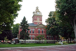
Marshall County is a county in the U.S. state of Indiana. The 2020 census recorded the population at 46,095. The county seat is Plymouth.

<span class="mw-page-title-main">LaGrange County, Indiana</span> County in Indiana, United States

LaGrange County is a county located in the U.S. state of Indiana. As of 2020, the population was 40,446. The county seat is LaGrange, Indiana.

<span class="mw-page-title-main">Kosciusko County, Indiana</span> County in Indiana, United States

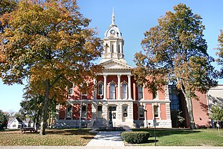
Kosciusko County is a county in the U.S. state of Indiana. At the 2020 United States Census, its population was 80,240. The county seat is Warsaw.

<span class="mw-page-title-main">Franklin County, Indiana</span> County in Indiana, United States

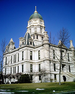
Franklin County is a county on the eastern border of the U.S. state of Indiana. In the 2020 United States Census, the county population was 22,785. The county seat is the town of Brookville. Franklin County is part of the Cincinnati, OH–KY–IN Metropolitan Statistical Area. The only incorporated city in Franklin County is Batesville, which lies mostly in adjoining Ripley County.

<span class="mw-page-title-main">Elkhart County, Indiana</span> County in Indiana, United States

Elkhart County is a county located in the U.S. state of Indiana. As of 2020, the county's population was 207,047. The county seat is Goshen. Elkhart County is part of the Elkhart-Goshen Metropolitan Statistical Area, which in turn is part of the South Bend-Elkhart-Mishawaka Combined Statistical Area. It is also considered part of the broader region of Northern Indiana known as Michiana, and is 20 miles (32 km) east of South Bend, Indiana, 110 miles (180 km) east of Chicago, Illinois, and 150 miles (240 km) north of Indianapolis, Indiana. The area is referred to by locals as the recreation vehicle (RV) capital of the world and is known for its sizable Amish and Old Order Mennonite population.

<span class="mw-page-title-main">Decatur County, Indiana</span> County in Indiana, United States

Decatur County is a county in the U.S. state of Indiana. As of the 2020 United States Census, the population was 26,472. The county seat is Greensburg.

<span class="mw-page-title-main">Bristol, Indiana</span> Town in Indiana, United States

Bristol is a town in Washington Township, Elkhart County, Indiana, United States. The population was 1,602 at the 2010 census.

<span class="mw-page-title-main">Dunlap, Indiana</span> Census-designated place in Indiana, United States

Dunlap is a census-designated place (CDP) in Elkhart County, Indiana, United States. The population was 6,235 at the 2010 census. Once a small farming community, by the 1980s it had become a suburb of Elkhart and Goshen, Indiana. Most of the town was destroyed by two violent F4 tornadoes during the Palm Sunday Tornado Outbreak on April 11, 1965.

<span class="mw-page-title-main">Wakarusa, Indiana</span> Town in Indiana, United States

Wakarusa is a town in Harrison and Olive townships in Elkhart County, Indiana, United States. The population was 1,758 at the 2010 census.

<span class="mw-page-title-main">Wolcottville, Indiana</span> Town in Indiana, United States

Wolcottville is a town in Orange Township, Noble County and Johnson Township, LaGrange County in the U.S. state of Indiana. The population was 998 at the 2010 census.

<span class="mw-page-title-main">Albion, Indiana</span> Town in Indiana, United States

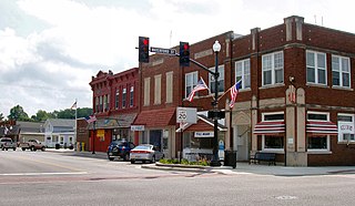
Albion is a town in Albion and Jefferson townships, Noble County, in the U.S. state of Indiana. The population was 2,349 at the 2010 census. The city is the county seat of Noble County.

<span class="mw-page-title-main">Kendallville, Indiana</span> City in Indiana, United States

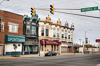
Kendallville is a city in Wayne Township, Noble County, in the U.S. state of Indiana. The population was 10,205 at the 2021 census.

<span class="mw-page-title-main">Rome City, Indiana</span> Town in Indiana, United States

Rome City is a town in Orange Township, Noble County, in the U.S. state of Indiana. The population was 1,361 at the 2010 census.

<span class="mw-page-title-main">North Shenango Township, Pennsylvania</span> Township in Pennsylvania, United States

North Shenango Township is a township in Crawford County, Pennsylvania, United States. The population was 1,274 at the 2020 census, down from 1,410 at the 2010 census.

<span class="mw-page-title-main">Thorncreek Township, Whitley County, Indiana</span> Township in Indiana, United States

Thorncreek Township is one of nine townships in Whitley County, Indiana, United States. As of the 2020 census, its population was 4,159 and it contained 1,909 housing units.

References

  1. "2020 Population and Housing State Data".
  2. "Find a County – Newton County IN". National Association of Counties. Archived from the original on December 11, 2017. Retrieved November 15, 2011.
  3. "Noble". Indiana Township Association. Archived from the original on April 15, 2012. Retrieved November 15, 2011.
  4. 1 2 "Duties". United Township Association of Indiana. Retrieved January 6, 2011.
  5. De Witt Clinton Goodrich & Charles Richard Tuttle (1875). An Illustrated History of the State of Indiana. Indiana: R. S. Peale & co. p.  568.
  6. Alvord's History of Noble County, Indiana ...: To Which Is Appended a Comprehensive Compendium of Local Biography - Memoirs of Representative Men and Women of the County, Whose Works of Merit Have Made Their Names Imperishable .. - Primary Source Edition
  7. 1 2 3 Noble County IN (Google Maps, accessed 29 July 2020)
  8. Sand Hill IN (PeakBagger.com, accessed 29 July 2020)
  9. "Sand Hill". Geographic Names Information System . United States Geological Survey, United States Department of the Interior.
  10. 1 2 "Population, Housing Units, Area, and Density: 2010 - County". US Census Bureau. Archived from the original on February 12, 2020. Retrieved July 10, 2015.
  11. 1 2 "Monthly Averages for Albion IN". The Weather Channel. Retrieved January 27, 2011.
  12. 1 2 Indiana Code. "Title 36, Article 2, Section 3". Government of Indiana. Retrieved September 16, 2008.
  13. 1 2 3 4 Indiana Code. "Title 2, Article 10, Section 2" (PDF). Government of Indiana. Retrieved September 16, 2008.
  14. "Government". United Township Association of Indiana. Retrieved January 6, 2011.
  15. "US Congressman Mark Souder". US Congress. Archived from the original on October 9, 2008. Retrieved October 8, 2008.
  16. "Indiana Senate District map". State of Indiana. Retrieved August 29, 2011.
  17. "Indiana House District map". State of Indiana. Retrieved August 29, 2018.
  18. Leip, David. "Atlas of US Presidential Elections". uselectionatlas.org. Retrieved May 18, 2018.
  19. "Annual Estimates of the Resident Population for Counties: April 1, 2020 to July 1, 2023". United States Census Bureau. Retrieved April 2, 2024.
  20. "US Decennial Census". US Census Bureau. Retrieved July 10, 2014.
  21. "Historical Census Browser". University of Virginia Library. Retrieved July 10, 2014.
  22. "Population of Counties by Decennial Census: 1900 to 1990". US Census Bureau. Retrieved July 10, 2014.
  23. "Census 2000 PHC-T-4. Ranking Tables for Counties: 1990 and 2000" (PDF). US Census Bureau. Retrieved July 10, 2014.
  24. "Noble County QuickFacts". United States Census Bureau. Archived from the original on June 7, 2011. Retrieved September 25, 2011.
  25. "QuickFacts. Noble County IN". US Census Bureau. Retrieved July 26, 2019.
  26. 1 2 3 "Profile of General Population and Housing Characteristics: 2010 Demographic Profile Data". US Census Bureau. Archived from the original on February 13, 2020. Retrieved July 10, 2015.
  27. "Selected Social Characteristics in the US – 2006-2010 American Community Survey 5-Year Estimates". US Census Bureau. Archived from the original on February 14, 2020. Retrieved July 10, 2015.
  28. "Selected Economic Characteristics – 2006-2010 American Community Survey 5-Year Estimates". US Census Bureau. Archived from the original on February 14, 2020. Retrieved July 10, 2015.

41°24′N85°25′W / 41.40°N 85.42°W / 41.40; -85.42