Vera Cruz, Indiana

Last updated

Vera Cruz, Indiana
Vera-cruz, Indiana.jpg
Wells County Indiana Incorporated and Unincorporated areas Vera Cruz Highlighted 1878776.svg
Location of Vera Cruz in Wells County, Indiana.
Coordinates: 40°42′06″N85°04′46″W / 40.70167°N 85.07944°W / 40.70167; -85.07944
Country United States
State Indiana
County Wells
Township Harrison
Area
[1]
  Total0.10 sq mi (0.26 km2)
  Land0.10 sq mi (0.26 km2)
  Water0.00 sq mi (0.00 km2)
Elevation
[2]
827 ft (252 m)
Population
 (2020)
  Total72
  Density712.87/sq mi (274.01/km2)
Time zone UTC−05:00 (Eastern (EST))
  Summer (DST) UTC−04:00 (EDT)
ZIP code
46714
Area code 260
FIPS code 18-78776 [3]
GNIS feature ID2397712 [2]

Vera Cruz is a town in Harrison Township, Wells County, in the U.S. state of Indiana. [2] The population was 80 at the 2010 census.

Contents

History

Vera Cruz was laid out in 1848, and was named after Veracruz, Mexico. Originally, the town was named Newville, but the US Post Office had to have the name changed because there was another town named Newville in DeKalb County, Indiana. When selecting a county seat, Wells county chose between Newville and Bluffton because, at the time, they were about the same size. Ultimately, Bluffton was named the county seat, probably because of its more central location in Wells County. [4] A post office was established at Vera Cruz in 1850, and remained in operation until it was discontinued in 1942. [5]

Geography

According to the 2010 census, Vera Cruz has a total area of 0.101 square miles (0.26 km2), of which 0.1 square miles (0.26 km2) (or 99.01%) is land and 0.001 square miles (0.00 km2) (or 0.99%) is water. [6]

Demographics

Historical population
CensusPop.Note
1880 260
1890 233−10.4%
1900 199−14.6%
1910 133−33.2%
1920 113−15.0%
1930 94−16.8%
1940 14251.1%
1950 1430.7%
1960 17623.1%
1970 140−20.5%
1980 117−16.4%
1990 83−29.1%
2000 55−33.7%
2010 8045.5%
2020 72−10.0%
U.S. Decennial Census [7]

2010 census

As of the census [8] of 2010, there were 80 people, 31 households, and 24 families living in the town. The population density was 800.0 inhabitants per square mile (308.9/km2). There were 32 housing units at an average density of 320.0 per square mile (123.6/km2). The racial makeup of the town was 93.8% White, 5.0% from other races, and 1.3% from two or more races. Hispanic or Latino of any race were 5.0% of the population.

There were 31 households, of which 41.9% had children under the age of 18 living with them, 61.3% were married couples living together, 6.5% had a female householder with no husband present, 9.7% had a male householder with no wife present, and 22.6% were non-families. 19.4% of all households were made up of individuals. The average household size was 2.58 and the average family size was 2.92.

The median age in the town was 28 years. 27.5% of residents were under the age of 18; 13.9% were between the ages of 18 and 24; 28.9% were from 25 to 44; 20.1% were from 45 to 64; and 10% were 65 years of age or older. The gender makeup of the town was 50.0% male and 50.0% female.

2000 census

As of the census [3] of 2000, there were 55 people, 24 households, and 13 families living in the town. The population density was 635.1 inhabitants per square mile (245.2/km2). There were 25 housing units at an average density of 288.7 per square mile (111.5/km2). The racial makeup of the town was 98.18% White, 1.82% from other races. Hispanic or Latino of any race were 1.82% of the population.

There were 24 households, out of which 33.3% had children under the age of 18 living with them, 54.2% were married couples living together, 4.2% had a female householder with no husband present, and 41.7% were non-families. 41.7% of all households were made up of individuals, and 29.2% had someone living alone who was 65 years of age or older. The average household size was 2.29 and the average family size was 3.21.

In the town, the population was spread out, with 29.1% under the age of 18, 14.5% from 18 to 24, 18.2% from 25 to 44, 14.5% from 45 to 64, and 23.6% who were 65 years of age or older. The median age was 34 years. For every 100 females, there were 96.4 males. For every 100 females age 18 and over, there were 105.3 males.

The median income for a household in the town was $20,625, and the median income for a family was $36,250. Males had a median income of $31,250 versus $25,000 for females. The per capita income for the town was $11,963. None of the population and none of the families were below the poverty line.

Related Research Articles

<span class="mw-page-title-main">Jamestown, Indiana</span> Town in Indiana, United States

Jamestown is a town in Jackson Township, Boone County and Eel River Township, Hendricks County, Indiana, United States. The population was 958 at the 2010 census.

<span class="mw-page-title-main">Mount Carmel, Indiana</span> Town in Indiana, United States

Mount Carmel is a town in Springfield Township, Franklin County, Indiana, United States. The population was 86 at the 2010 census.

<span class="mw-page-title-main">Lizton, Indiana</span> Town in Indiana, United States

Lizton is a town in Union Township, Hendricks County, Indiana, United States. The population was 488 at the 2010 Census. It is one of the three towns that make up North West Hendricks School Corporation.

<span class="mw-page-title-main">North Salem, Indiana</span> Town in Indiana, United States

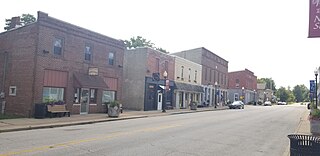
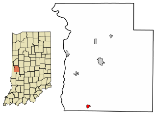
North Salem is a town in Eel River Township, Hendricks County, Indiana, United States. The population was 518 at the 2010 Census.

<span class="mw-page-title-main">Mount Etna, Indiana</span> Town in Indiana, United States

Mount Etna is a town in Huntington County, Indiana, United States. The population was 94 at the 2010 census. It lies at the intersection of four townships: Jefferson, Lancaster, Polk and Wayne.

<span class="mw-page-title-main">Milford, Kosciusko County, Indiana</span> Town in Indiana, United States

Milford is a town in Van Buren Township, Kosciusko County, in the U.S. state of Indiana. The population was 1,614 at the 2020 census.

<span class="mw-page-title-main">Wolcottville, Indiana</span> Town in Indiana, United States

Wolcottville is a town in Orange Township, Noble County and Johnson Township, LaGrange County in the U.S. state of Indiana. The population was 998 at the 2010 census.

<span class="mw-page-title-main">River Forest, Indiana</span> Town in Indiana, United States

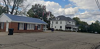
River Forest is a town in Anderson Township, Madison County, Indiana, United States. It is part of the Indianapolis–Carmel–Anderson metropolitan statistical area. The population was 26 at the 2020 census.

New Richmond is a town in Coal Creek Township, Montgomery County, in the U.S. state of Indiana. The population was 309 at the 2020 census.

<span class="mw-page-title-main">Rising Sun, Indiana</span> City in Indiana, United States

Rising Sun is a city in Randolph Township and the county seat of Ohio County, Indiana, United States, along the Ohio River. It is also the only incorporated community in the county. The population of Rising Sun was 2,304 at the 2010 census.

<span class="mw-page-title-main">Rosedale, Indiana</span> Town in Indiana, United States

Rosedale is a town in Florida Township, Parke County, in the U.S. state of Indiana. The population was 725 at the 2010 census.

<span class="mw-page-title-main">Ridgeville, Indiana</span> Town in Indiana, United States

Ridgeville is a town in Franklin Township, Randolph County, Indiana, United States, along the Mississinewa River. The population was 688 at the 2020 census.

<span class="mw-page-title-main">Economy, Indiana</span> Town in Indiana, United States

Economy is a town in Perry Township, Wayne County, in the U.S. state of Indiana. The population was 173 at the 2021 census.

<span class="mw-page-title-main">Fountain City, Indiana</span> Town in Indiana, United States

Fountain City, formerly Newport, is a town in New Garden Township, Wayne County, in the U.S. state of Indiana. The population was 796 at the 2010 census.

<span class="mw-page-title-main">Whitewater, Indiana</span> Town in Indiana, United States

Whitewater is a town in Franklin Township, Wayne County, in the U.S. state of Indiana. The population was 83 at the 2010 census.

<span class="mw-page-title-main">Bluffton, Indiana</span> City in Indiana, United States

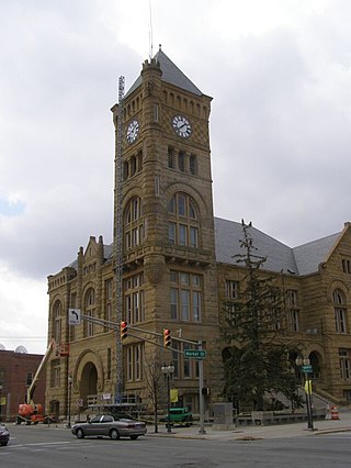
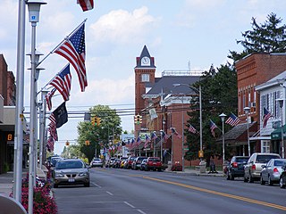
Bluffton is a city in and the county seat of Wells County, Indiana, United States. The population was 10,308 at the 2020 census, up from 9,897 at the 2010 census. Bluffton is nicknamed the "Parlor City" for its history of having some of the first clean paved streets in the area during the time of the Indiana gas boom.

<span class="mw-page-title-main">Ossian, Indiana</span> Town in Indiana, United States

Ossian is a town in Jefferson Township, Wells County, in the U.S. state of Indiana. The town was named after Ossian, the narrator of a cycle of epic poems by the Scottish poet James Macpherson. The population was 3,289 at the 2010 census.

<span class="mw-page-title-main">Uniondale, Indiana</span> Town in Indiana, United States

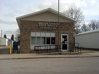
Uniondale is a town in Union and Rockcreek townships, Wells County, in the U.S. state of Indiana. The population was 310 at the 2010 census, down from 271 at the 2020 Census.

<span class="mw-page-title-main">Bluffton, Minnesota</span> City in Minnesota, United States

Bluffton is a city in Otter Tail County, Minnesota, United States, along the Leaf River. The population was 210 at the 2020 census.

<span class="mw-page-title-main">Bluffton, Ohio</span> Village in Ohio, United States

Bluffton, originally known as Shannon, is a village in Allen and Hancock counties in the U.S. state of Ohio. The population was 3,967 at the 2020 census. Bluffton is home to Bluffton University, a four-year educational institution affiliated with Mennonite Church USA. Bluffton is served by the Bluffton general aviation airport. Bluffton participates in the Tree City USA program.

References

  1. "2020 U.S. Gazetteer Files". United States Census Bureau. Retrieved March 16, 2022.
  2. 1 2 3 U.S. Geological Survey Geographic Names Information System: Vera Cruz, Indiana
  3. 1 2 "U.S. Census website". United States Census Bureau . Retrieved January 31, 2008.
  4. Baker, Ronald L. (October 1995). From Needmore to Prosperity: Hoosier Place Names in Folklore and History . Indiana University Press. p.  333. ISBN   978-0-253-32866-3. ...laid out on September 21, 1848, and named for the Mexican city...
  5. "Wells County". Jim Forte Postal History. Retrieved July 6, 2016.
  6. "G001 - Geographic Identifiers - 2010 Census Summary File 1". United States Census Bureau. Archived from the original on February 13, 2020. Retrieved July 25, 2015.
  7. "Census of Population and Housing". Census.gov. Retrieved June 4, 2015.
  8. "U.S. Census website". United States Census Bureau . Retrieved December 11, 2012.