Waterloo, Indiana

Last updated

Waterloo, Indiana
DeKalb County Indiana Incorporated and Unincorporated areas Waterloo Highlighted 1881278.svg
Location of Waterloo in DeKalb County, Indiana.
Coordinates: 41°25′50″N85°01′24″W / 41.43056°N 85.02333°W / 41.43056; -85.02333
Country United States
State Indiana
County DeKalb
Township Grant, Smithfield
Area
[1]
  Total2.11 sq mi (5.47 km2)
  Land2.11 sq mi (5.47 km2)
  Water0.00 sq mi (0.00 km2)
Elevation
[2]
915 ft (279 m)
Population
 (2020)
  Total2,116
  Density1,002.84/sq mi (387.16/km2)
Time zone UTC-5 (Eastern (EST))
  Summer (DST) UTC-4 (EDT)
ZIP code
46793
Area code 260
FIPS code 18-81278 [3]
GNIS feature ID2397725 [2]

Waterloo is a town in Grant and Smithfield townships, DeKalb County, Indiana, United States. The population was 2,116 at the 2020 census.

Contents

History

Waterloo was laid out in 1856 when the railroad was extended to that point. [4] It was likely named after Waterloo, in Belgium. [5]

The Waterloo Community Mausoleum was added to the National Register of Historic Places in 2014. [6]

Geography

Historic houses in Waterloo Waterloo, Indiana, USA.jpg
Historic houses in Waterloo

According to the 2010 census, Waterloo has a total area of 1.74 square miles (4.51 km2), all land. [7]

A nearly complete mastodon skeleton discovered near Waterloo in 1888 is displayed at the Carnegie Museum of Natural History in Pittsburgh. [8]

Demographics

Historical population
CensusPop.Note
1860 343
1870 1,259267.1%
1880 1,3769.3%
1890 1,4787.4%
1900 1,244−15.8%
1910 1,167−6.2%
1920 1,1720.4%
1930 1,2446.1%
1940 1,2571.0%
1950 1,41412.5%
1960 1,4321.3%
1970 1,87631.0%
1980 1,9514.0%
1990 2,0404.6%
2000 2,2007.8%
2010 2,2421.9%
2020 2,116−5.6%
U.S. Decennial Census [9]
Waterloo, Indiana from 1876 Illustrated Historical Atlas of the State of Indiana, Baskin, Forster, Co., Chicago. Waterloo, Indiana 1876.PNG
Waterloo, Indiana from 1876 Illustrated Historical Atlas of the State of Indiana, Baskin, Forster, Co., Chicago.

2010 census

As of the census [10] of 2010, there were 2,242 people, 809 households, and 577 families living in the town. The population density was 1,288.5 inhabitants per square mile (497.5/km2). There were 942 housing units at an average density of 541.4 per square mile (209.0/km2). The racial makeup of the town was 95.3% White, 0.5% African American, 0.1% Native American, 1.7% from other races, and 2.4% from two or more races. Hispanic or Latino of any race were 3.8% of the population.

There were 809 households, of which 42.5% had children under the age of 18 living with them, 48.1% were married couples living together, 16.8% had a female householder with no husband present, 6.4% had a male householder with no wife present, and 28.7% were non-families. 23.4% of all households were made up of individuals, and 7.5% had someone living alone who was 65 years of age or older. The average household size was 2.77 and the average family size was 3.19.

The median age in the town was 31.5 years. 30% of residents were under the age of 18; 10.1% were between the ages of 18 and 24; 29.1% were from 25 to 44; 22.9% were from 45 to 64; and 8% were 65 years of age or older. The gender makeup of the town was 50.6% male and 49.4% female.

2000 census

As of the census [3] of 2000, there were 2,200 people, 832 households, and 584 families living in the town. The population density was 1,466.6 inhabitants per square mile (566.3/km2). There were 898 housing units at an average density of 598.7 per square mile (231.2/km2). The racial makeup of the town was 95.50% White, 0.23% African American, 0.45% Native American, 0.18% Asian, 2.82% from other races, and 0.82% from two or more races. Hispanic or Latino of any race were 3.68% of the population.

There were 832 households, out of which 39.1% had children under the age of 18 living with them, 52.3% were married couples living together, 11.8% had a female householder with no husband present, and 29.7% were non-families. 23.8% of all households were made up of individuals, and 8.4% had someone living alone who was 65 years of age or older. The average household size was 2.64 and the average family size was 3.10.

In the town, the population was spread out, with 30.4% under the age of 18, 9.5% from 18 to 24, 33.0% from 25 to 44, 18.8% from 45 to 64, and 8.4% who were 65 years of age or older. The median age was 31 years. For every 100 females, there were 106.4 males. For every 100 females age 18 and over, there were 100.8 males.

The median income for a household in the town was $39,831, and the median income for a family was $45,625. Males had a median income of $35,035 versus $24,635 for females. The per capita income for the town was $16,248. About 7.9% of families and 12.4% of the population were below the poverty line, including 16.8% of those under age 18 and 17.8% of those age 65 or over.

Education

Waterloo lies in the Dekalb County Central United School District. Public schools serving Waterloo are:

The town is served by the Waterloo-Grant Township Public Library, one of four public libraries in Dekalb County. It is a Carnegie library that opened in 1913. [11]

Rail transportation

Waterloo is located on the old Lake Shore and Michigan Southern Railway, and is now on the Norfolk Southern Railway. The town is now served daily by two Amtrak trains: the Capitol Limited and the Lake Shore Limited .

In October 2010, the Town of Waterloo received a $1.8 million grant from the federal government to build a longer platform just east of the current station, bringing it up to ADA standards, and add a canopy, lighting, and interactive signage. [12] Ultimately, the platform was not built, but the grant was used to install the lighting and electronic signage, as well as a parking lot, in 2016. The previous rail depot, which was restored in 2010, was moved closer to the existing platform and reopened to Amtrak passengers.

Media

WINT-TV, Channel 15, which became WANE-TV, Fort Wayne, in 1956, began broadcasting from studios in Waterloo in 1954.

Related Research Articles

<span class="mw-page-title-main">Henagar, Alabama</span> City in Alabama, United States

Henagar is a city in DeKalb County, Alabama, United States. At the 2020 census, the population was 2,292.

<span class="mw-page-title-main">Monroe, Adams County, Indiana</span> Town in Indiana, United States

Monroe is a town in Washington and Monroe townships, Adams County, Indiana, United States. The population of the town was 945 residents at the 2019 census. Adams Central Community Schools is located in Monroe.

<span class="mw-page-title-main">Milltown, Indiana</span> Town in Indiana, United States

Milltown is a town in Whiskey Run Township in Crawford County, Indiana and in Blue River and Spencer townships in Harrison County. The population was 818 at the time of the 2010 census.

<span class="mw-page-title-main">Altona, Indiana</span> Town in Indiana, United States

Altona is a town in Keyser Township, DeKalb County, Indiana, United States. The population was 197 at the 2010 census.

<span class="mw-page-title-main">Ashley, Indiana</span> Town in Indiana, United States

Ashley is a town in Indiana located on the border of Smithfield Township, DeKalb County and Steuben Township, Steuben County. The population was 983 at the 2010 census.

<span class="mw-page-title-main">Butler, Indiana</span> City in Indiana, United States

Butler is a city in DeKalb County, Indiana, United States. The population was 2,684 at the 2010 census.

<span class="mw-page-title-main">Corunna, Indiana</span> Town in Indiana, United States

Corunna is a town in Richland Township, DeKalb County, Indiana, United States. The population was 236 at the 2020 census estimate.

<span class="mw-page-title-main">Garrett, Indiana</span> Town in Indiana, United States

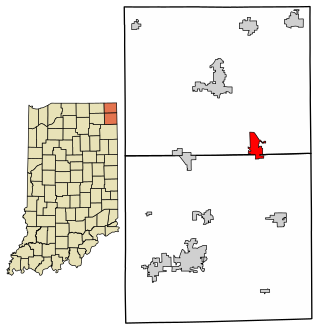
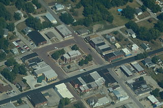
Garrett is a city in Keyser Township, DeKalb County, Indiana, United States. The population was 6,286 at the 2010 census.

<span class="mw-page-title-main">Hamilton, Indiana</span> Town in Indiana, United States

Hamilton is a town located on the border of Steuben County, Indiana and DeKalb County, Indiana. In Steuben County, it is in Otsego Township, and in DeKalb County it is in Franklin Township. The population was 1,532 at the 2010 census.

<span class="mw-page-title-main">Saint Joe, Indiana</span> Place in Indiana, United States

Saint Joe is a town in Concord Township, DeKalb County, Indiana, United States. The population was 460 at the 2010 census.

<span class="mw-page-title-main">Albany, Indiana</span> Town in Indiana, United States

Albany is a town in Delaware and Randolph counties in the U.S. state of Indiana, along the Mississinewa River. The population was 2,295 at the 2020 census. It is part of the Muncie, IN Metropolitan Statistical Area.

<span class="mw-page-title-main">Shirley, Indiana</span> Town in Indiana, United States

Shirley is a town in Brown Township, Hancock County and Greensboro Township, Henry County, Indiana, United States. The population was 830 at the 2010 census.

<span class="mw-page-title-main">Paragon, Indiana</span> Town in Indiana, United States

Paragon is a town in Ray Township, Morgan County, in the U.S. state of Indiana. The population was 556 at the 2020 census, down from 659 in 2010.

<span class="mw-page-title-main">Maysville, Missouri</span> City in Missouri, United States

Maysville is a city in DeKalb County, Missouri, United States. The population was 1,095 at the 2020 census. Maysville is the county seat of DeKalb County.

<span class="mw-page-title-main">Weatherby, Missouri</span> Village in Missouri, United States

Weatherby is a village in eastern DeKalb County, Missouri, United States. The population was 80 at the 2020 census. It is part of the St. Joseph, MO–KS Metropolitan Statistical Area.

<span class="mw-page-title-main">Waterloo, Oregon</span> City in Oregon, United States

Waterloo is a city in Linn County, Oregon, United States. The population was 229 at the 2010 census.

<span class="mw-page-title-main">Meridian Hills, Indiana</span> Town in Indiana, United States

Meridian Hills is a town in Washington Township, Marion County, Indiana, about 8 miles (13 km) north of downtown Indianapolis. It had a population of 1,774 at the 2020 census, up from 1,616 in 2010.

<span class="mw-page-title-main">Afton Township, DeKalb County, Illinois</span> Township in Illinois, United States

Afton Township is one of nineteen townships in DeKalb County, Illinois, USA. As of the 2020 census, its population was 901 and it contained 384 housing units.

<span class="mw-page-title-main">Cortland Township, DeKalb County, Illinois</span> Township in Illinois, United States

Cortland Township is one of nineteen townships in DeKalb County, Illinois, USA. As of the 2020 census, its population was 11,244 and it contained 4,357 housing units. Cortland Township was originally named Richland Township, but was renamed to Pampas Township on November 20, 1850; it was renamed to Cortland Township on February 1, 1865.

<span class="mw-page-title-main">DeKalb Township, DeKalb County, Illinois</span> Township in Illinois, United States

DeKalb Township is one of nineteen townships in DeKalb County, Illinois, USA. As of the 2020 census, its population was 42,667 and it contained 18,004 housing units. DeKalb Township was originally named Orange Township, but was renamed on November 20, 1850.

References

  1. "2020 U.S. Gazetteer Files". United States Census Bureau. Retrieved March 16, 2022.
  2. 1 2 U.S. Geological Survey Geographic Names Information System: Waterloo, Indiana
  3. 1 2 "U.S. Census website". United States Census Bureau . Retrieved January 31, 2008.
  4. History of DeKalb County, Indiana: Together with Sketches of Its Cities, Villages and Towns. Inter-State Publishing Company. 1885. pp. 830–831.
  5. Baker, Ronald L. (October 1995). From Needmore to Prosperity: Hoosier Place Names in Folklore and History. Indiana University Press. p. 339. ISBN   978-0-253-32866-3. ..apparently named for the Belgian village....
  6. "National Register of Historic Places Listings". Weekly List of Actions Taken on Properties: 3/24/14 through 3/28/14. National Park Service. April 4, 2014.
  7. "G001 - Geographic Identifiers - 2010 Census Summary File 1". United States Census Bureau. Archived from the original on February 13, 2020. Retrieved July 25, 2015.
  8. Mastodon skeleton
  9. "Census of Population and Housing". Census.gov. Retrieved June 4, 2015.
  10. "U.S. Census website". United States Census Bureau . Retrieved December 11, 2012.
  11. "Indiana public library directory" (PDF). Indiana State Library. Retrieved March 7, 2018.
  12. "Gravy train for Waterloo". The Journal-Gazette (Fort Wayne, Indiana). October 23, 2010. Retrieved October 23, 2010.