
Noble County is a county in the U.S. state of Indiana. As of the 2020 United States Census, the population was 47,457. The county seat is Albion. The county is divided into 13 townships which provide local services.
Kendallville is a city in Wayne Township, Noble County, in the U.S. state of Indiana. The population was 10,205 at the 2021 census.

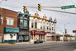
Avilla is a rural village in Jasper County, Missouri, United States. The population was 103 at the 2020 census. It is part of the Joplin, Missouri Metropolitan Statistical Area. Avilla is the fourth-oldest settlement in Jasper County today, founded in 1856. It was platted and laid out for public use July 23, 1858, by Andrew L. Love and David S. Holman.

As of March 2020, the Fort Wayne–Huntington–Auburn Combined Statistical Area (CSA), or Fort Wayne Metropolitan Area, or Northeast Indiana is a federally designated metropolitan area consisting of eight counties in northeast Indiana, anchored by the city of Fort Wayne.

State Road 3 (SR 3) in the U.S. state of Indiana is a discontinuous state highway running through eastern Indiana from near the Ohio River to near the Michigan state line. The southernmost terminus is at SR 62 in Charlestown, and the northernmost terminus is at SR 120 near Brighton.
Stapleton is a small unincorporated community in northern Baldwin County, Alabama, United States, with a population of 519.. It is part of the Daphne-Fairhope-Foley metropolitan area. Stapleton lies along U.S. Route 31 and State Route 59 and has been considered for incorporation within the cities of Loxley and Bay Minette. There is a bluegrass music festival held at Stapleton Elementary School every fall. There are about 250 students at the school that runs from Pre-K to the 6th grade.
Arcola is an unincorporated community and census-designated place in Lake Township, Allen County, in the U.S. state of Indiana. The population of the community is only 33.

State Road 827 is a northeast–southwest State Road located in Steuben County, Indiana, United States, in the northeastern part of the state. The highway runs from the City of Angola northeast to SR 120 in Fremont. The highway was formed in the 1930s, as an alternative for traffic between Toledo, Ohio and Angola. A section of roadway was authorized as SR 827, but later became part of SR 120. A small realignment project was completed in Angola during the 2000s.
East Noble School Corporation is the largest of the four school corporations in Noble County, Indiana, covering the eastern third of the county. It includes the areas of Orange, Wayne, Allen and Swan Townships, and serves to educate the children located in the cities and towns of Rome City, Brimfield, Kendallville, Avilla and LaOtto.
East Noble High School is a public high school located in Kendallville, Indiana and is the only high school that is part of the East Noble School Corporation. It serves to educate more than 1,000 students from the cities and towns of Rome City, Brimfield, Kendallville, Avilla and LaOtto.

Liberty Township is one of twelve townships in Porter County, Indiana. As of the 2010 census, its population was 9,319.

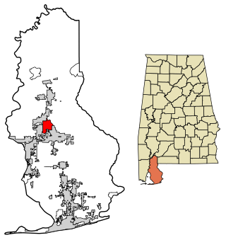
Allen Township is one of thirteen townships in Noble County, Indiana, United States. As of the 2010 census, its population was 7,134 and it contained 2,933 housing units.
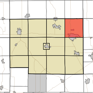
Wayne Township is one of thirteen townships in Noble County, Indiana. As of the 2010 census, its population was 10,260 and it contained 4,554 housing units.
Bear Lake is a lake side community in Noble Township, Noble County, in the U.S. state of Indiana. Points of interest include Bear Lake Camp, Bear Lake Church, Elwood H. Thomas Public Beach, and Merry Lea Environmental Center.

U.S. Route 6 (US 6) is a part of the United States Numbered Highway System that runs from California to Provincetown, Massachusetts. In Indiana, it is part of the Indiana state road system that enters the state concurrent with the Borman Expressway between Lansing, Illinois, and Munster, Indiana. The 149 miles (240 km) of US 6 that lie within Indiana serve as a major conduit. Some sections of the highway is listed on the National Highway System. Various sections are rural two-lane highway and urbanized four-lane divided highways. The easternmost community along the highway is Butler at the Ohio state line.
The News Sun is an American daily newspaper published in Kendallville, Indiana. It is the flagship newspaper of KPC Media Group.

McCutchanville is an unincorporated community in Center Township, Vanderburgh County, in the U.S. state of Indiana. McCutchanville was established in 1845 and is named for Samuel McCutchan, a Scottish/Irish immigrant who was the first postmaster for the area.
KPC Media Group Inc. is an American privately owned printer and publisher of daily and weekly newspapers, based in Kendallville, Indiana.
The Star is an American daily newspaper published in Auburn, Indiana. It is owned by KPC Media Group.


