
Little Turtle was a Sagamore (chief) of the Miami people, who became one of the most famous Native American military leaders. Historian Wiley Sword calls him "perhaps the most capable Indian leader then in the Northwest Territory," although he later signed several treaties ceding land, which caused him to lose his leader status during the battles which became a prelude to the War of 1812. In the 1790s, Mihšihkinaahkwa led a confederation of native warriors to several major victories against U.S. forces in the Northwest Indian Wars, sometimes called "Little Turtle's War", particularly St. Clair's defeat in 1791, wherein the confederation defeated General Arthur St. Clair, who lost 900 men in the most decisive loss by the U.S. Army against Native American forces.

Noble County is a county in the U.S. state of Indiana. As of the 2020 United States Census, the population was 47,457. The county seat is Albion. The county is divided into 13 townships which provide local services.

Washington is a city in Daviess County, Indiana. The population was 12,017 at the time of the 2020 census. The city is the county seat of Daviess County. It is also the principal city of the Washington, Indiana Micropolitan Statistical Area, which comprises all of Daviess County and had an estimated 2017 population of 31,648.

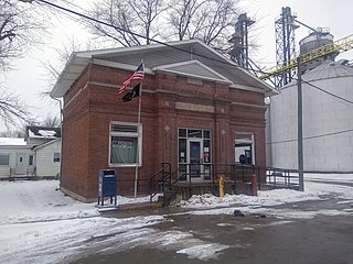
Albion is a town in Albion and Jefferson townships, Noble County, in the U.S. state of Indiana. The population was 2,349 at the 2010 census. The city is the county seat of Noble County.

Avilla is a town in Allen Township, Noble County, in the U.S. state of Indiana. The population was 2,401 at the 2010 census.

Ligonier is a city in Perry Township, Noble County, in the U.S. state of Indiana. The population was 4,568 at the 2020 census.

The Indiana Territory, officially the Territory of Indiana, was created by an organic act that President John Adams signed into law on May 7, 1800, to form an organized incorporated territory of the United States that existed from July 4, 1800, to December 11, 1816, when the remaining southeastern portion of the territory was admitted to the Union as the state of Indiana. The territory originally contained approximately 259,824 square miles (672,940 km2) of land, but its size was decreased when it was subdivided to create the Michigan Territory (1805) and the Illinois Territory (1809). The Indiana Territory was the first new territory created from lands of the Northwest Territory, which had been organized under the terms of the Northwest Ordinance of 1787. The territorial capital was the settlement around the old French fort of Vincennes on the Wabash River, until transferred to Corydon near the Ohio River in 1813.

William W. Wick was a U.S. Representative from Indiana and Secretary of State of Indiana. He was a lawyer and over his career he was a judge for 15 years. President Franklin Pierce appointed him Postmaster of Indianapolis, Indiana.

Saluda Township is one of ten townships in Jefferson County, Indiana, United States. As of the 2010 census, its population was 1,370 and it contained 619 housing units. It was created by the Jefferson County Court of Common Pleas on Feb. 13, 1817. Saluda is derived from a Native American name meaning "river of corn".
Elkhart Township is one of thirteen townships in Noble County, Indiana, United States. As of the 2010 census, its population was 2,065 and it contained 826 housing units.

Rivare is an unincorporated community in St. Marys Township, Adams County, in the U.S. state of Indiana.

Brimfield is an unincorporated community in Orange Township, Noble County, in the U.S. state of Indiana.
Cosperville is an unincorporated community in Elkhart Township, Noble County, in the U.S. state of Indiana.

Kimmell is an unincorporated census-designated place in Sparta Township, Noble County, in the U.S. state of Indiana.
Merriam is an unincorporated community in Noble Township, Noble County, in the U.S. state of Indiana.

Ari is an unincorporated community in Allen and Noble counties, in the U.S. state of Indiana.

Indiana is a U.S. state in the Midwestern United States. It is the 38th-largest by area and the 17th-most populous of the 50 States. Its capital and largest city is Indianapolis. Indiana was admitted to the United States as the 19th state on December 11, 1816. It is bordered by Lake Michigan to the northwest, Michigan to the north and northeast, Ohio to the east, the Ohio River and Kentucky to the south and southeast, and the Wabash River and Illinois to the west.

Bellfountain is an unincorporated community in Noble Township, Jay County, in the U.S. state of Indiana.
Burr Oak is an unincorporated community in Noble Township, Noble County, in the U.S. state of Indiana.
Lisbon is an unincorporated community in Allen Township, Noble County, in the U.S. state of Indiana.


