Clarksville, Indiana

Last updated

Clarksville, Indiana
Clarksville IN Town Hall.jpg
Clarksville Town Hall
Flag of Clarksville, Indiana.svg
Clark County Indiana Incorporated and Unincorporated areas Clarksville Highlighted 1812934.svg
Location of Clarksville in Clark County, Indiana.
Coordinates: 38°21′02″N85°46′02″W / 38.35056°N 85.76722°W / 38.35056; -85.76722
CountryUnited States
State Indiana
County Clark
Townships Silver Creek, Jeffersonville
Government
  Type Town Council
  PresidentRyan Ramsey[ citation needed ]
Area
[1]
  Total10.23 sq mi (26.51 km2)
  Land10.04 sq mi (26.00 km2)
  Water0.20 sq mi (0.51 km2)
Elevation
[2]
469 ft (143 m)
Population
 (2020)
  Total22,333
  Density2,224.62/sq mi (858.90/km2)
Time zone UTC−5 (EST)
  Summer (DST) UTC−4 (EDT)
ZIP codes
47129
Area code(s) 812 & 930
FIPS code 18-12934 [3]
GNIS feature ID2396649 [2]
Website townofclarksville.com

Clarksville is a town in Clark County, Indiana, United States, along the Ohio River and is a part of the Louisville Metropolitan area. The population was 22,333 at the 2020 census. [4] The town was founded in 1783 by early resident George Rogers Clark [5] at the only seasonal rapids on the entire Ohio River, it is the oldest American town in the former Northwest Territory. The town is home to the Colgate clock, one of the largest clocks in the world and the Falls of the Ohio State Park, home to the world's largest exposed Devonian period fossil bed.

Contents

History

Original plat of Clark's Grant Clark's grant.jpg
Original plat of Clark's Grant

The site that would become Clarksville was first used as a base of operations by George Rogers Clark during the American Revolutionary War. In 1778 he established a post on an island at the head of the Falls of the Ohio, from which he trained his 175-man regiment. After the war, Clark was granted a tract of 150,000 acres (610 km2) for his services in the war. In 1783, 1,000 acres (4 km2) were set aside for the development of a town, Clarksville. The same year a stockade was built and settlement began. [6]

The explorer William Clark was a younger brother of George Rogers Clark. Historian Stephen Ambrose writes of Meriwether Lewis and William Clark in Undaunted Courage , "When they shook hands [at Clarksville], the Lewis and Clark Expedition began." A two-figure statue near the falls commemorates the expedition. Several localities other than Clarksville claim precedence for the start of the Lewis and Clark Expedition, most notably St. Louis, Missouri. [7]

Due to the many floods in the nineteenth century and the Indiana Canal Company's failed competition to build a canal around the Ohio Falls, the town struggled. On August 24, 1805, the Indiana Territorial Legislature authorized the construction of a canal around the Falls of the Ohio at Clarksville. The first attempt failed and the investors lost their money. Historians believe it was used to finance the conspiracy of Aaron Burr. Developers tried to build a canal in 1817 and again in 1820. But the race to build the canal was lost in 1826 when the federal government made a large grant to build the Louisville and Portland Canal. The lack of a canal handicapped the growth of the town as the Falls of the Ohio made river transport from the city difficult. [8]

Clarksville became a popular dueling spot for Kentuckians who wanted to dodge their home state's anti-dueling laws. The most famous of these was the 1809 duel between Henry Clay and Humphrey Marshall. [9] There was an attempt to build a second town within Clarksville's boundaries, named Ohio Falls City, until the Indiana Supreme Court ruled that this would be illegal.

George Rogers Clark cabin along the Ohio River George Rogers Clark cabin reproduction at Clarksville, closeup.jpg
George Rogers Clark cabin along the Ohio River

The town was managed by a ten-member Board of Trustees in the charter from Virginia. [7] The trustees were allowed to align lots along roads and sell the lots for the proceeds to benefit the town. The trustees could elect replacements as needed and did not have to reside in the town. This remained controversial with residents until 1889 when the board stopped meeting and was replaced by a three-member board. One member was selected by the Floyd County Commissioners, one by the Clark County Commissioners, and one by residents of Clarksville. Between 1889 and 1937, the town established a five-member board entirely elected by residents. The historic records related to this governmental change were lost in the Ohio River flood of 1937. [7]

The Great Flood of 1937 decimated the town. The entire town was submerged beneath as much as 12 feet (3.7 m) of water in some areas for over three weeks during January and February. With almost all of the old town destroyed, Clarksville was rebuilt with a new modern city plan.

The post-World War II housing boom and new jobs brought growth to the city. The population increased from 2,400 in 1940 to 22,000 in 2000. The city has expanded to the north by annexing several sizable suburbs. By 1981 the State of Indiana changed statutes to convert the managing board of trustees to a council with members rather than trustees. In 1990 voters approved expansion of members of the Town Council from five to seven following the area growth. [7] Clarksville is now the major shopping hub of Southern Indiana, with the hub area centered on Lewis and Clark Parkway and nearby Veterans Parkway.

Geography

According to the 2010 census, Clarksville has a total area of 10.17 square miles (26.34 km2), of which 9.97 square miles (25.82 km2) (or 98.03%) is land and 0.2 square miles (0.52 km2) (or 1.97%) is water. [10]

Demographics

Historical population
CensusPop.Note
1880 1,037
1890 1,69263.2%
1900 2,37040.1%
1910 2,74315.7%
1920 2,322−15.3%
1930 2,243−3.4%
1940 2,3866.4%
1950 5,905147.5%
1960 8,08837.0%
1970 13,29864.4%
1980 15,16414.0%
1990 19,83330.8%
2000 21,4007.9%
2010 21,7241.5%
2020 22,3332.8%
Source: US Census Bureau

2010 census

As of the census [11] of 2010, there were 21,724 people, 9,175 households, and 5,464 families living in the town. The population density was 2,178.9 inhabitants per square mile (841.3/km2). There were 9,839 housing units at an average density of 986.9 per square mile (381.0/km2). The racial makeup of the town was 85.1% White, 5.6% African American, 0.3% Native American, 0.7% Asian, 5.7% from other races, and 2.5% from two or more races. Hispanic or Latino of any race were 9.5% of the population.

There were 9,175 households, of which 29.9% had children under the age of 18 living with them, 39.0% were married couples living together, 14.5% had a female householder with no husband present, 6.0% had a male householder with no wife present, and 40.4% were non-families. 33.8% of all households were made up of individuals, and 13.9% had someone living alone who was 65 years of age or older. The average household size was 2.34 and the average family size was 2.98.

The median age in the town was 37.3 years. 22.9% of residents were under the age of 18; 9.5% were between the ages of 18 and 24; 27.5% were from 25 to 44; 24.8% were from 45 to 64; and 15.2% were 65 years of age or older. The gender makeup of the town was 48.0% male and 52.0% female.

2000 census

As of the census [3] of 2000, there were 21,400 people, 8,984 households, and 5,561 families living in the town. The population density was 2,120.6 inhabitants per square mile (818.8/km2). There were 9,537 housing units at an average density of 945.1 per square mile (364.9/km2). The racial makeup of the town was 90.56% White, 5.59% African American, 0.27% Native American, 0.93% Asian, 0.03% Pacific Islander, 1.08% from other races, and 1.53% from two or more races. Hispanic or Latino of any race were 2.80% of the population.

There were 8,984 households, out of which 28.4% had children under the age of 18 living with them, 44.4% were married couples living together, 13.3% had a female householder with no husband present, and 38.1% were non-families. 31.6% of all households were made up of individuals, and 13.2% had someone living alone who was 65 years of age or older. The average household size was 2.32 and the average family size was 2.92.

In the town, the population was spread out, with 23.1% under the age of 18, 9.9% from 18 to 24, 29.8% from 25 to 44, 22.0% from 45 to 64, and 15.2% who were 65 years of age or older. The median age was 36 years. For every 100 females, there were 91.1 males. For every 100 females age 18 and over, there were 87.8 males.

The median income for a household in the town was $35,473, and the median income for a family was $44,688. Males had a median income of $30,860 versus $23,329 for females. The per capita income for the town was $20,315. About 5.6% of families and 8.1% of the population were below the poverty line, including 10.5% of those under age 18 and 6.7% of those age 65 or over.

Attractions

The Falls of the Ohio Interpretive Center located next to the Ohio River fossil beds 2016WIKI FallsOfTheOhioSP3June13.jpg
The Falls of the Ohio Interpretive Center located next to the Ohio River fossil beds

Clarksville has the largest exposed fossil beds from the Devonian period. This area has now been incorporated in the Falls of the Ohio State Park, where the state has built an education center. The fossils include plant and marine life from a prehistoric coral reef that are 386 million years old. [12]

Several other local parks included sports fields, such as the 332-acre (1.3 km2) Lapping Park, which contains a golf course, a Disc Golf course, soft ball field, shelter house, amphitheater, and hiking trails. [13]

The city has the "7th largest clock in the world", at the former Colgate-Palmolive Plant near the Ohio River. Many locals still mistakenly claim it as the "2nd largest clock in the world", but it was surpassed years ago. As the Colgate company closed the plant in early 2008, the clock's future was in question. The town has vowed to keep the clock in its current location, which can be seen from across the river in downtown Louisville, Kentucky.

The Clarksville Little Theater is one of the oldest continuously running community theaters in the United States. Also located here is Derby Dinner Playhouse, the only dinner theater in the area. [14]

First Texas Roadhouse at the Green Tree Mall Texas Roadhouse.jpg
First Texas Roadhouse at the Green Tree Mall

Clarksville is home to several churches, including Southeast Christian Church, Faith Assembly Church, [15] St. Anthony Parish, [16] and Seven Pillars Church International. [17]

The restaurant chain Texas Roadhouse first started in Clarksville, and its original location is open as an outlet at the Green Tree Mall. Clarksville is the home of the United States's second-largest Bass Pro at the River Falls Mall.

Education

Clarksville Community School Corporation,Greater Clark County Schools, and West Clark Community Schools serve sections of Clarksville. [18]

Notable people

Twin cities

The Clarksville sister or twin city program began in 1998. Bewdley and Melton Mowbray in the UK were the first sister cities to begin friendship ties in 1998 and 1999 and relations have continued. [19] Most recently La Garenne-Colombes in Paris urban area, France joined the sister cities of Clarksville. [20]

See also

Related Research Articles

<span class="mw-page-title-main">Fayette County, Indiana</span> County in Indiana, United States

Fayette County is one of 92 counties in U.S. state of Indiana located in the east central portion of the state. As of 2020, the population was 23,398. Most of the county is rural; land use is farms, pasture and unincorporated woodland. The county seat and only incorporated town is Connersville, which holds a majority of the county's population.

<span class="mw-page-title-main">Clark County, Indiana</span> County in Indiana, United States

Clark County is a county in the U.S. state of Indiana, located directly across the Ohio River from Louisville, Kentucky. At the 2020 census, the population was 121,093. The county seat is Jeffersonville. Clark County is part of the Louisville/Jefferson County, KY–IN Metropolitan Statistical Area.

<span class="mw-page-title-main">Charlestown, Indiana</span> City in Indiana, United States

Charlestown is a city located within Charlestown Township, in Clark County, Indiana, United States. The population was 7,775 at the 2020 census.

<span class="mw-page-title-main">Jeffersonville, Indiana</span> City in Indiana, United States

Jeffersonville is a city and the county seat of Clark County, Indiana, United States, situated along the Ohio River. Locally, the city is often referred to by the abbreviated name Jeff. It lies directly across the Ohio River to the north of Louisville, Kentucky, along I-65. The population was 49,447 at the 2020 census.

<span class="mw-page-title-main">Utica, Indiana</span> Town in Indiana, United States

Utica is a town in Utica Township, Clark County, Indiana, United States. The population was 776 at the 2010 census.

<span class="mw-page-title-main">Lawrenceburg, Indiana</span> City in Indiana, United States

Lawrenceburg is a city and the county seat of Dearborn County, Indiana, United States. The population was 5,129 at the 2020 census. It is the largest city in Dearborn County. Lawrenceburg is in southeast Indiana, on the Ohio River west of Cincinnati.

<span class="mw-page-title-main">New Albany, Indiana</span> City in Indiana, United States

New Albany is a city in Floyd County, Indiana, United States, situated along the Ohio River, opposite Louisville, Kentucky. The population was 37,841 as of the 2020 census. The city is the county seat of Floyd County. It is bounded by I-265 to the north and the Ohio River to the south, and is considered part of the Louisville, Kentucky Metropolitan Statistical Area. The mayor of New Albany is Jeff Gahan, a Democrat; he was re-elected in 2023.

<span class="mw-page-title-main">Francisco, Indiana</span> Town in Indiana, United States

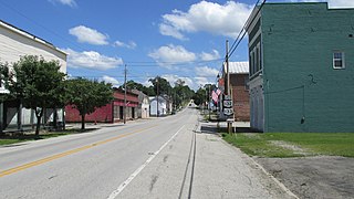
Francisco is the fifth largest town and seventh largest community in Gibson County, Indiana, United States. A town in Center Township, the population was 469 at the 2010 census and was founded in 1851. Local tradition says the town was named for its first settler, a Spanish laborer working on the Wabash and Erie Canal who built a shack in the area. It is part of the Evansville, Indiana, Metropolitan Area.

<span class="mw-page-title-main">Rockport, Indiana</span> City in Indiana, United States

Rockport is a city in Ohio Township and the county seat of Spencer County, Indiana, along the Ohio River. The population was 2,270 at the 2010 census. Once the largest community in Spencer County, the city has recently been surpassed by the town of Santa Claus. At 37°53'1" north, Rockport is also the southernmost city in the state, located slightly south of Evansville, Cannelton, or Mount Vernon.

<span class="mw-page-title-main">Perrysville, Indiana</span> Town in Indiana, United States

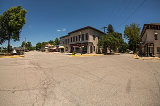
Perrysville is a town in Highland Township, Vermillion County, in the U.S. state of Indiana. The population was 456 at the 2010 census.

<span class="mw-page-title-main">Williamsport, Indiana</span> Town in Indiana, United States

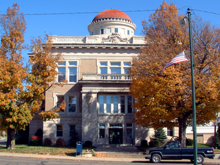
Williamsport is a town in Washington Township, Warren County, in the U.S. state of Indiana. The population was 1,898 at the 2010 census. It is the county seat of Warren County and is the largest of the four incorporated towns in the county. Williamsport Falls is located in downtown Williamsport.

<span class="mw-page-title-main">Chandler, Indiana</span> Town in Indiana, United States

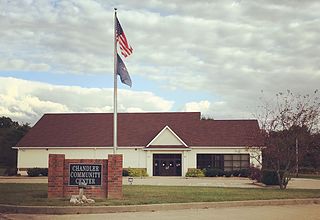
Chandler is a town straddling Ohio and Boon Township in Warrick County, Indiana, United States, located just east of Evansville, Indiana along the Ohio River. The population was 3,693 at the 2020 census, making it Warrick County's second-most populous municipality after Boonville. The town is part of the Evansville metropolitan area with a population of 342,815.

<span class="mw-page-title-main">Clarksville, Missouri</span> City in Missouri, United States

Clarksville is a city in Calumet Township, Pike County, Missouri, United States. The population was 442 at the 2010 census.

<span class="mw-page-title-main">Clarksville, New Hampshire</span> Town in New Hampshire, United States

Clarksville is a town in northern Coös County, New Hampshire, United States. The population was 294 at the 2020 census. It is part of the Berlin, NH-VT Micropolitan Statistical Area.

<span class="mw-page-title-main">St. Marys, Ohio</span> City in Ohio, United States

St. Marys is a city in Auglaize County, Ohio, United States. Located in western Ohio, it is 11 miles (18 km) west of Wapakoneta and 20 miles (32 km) east of the Ohio–Indiana border. Founded in 1823, the city is located on a portage between the St. Marys and Auglaize river systems, which was a significant factor in its development before the era of canals. The population was 8,397 at the 2020 census. It is included in the Wapakoneta micropolitan area.

<span class="mw-page-title-main">Clarksville, Ohio</span> Village in Ohio, United States

Clarksville is a village in Clinton County, Ohio, United States. The population was 534 at the 2020 census. It is served by the Clinton Massie branch of the Wilmington Public Library of Clinton County.

<span class="mw-page-title-main">Ludlow Falls, Ohio</span> Village in Ohio, United States

Ludlow Falls is a village in Miami County, Ohio, United States. The population was 175 at the 2020 census. It is part of the Dayton Metropolitan Statistical Area. Ludlow Falls is named after surveyor Israel Ludlow.

<span class="mw-page-title-main">Munroe Falls, Ohio</span> City in Ohio, United States

Munroe Falls is a city in east-central Summit County, Ohio, United States, along the Cuyahoga River. The population was 5,044 at the 2020 census. It is a suburb of Akron and is part of the Akron metropolitan area.

<span class="mw-page-title-main">Clarksville, Virginia</span> Town in Virginia, United States

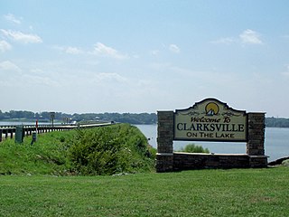
Clarksville is a town in Mecklenburg county in the U.S. state of Virginia, near the southern border of the commonwealth. The population was 1,139 at the 2010 census. Since the town has numerous buildings of the 18th-, 19th-, and early 20th-century architecture, the downtown area of Clarksville has been designated a Historic District on the National Register of Historic Places and Virginia's Historic Register. Clarksville claims the title of Virginia's only Lakeside town. Nearby the town of Clarksville is Occoneechee State Park.

<span class="mw-page-title-main">Hagerstown, Indiana</span> Town in Indiana, United States

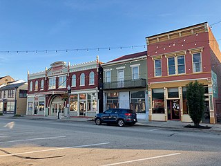
Hagerstown is a town in Jefferson Township, Wayne County, in the U.S. state of Indiana. As of the 2020 census, the population was 1,681.

References

  1. "2020 U.S. Gazetteer Files". Census.gov . United States Census Bureau. Archived from the original on March 18, 2021. Retrieved March 16, 2022.
  2. 1 2 U.S. Geological Survey Geographic Names Information System: Clarksville, Indiana
  3. 1 2 "U.S. Census website". Census.gov . United States Census Bureau. Archived from the original on May 12, 2015. Retrieved January 31, 2008.
  4. "U.S. Census Bureau QuickFacts: Clarksville town, Indiana". Census.gov . Archived from the original on January 26, 2024. Retrieved June 28, 2022.
  5. Gannett, Henry (1905). The Origin of Certain Place Names in the United States. Govt. Print. Off. pp.  83.
  6. Sarles, Jane, Clarksville, Indiana, p. 9
  7. 1 2 3 4 5 "Town of Clarksville:Pre-History & History". Archived from the original on February 11, 2008.
  8. Gray, Ralph D., Indiana History, p. 123
  9. Clay, Thomas Hart; Oberholtzer, Ellis Paxson (1910). Henry Clay. George W. Jacobs & Company. p. 50.
  10. "G001 – Geographic Identifiers – 2010 Census Summary File 1". United States Census Bureau. Archived from the original on February 13, 2020. Retrieved July 14, 2015.
  11. "U.S. Census website". United States Census Bureau. Archived from the original on May 12, 2015. Retrieved December 11, 2012.
  12. "Welcome to the Falls of the Ohio". Fallsoftheohio.org. Archived from the original on December 13, 2007. Retrieved July 13, 2009.
  13. "Town of Clarksville's Parks". Clarksvilleparks.com. Archived from the original on June 11, 2008. Retrieved July 13, 2009.
  14. "Town of Clarksville: Information". Archived from the original on August 10, 2007.
  15. "Faith Assembly Church". fachurch.org. Archived from the original on October 1, 2023. Retrieved January 26, 2024.
  16. "St. Anthony Parish". Archived from the original on January 23, 2019. Retrieved September 7, 2019.
  17. "HOME". Seven Pillars Church. Archived from the original on August 7, 2020. Retrieved September 7, 2019.
  18. "2020 CENSUS – SCHOOL DISTRICT REFERENCE MAP: Clark County, IN" (PDF). U.S. Census Bureau. Archived (PDF) from the original on February 13, 2022. Retrieved February 13, 2022.
  19. "Town of Clarksville: Sister City Information". Archived from the original on August 19, 2007.
  20. Welcome to the Town of Clarksville Archived May 4, 2011, at the Wayback Machine