Utica, Indiana

Last updated

Utica, Indiana
Town of Utica
Clark County Indiana Incorporated and Unincorporated areas Utica Highlighted 1878110.svg
Location of Utica in Clark County, Indiana.
Coordinates: 38°21′24″N85°39′08″W / 38.35667°N 85.65222°W / 38.35667; -85.65222
Country United States
State Indiana
County Clark
Township Utica
Area
[1]
  Total1.44 sq mi (3.73 km2)
  Land1.19 sq mi (3.08 km2)
  Water0.25 sq mi (0.65 km2)
Elevation
[2]
522 ft (159 m)
Population
 (2020)
  Total860
  Density723.30/sq mi (279.25/km2)
Time zone UTC-5 (Eastern (EST))
  Summer (DST) UTC-4 (EDT)
ZIP code
47130
Area code 812
FIPS code 18-78110 [3]
GNIS feature ID2397708 [2]
Website https://uticaindiana.org/

Utica is a town in Utica Township, Clark County, Indiana, United States. The population was 776 at the 2010 census.

Contents

History

From 1794 to 1825, Utica was a popular ferry crossing, as ferry crossings were considered too dangerous at Jeffersonville, due to inexperienced ferry operators and the Falls of the Ohio. James Noble Wood, the founder of Utica, was the first ferryman in the area, and he served as one of only a handful of territorial judges in "Indian Territory" during this period.

After a flood in 1997, Utica grew because it was required to strengthen its building, planning, and zoning laws in order to obtain Federal Emergency Management Agency (FEMA) and Indiana DNR rebuilding funds. However, Utica is unlikely to see much more growth due to being surrounded by the Port of Indiana – Jeffersonville, a new I-265 bridge over the Ohio River at Utica (complete late 2016), and the River Ridge Commerce Center. [4]

Geography

According to the 2010 census, Utica has a total area of 1.448 square miles (3.75 km2), of which 1.27 square miles (3.29 km2) (or 87.71%) is land and 0.178 square miles (0.46 km2) (or 12.29%) is water. [5]

Demographics

Historical population
CensusPop.Note
1880 525
1970 644
1980 501−22.2%
1990 411−18.0%
2000 59143.8%
2010 77631.3%
2020 86010.8%
U.S. Decennial Census [6]

2010 census

As of the census [7] of 2010, there were 776 people, 328 households, and 212 families living in the town. The population density was 611.0 inhabitants per square mile (235.9/km2). There were 379 housing units at an average density of 298.4 per square mile (115.2/km2). The racial makeup of the town was 89.6% White, 3.4% African American, 0.8% Native American, 1.9% Asian, 1.9% from other races, and 2.4% from two or more races. Hispanic or Latino of any race were 3.4% of the population.

There were 328 households, of which 29.3% had children under the age of 18 living with them, 48.5% were married couples living together, 10.7% had a female householder with no husband present, 5.5% had a male householder with no wife present, and 35.4% were non-families. 28.7% of all households were made up of individuals, and 6.7% had someone living alone who was 65 years of age or older. The average household size was 2.37 and the average family size was 2.88.

The median age in the town was 43.3 years. 19.3% of residents were under the age of 18; 7.4% were between the ages of 18 and 24; 25.4% were from 25 to 44; 33.7% were from 45 to 64; and 14.2% were 65 years of age or older. The gender makeup of the town was 47.7% male and 52.3% female.

2000 census

Memorial in Utica, Indiana Utica Indiana.jpg
Memorial in Utica, Indiana

As of the census [3] of 2000, there were 591 people, 254 households, and 164 families living in the town. The population density was 1,361.7 inhabitants per square mile (525.8/km2). There were 279 housing units at an average density of 642.8 per square mile (248.2/km2). The racial makeup of the town was 97.63% White, 1.02% African American, 0.17% Native American, 0.34% Asian, 0.51% from other races, and 0.34% from two or more races. Hispanic or Latino of any race were 1.18% of the population.

There were 254 households, out of which 23.2% had children under the age of 18 living with them, 50.0% were married couples living together, 9.8% had a female householder with no husband present, and 35.4% were non-families. 30.7% of all households were made up of individuals, and 11.4% had someone living alone who was 65 years of age or older. The average household size was 2.33 and the average family size was 2.85.

In the town, the population was spread out, with 21.0% under the age of 18, 6.8% from 18 to 24, 23.9% from 25 to 44, 33.0% from 45 to 64, and 15.4% who were 65 years of age or older. The median age was 44 years. For every 100 females, there were 87.0 males. For every 100 females age 18 and over, there were 92.2 males.

The median income for a household in the town was $36,023, and the median income for a family was $38,750. Males had a median income of $35,156 versus $19,821 for females. The per capita income for the town was $23,518. About 5.3% of families and 8.1% of the population were below the poverty line, including 6.7% of those under age 18 and 19.4% of those age 65 or over.

Related Research Articles

<span class="mw-page-title-main">Monroe, Adams County, Indiana</span> Town in Indiana, United States

Monroe is a town in Washington and Monroe townships, Adams County, Indiana, United States. The population of the town was 945 residents at the 2019 census. Adams Central Community Schools is located in Monroe.

<span class="mw-page-title-main">Zanesville, Indiana</span> Town in Indiana, United States

Zanesville is a town in Wells and Allen counties in the U.S. state of Indiana, southwest of Fort Wayne. The population was 580 at the 2020 Census, down from 600 at the 2010 census.

<span class="mw-page-title-main">Milltown, Indiana</span> Town in Indiana, United States

Milltown is a town in Whiskey Run Township in Crawford County, Indiana and in Blue River and Spencer townships in Harrison County. The population was 818 at the time of the 2010 census.

<span class="mw-page-title-main">St. Leon, Indiana</span> Town in Indiana, United States

St. Leon or Saint Leon is a town in Kelso Township, Dearborn County, Indiana, United States. The population was 678 at the 2010 census.

<span class="mw-page-title-main">Ashley, Indiana</span> Town in Indiana, United States

Ashley is a town in Indiana located on the border of Smithfield Township, DeKalb County and Steuben Township, Steuben County. The population was 983 at the 2010 census.

<span class="mw-page-title-main">Selma, Indiana</span> Town in Indiana, United States

Selma is a town in Liberty Township, Delaware County, Indiana, United States. As of the 2020 census, the town had a total population of 747. It is part of the Muncie, IN Metropolitan Statistical Area.

<span class="mw-page-title-main">Lyons, Indiana</span> Town in Indiana, United States

Lyons is a town in Washington Township, Greene County, Indiana, United States. The population was 742 at the 2010 census. It is part of the Bloomington, Indiana Metropolitan Statistical Area.

<span class="mw-page-title-main">Worthington, Indiana</span> Town in Indiana, United States

Worthington is a town in Jefferson Township, Greene County, Indiana, United States. The population was 1,463 at the 2010 United States Census. It is part of the Bloomington, Indiana, Metropolitan Statistical Area.

<span class="mw-page-title-main">Shirley, Indiana</span> Town in Indiana, United States

Shirley is a town in Brown Township, Hancock County and Greensboro Township, Henry County, Indiana, United States. The population was 830 at the 2010 census.

<span class="mw-page-title-main">Coatesville, Indiana</span> Town in Indiana, United States

Coatesville is a town in Clay Township, Hendricks County, Indiana, United States. The population was 523 at the 2010 Census.

<span class="mw-page-title-main">Andrews, Indiana</span> Town in Indiana, United States

Andrews is a town in Dallas Township, Huntington County, Indiana, United States. The population was 1,048 at the 2020 census.

<span class="mw-page-title-main">Prince's Lakes, Indiana</span> Town in Indiana, United States

Prince's Lakes is a town in Nineveh Township, Johnson County, Indiana, United States. The population was 1,312 at the 2010 census.

<span class="mw-page-title-main">Silver Lake, Indiana</span> Town in Indiana, United States

Silver Lake is a town in Lake Township, Kosciusko County, in the U.S. state of Indiana. The population was 915 at the 2010 census.

<span class="mw-page-title-main">Pottawattamie Park, Indiana</span> Town in Indiana, United States

Pottawattamie Park is a town in Michigan Township, LaPorte County, Indiana, United States. The population was 235 at the 2010 census. It is included in the Michigan City, Indiana-La Porte, Indiana Metropolitan Statistical Area.

<span class="mw-page-title-main">Edgewood, Indiana</span> Town in Indiana, United States

Edgewood is a town in Anderson Township, Madison County, Indiana, United States. It is part of the Indianapolis–Carmel–Anderson metropolitan statistical area. The population was 2,053 at the 2020 census.

<span class="mw-page-title-main">Fillmore, Indiana</span> Town in Indiana, United States

Fillmore is a town in Marion Township, Putnam County, in the U.S. state of Indiana. The population was 532 at the 2020 census.

<span class="mw-page-title-main">Clear Lake, Indiana</span> Town in Indiana, United States

Clear Lake is a town located in the northeast corner of Steuben County, Indiana, in Clear Lake Township. As such, is the northeasternmost community in the State of Indiana. The population was 339 at the 2010 census.

<span class="mw-page-title-main">Utica, Minnesota</span> City in Minnesota, United States

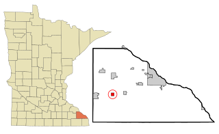
Utica is a city in Winona County, Minnesota, United States. The population was 266 at the 2020 census.

<span class="mw-page-title-main">Meridian Hills, Indiana</span> Town in Indiana, United States

Meridian Hills is a town in Washington Township, Marion County, Indiana, about 8 miles (13 km) north of downtown Indianapolis. It had a population of 1,774 at the 2020 census, up from 1,616 in 2010.

<span class="mw-page-title-main">Wynnedale, Indiana</span> Town in Indiana, United States

Wynnedale is a town in Washington Township, Marion County, Indiana, United States. The population was 215 at the 2020 census. It has existed as an "included town" since 1970, when it was incorporated into Indianapolis as part of Unigov. It is part of Indianapolis, but retains a functioning town government under IC 36-3-1-11.

References

  1. "2020 U.S. Gazetteer Files". United States Census Bureau. Retrieved March 16, 2022.
  2. 1 2 U.S. Geological Survey Geographic Names Information System: Utica, Indiana
  3. 1 2 "U.S. Census website". United States Census Bureau . Retrieved January 31, 2008.
  4. Larry Thomas (July 7, 2006). "They're building this city ..." News and Tribune .
  5. "G001 - Geographic Identifiers - 2010 Census Summary File 1". United States Census Bureau. Archived from the original on February 13, 2020. Retrieved July 25, 2015.
  6. "Census of Population and Housing". Census.gov. Retrieved June 4, 2015.
  7. "U.S. Census website". United States Census Bureau . Retrieved December 11, 2012.