
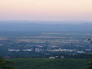
Thohoyandou is a town in the Limpopo Province of South Africa. It is the administrative centre of Vhembe District Municipality and Thulamela Local Municipality. It is also known for being the former capital of the bantustan of Venda.

Gazankulu was a bantustan in South Africa, intended by the apartheid government to be a semi-independent homeland for the Tsonga people. It was located in both the Northern Transvaal, now Limpopo province and Eastern Transvaal, now Mpumalanga province.

Vivo is a small farming town in the Blouberg Local Municipality of the Capricorn District Municipality in the northern part of Limpopo province, South Africa.

Makhado Municipality is a local municipality within the Vhembe District Municipality, in the Limpopo province of South Africa. The seat is Louis Trichardt.
Louis Trichardt, informally shortened to Louis Tri, is a town at the foot of Songozwi, in the Soutpansberg mountain range in the Limpopo province of South Africa. It is the centre of the Makhado Local Municipality, which comprises 16,000 km² with a total population of 270,000 (2001). Louis Trichardt is located in a fertile region where litchis, bananas, mangoes and nuts are produced. The N1 National Route runs through the town. Louis Trichardt is 437 kilometres from Johannesburg and one hour's drive from the Zimbabwean border at Beitbridge. Louis Trichardt was known for a time as Makhado, but it was changed back to Louis Trichardt. Vleifontein, Elim, Tshikota, Madombidzha, Makhado Park and Dzanani surround the town at all directions.
Olifantshoek is a town in John Taolo Gaetsewe District Municipality in the Northern Cape Province of South Africa.
Tiyani is a village situated on the banks of the Middle Letaba Dam in the Hlanganani District of the former Gazankulu homeland, which currently form part of the Vhembe District Municipality in the Limpopo province of South Africa.
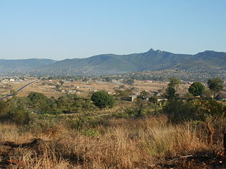
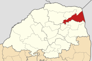
Vuwani is a town in Vhembe District Municipality in the Limpopo province of South Africa.
Hoekwil is a town in Garden Route District Municipality in the Western Cape province of South Africa. It is a mountain-top village connected to the coastal village of Wilderness,_South_Africa via the Hoekwil Pass, a well-designed, tarred road that serves both the village of Hoekwil and local forestry areas and farms.
Hlanganani, also known as Spelonken, is an amalgamation of various large villages which are situated in the north western portion of the former Tsonga homeland of Gazankulu, South Africa. Hlanganani is situated alongside the R578 road to Giyani and Elim.
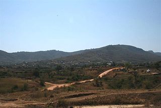
Bungeni is a large sprawling rural settlement situated on top of one of the foothills and tail end of the Soutpansberg mountain in Louis Trichardt, Limpopo Province, South Africa. The Levubu agricultural plantation, where avocado, bananas, litchis, macadamia nuts, peaches and mangoes are grown in abundance is just 3km away north of Bungeni village. It lies 35 km east of Makhado, with the R578 road passing through it. With more than 30 000 people, Bungeni is the largest Tsonga village in Makhado local municipality. In 1994 and in 2016, administrative control of this western portion of Gazankulu has been sub-divided in half and allocated to two Municipalities, first in 1994 to Makhado Local Municipality and in 2016, to the New Malamulele Municipality in the Vhembe district. As of April 2016, the Western portion, known as 'Bungeni West' by the locals, has remained in Makhado local municipality, while the eastern portion, known as 'Bungeni east', has been allocated to the new Malamulele Municipality.
Askham is a village in the Dawid Kruiper Local Municipality in the ZF Mgcawu District Municipality in the Northern Cape province of South Africa. Askham lies not far from the confluence of the mostly dry Molopo and Kuruman Rivers in the Red Kalahari Desert, about 200 km north of Upington at the junction of the R31 and the R360 roads.
Laatsgevonden is a town in Makhado Local Municipality in the Limpopo province of South Africa.
Kranspoort is a town in the Makhado Local Municipality in the Limpopo province of South Africa.
Levubu is a village in the Makhado Local Municipality, part of the Vhembe District Municipality of Limpopo province, South Africa. It is located some 10 km south-west of Rembander. It takes its name from the Luvuvhu River.
Buysdorp is a village in Makhado Local Municipality in the Limpopo province of South Africa.
Collins Chabane Municipality is a local municipality within the Vhembe District Municipality, in the Limpopo province of South Africa. It was established after the August 2016 local elections by merging portions of the Thulamela and Makhado local municipalities. Malamulele is the seat of the municipality.
Madombidzha is a township west of Louis Trichardt under the Makhado Local Municipality of the Vhembe District Municipality in the Limpopo province of South Africa.
Mavhungu Maureen Lerule-Ramakhanya is a South African politician. A member of the African National Congress, Lerule-Ramakhanya is a former mayor of the Vhembe District Municipality. She was elected as a Member of the Limpopo Provincial Legislature in May 2019. She was then elected as the speaker of the legislature. In March 2020, Lerule-Ramakhanya was appointed as the Member of the Executive Council (MEC) for Transport and Community Safety. She was moved to the Education portfolio of the executive council in June 2022.
Anthony Matumba is a South African politician who has been a Member of the National Assembly of South Africa since January 2022. A member of the Economic Freedom Fighters, he serves on the party's Central Command Team, its highest decision-making structure. He is a former Makhado Local Municipality councillor.


