Osgood, Indiana

Last updated

Osgood, Indiana
Damm Theatre, Osgood, Indiana (48467719557).jpg
The Damm Theatre in Downtown Osgood
Ripley County Indiana Incorporated and Unincorporated areas Osgood Highlighted 1857132.svg
Location of Osgood in Ripley County, Indiana.
Coordinates: 39°07′32″N85°17′36″W / 39.12556°N 85.29333°W / 39.12556; -85.29333
Country United States
State Indiana
County Ripley
Township Center
Area
[1]
  Total1.58 sq mi (4.11 km2)
  Land1.55 sq mi (4.01 km2)
  Water0.04 sq mi (0.09 km2)
Elevation
[2]
984 ft (300 m)
Population
 (2020)
  Total1,587
  Density1,024.53/sq mi (395.52/km2)
Time zone UTC-5 (Eastern (EST))
  Summer (DST) UTC-4 (EDT)
ZIP code
47037
Area code 812
FIPS code 18-57132 [3]
GNIS feature ID2396839 [2]
Website http://www.osgoodindiana.org

Osgood is a town in Center Township, Ripley County, in the U.S. state of Indiana. [2] The population was 1,624 at the 2010 census.

Contents

Osgood's Carnegie library Osgood Carnegie Public Library, Osgood, Indiana (48467678282).jpg
Osgood's Carnegie library

History

Osgood was platted in 1854 when the railroad was extended to that point. [4] The town was named for A. L. Osgood, a railroad official. [5] A post office called Osgood has been in operation since 1855. [6] In the 1890s, Osgood was a sundown town, where African Americans were not allowed to reside. By then, Osgood was still much more closely connected to Cincinnati than Indianapolis in terms of trade. [7]

In 1999, the community received a $23 million bequest from the Gilmore and Golda Reynolds Foundation, which was established by two lifelong Osgood residents to assist the town government as well as local non-profit organizations. [8]

Geography

According to the 2010 census, Osgood has a total area of 1.48 square miles (3.83 km2), of which 1.45 square miles (3.76 km2) (or 97.97%) is land and 0.03 square miles (0.08 km2) (or 2.03%) is water. [9]

Demographics

Historical population
CensusPop.Note
1880 758
1890 84110.9%
1900 1,03523.1%
1910 1,16912.9%
1920 1,093−6.5%
1930 1,1737.3%
1940 1,1982.1%
1950 1,2282.5%
1960 1,43416.8%
1970 1,346−6.1%
1980 1,55415.5%
1990 1,6888.6%
2000 1,669−1.1%
2010 1,624−2.7%
2020 1,587−2.3%
U.S. Decennial Census [10]

2010 census

As of the census [11] of 2010, there were 1,624 people, 638 households, and 417 families living in the town. The population density was 1,120.0 inhabitants per square mile (432.4/km2). There were 728 housing units at an average density of 502.1 per square mile (193.9/km2). The racial makeup of the town was 98.2% White, 0.1% African American, 0.2% Native American, 0.1% from other races, and 1.5% from two or more races. Hispanic or Latino of any race were 1.3% of the population.

There were 638 households, of which 36.2% had children under the age of 18 living with them, 44.7% were married couples living together, 15.2% had a female householder with no husband present, 5.5% had a male householder with no wife present, and 34.6% were non-families. 31.2% of all households were made up of individuals, and 14% had someone living alone who was 65 years of age or older. The average household size was 2.45 and the average family size was 3.06.

The median age in the town was 36 years. 26.9% of residents were under the age of 18; 8.5% were between the ages of 18 and 24; 26% were from 25 to 44; 22.3% were from 45 to 64; and 16.4% were 65 years of age or older. The gender makeup of the town was 47.5% male and 52.5% female.

2000 census

As of the census [3] of 2000, there were 1,669 people, 668 households, and 424 families living in the town. The population density was 1,285.0 inhabitants per square mile (496.1/km2). There were 731 housing units at an average density of 562.8 per square mile (217.3/km2). The racial makeup of the town was 98.98% White, 0.12% African American, 0.54% Native American, 0.12% Asian, 0.06% from other races, and 0.18% from two or more races. Hispanic or Latino of any race were 0.96% of the population.

There were 668 households, out of which 34.0% had children under the age of 18 living with them, 47.2% were married couples living together, 12.3% had a female householder with no husband present, and 36.4% were non-families. 31.3% of all households were made up of individuals, and 16.5% had someone living alone who was 65 years of age or older. The average household size was 2.41 and the average family size was 3.03.

In the town, the population was spread out, with 27.4% under the age of 18, 8.0% from 18 to 24, 26.4% from 25 to 44, 19.7% from 45 to 64, and 18.6% who were 65 years of age or older. The median age was 36 years. For every 100 females, there were 89.7 males. For every 100 females age 18 and over, there were 83.4 males.

The median income for a household in the town was $29,659, and the median income for a family was $35,750. Males had a median income of $29,375 versus $20,938 for females. The per capita income for the town was $13,842. About 9.2% of families and 11.0% of the population were below the poverty line, including 10.4% of those under age 18 and 17.2% of those age 65 or over.

Education

The town has a lending library, the Osgood Public Library. [12]

Notable people

Related Research Articles

<span class="mw-page-title-main">Jamestown, Indiana</span> Town in Indiana, United States

Jamestown is a town in Jackson Township, Boone County and Eel River Township, Hendricks County, Indiana, United States. The population was 958 at the 2010 census.

<span class="mw-page-title-main">Chesterfield, Indiana</span> Town in Indiana, United States

Chesterfield is a town in the U.S. state of Indiana which lies in Union Township, Madison County, and Salem Township, Delaware County. The population was 2,490 at the 2020 census. It is part of the Indianapolis–Carmel–Anderson metropolitan statistical area.

<span class="mw-page-title-main">McCordsville, Indiana</span> Town in Indiana, United States

McCordsville is a town in Vernon Township, Hancock County, Indiana, United States. The town is a fast-growing suburb of Indianapolis with an estimated population of 8,592 in 2020.

<span class="mw-page-title-main">Wilkinson, Indiana</span> Town in Indiana, United States

Wilkinson is a town in Brown Township, Hancock County, Indiana, United States. The population was 449 at the 2010 census.

<span class="mw-page-title-main">Whiteland, Indiana</span> Town in Indiana, United States

Whiteland is a town in Pleasant, Franklin and Clark townships, Johnson County, Indiana, United States. The population was 4,599 at the 2020 census.

<span class="mw-page-title-main">Ingalls, Indiana</span> Town in Indiana, United States

Ingalls is a town in Green Township, Madison County, Indiana, United States. It is part of the Indianapolis–Carmel–Anderson metropolitan statistical area. The population was 2,223 at the 2020 census.

<span class="mw-page-title-main">Roachdale, Indiana</span> Town in Indiana, United States

Roachdale is a town in Franklin and Jackson townships, Putnam County, in the U.S. state of Indiana. The population was 926 at the 2010 census.

<span class="mw-page-title-main">Holton, Indiana</span> Town in Indiana, United States

Holton is a town in Otter Creek Township, Ripley County, in the U.S. state of Indiana. The population was 480 at the 2010 census.

<span class="mw-page-title-main">Milan, Indiana</span> Town in Indiana, United States

Milan is a town in Franklin and Washington townships, Ripley County, in the U.S. state of Indiana. The population was 1,899 at the 2010 census.

<span class="mw-page-title-main">Napoleon, Indiana</span> Town in Indiana, United States

Napoleon is a town in Jackson Township, Ripley County, in the U.S. state of Indiana. The population was 234 at the 2010 census.

<span class="mw-page-title-main">Sunman, Indiana</span> Town in Indiana, United States

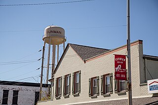
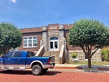
Sunman is a town in Adams Township, Ripley County, in the U.S. state of Indiana. The population was 1,049 at the 2010 census.

<span class="mw-page-title-main">Versailles, Indiana</span> Town in Indiana, United States

Versailles is a town in Johnson Township, Ripley County, in the U.S. state of Indiana. The population was 2,113 at the 2010 census. The town is the county seat of Ripley County.

<span class="mw-page-title-main">Doniphan, Missouri</span> City in Missouri, United States

Doniphan is a city in Ripley County, Missouri, United States. The population was 1,781 at the 2020 census. It is the county seat of Ripley County.

<span class="mw-page-title-main">Meridian Hills, Indiana</span> Town in Indiana, United States

Meridian Hills is a town in Washington Township, Marion County, Indiana, about 8 miles (13 km) north of downtown Indianapolis. It had a population of 1,774 at the 2020 census, up from 1,616 in 2010.

<span class="mw-page-title-main">North Crows Nest, Indiana</span> Town in Indiana, United States

North Crows Nest is a town in Washington Township, Marion County, Indiana, United States. It is approximately 7 miles (11 km) north of downtown Indianapolis. The population was 44 at the 2020 census. It has existed as an "included town" since 1970, when it was incorporated into Indianapolis as part of Unigov. It is part of Indianapolis, but retains town governmental powers under IC 36-3-1-11.

<span class="mw-page-title-main">Rocky Ripple, Indiana</span> Town in Indiana, United States

Rocky Ripple is a town in Marion County, Indiana, United States. The population was 655 at the 2020 census. It was founded in 1927, and the town was incorporated as an "included town" as part of Unigov in 1970. It is part of Indianapolis, but retains a separate functioning town government under IC 36-3-1-11. Although not far from the city center, Rocky Ripple is a somewhat isolated area, located between the Central Canal and the White River; only two traffic-supporting bridges over the canal provide access to the town.

<span class="mw-page-title-main">Spring Hill, Indiana</span> Town in Indiana, United States

Spring Hill is a town in Marion County, Indiana, United States. The population was 95 at the 2020 census. It has existed as an "included town" since 1970, when it was incorporated into Indianapolis as part of Unigov. It is part of Indianapolis, but retains town governmental powers under IC 36-3-1-11.

<span class="mw-page-title-main">Warren Park, Indiana</span> Town in Indiana, United States

Warren Park is a town in Warren Township, Marion County, Indiana, United States. The population was 1,490 at the 2020 census. It has existed as an "included town" since 1970, when it was incorporated into Indianapolis as part of Unigov. It is part of Indianapolis, but retains a functioning town government under IC 36-3-1-11.

<span class="mw-page-title-main">Williams Creek, Indiana</span> Town in Indiana, United States

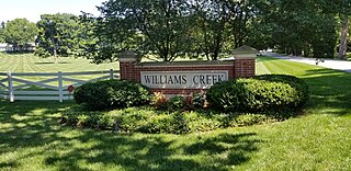
Williams Creek is a town in Washington Township, Marion County, Indiana, United States. It is located about 9 miles (14 km) north of downtown Indianapolis. The population was 430 at the 2020 census. It has existed as an "included town" since 1970, when it was incorporated into Indianapolis as part of Unigov. It is part of Indianapolis, but retains a functioning town government under IC 36-3-1-11.

<span class="mw-page-title-main">Wynnedale, Indiana</span> Town in Indiana, United States

Wynnedale is a town in Washington Township, Marion County, Indiana, United States. The population was 215 at the 2020 census. It has existed as an "included town" since 1970, when it was incorporated into Indianapolis as part of Unigov. It is part of Indianapolis, but retains a functioning town government under IC 36-3-1-11.

References

  1. "2020 U.S. Gazetteer Files". United States Census Bureau. Retrieved March 16, 2022.
  2. 1 2 3 U.S. Geological Survey Geographic Names Information System: Osgood, Indiana
  3. 1 2 "U.S. Census website". United States Census Bureau . Retrieved January 31, 2008.
  4. Wonning, Paul R. A Visit to Ripley County Indiana: Travel Guide for Ripley County, Indiana. Mossy Feet Books. p. 33. ISBN   978-1-301-25438-5.
  5. A Visit to Osgood and Napoleon, Indiana: A Guide to Osgood and Napoleon in Southern Indiana. Mossy Feet Books. July 29, 2011. p. 6. ISBN   978-1-4657-2522-6.
  6. "Ripley County". Jim Forte Postal History. Retrieved November 30, 2015.
  7. "No Colored Men There". Indianapolis Journal . Indianapolis. October 22, 1894. p. 8 via Chronicling America. 'Damage suits brought by "colored" citizens because of real or fancied deprivation from civil rights through "man's inhumanity to man" are frequently reported throughout the North, and occasionally in this city,' says Dr. W. B. Clarke. 'But I was recently much surprised to learn that there are portions of this very State where a colored person is not even allowed to become a citizen, or even reside. During a month's sojourn in Ripley county I visited several towns without seeing a single Afro-American, and at Osgood, the largest town in the county, was informed that negroes were not allowed to live there, and that there was not a colored family within quite a number of miles of the town. This is only fifty-two miles west of Cincinnati, on the Baltimore & Ohio Southwestern (the old Ohio & Mississippi), in Congressman Objector Holman's Democratic balliwick. Without moralizing on the matter I will only say that this is not because there is no work suitable for them, for domestic help is very scarce and in great demand, and there are extensive quarries, dairies and farms and much timber to cut. Another matter there struck me as rather peculiar, and that is, there is no affiliation in any way with the capital city of the State except the little legal business absolutely necessary. The colloquial phrase, "the city," always refers to Cincinnati. Yet all this is because of the roundabout means of access, which would quickly be changed if the Big Four would build an extension from Greensburg, only eighteen miles, paralleling the Michigan road, via Napoleon.'
  8. Emmis Communications (November 2000). Indianapolis Monthly. Emmis Communications. p. 249. ISSN   0899-0328.
  9. "G001 - Geographic Identifiers - 2010 Census Summary File 1". United States Census Bureau. Archived from the original on February 13, 2020. Retrieved July 17, 2015.
  10. "Census of Population and Housing". Census.gov. Retrieved June 4, 2015.
  11. "U.S. Census website". United States Census Bureau . Retrieved December 11, 2012.
  12. "Indiana public library directory" (PDF). Indiana State Library. Retrieved March 14, 2018.
  13. Pete Cava (September 22, 2015). Indiana-Born Major League Baseball Players: A Biographical Dictionary, 1871-2014. McFarland. p. 83. ISBN   978-0-7864-9901-4.