
Greenwich Township is the westernmost township in Cumberland County, in the U.S. state of New Jersey. As of the 2020 United States census, the township's population was 771, a decrease of 33 (−4.1%) from the 2010 census count of 804, which in turn reflected a decline of 43 (−5.1%) from the 847 counted in the 2000 census. It is part of the Vineland-Bridgeton metropolitan statistical area, which encompasses those cities and all of Cumberland County for statistical purposes and which constitutes a part of the Delaware Valley.
Deerfield is an unincorporated community and census-designated place (CDP) located within Upper Deerfield Township, Cumberland County, in the U.S. state of New Jersey. It was first listed as a CDP in the 2020 census with a population of 230.
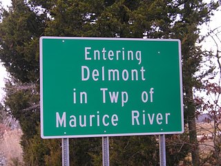
Delmont is an unincorporated community and census-designated place (CDP) located within Maurice River Township, in Cumberland County, in the U.S. state of New Jersey. The area is served as United States Postal Service ZIP Code 08314. It was first listed as a CDP in the 2020 census with a population of 122.

Middlebush is an unincorporated community and census-designated place (CDP) located in Franklin Township, in Somerset County, in the U.S. state of New Jersey. As of the 2010 United States Census, the CDP's population was 2,326. It is perhaps most distinguished as being the host section for Franklin Township's municipal complex.
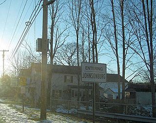
Johnsonburg is an unincorporated community and census-designated place (CDP) located within Frelinghuysen Township in Warren County, in the U.S. state of New Jersey, that was created as part of the 2010 United States Census. As of the 2020 Census, the CDP's population was 381, up from 101 in the 2010 Census.

Mercerville is an unincorporated community and census-designated place (CDP) located within Hamilton Township, in Mercer County, in the U.S. state of New Jersey. As of the 2010 United States Census, the CDP's population was 13,230. Until after the 2000 census, the area was part of the Mercerville-Hamilton Square CDP. For the 2010 Census it was split into two CDPs, Mercerville and Hamilton Square.

Stewartsville is an unincorporated community and census-designated place (CDP) located within Greenwich Township in Warren County, in the U.S. state of New Jersey, that was created as part of the 2010 United States Census. As of the 2010 Census, the CDP's population was 349.
Roadstown is an unincorporated community located within Stow Creek Township, in Cumberland County, in the U.S. state of New Jersey.

Ellisburg is an unincorporated community and census-designated place (CDP) located within Cherry Hill Township, in Camden County, in the U.S. state of New Jersey. As of the 2010 United States Census, the CDP's population was 8,168. The area had been part of the combined Erlton-Ellisburg CDP, which was discontinued after the 2000 census.
Broadway is an unincorporated community and census-designated place (CDP) located within Franklin Township, in Warren County, in the U.S. state of New Jersey, that was created as part of the 2010 United States Census. As of the 2010 Census, the CDP's population was 244.
Greenwich is an unincorporated community and census-designated place (CDP) located within Greenwich Township in Warren County, in the U.S. state of New Jersey, that was defined as part of the 2010 United States Census. As of the 2010 Census, the CDP's population was 2,755.
Seeley is a census-designated place (CDP) in Cumberland County, in the U.S. state of New Jersey. It is in the northern part of the county, on the west side of Upper Deerfield Township. The western border of the CDP is the Cohansey River, which forms the border with Hopewell Township to the west. Seeley is 5 miles (8 km) north of Bridgeton, the county seat, and 13 miles (21 km) west of Vineland.
Carlls Corner is a census-designated place (CDP) located in Upper Deerfield Township in Cumberland County, in the U.S. state of New Jersey. It is bordered at its southwest corner by the city of Bridgeton, the county seat.
Cumberland-Hesstown is a census-designated place (CDP) located in the northern part of Maurice River Township in Cumberland County, in the U.S. state of New Jersey. Consisting of the unincorporated communities of Cumberland and Hesstown, it is in the eastern part of the county. New Jersey Route 49 passes through the CDP, leading northwest 6 miles (10 km) to Millville and southeast 11 miles (18 km) to Tuckahoe.
Dutch Neck is a census-designated place (CDP) located in Cumberland County, in the U.S. state of New Jersey. It is in the northwestern part of the county, in the southern part of Hopewell Township. It is 4 miles (6 km) southwest of Bridgeton, the county seat.
Greenwich is an unincorporated community and census-designated place (CDP) in Cumberland County, in the U.S. state of New Jersey. It is in the western part of the county, in the southeast part of Greenwich Township, on the northwest side of the tidal Cohansey River, 4 miles (6 km) northeast of its mouth at Delaware Bay. The community is 7 miles (11 km) southwest of Bridgeton, the county seat.
Lakeside-Beebe Run is a census-designated place (CDP) in Hopewell Township, in Cumberland County, in the U.S. state of New Jersey. It is in the northern part of the county, on the eastern side of the township, on high ground overlooking Sunset Lake to the east and Mary Elmer Lake to the south. It is bordered to the south by the city of Bridgeton, the county seat.
Sheppards Mill is an unincorporated community and census-designated place (CDP) in Cumberland County, in the U.S. state of New Jersey. It is located in the western part of the county in northeastern Greenwich Township and southwestern Hopewell Township. The community is centered on Mill Creek, which is dammed to form Sheppards Millpond in the northwestern part of the CDP. Mill Creek is a southwest-flowing tributary of Wheaton Run, part of the Cohansey River watershed leading to Delaware Bay.
Silver Lake is a census-designated place (CDP) in Cumberland County, in the U.S. state of New Jersey. It is in the northern part of the county, in the southwest part of Upper Deerfield Township. It is bordered to the west by the Cohansey River, which forms the boundary with Hopewell Township, to the north by Seeley, and to the south by Sunset Lake. Bridgeton, the Cumberland county seat, is 3 miles (5 km) to the south.
Sunset Lake is a census-designated place (CDP) in Cumberland County, in the U.S. state of New Jersey. It is in the northern part of the county, in the southwest corner of Upper Deerfield Township. It is bordered to the south by the city of Bridgeton, the county seat. It is bordered to the east by Laurel Heights, to the north by Silver Lake, and to the west by Sunset Lake, an impoundment on the Cohansey River. Across the lake is Hopewell Township.


