Related Research Articles

Baker County is a county in the U.S. state of Florida. As of the 2020 census, the population was 28,259. Its county seat is Macclenny. The county was founded in 1861 and is named for James McNair Baker, a judge and Confederate Senator.
Ridge Manor is a census-designated place (CDP) in Hernando County, Florida, United States. The population was 4,513 at the 2010 census.

Eatonville is a town in Orange County, Florida, United States, six miles north of Orlando. It is part of Greater Orlando. Incorporated on August 15, 1887, it was one of the first self-governing all-black municipalities in the United States. The Eatonville Historic District and Moseley House Museum are in Eatonville. Author Zora Neale Hurston grew up in Eatonville and the area features in many of her stories.

Humboldt is a town in Brown County in the U.S. state of Wisconsin. The population was 1,311 at the 2010 census. The community name was chosen by Henry Fontaine.
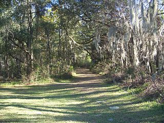
The Marjorie Harris Carr Cross Florida Greenway is a protected green belt corridor, more than one and a half miles (1.6 km) wide in places, that was the former route of the proposed Cross Florida Barge Canal. It is named for the leader of opposition to the Cross Florida Barge Canal, Marjorie Harris Carr, and was originally a U.S. Army Corps of Engineers canal project to connect the Gulf of Mexico and the Atlantic Ocean across Florida for barge traffic. Two sections were built, but the project was ultimately cancelled because of local opposition related to environmental concerns, including protecting the state's water supply and conservation of the Ocklawaha River Valley ecosystem, as well as national opposition for the costs being perceived as "government waste" with "limited national value." The greenway is part of the system of Florida State Parks, including the Santos Trail System, and is managed by the Florida Department of Environmental Protection.
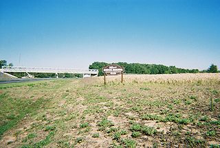
State Road 997, also known as Krome Avenue and West 177th Avenue is a 36.7-mile-long (59.1 km) north–south state highway in western Miami-Dade County, Florida. It runs from State Road 998 in Homestead north across U.S. Route 41 to U.S. Route 27 near Countyline Dragway, just south of the Broward County line. Its main use is as a bypass around the western side of Miami, linking the routes that run southwest, west and northwest from that city. The road passes through newer suburbs in the southern third of its length, while the northern two thirds of the highway traverse the eastern edge of the Everglades.

Crystal River Preserve State Park is a Florida State Park, originally known as the Crystal River Buffer Preserve. The Preserve comprises 27,500 acres of salt marsh, tidal creeks, mangrove islands, hardwood forests, coastal scrub and pine flat woods.

The Withlacoochee River or Crooked River is a river in central Florida, in the United States. It originates in the Green Swamp, east of Polk City, flowing west, then north, then northwest and finally west again before emptying into the Gulf of Mexico near Yankeetown. The river is 141 miles (227 km) long and has a drainage basin of 1,170 square miles (3,000 km2). It is believed to have been named after the Withlacoochee River in the northern part of the state, near the border with Georgia.

The Manuka State Wayside Park is a state park of 13.4 acres (5.4 ha) with an arboretum located approximately 19 miles (31 km) west of Naʻalehu, on the Mamalahoa Highway section of the Hawaii Belt Road, on the island of Hawaii, Hawaii, coordinates 19°6′33″N155°49′33″W

The Tray Mountain Wilderness was designated in 1986 and currently consists of 9,702 acres (39.26 km2). The Wilderness is located within the borders of the Chattahoochee National Forest in Habersham, Rabun, Towns and White counties, Georgia and is managed in the Chattooga Ranger District. The Wilderness is managed by the United States Forest Service and is part of the National Wilderness Preservation System.

Bear Swamp is a forested parkland in Ashfield, Massachusetts. The Trustees of Reservations owns and maintains the property.

Harrisonville was a small town, now extinct, in Tippecanoe Township, Tippecanoe County, in the U.S. state of Indiana.
Uniontown is an unincorporated community in Vernon Township, Jackson County, Indiana.
Palmyra Township is a township in Douglas County, Kansas, USA. As of the 2000 census, its population was 5,760. It was named after a small trail stop on the Santa Fe Trail that was later absorbed into Baldwin City. When it was first established in 1855, it was called Calhoun, until 1858.

Holder is an unincorporated community in Citrus County, Florida, United States. Holder is located around the intersection of U.S. Route 41 and County Road 491. West of this intersection is a crossing for the Withlacoochee State Trail. The ZIP Code for Holder is 34445.
Nashville was a community, now a ghost town, on the southeast bank of the Brazos River in present-day Milam County, Texas, United States.
Pleasant Corners is a hamlet in the town of Wilson in Niagara County, New York, United States.
Cool Spring is an unincorporated community located in Brunswick County, in the U.S. state of Virginia.
Ethlyn is an unincorporated community in Lincoln County, in the U.S. state of Missouri.
Haysville Corner is an unincorporated community in Wayne Township, Randolph County, in the U.S. state of Indiana.
