Related Research Articles

Pierre Bouguer was a French mathematician, geophysicist, geodesist, and astronomer. He is also known as "the father of naval architecture".

Charles Marie de La Condamine was a French explorer, geographer, and mathematician. He spent ten years in territory which is now Ecuador, measuring the length of a degree of latitude at the equator and preparing the first map of the Amazon region based on astro-geodetic observations. Furthermore he was a contributor to the Encyclopédie.
Mount Roraima is the highest of the Pakaraima chain of tepuis or plateaux in South America. It is located at the junction of Venezuela, Brazil and Guyana. A characteristic large flat-topped mountain surrounded by cliffs 400 to 1,000 meters high. The highest point of Mount Roraima is located on the southern edge of the cliff at an altitude of 2,810 meters in Venezuela, and another protrusion at an altitude of 2,772 meters at the junction of the three countries in the north of the plateau is the highest point in Guyana. The name of Mount Roraima came from the native Pemon people. Roroi in the Pemon language means "blue-green", and ma means "great".
Condamine may refer to any of the following:
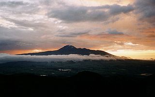
Corazón is an inactive, eroded stratovolcano of Ecuador, situated about 30 km southwest of Quito in the western slopes of the Andes.
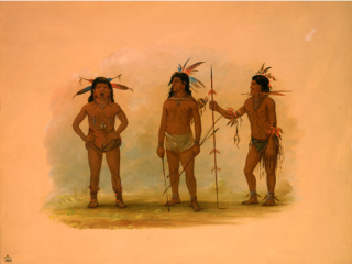
The Omagua people are an indigenous people in Brazil's Amazon Basin. Their territory, when first in contact with Spanish explorers in the 16th century, was on the Amazon River upstream from the present-day city of Manaus extending into Peru. They speak the Omagua language. The Omagua exist today in small numbers, but they were a populous, organized society in the late Pre-Columbian era. Their population suffered steep decline, mostly from infectious diseases, in the early years of the Columbian Exchange. During the 18th century, the Omagua largely abandoned their indigenous identity in response to prejudice and racism that marginalized aboriginal peoples in Brazil and Peru. More tolerant attitudes led to a renewed tribal identity starting in the 1980s.

Le Sud-Ouest is a borough (arrondissement) of the city of Montreal, Quebec, Canada.

Jean Marie Le Bris was a French aviator, born in Concarneau, Brittany who built two glider aircraft and performed at least one flight on board of his first machine in late 1856. His name is sometimes spelled Jean-Marie Le Bris, and he is also known as Yann Vari Ar Briz in Breton language.
The French Geodesic Mission to the Equator was an 18th-century expedition to what is now Ecuador carried out for the purpose of performing an arc measurement, measuring the length of a degree of latitude near the Equator, by which the Earth radius can be inferred. The mission was one of the first geodesic missions carried out under modern scientific principles, and the first major international scientific expedition.
Jean Godin des Odonais was a French cartographer and naturalist.

Pléven is a commune in the Côtes-d'Armor department of Brittany in northwestern France, 70km north west of Rennes.
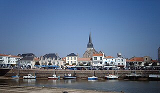
Saint-Gilles-Croix-de-Vie is a commune in the Vendée department, region of Pays de la Loire, western France.
Samuel Fritz SJ was a Czech Jesuit missionary, noted for his exploration of the Amazon River and its basin. He spent most of his life preaching to Indigenous communities in the western Amazon region, including the Omaguas, the Yurimaguas, the Aisuare, the Ibanomas, and the Ticunas. In 1707 he produced the first accurate map of the Amazon River, establishing as its source the Marañón.

Marie-Angélique Memmie Le Blanc was a famous feral child of the 18th century in France who was known as The Wild Girl of Champagne, The Maid of Châlons, or The Wild Child of Songy.

Lake Parime or Lake Parima is a legendary lake located in South America. It was reputedly the location of the fabled city of El Dorado, also known as Manoa, much sought-after by European explorers. Repeated attempts to find the lake failed to confirm its existence, and it was dismissed as a myth along with the city. The search for Lake Parime led explorers to map the rivers and other features of southern Venezuela, northern Brazil, and southwestern Guyana before the lake's existence was definitively disproved in the early 19th century. Some explorers proposed that the seasonal flooding of the Rupununi savannah may have been misidentified as a lake. Recent geological investigations suggest that a lake may have existed in northern Brazil, but that it dried up some time in the 18th century. Both "Manoa" and "Parime" are believed to mean "big lake".

Wei-Assipu-tepui, also known as Little Roraima or Roraimita, is a minor tepui of the Eastern Tepuis chain. It lies just off the northeastern flank of Roraima-tepui, directly on the border between Brazil and the disputed Guayana Esequiba territory, claimed by Venezuela but controlled by Guyana, and very close to the tripoint of all three countries. The mountain is known for its extensive cave systems, with one extending for over a kilometre.
Events from the year 1774 in France
Loups Marins River is a river in the Côte-Nord region of Quebec, Canada. It empties into the Gulf of Saint Lawrence.
References
- ↑ Brazilian Ministry of Transport
- ↑ Charles Marie de La Condamine, Relation abrégée d'un voyage fait dans l'intérieur de l'Amérique méridionale: depuis la côte de la mer du Sud, jusqu'aux côtes du Brésil et de la Guyane, en descendant la rivière des Amazones..., Jean-Edme Dufour & Philippe Roux, 1778; University of Lausanne