Pedlar River

Last updated
The Pedlar River as viewed from the Appalachian Trail Pedlar River Virginia.jpg
The Pedlar River as viewed from the Appalachian Trail

The Pedlar River is a 33.9-mile-long (54.6 km) [1] tributary of the James River in west-central Virginia in the United States. Via the James River, it is part of the watershed of Chesapeake Bay.

Tributary stream or river that flows into a main stem river or lake

A tributary or affluent is a stream or river that flows into a larger stream or main stem river or a lake. A tributary does not flow directly into a sea or ocean. Tributaries and the main stem river drain the surrounding drainage basin of its surface water and groundwater, leading the water out into an ocean.

James River river in Virginia, United States

The James River is a river in the U.S. state of Virginia that begins in the Appalachian Mountains and flows 348 miles (560 km) to Chesapeake Bay. The river length extends to 444 miles (715 km) if one includes the Jackson River, the longer of its two source tributaries. It is the longest river in Virginia and the 12th longest river in the United States that remains entirely within a single state. Jamestown and Williamsburg, Virginia’s first colonial capitals, and Richmond, Virginia's current capital, lie on the James River.

Virginia State of the United States of America

Virginia, officially the Commonwealth of Virginia, is a state in the Southeastern and Mid-Atlantic regions of the United States located between the Atlantic Coast and the Appalachian Mountains. The geography and climate of the Commonwealth are shaped by the Blue Ridge Mountains and the Chesapeake Bay, which provide habitat for much of its flora and fauna. The capital of the Commonwealth is Richmond; Virginia Beach is the most populous city, and Fairfax County is the most populous political subdivision. The Commonwealth's estimated population as of 2018 is over 8.5 million.

The Pedlar River flows for its entire length in western Amherst County. It rises in the Blue Ridge Mountains and flows generally southwardly to its confluence with the James River about 9 miles (14 km) northwest of Lynchburg.

Amherst County, Virginia County in the United States

Amherst County is a county, located in the Piedmont region and near the center of the Commonwealth of Virginia in the United States. The county is part of the Lynchburg, VA Metropolitan Statistical Area, and its county seat is also called Amherst.

Blue Ridge Mountains mountain range

The Blue Ridge Mountains are a physiographic province of the larger Appalachian Mountains range. The mountain range is located in the eastern United States, and extends 550 miles southwest from southern Pennsylvania through Maryland, West Virginia, Virginia, North Carolina, South Carolina, Tennessee and Georgia. This province consists of northern and southern physiographic regions, which divide near the Roanoke River gap. To the west of the Blue Ridge, between it and the bulk of the Appalachians, lies the Great Appalachian Valley, bordered on the west by the Ridge and Valley province of the Appalachian range.

Lynchburg, Virginia Independent city in Virginia, United States

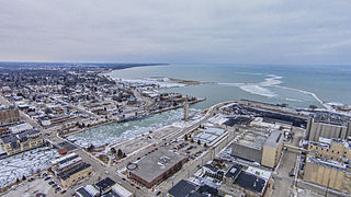
Lynchburg is an independent city in the Commonwealth of Virginia in the United States. As of the 2010 census, the population was 75,568. The 2017 census estimates an increase to 81,000. Located in the foothills of the Blue Ridge Mountains along the banks of the James River, Lynchburg is known as the "City of Seven Hills" or the "Hill City". In the 1860s, Lynchburg was the only major city in Virginia that was not recaptured by the Union before the end of the American Civil War.

See also

Related Research Articles

English River (Iowa) watercourse in the United States of America

The English River is a tributary of the Iowa River in southeastern Iowa in the United States. The main stem of the river is 37.4 miles (60.2 km) long. Including its longest headwaters tributary, the North English River, the total length increases to 89.2 miles (143.6 km). Via the Iowa River, it is part of the Mississippi River watershed. The Deep River is a minor tributary of the English River. The towns of North English, South English and Deep River are named for the English and Deep rivers.

Pamunkey River river in the United States of America

The Pamunkey River is a tributary of the York River, about 93 miles (150 km) long, in eastern Virginia in the United States. Via the York River it is part of the watershed of Chesapeake Bay.

North Anna River river in the United States of America

The North Anna River is a principal tributary of the Pamunkey River, about 62 miles (100 km) long, in central Virginia in the United States. Via the Pamunkey and York rivers, it is part of the watershed of Chesapeake Bay. The river was the site of the Battle of North Anna during the American Civil War.

The South Anna River is a principal tributary of the Pamunkey River, about 102 miles (164 km) long, in central Virginia in the United States. Via the Pamunkey and York rivers, it is part of the watershed of Chesapeake Bay.

The Newfound River is a 22.1-mile-long (35.6 km) tributary of the South Anna River in east-central Virginia in the United States. Via the South Anna, Pamunkey and York rivers, it is part of the watershed of Chesapeake Bay.

The Hardware River is a 23.3-mile-long (37.5 km) tributary of the James River in central Virginia in the United States. It is part of the watershed of Chesapeake Bay.

The Mechums River is a 25.5-mile-long (41.0 km) tributary of the South Fork of the Rivanna River in central Virginia in the United States. Via the Rivanna and James rivers, it is part of the watershed of Chesapeake Bay.

The Moormans River is a 14.3-mile-long (23.0 km) tributary of the South Fork of the Rivanna River in central Virginia in the United States. Via the Rivanna and James rivers, it is part of the watershed of Chesapeake Bay.

The Doyles River is a 10.1-mile-long (16.3 km) tributary of the Moormans River in central Virginia in the United States. Via the Moormans, Rivanna and James rivers, it is part of the watershed of Chesapeake Bay.

The Willis River is a 61.8-mile-long (99.5 km) tributary of the James River in central Virginia in the United States. Via the James River, it is part of the watershed of Chesapeake Bay.

The Rockfish River is a 28.7-mile-long (46.2 km) tributary of the James River in central Virginia in the United States. Via the James River, it is part of the watershed of the Chesapeake Bay.

Manitowoc River river in the United States of America

The Manitowoc River is a 35.8-mile-long (57.6 km) river in eastern Wisconsin in the United States. It flows into Lake Michigan at the city of Manitowoc.

The Banister River is a tributary of the Dan River, about 65 mi (105 km) long, in southern Virginia in the United States. Via the Dan, it is part of the watershed of the Roanoke River, which flows to the Atlantic Ocean. It rises on Brier Mountain in western Pittsylvania County and flows generally eastwardly into Halifax County, past the town of Halifax. It joins the Dan River 6 mi (9.7 km) east of the town of South Boston.

Rough River river in the United States of America

The Rough River is a 156-mile-long (251 km) tributary of the Green River in west-central Kentucky in the United States. Via the Green and Ohio rivers, it is part of the watershed of the Mississippi River. According to the Geographic Names Information System, it has also been known historically as "Rough Creek".

Nolin River river in the United States of America

The Nolin River is a 104-mile-long (167 km) tributary of the Green River in central Kentucky in the United States. Via the Green and Ohio rivers, it is a part of the watershed of the Mississippi River.

The Rock River is a 12.9-mile-long (20.8 km) tributary of the West River in southern Vermont in the United States. Via the West River, it is part of the watershed of the Connecticut River.

Ottauquechee River river in the United States of America

The Ottauquechee River is a 41.4-mile-long (66.6 km) river in eastern Vermont in the United States. It is a tributary of the Connecticut River, which flows to Long Island Sound.

Rocky Mountain is a peak of the Blue Ridge Mountains in Virginia. It is located about 2 miles (3.5 km) east of Irish Gap, on the border of Rockbridge County and Amherst County; it is the highest point of both counties. Rocky Mountain is flanked to the northeast by Elk Pond Mountain, to the southwest by Grapevine Ridge, and to the south by Tar Jacket Ridge.

Craig Creek river in the United States of America

Craig Creek is an 84-mile-long (135 km) tributary of the James River in the U.S. state of Virginia. It flows through the Ridge-and-Valley Appalachians in western Virginia, passing 15 miles (24 km) northwest of Roanoke.

The Saint Marys River is an 8.4-mile-long (13.5 km) tributary of the South River in Augusta County in the U.S. state of Virginia. By the South and Maury rivers, it is part of the James River watershed.

References

  1. U.S. Geological Survey. National Hydrography Dataset high-resolution flowline data. The National Map, accessed April 1, 2011
DeLorme company

DeLorme is a producer of personal satellite tracking, messaging, and navigation technology. The company’s main product, inReach, integrates GPS and satellite technologies. inReach provides the ability to send and receive text messages anywhere in the world by using the Iridium satellite constellation. By pairing with a smart phone, navigation is possible with access to free downloadable topographic maps and NOAA charts. On February 11, 2016, the company announced that it had been purchased by Garmin, a multinational producer of GPS products and services.

International Standard Book Number Unique numeric book identifier

The International Standard Book Number (ISBN) is a numeric commercial book identifier which is intended to be unique. Publishers purchase ISBNs from an affiliate of the International ISBN Agency.

Coordinates: 37°30′35″N79°16′05″W / 37.50986°N 79.26808°W / 37.50986; -79.26808

Geographic coordinate system Coordinate system

A geographic coordinate system is a coordinate system that enables every location on Earth to be specified by a set of numbers, letters or symbols. The coordinates are often chosen such that one of the numbers represents a vertical position and two or three of the numbers represent a horizontal position; alternatively, a geographic position may be expressed in a combined three-dimensional Cartesian vector. A common choice of coordinates is latitude, longitude and elevation. To specify a location on a plane requires a map projection.