23rd Street NW, H Street NW (to Southern Avenue/Naylor Road), I Street NW (to Potomac Park), Pennsylvania Avenue NW/SE, Naylor Road SE, Branch Avenue SE (36), Alabama Avenue SE (32)
The current routing also incorporates portions of the Naylor Road Line, formerly a standalone route.
Current route
Routes 32 and 36 begin at the Potomac Park apartments near the Foggy Bottom–GWU station and follow H and I Streets to Pennsylvania Avenue. Both buses routes travel across Southeast and over the Sousa Bridge. At L'Enfant Square, the routes separate. Route 32 takes Naylor Road and Alabama Avenue, while Route 36 continues along Pennsylvania to Branch Avenue. Route 32 terminates at the Southern Avenue station, just across the Maryland border, while Route 36 finishes at Naylor Road station, also in Maryland. Both stations are served by the Green Line.
Routes 32 and 36 operate seven days a week. Both routes are supplemented by the Wisconsin Avenue Line, operated by Routes 31 and 33, which traverse the same route as the 32 and 36, but continue north along Wisconsin Avenue to Friendship Heights station. As of November 2022, the 34 Route has been suspended and the 32 and 36 have increased service.
Both lines currently operates out of Andrews Federal Center division with some trips operated out of Shepherd Parkway division. Prior to being moved to Andrews, the line operated both out of Bladensburg and Western division at some points.
On March 3, 1875, the Washington and Georgetown and Metropolitan Railroad were "directed to take up such portions of their tracks as may come in way of the improvement of the Capitol Grounds".[4] This improvement gave the Capitol Grounds their present shape, bounded by First Street West and East and B Street North and South, and the Pennsylvania Avenue Line was moved to First Street West and B Street South.[6] The B&O station branch was moved to First Avenue West and C Street North, ending at New Jersey Avenue; this had been the route of the B&O before its tracks (actually those of the Alexandria and Washington Railroad) were ripped up in 1872.[citation needed]
Also on March 3, 1875, the Washington and Georgetown was required to move its line from the Pennsylvania Avenue Bridge to the M Street Bridge via 26th Street West.[4] The old bridge was reconstructed in the mid-1910s, with Capital Traction paying one-third of the cost, and cars moved back to Pennsylvania on July 7, 1916 (eastbound), and July 15 (westbound).[7]
On August 23, 1894, the company was required to, within a year, build a union station at the Georgetown end of the Aqueduct Bridge and extend its line west to it, where passengers could transfer to lines into Virginia.[4]
A loop off the line through the West End of Washington was authorized on June 4, 1900[7] and opened on March 24, 1901.[8] Westbound cars could turn south on 17th Street West, west on G Street North, and north on 25th Street West to return to Pennsylvania Avenue, while the eastbound track was laid in 26th Street West, F Street North, and 17th Street West. A track in G Street between 25th and 26th Streets allowed for a short-turn service, reversing direction at 26th Street.[6][9]
On May 23, 1908, Congress authorized extensions of several companies to serve the new Union Station. The Capital Traction's branch to the old B&O station was extended east on C Street and northeast on Delaware Avenue to the station, and a second route between this branch and the tracks towards the east ran via First Street East and B Street North to Delaware Avenue (over trackage owned by other companies).[7][9]
A second loop through the West End was approved on December 7, 1916, from Pennsylvania Avenue south to Virginia Avenue near West Potomac Park via 18th and 19th Streets.[10]
After consolidation
After Capital Traction and the Washington Railway and Electric Company were merged in 1933 to form the Capital Transit Company, some of the redundant lines were abandoned. This included the WR&E's Georgetown line between Connecticut and Wisconsin Avenues, resulting in Cabin John Line and Tenleytown Line cars, and cars of other lines that ran to Georgetown, being routed via Pennsylvania Avenue between Georgetown and the White House. When numbers were assigned to the car routes in 1936, the following regular routes used the Pennsylvania Avenue Line:
Thus Pennsylvania Avenue Line streetcars (Route 30) were discontinued on January 3, 1960, and the tracks east of 14th Street Northwest were last used on January 28, 1962. Route 54 buses still serve a small part of Pennsylvania Avenue, used by the 50 streetcar line.
The East Washington Heights Traction Company's streetcars, which ran from Barney Circle to Randle Highlands via the Sousa Bridge, were replaced by buses on December 1, 1923, originally numbered Route C2 in 1936, before eventually being renamed as routes, "32 & 34". The 32 streetcar line operated between Shipley Terrace & Friendship Heights; while the 34 streetcar line operated between Hillcrest & Friendship Heights.
The Capital Traction Company began operating buses to Hillcrest and Good Hope on December 23, 1924,[2] originally numbered as Route C6 in 1936, before eventually being renamed as routes, "35 & 36". Both the 35 & 36 bus routes operated between Hillcrest & Friendship Heights, just like the 34 bus route, only with the exception that 35 & 36 would divert off of the intersection of Naylor Road SE onto the intersection of Branch Avenue SE, then operate on Branch Avenue SE, before operating on Pennsylvania Avenue SE, while 34 would remain straight on Naylor Road SE, then divert onto 23rd Street SE (to Friendship Heights), 25th Street SE (to Hillcrest), and Minnesota Avenue SE (to Hillcrest), before operating on Pennsylvania Avenue SE.
Later, routes 32, 34, 35, and 36 would operate under DC Transit after streetcars were phased out.[11] Routes 30, 32, 34, 35, and 36 eventually became Metrobus routes on February 4, 1973 when WMATA acquired DC Transit and three other transit agencies all operating their original routes.[12]
On April 30, 1983, when Archives station opened, the 32, 34, 35, & 36 began serving Archives station in the middle of their routes. No route changes were made during this particular time. However, the 30 streetcar line, which had been discontinued, was reincarnated to operate as a new Metrobus Route between Archives station and Friendship Heights.
On August 25, 1984 when Friendship Heights station opened, the 30, 32, 34, 35, and 36 were all extended from their original Friendship Heights terminus at the intersection of Wisconsin Avenue NW and Western Avenue NW, to instead terminate at the newly opened Friendship Heights station. During this same exact time, the 30, 32, 34, 35, and 36 also began serving the newly opened Tenleytown–AU station. The routes remained on Wisconsin Avenue instead of diverting onto Fort Drive Road and 40th Street to serve Tenleytown.
On January 13, 2001 when both Naylor Road & Southern Avenue stations opened, routes 34, 35, and 36 were extended south of their original Naylor Gardens (34 and 35) and Hillcrest (36) terminus, to instead terminate at the newly opened Naylor Road station while the 32 was extended south of its original Shipley Terrace terminus, to instead terminate at the newly opened Southern Avenue station. Route 30 was also extended to operate all the way between the Friendship Heights and Potomac Avenue station. The 35 was rerouted on 30th Street between Erie Street and Naylor Road and route. 36 was extended via 31st, Erie and 30th streets and Naylor Road. Route 30 was not affected by the changes.[13]
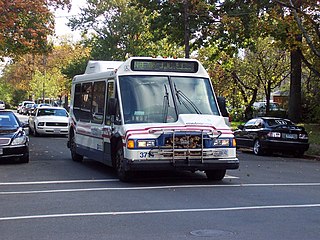
Route 32 in 2014 when it was still serving Friendship Heights.
On June 29, 2008, there were several major changes made to the Pennsylvania Avenue Line as part of a restructuring effort after proposals from riders.[14]
The 30, 34 and 35 routes were completely discontinued and replaced by new routes 31, 37, and 39, plus the existing routes 32, 36. The 34 was replaced by a new route M5 under the Naylor Road Line, which would operate between the Naylor Road station & Eastern Market station. Route 30 which only operated during weekday peak-hours only, was replaced by the brand new route 37 under the Wisconsin Avenue Limited Line, which was designed to operate as a limited-stop MetroExtra Route, that would provide express service between Friendship Heights station & Archives station which was route 30's routing from 1984 to 2001.[15]
WMATA also created a new route 39 under the Pennsylvania Avenue Limited Line to provide new limited stop Metrobus service between the Naylor Road station and Foggy Bottom during weekday peak-hours only like the 37.[15] WMATA also created a new route 31 under the Wisconsin Avenue Line to provide extra service between Foggy Bottom–GWU station & Friendship Heights, to ease up crowding on the 32 and 36.[15]
On December 28, 2008, the M5 was renamed as Route 34 which was also extended to Archives station. The new 34 would operate between Naylor Road station and Archives station operating on portions of routes 32 and 36. Additionally, 34 operated as part of the Naylor Road Line, instead of operating as part of the Pennsylvania Avenue Line instead.[16]
In 2013, WMATA announced proposals to simplify the busy Pennsylvania Avenue Line and Naylor Road Line.[17] Under the proposals, Routes 32 and 36 will terminate at Foggy Bottom with a new 30s line to replace portions of the 32, and 36, and discontinue the 34 with four options to replace the 32 and 36. According to WMATA, it proposes the following:[18]
Option 1: Same as Route 32 between Southern Avenue and Potomac Avenue Station SE, then west to Georgetown via Lincoln Park, Union Station, and Thomas Circle, and then follow Route 31 between Georgetown and Friendship Heights.
Option 2: Same as Route 32 between Southern Avenue and Eastern Market, then west to Georgetown via 8th Street, Massachusetts Avenue, Union Station, and Thomas Circle, and then follow Route 31 between Georgetown and Friendship Heights.
Option 3: Same as Route 32 between Southern Avenue and Independence Ave & 7th St SW, then west to Foggy Bottom via Independence Ave, 17th St SW, Virginia Ave, and Washington Circle, and then follow Route 31 to Friendship Heights.
Option 4: Same as Route 32 between Southern Avenue and Anacostia Freeway SE, then west to Foggy Bottom via Anacostia Freeway, Southeast/Southwest Freeway, Maine Avenue, 17th St SW, Virginia Ave, and Washington Circle, and then follow Route 31 to Friendship Heights.
This was in order to improve service frequency, reliability and efficiency of 30s Line routes and provide transfer-free bus service between Southeast DC and Upper Northwest that bypasses downtown traffic congestion.[18]
On August 24, 2014, changes were made to the Pennsylvania Avenue Line as part of another reconstructing effort.[19]
Route 32 & 36 were both rerouted to operate to Foggy Bottom–GWU station, instead of operating to Friendship Heights station being replacing 30N and 30S which covers the same routes as route 32 and 36.[20] Both the 30N and 30S would operate 24 hours a day with each trips every hour from each other.
A new route 33 was also introduced to operate alongside the 31. The 33 provides service along Wisconsin Avenue NW to provide discontinued service from the 32 and 36 lines running from Friendship Heights station and Federal Triangle.[21]
The 32 and 36 will operate alongside the 34 with the Naylor Road Line name being discontinued and replaced by the current Pennsylvania Avenue Line name.
In 2015, WMATA proposed to eliminate all evening and weekend service for route 34 due to riders mostly riding routes 30N, 30S, 32, and 36.[22]
On March 27, 2016, route 34 discontinued all late-night service after 9:19 PM and all weekend service, with alternative service provided by the 30N and 36.[23]
Beginning on December 15, 2019, routes 32, 34, and 36 along with routes 30N, 30S, and 39 were rerouted to travel across the National Mall along 4th Street between Pennsylvania Avenue NW and Independence Avenue SW towards Archives, Friendship Heights and Potomac Park instead of 7th Street to provide a more direct service to the route.[24]
During the COVID-19 pandemic, all route 34 service was suspended and all route 32 and 36 service was reduced to operate on its Saturday supplemental schedule beginning on March 16, 2020.[25] However beginning on March 18, 2020, route 32 and 36 was further reduced to operate on its Sunday schedule.[26] Service on weekends were also suspended being replaced by the 30N and 30S that operated every 30 minutes.[27] On August 23, 2020, route 32 and 36 service had their normal weekday schedule restored with an increased weekend service to replace weekend route 30N and 30S service which was suspended. However, route 34 remained suspended.[28]
During WMATA's 2021 fiscal year budget, it was proposed for the 34 to be fully eliminated as it overlaps both routes 32 and 36 in order to simplify the 30s line.[29] However WMATA later backed out the elimination of the 34 on April 2, 2020.[30] The 34 elimination was brought back on February 20, 2021 during WMATA's FY2022 budget.[31]
On September 5, 2021, the line was increased to operate every 12 minutes daily between both the 32 and 36.[32] This also essentially eliminated the 34 due to its overlap with the 32 and 36.
Related Research Articles
Randle Highlands is a neighborhood in Southeast Washington, D.C., east of the Anacostia River.
The 14th Street Line, designated Routes 52, 54, is a daily bus route operated by the Washington Metropolitan Area Transit Authority between Takoma station of the Red Line of the Washington Metro and L'Enfant Plaza station (52) of the Blue, Yellow, Orange, Green, and Silver lines of the Washington Metro or Metro Center station (54) of the Red, Blue, Orange, and Silver Lines of the Washington Metro. Some trips terminate at 14th Street & Colorado Avenue NW.
The Connecticut Avenue Line, designated Route L2, is a daily bus route in Northwest Washington, D.C., United States. The L2 operates seven days a week.
The Friendship Heights–Southeast Line, designated as Routes 30N or 30S, were daily bus routes operated by the Washington Metropolitan Area Transit Authority between Friendship Heights station of the Red Line of the Washington Metro and Naylor Road station or Southern Avenue station of the Green Line of the Washington Metro. Both lines operated every 60 minutes at all times. Trips were roughly 90 minutes long. This line provided service from Friendship Heights, operating through most of NW and SE DC and ending in Southern Prince Georges County via a one bus ride. Extra services are provided by the 32, 34, and 36 in Southeast and 31 and 33 in Northwest. Service was eliminated on September 5, 2021 due to redundancy.
The Martin Luther King Jr. Highway Line, designated Route A12 is a daily bus route operated by the Washington Metropolitan Area Transit Authority between Addison Road station of the Blue and Silver Lines of the Washington Metro and New Carrollton station of the Orange Line of the Washington Metro. The line operates every 20 minutes between 7AM and 9PM, 30 minutes after 9PM weekdays and 60 minutes after 9PM weekends. Route A12 trips roughly take 30 minutes. On Sundays, Route A12 is extended to Capitol Heights station replacing a portion of route F14.
The Wisconsin Avenue Line, designated as Routes 31 or 33, is a daily bus route operated by the Washington Metropolitan Area Transit Authority. Its main purpose is to provide service to the upper Northwest side via Wisconsin Avenue NW.
The Temple Hills-Marlow Heights Line, designated Route H12, is a daily bus route operated by the Washington Metropolitan Area Transit Authority between Naylor Road station of the Green Line of the Washington Metro and Heather Hill Apartment Complex in Temple Hills, Maryland, via the Iverson Mall and the Marlow Heights Shopping Center. The line operates 35 minutes Monday-Friday and 60 minutes on Saturdays & Sundays. Trips are roughly 30 minutes long.
The Forestville Line, designated as Route K12, is a daily bus route operated by the Washington Metropolitan Area Transit Authority between Suitland station and Branch Avenue station of the Green Line of the Washington Metro. The line operates every 15 – 45 minutes during weekdays and 60 minutes during weekends. Trips are roughly 30 – 40 minutes long. There are a few early morning/late night and rush hour trips that only operate between the Suitland Metro Station & Penn Mar Shopping Center.
The District Heights–Suitland Line, designated Route V12, is a daily bus route operated by the Washington Metropolitan Area Transit Authority between the Addison Road station of the Blue & Silver Lines of the Washington Metro and Suitland station of the Green Line of the Washington Metro. The line operates every 30–40 minutes on weekdays and 60 minutes on weekends. V12 trips are roughly 35 minutes long.
The District Heights–Seat Pleasant Line, designated Route V14, is a daily bus route operated by the Washington Metropolitan Area Transit Authority between the Deanwood station of the Orange Line of the Washington Metro and Penn Mar Shopping Center in District Heights. The line operates every 20–30 minutes during the rush hour, 60 minutes during weekday middays, and 60 minutes on the weekends. V14 trips are roughly 40–45 minutes long.
The East Capitol Street–Cardozo Line, designated Route 96, is a daily bus route operated by the Washington Metropolitan Area Transit Authority between Tenleytown-AU station of the Red Line of the Washington Metro and Capitol Heights station of the Blue and Silver Lines of the Washington Metro. The line operates every 20–30 minutes at all times. Route 96 trips are roughly 80 minutes long.
The Benning Heights–M Street Line, designated Route V1, is a weekday peak-hour only bus route operated by the Washington Metropolitan Area Transit Authority between the neighborhood of Benning Heights and Smithsonian station of the Blue, Orange, and Silver Lines of the Washington Metro. The line runs every 20–30 minutes in the weekday peak-hour direction only. Trips take roughly 55 minutes.
The Tenleytown–Glover Park Line, designated Route N8, was a bus route operated by the Washington Metropolitan Area Transit Authority between Tenleytown–AU station of the Red Line of the Washington Metro and Glover Park. The line operated every 20–40 minutes on weekdays only with trips roughly taking 30 minutes. The route was discontinued on September 23, 2011 due to low ridership.
The Benning Road Line, designated Route X1, X3 is a weekday peak hour only bus route operated by the Washington Metropolitan Area Transit Authority between Minnesota Avenue station of the Orange Line of the Washington Metro and Foggy Bottom–GWU station of the Orange, Blue, and Silver Lines of the Washington Metro (X1) or Duke Ellington Bridge in Adams Morgan (X3). The line operates every 10–31 minutes during weekday peak hours in the peak direction only. X1 trips are roughly 41 minutes while X3 trips are roughly 45 minutes. All service along the X1 and X3 lines is currently suspended.
The Wisconsin Avenue Limited Line, designated Route 37, was a weekday peak-hour bus route operated by the Washington Metropolitan Area Transit Authority between Friendship Heights station of the Red Line of the Washington Metro and Archives station of the Green and Yellow Lines of the Washington Metro. The line operated every 15–22 minutes during the weekday peak hours only in the peak direction only. Route 37 trips were roughly 45 minutes long. This route provided limited stop service along Pennsylvania Avenue and Wisconsin Avenue supplementing routes 31, and 33.
The Anacostia–Eckington Line, designated Route P6, is a daily bus route operated by the Washington Metropolitan Area Transit Authority between Rhode Island Avenue–Brentwood station of the Red Line of the Washington Metro and Anacostia station of the Green Line of the Washington Metro With late night and early morning trips shortened to operate between Anacostia station of the Green Line of the Washington Metro and L'Enfant Plaza station of the Blue, Orange, Silver, Green and Yellow Lines of the Washington Metro. The line operates every 15–20 minutes during the weekday peak hours, 24 minutes during the weekday midday, and 30–35 minutes during the late nights and weekends. Route P6 trips are roughly 65 minutes long.
The Massachusetts Avenue Line, designated Route N2, N4, N6, is a daily bus route operated by the Washington Metropolitan Area Transit Authority between Friendship Heights station of the Red Line of the Washington Metro and Farragut Square in Downtown Washington DC. The line operates every 27 minutes during the weekdays and 40 minutes on weekends. Trips take roughly 45 minutes to complete.
The U Street–Garfield Line, designated Routes 90 and 92, are daily bus routes operated by the Washington Metropolitan Area Transit Authority between Anacostia station (90) or Congress Heights station (92) of the Green Line of the Washington Metro and Duke Ellington Bridge (90) in Adams Morgan or Reeves Center / U Street station (92) of the Green Line of the Washington Metro. Late Night & Early Morning 92 trips are extended to Duke Ellington Bridge. The lines operate every 12 - 24 minutes between 7 AM and 9 PM, and 15 - 30 minutes at all other times. Route 90 and 92 trips are roughly 60 to 70 minutes.
The Pennsylvania Avenue Limited Line, designated Route 39 was a limited weekday peak-hour only MetroExtra route that operated between Naylor Road station of the Green Line of the Washington Metro and Potomac Park. The route gave limited stop service to local Metrobus routes 32, 34, and 36.
This page is based on this Wikipedia article Text is available under the CC BY-SA 4.0 license; additional terms may apply. Images, videos and audio are available under their respective licenses.


