
Tipton County is a county in the U.S. state of Indiana, located north of the state capital of Indianapolis. According to the 2020 census, it had a population of 15,359. Its county seat is Tipton. The county has four incorporated towns with a total population of about 7,000, as well as many small unincorporated communities. It is divided into six townships which provide local services. Three Indiana state roads and one U.S. Route cross the county, as do two railroad lines. Before the arrival of non-indigenous settlers in the early 19th century, the area was inhabited by several Native American tribes. The county was officially established in 1844, one of the last Indiana counties to be settled. Tipton and Howard Counties were established by the same legislative action on January 15.
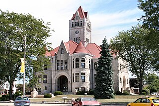
Starke County is a county in the U.S. state of Indiana. As of the 2020 United States Census, its population was 23,371. The county seat is Knox.
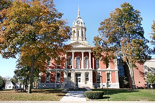
Marshall County is a county in the U.S. state of Indiana. The 2020 census recorded the population at 46,095. The county seat is Plymouth.
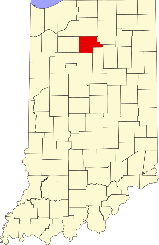
Fulton County is a county located in the U.S. state of Indiana. As of 2020, the population was 20,480. The county seat is Rochester.

Rochester is a city in, and the county seat of, Fulton County, Indiana, United States. The population was 6,270 at the 2020 census.
Tipton is a city in and the county seat of Tipton County, Indiana, United States. The population was estimated to be 5,275 as of July 1, 2021.

East Germantown is a town in Jackson Township, Wayne County, in the U.S. state of Indiana. The population was 410 at the 2010 census.

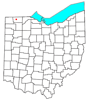
Pettisville is an unincorporated community and census-designated place (CDP) in Clinton and German townships, Fulton County, Ohio, United States. Located at the intersection of County Road 19 and Country Road D, its elevation is 755 feet (230 m). As of the 2020 census the population was 469.

The Potawatomi Trail of Death was the forced removal by militia in 1838 of about 859 members of the Potawatomi nation from Indiana to reservation lands in what is now eastern Kansas.
Tedrow is an unincorporated community and census-designated place (CDP) in southwestern Dover Township, Fulton County, Ohio, United States. It lies at the intersection of the east-west County Road J with the north-south County Roads 17-2 and 17-3, 3 miles (5 km) north and 3.5 miles (5.6 km) west of the northern edge of the city of Wauseon, the county seat of Fulton County. The community lies less than one mile north of the Ohio Turnpike, although the nearest exit is several miles away.

Van Buren Township is one of four townships in Brown County, Indiana. As of the 2010 census, its population was 2,008 and it contained 941 housing units. The township includes the southern portion of Brown County State Park.

Hackleman is a small unincorporated community in central Liberty Township, Grant County, Indiana.
Fletcher or Fletcher Lake is an unincorporated community in Wayne Township, Fulton County, Indiana.
Green Oak is an unincorporated community in Rochester Township, Fulton County, Indiana.
Tiosa is an unincorporated community in Richland Township, Fulton County, Indiana.

Butlerville is an unincorporated community and census-designated place (CDP) in central Campbell Township, Jennings County, Indiana, United States. As of the 2010 census it had a population of 282.
The Rochester Downtown Historic District is a historic district on the National Register of Historic Places (NRHP) in Rochester, Indiana, United States. It was placed on the Register on June 24, 2008. The majority of buildings in the area are masonry and Italianate while structures outside the district are largely residential frame built structures.
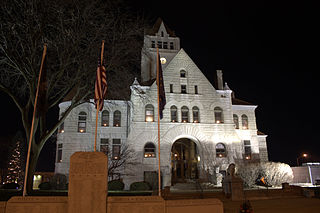
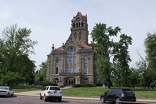
The Fulton County Courthouse is a historic courthouse located at Rochester, Fulton County, Indiana. It was built in 1895–1896, and is a four-story, Richardsonian Romanesque style limestone building. It has a cross-hall plan and features a central bell and clock tower with a pyramidal roof. In addition to the courthouse, the grounds have four memorials: one for the Pottawatomies' Trail of Death, a cornerstone for the Rochester College, and two war memorials.
This is a list of the National Register of Historic Places listings in Fulton County, Indiana.
Germany Bridge was a historic Whipple Truss bridge located near Rochester, Fulton County, Indiana. It was built in 1879 by the Wrought Iron Bridge Co., and spanned the Tippecanoe River. It was a single span iron bridge on cut stone abutments. It collapsed on October 23, 1979, and was replaced with new span in 1980


