Trempealeau County is a county in the U.S. state of Wisconsin. As of the 2020 census, the population was 30,760. Its county seat is Whitehall.

St. Croix County is a county in the U.S. state of Wisconsin. As of the 2020 census, the population was 93,536. Its county seat is Hudson. The county was created in 1840 and organized in 1849. St. Croix County is part of the Minneapolis-St. Paul-Bloomington, MN-WI Metropolitan Statistical Area. Between 2000 and 2010, it was the fastest-growing county in Wisconsin.

Richland County is a county in the U.S. state of Wisconsin. As of the 2020 census, the population was 17,304. Its county seat is Richland Center. The county was created from the Wisconsin Territory in 1842 and organized in 1850. It is named for the high quality of its soil.

Racine County is a county in southeastern Wisconsin. As of the 2020 census, its population was 197,727, making it Wisconsin's fifth-most populous county. Its county seat is Racine. The county was founded in 1836, then a part of the Wisconsin Territory. Racine County comprises the Racine metropolitan statistical area. This area is part of the Milwaukee-Racine-Waukesha combined statistical area. According to the U.S. Census Bureau, the county has an area of 792 square miles (2,050 km2), of which 333 square miles (860 km2) is land and 460 square miles (1,200 km2) (58%) is water. The county's unemployment rate was 5.6% in June 2021.
Polk County is a county in the U.S. state of Wisconsin. As of the 2020 census, the population was 44,977. Its county seat is Balsam Lake. The county was created in 1853 and named for United States President James K. Polk.

Marinette County is a county in the U.S. state of Wisconsin. As of the 2020 census, the population was 41,872. Its county seat is Marinette. Marinette County is part of the Marinette, WI–MI Micropolitan Statistical Area.
Manitowoc County is a county in the U.S. state of Wisconsin. As of the 2020 census, the population was 81,359. Its county seat is Manitowoc. The county was created in 1836 prior to Wisconsin's statehood and organized in 1848. Manitowoc County comprises the Manitowoc, WI Micropolitan Statistical Area.

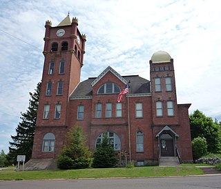
Jackson County is a county located in the U.S. state of Wisconsin. As of the 2020 census, the population was 21,145. Its county seat is Black River Falls. Jackson County was formed from Crawford County in 1853. It was named for President Andrew Jackson.
Iron County is a county located in the U.S. state of Wisconsin. As of the 2020 census, the population was 6,137, making it the third-least populous county in Wisconsin. Its county seat is Hurley. It was named for the valuable iron ore found within its borders. The county overlaps with small parts of the Bad River and Lac du Flambeau Indian reservations.

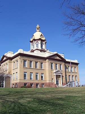
Green Lake County is a county located in the U.S. state of Wisconsin. As of the 2020 census, the population was 19,018. Its county seat is Green Lake. In 2020, the center of population of Wisconsin was located in Green Lake County, near the city of Markesan.

Dunn County is a county in the U.S. state of Wisconsin. As of the 2020 census, the population was 45,440. Its county seat is Menomonie. Dunn County comprises the Menomonie Micropolitan Statistical Area and is included in the Eau Claire-Menomonie, WI Combined Statistical Area.

Chippewa County is a county located in the U.S. state of Wisconsin. It is named for the historic Chippewa people, also known as the Ojibwe, who long controlled this territory. As of the 2020 census, the population was 66,297. Its county seat is Chippewa Falls. The county was founded in 1845 from Crawford County, then in the Wisconsin Territory, and organized in 1853.

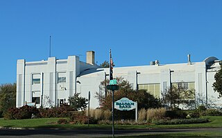
Burnett County is a county located in the U.S. state of Wisconsin. As of the 2020 census, the population was 16,526. Its county seat is Siren, with the majority of county governmental services located at the Burnett County Government Center. The county was created in 1856 and organized in 1865. The St. Croix Chippewa Indians of Wisconsin have reservation lands in Burnett County and are the county's largest employer.

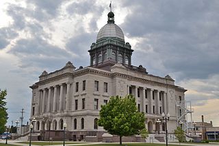
Buffalo County is a county located in the U.S. state of Wisconsin. As of the 2020 census, the population was 13,317. Its county seat is Alma. The county was created in 1853 and organized the following year.
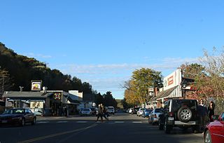
Taylors Falls is a city in Chisago County, Minnesota, United States, located at the junction of U.S. Highway 8 and Minnesota State Highway 95. The population was 1,055 at the 2020 census.
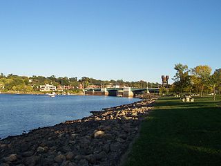
Prescott is a city in Pierce County, Wisconsin at the confluence of the St. Croix River and Mississippi River. The population was 4,258 at the 2010 census, making it the second-largest city in the county after River Falls, and the largest entirely within Pierce County.

Ellsworth is a village in and the county seat of Pierce County, Wisconsin, United States. The population was 3,348 at the 2020 census. The village is adjacent to the Town of Ellsworth and now incorporates the formerly separate district known as East Ellsworth. The municipality of Ellsworth and its surroundings are slowly becoming incorporated into the Twin Cities Metro Area.

River Falls is a city in Pierce and St. Croix counties in the U.S. state of Wisconsin. It is located mostly within the town of River Falls, and adjacent to the town of Kinnickinnic in St. Croix County. River Falls is the most populous city in Pierce County. The population was 16,182 at the 2020 census, with 12,546 residing in Pierce County and 3,636 in St. Croix County. It is part of the Minneapolis-St. Paul metropolitan area and located approximately 30 miles (48 km) east of the center of that region.

St. Croix Falls is a town in Polk County, Wisconsin, United States. The population was 1,119 at the 2000 census. The City of St. Croix Falls is located within the town. The unincorporated community of Lamar is located in the town.

St. Croix Falls is a city in Polk County, Wisconsin, United States. The population was 2,208 at the 2020 census. The city is located within the Town of St. Croix Falls.