Pilar, Capiz

Last updated
Pilar
Municipality of Pilar
Flag of Pilar, Capiz.png
Etymology: Sibala
Ph locator capiz pilar.png
Map of Capiz with Pilar highlighted
OpenStreetMap
Pilar, Capiz
Philippines location map (square).svg
Red pog.svg
Pilar
Location within the Philippines
Coordinates: 11°29′16″N122°59′44″E / 11.4878°N 122.9956°E / 11.4878; 122.9956 Coordinates: 11°29′16″N122°59′44″E / 11.4878°N 122.9956°E / 11.4878; 122.9956
Country Philippines
Region Western Visayas
Province Capiz
District 1st district
Barangays 24 (see Barangays)
Government
[1]
  Type Sangguniang Bayan
   Mayor Arnold A. Perez
   Vice Mayor Doujie-Jack B. Cantiller
   Representative Emmanuel A. Billones
   Municipal Council
Members
   Electorate 29,375 voters (2022)
Area
[2]
  Total77.99 km2 (30.11 sq mi)
Elevation
34 m (112 ft)
Highest elevation
812 m (2,664 ft)
Lowest elevation
−1 m (−3 ft)
Population
 (2020 census) [3]
  Total47,100
  Density600/km2 (1,600/sq mi)
   Households
12,254
Economy
   Income class 3rd municipal income class
   Poverty incidence
8.88
% (2018) [4]
   Revenue 141.5 million (2020)
   Assets 419.8 million (2020)
   Expenditure 109.5 million (2020)
   Liabilities 66.59 million (2020)
Service provider
  ElectricityCapiz Electric Cooperative (CAPELCO)
Time zone UTC+8 (PST)
ZIP code
5804
PSGC
IDD : area code +63(0)36
Native languages Capiznon
Hiligaynon
Tagalog
Website www.pilar-capiz.gov.ph

Pilar, officially the Municipality of Pilar (Capiznon/Hiligaynon: Banwa sang Pilar; Tagalog : Bayan ng Pilar), is a 3rd class municipality in the province of Capiz, Philippines. According to the 2020 census, it has a population of 47,100 people. [3]

Contents

Pilar is 51 kilometres (32 mi) from Roxas City.

History

The coastal town sprang out from an Austronesian settlement in the early 16th century when indio natives managed to escape oppression from Spanish colonial authorities. The settlement was then known as Sibala, named after the river that ran through the coastal village. In 1570, however, the settlement was seized by Spanish forces and the guardia civil took full control of the village fortifying it with a military garrison. It later flourished into a bigger town and was renamed after its designated patron La Nuestra Señora del Pilar (Our Lady of the Pillar). In the 18th century, it adopted the (Holy Trinity) La Santisima Trinidad as its municipal patron after a wooden image of the Holy Trinity from the wreckage of a Spanish galleon ship en route from Mexico was found in the town's coastline. Augustinian friars were initially assigned to preach in the town since then until it would later receive its permanent parish priest and Roman Catholic Church.

In 1897, there had been an armed insurgency known as the Battle of Balisong during the Philippine Revolution in an attempt to overthrow Spanish authorities in the municipality led by local revolutionaries with the support of other resistance groups in Capiz, namely from the neighboring towns of Pan-ay and Pontevedra.

In 1949, the sitios and barrios of Aranguel, Culilang, Pandan, Pinamihagan, Cadoulan, Quiajo, Sangcal, Pondol, Marita, Madulano, Jabuyana, Bo-ac, Cabugcabug, Goce Badiangon, Bayuyan, Agbobolo, Cubay, Ibaca, and the sitio of Lotudlotud, which was converted into a barrio of Elizalde, were separated from the municipal jurisdiction of Pilar to form a separate town, namely President Roxas, by virtue of Republic Act No. 374. [5]

Geography

Barangays

Pilar is politically subdivided into 24 barangays. [6]

  • Balogo
  • Binaobawan
  • Blasco
  • Casanayan
  • Cayus
  • Dayhagan
  • Dulangan
  • Monteflor
  • Natividad
  • Olalo
  • Poblacion
  • Rosario
  • San Antonio
  • San Blas
  • San Esteban
  • San Fernando
  • San Nicolas
  • San Pedro
  • San Ramon
  • San Silvestre
  • Sinamongan
  • Santa Fe
  • Tabun-acan
  • Yating

Climate

Climate data for Pilar, Capiz
MonthJanFebMarAprMayJunJulAugSepOctNovDecYear
Average high °C (°F)27
(81)
28
(82)
29
(84)
31
(88)
32
(90)
31
(88)
30
(86)
30
(86)
29
(84)
29
(84)
29
(84)
27
(81)
29
(85)
Average low °C (°F)23
(73)
23
(73)
23
(73)
24
(75)
25
(77)
25
(77)
24
(75)
24
(75)
24
(75)
24
(75)
24
(75)
23
(73)
24
(75)
Average precipitation mm (inches)61
(2.4)
39
(1.5)
46
(1.8)
48
(1.9)
90
(3.5)
144
(5.7)
152
(6.0)
145
(5.7)
163
(6.4)
160
(6.3)
120
(4.7)
90
(3.5)
1,258
(49.4)
Average rainy days12.39.09.910.018.525.027.426.025.924.917.914.2221
Source: Meteoblue [7]

Demographics

Population census of Pilar
YearPop.±% p.a.
1903 7,038    
1918 11,830+3.52%
1939 22,301+3.07%
1948 25,720+1.60%
1960 19,350−2.34%
1970 24,573+2.42%
1975 28,589+3.08%
1980 30,104+1.04%
1990 35,929+1.78%
1995 36,464+0.28%
2000 38,903+1.40%
2007 40,912+0.70%
2010 41,572+0.58%
2015 45,287+1.64%
2020 47,100+0.77%
Source: Philippine Statistics Authority [8] [9] [10] [11]

In the 2020 census, the population of Pilar, Capiz, was 47,100 people, [3] with a density of 600 inhabitants per square kilometre or 1,600 inhabitants per square mile.

Most of the town's population are made up by Austronesian descendants, such as Capiznon and Hiligaynon, followed by Aetas and a few of Chinese and Spanish ancestry.

Economy

Culture

Roman Catholicism combined with indigenous superstitious traditions have a strong imprint on the town's local culture.

An iconic 12-foot landmark of the Virgin Mary is visible at a mountaintop in Barangay Dulangan, built by an affluent Filipino-Chinese businessman from Roxas City. A chapel facing the figurine has been erected where occasional thanksgiving masses are held during special occasions.

The town celebrates its annual feast along with the coming of the sacred Santisima Trinidad (The Holy Trinity), an early 18th-century wooden figurine from Mexico found by local fishermen in the shores of the town during the British invasion of the Philippines in 1762. The figurine is believed to have been brought over by a galleon trading ship from the port of Acapulco, Mexico, but destroyed by British warships on its route to Luzon and was washed off to the coast of Pilar. It is on display in the altar of the town's church, the Parish of the Most Holy Trinity.

The town also has its own Baptist church, Iglesia Filipina Independiente and Iglesia ni Kristo Parish. The barangays of Dulangan and Casanayan are known to be satellite villages of the municipality.

The town is also known for its rich heritage oral folklore and supernatural practices. The Legend of the Golden Ship, a trading ship owned by deities that docks on the town's coast en route to a parallel world and the enchanted Balisong Caves inhabited by beautiful fairies but highly territorial are popular stories that have been passed down for generations.

Barangay Casanayan is home to the mummified corpse of Lola Bebe or Maria de Juan Basañes, a migrant from Cavite who married a town local but died from heart attack in 1929 only to be found fully intact in her grave several decades later. The cadaver is believed to be miraculous as it has healed many residents from illness and is preserved by family descendants for public viewing.

Related Research Articles

<span class="mw-page-title-main">Western Visayas</span> Administrative region of the Philippines

Western Visayas is an administrative region in the Philippines, numerically designated as Region VI. It consists of six provinces and two highly urbanized cities. The regional center is Iloilo City. The region is dominated by the native speakers of four Visayan languages: Hiligaynon, Kinaray-a, Aklanon and Capiznon. The land area of the region is 20,794.18 km2 (8,028.68 sq mi), and with a population of 7,954,723 inhabitants, it is the second most populous region in the Visayas after Central Visayas.

<span class="mw-page-title-main">Trinidad, Bohol</span> Municipality in Bohol, Philippines

Trinidad, officially the Municipality of Trinidad, is a 3rd class municipality in the province of Bohol, Philippines. According to the 2020 census, it has a population of 35,119 people. 

<span class="mw-page-title-main">Cuartero</span> Municipality in Capiz, Philippines

Cuartero, officially the Municipality of Cuartero, is a 4th class municipality in the province of Capiz, Philippines. According to the 2020 census, it has a population of 27,993 people. 

<span class="mw-page-title-main">Dao, Capiz</span> Municipality in Capiz, Philippines

Dao, officially the Municipality of Dao, is a 4th class municipality in the province of Capiz, Philippines. According to the 2020 census, it has a population of 33,842 people. 

<span class="mw-page-title-main">Dumalag</span> Municipality in Capiz, Philippines

Dumalag, officially the Municipality of Dumalag, is a 4th class municipality in the province of Capiz, Philippines. According to the 2020 census, it has a population of 30,098 people. 

<span class="mw-page-title-main">Dumarao</span> Municipality in Capiz, Philippines

Dumarao, officially the Municipality of Dumarao, is a 2nd class municipality in the province of Capiz, Philippines. According to the 2020 census, it has a population of 49,506 people. 

<span class="mw-page-title-main">Ivisan</span> Municipality in Capiz, Philippines

Ivisan, officially the Municipality of Ivisan, is a 4th class municipality in the province of Capiz, Philippines. According to the 2020 census, it has a population of 31,278 people. 

<span class="mw-page-title-main">Jamindan</span> Municipality in Capiz, Philippines

Jamindan, officially the Municipality of Jamindan, is a 2nd class municipality in the province of Capiz, Philippines. According to the 2020 census, it has a population of 38,670 people. 

<span class="mw-page-title-main">Ma-ayon</span> Municipality in Capiz, Philippines

Ma-ayon, officially the Municipality of Ma-ayon, is a 3rd class municipality in the province of Capiz, Philippines. According to the 2020 census, it has a population of 41,226 people.  It has a total land area of 142.32 km2 (54.95).

<span class="mw-page-title-main">Mambusao</span> Municipality in Capiz, Philippines

Mambusao, officially the Municipality of Mambusao, is a 3rd class municipality in the province of Capiz, Philippines. According to the 2020 census, it has a population of 40,690 people. 

<span class="mw-page-title-main">Panay, Capiz</span> Municipality in Capiz, Philippines

Panay, officially the Municipality of Panay, is a 3rd class municipality in the province of Capiz, Philippines. According to the 2020 census, it has a population of 48,890 people. 

<span class="mw-page-title-main">Panitan</span> Municipality in Capiz, Philippines

Panitan, officially the Municipality of Panitan, is a 3rd class municipality in the province of Capiz, Philippines. According to the 2020 census, it has a population of 42,565 people. 

<span class="mw-page-title-main">Pontevedra, Capiz</span> Municipality in Capiz, Philippines

Pontevedra, officially the Municipality of Pontevedra, is a 3rd class municipality in the province of Capiz, Philippines. According to the 2020 census, it has a population of 49,725 people. 

<span class="mw-page-title-main">President Roxas, Capiz</span> Municipality in Capiz, Philippines

President Roxas, officially the Municipality of President Roxas, is a 4th class municipality in the province of Capiz, Philippines. According to the 2020 census, it has a population of 31,269 people. 

<span class="mw-page-title-main">Sapian</span> Municipality in Capiz, Philippines

Sapian, officially the Municipality of Sapian, and sometimes spelled Sapi-an, is a 4th class municipality in the province of Capiz, Philippines. According to the 2020 census, it has a population of 26,697 people.  It is 27 kilometres (17 mi) from Roxas City, the provincial capital.

<span class="mw-page-title-main">Sigma, Capiz</span> Municipality in Capiz, Philippines

Sigma, officially the Municipality of Sigma, is a 4th class municipality in the province of Capiz, Philippines. According to the 2020 census, it has a population of 31,688 people. 

<span class="mw-page-title-main">Tapaz</span> Municipality in Capiz, Philippines

Tapaz, officially the Municipality of Tapaz, is a 1st class municipality in the province of Capiz, Philippines. According to the 2020 census, it has a population of 54,423 people. 

<span class="mw-page-title-main">Basey</span> Municipality in Samar, Philippines

Basey, officially the Municipality of Basey, is a 1st class municipality in the province of Samar, Philippines. According to the 2020 census, it has a population of 56,685 people. 

<span class="mw-page-title-main">Catubig</span> Municipality in Northern Samar, Philippines

Catubig, officially the Municipality of Catubig, is a 3rd class municipality in the province of Northern Samar, Philippines. According to the 2020 census, it has a population of 32,174 people. 

<span class="mw-page-title-main">San Miguel, Iloilo</span> Municipality in Iloilo, Philippines

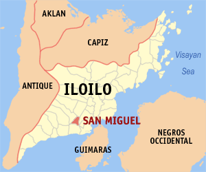
San Miguel, officially the Municipality of San Miguel, is a 4th class municipality in the province of Iloilo, Philippines. According to the 2020 census, it has a population of 30,115 people. 

References

  1. Municipality of Pilar | (DILG)
  2. "2015 Census of Population, Report No. 3 – Population, Land Area, and Population Density" (PDF). Philippine Statistics Authority. Quezon City, Philippines. August 2016. ISSN   0117-1453. Archived (PDF) from the original on May 25, 2021. Retrieved July 16, 2021.
  3. 1 2 3 Census of Population (2020). "Region VI (Western Visayas)". Total Population by Province, City, Municipality and Barangay. PSA . Retrieved 8 July 2021.
  4. "PSA Releases the 2018 Municipal and City Level Poverty Estimates". Philippine Statistics Authority. 15 December 2021. Retrieved 22 January 2022.
  5. "An act to create the municipality of President Roxas in the province of Capiz". LawPH.com. Retrieved 2011-04-09.
  6. "Province: Capiz". PSGC Interactive. Quezon City, Philippines: Philippine Statistics Authority . Retrieved 12 November 2016.
  7. "Pilar: Average Temperatures and Rainfall". Meteoblue. Retrieved 2 May 2020.
  8. Census of Population (2015). "Region VI (Western Visayas)". Total Population by Province, City, Municipality and Barangay. PSA . Retrieved 20 June 2016.
  9. Census of Population and Housing (2010). "Region VI (Western Visayas)". Total Population by Province, City, Municipality and Barangay. NSO . Retrieved 29 June 2016.
  10. Censuses of Population (1903–2007). "Region VI (Western Visayas)". Table 1. Population Enumerated in Various Censuses by Province/Highly Urbanized City: 1903 to 2007. NSO.
  11. "Province of Capiz". Municipality Population Data. Local Water Utilities Administration Research Division. Retrieved 17 December 2016.
  12. "Poverty incidence (PI):". Philippine Statistics Authority. Retrieved December 28, 2020.
  13. https://psa.gov.ph/sites/default/files/NSCB_LocalPovertyPhilippines_0.pdf; publication date: 29 November 2005; publisher: Philippine Statistics Authority.
  14. https://psa.gov.ph/sites/default/files/2003%20SAE%20of%20poverty%20%28Full%20Report%29_1.pdf; publication date: 23 March 2009; publisher: Philippine Statistics Authority.
  15. https://psa.gov.ph/sites/default/files/2006%20and%202009%20City%20and%20Municipal%20Level%20Poverty%20Estimates_0_1.pdf; publication date: 3 August 2012; publisher: Philippine Statistics Authority.
  16. https://psa.gov.ph/sites/default/files/2012%20Municipal%20and%20City%20Level%20Poverty%20Estima7tes%20Publication%20%281%29.pdf; publication date: 31 May 2016; publisher: Philippine Statistics Authority.
  17. https://psa.gov.ph/sites/default/files/City%20and%20Municipal-level%20Small%20Area%20Poverty%20Estimates_%202009%2C%202012%20and%202015_0.xlsx; publication date: 10 July 2019; publisher: Philippine Statistics Authority.
  18. "PSA Releases the 2018 Municipal and City Level Poverty Estimates". Philippine Statistics Authority. 15 December 2021. Retrieved 22 January 2022.