Related Research Articles

The Drakensberg is the eastern portion of the Great Escarpment, which encloses the central Southern African plateau. The Great Escarpment reaches its greatest elevation – 2,000 to 3,482 metres within the border region of South Africa and Lesotho.

The Maputaland-Pondoland bushland and thickets is one of the ecoregions of South Africa. It consists of the montane shrubland biome.

The Kwazulu-Cape coastal forest mosaic is a subtropical moist broadleaf forest ecoregion of South Africa. It covers an area of 17,800 square kilometers (6,900 sq mi) in South Africa's Eastern Cape and KwaZulu-Natal provinces.

The Usambara Mountains of northeastern Tanzania in tropical East Africa, comprise the easternmost ranges of the Eastern Arc Mountains. The ranges of approximately 90 kilometres (56 mi) long and about half that wide, are situated in the Lushoto District of the Tanga Region. They were formed nearly two million years ago by faulting and uplifting, and are composed of Precambrian metamorphic rocks. They are split into two sub-ranges; the West Usambaras being higher than the East Usambaras, which are nearer the coast and receive more rainfall.

The Cape Floral Region is a floristic region located near the southern tip of South Africa. It is the only floristic region of the Cape Floristic Kingdom, and includes only one floristic province, known as the Cape Floristic Province.

The Succulent Karoo is a ecoregion defined by the World Wide Fund for Nature to include regions of desert in South Africa and Namibia, and a biodiversity hotspot. The geographic area chosen by the WWF for what they call 'Succulent Karoo' does not correspond to the actual Karoo.

Pondoland or Mpondoland, is a natural region on the South African shores of the Indian Ocean. It is located in the coastal belt of the Eastern Cape province. Its territory is the former Mpondo Kingdom of the Mpondo people.

The Umtamvuna Nature Reserve is situated in South Africa on the KwaZulu-Natal side of the Mtamvuna River, and is managed by Ezemvelo KZN Wildlife. The reserve is 3,257 hectares in extent and was established on 25 July 1971.

Mkhambathi Nature Reserve is a protected area at Lusikisiki in the Eastern Cape, South Africa. It is 7,720 hectares, with the Pondoland Marine Protected Area off its coastal edge. The reserve is located in the Pondoland Centre of Plant Endemism and the greater Maputaland–Pondoland–Albany Hotspot, and is covered in open grassland, dotted with patches of indigenous forest, swamp forests and flanked by the forested ravines of the Msikaba and Mtentu rivers.
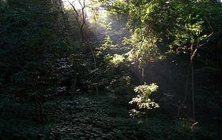
Areas of forest which grow in KwaZulu-Natal, South Africa mostly on south facing slopes in higher rainfall areas, and along the humid coastal areas. Different types of forest can be identified by their species composition which depends mostly on the altitude, latitude and substrate in which they grow. South facing slopes are favourable for the development of forest as they are more shaded, and therefore cooler and retain more moisture than the northern slopes. The extra moisture on the south slopes is not only favoured by forest trees, but also helps to prevent or subdue wildfires. Fires can also be blocked by cliff faces and rocks or boulders on these slopes, and by streams or rivers at the base of the slopes. The coastal regions are conducive to forest formation, because of high rainfall and humidity which are favoured by forest trees and also help to prevent or subdue fires. The rivers of the coastal areas are also broader than further inland, which may often prevent fires from spreading long distances, and fires generally burn uphill and therefore more often away from areas at low altitude.

oNgoye Forest, also known as Ngoye or Ngoya Forest, is an ancient coastal scarp forest, protected by the oNgoye Forest Reserve in South Africa's KwaZulu-Natal province. The forest of almost 4,000 ha covers an extensive granite ridge that rises from 200 to 460 metres above sea level. It is found some 10 km inland, or 16 km by road, from the coastal town of Mtunzini, and adjoins smaller forest reserves on its periphery, namely Impeshulu in the west, Ezigwayini in the north, and Dengweni in the south.

The Maputaland-Pondoland-Albany Hotspot (MPA) is a biodiversity hotspot, a biogeographic region with significant levels of biodiversity, in Southern Africa. It is situated near the south-eastern coast of Africa, occupying an area between the Great Escarpment and the Indian Ocean. The area is named after Maputaland, Pondoland and Albany. It stretches from the Albany Centre of Plant Endemism in the Eastern Cape Province of South Africa, through the Pondoland Centre of Plant Endemism and KwaZulu-Natal Province, the eastern side of Eswatini and into southern Mozambique and Mpumalanga. The Maputaland Centre of Plant Endemism is contained in northern KwaZulu-Natal and southern Mozambique.

Dalbergia armata is a scrambling, deciduous species of legume that is native to subtropical to temperate regions of southeastern Africa. The robust, woody liana or small tree is armed with strong spines on the main stem and branches. It occurs sparsely or commonly in forest, bush, riparian fringes and in wooded ravines. It is sometimes employed as a bonsai subject, and it can be propagated from either seed or cuttings.
The Gouritz Cluster Biosphere Reserve is located in the Western Cape of South Africa. It is the 7th and largest of South Africa’s biosphere reserves; divided into four connected sectors ranging from sea level to 2,240 metres. The area is the only place in the world where three recognised biodiversity hotspots converge. The site is characterised by high endemism of plant species and threatened invertebrates including seven endemic species of the enigmatic beetle genus Colophon and 14 butterfly species. It provides a migratory route for large mammals such as the leopard and serves as a nursery for marine species.
The Pondoland Marine Protected Area is an inshore conservation region in the territorial waters of South Africa.
The Albany Centre of Plant Endemism is situated in the coastal region of South Africa at the eastern end of the Eastern Cape Province. It is named after the district of Albany and falls within the Maputaland-Pondoland-Albany Hotspot. It is notable for its biodiversity and unique, endemic flora and fauna.
The Maputaland Centre of Plant Endemism is situated in the coastal region of South Africa in the northern part of the province of KwaZulu-Natal, and also includes the southernmost part of Mozambique. It forms part of the Maputaland-Pondoland-Albany Hotspot. It is notable for its biodiversity and unique, endemic flora and fauna.
The Indian Ocean coastal belt is one of the nine recognised biomes of South Africa. They are described in terms of their vegetation and climatic variations.
The Biodiversity of South Africa is the variety of living organisms within the boundaries of South Africa and its exclusive economic zone. South Africa is a region of high biodiversity in the terrestrial and marine realms. The country is ranked sixth out of the world's seventeen megadiverse countries, and is rated among the top 10 for plant species diversity and third for marine endemism.
The Rocherpan Marine Protected Area is a small coastal conservation region on the West Coast of the Western Cape province, in the territorial waters of South Africa. It is about 25 km north of Velddrif on the road to Elands Bay, north of Dwarskersbos.
References
- ↑ McCarthy, T. & Rubidge, B. (2005). The Story of Earth and Life, a South African perspective on a 4.6-billion-year journey. ISBN 1-77007-148-2
- ↑ "September 21 - Flash Mob for Climate WAKE UP | Wild Coast".