Dora is an unincorporated community in Ozark County, in the U.S. state of Missouri. The ZIP Code for Dora is 65637.

Couch is a small, unincorporated community in Oregon County, Missouri, United States. It is located six miles south of Alton on Missouri Route A. The ZIP Code for Couch is 65690.
Cape Fair is an unincorporated community in Stone County, Missouri, United States. It is located on Route 76 and the southern terminus of Route 173. Cape Fair is on the west side of the James River arm of Table Rock Lake. The community is part of the Branson, Missouri Micropolitan Statistical Area. The ZIP Code for Cape Fair is 65624.
Hocomo is a small unincorporated community in Howell County, Missouri, United States. It is located approximately thirteen miles southwest of West Plains on U.S. Route 160.
Bucyrus is an unincorporated community in central Texas County, Missouri, United States. It is located on Route 17, approximately three miles northwest of Houston. The ZIP Code for Bucyrus is 65444.
Eldridge is an unincorporated community in northern Laclede County, Missouri, United States. It is situated approximately twelve miles northwest of Lebanon on Missouri Route E, west of Missouri Route 5. The ZIP Code for Eldridge is 65463.
Falcon is an unincorporated community in eastern Laclede County, Missouri, United States. It is approximately sixteen miles east of Lebanon on Route 32. The Gasconade River lies just east of the community, which is within the Mark Twain National Forest. The community consists of a post office and two houses.

Valles Mines is an unincorporated community in southern Jefferson County, Missouri, United States. It is located approximately seven miles south of De Soto. It is located on Missouri Route V less than one mile west of U.S. Route 67. Joachim Creek flows past the north side of the community. The ZIP Code for Valles Mines is 63087.

Maywood is an unincorporated community in southern Lewis County, Missouri, United States. It is located on Missouri Route V just north of the Lewis-Marion county line, approximately eleven miles northwest of Palmyra and ten miles west of Quincy, Illinois. The community is part of the Quincy, IL–MO Micropolitan Statistical Area. The ZIP Code for Maywood is 63454.
Rocky Mount is an unincorporated community in eastern Morgan County, Missouri, United States. It is located six miles southwest of Eldon, near the Lake of the Ozarks. The ZIP Code for Rocky Mount is 65072.
Henley is an unincorporated community in southwestern Cole County, Missouri, United States. It is located twelve miles east of Eldon. The ZIP Code for Henley is 65040.

Pottersville is an unincorporated community split between Bedminster Township in Somerset County, Tewksbury Township in Hunterdon County and Washington Township in Morris County, New Jersey, United States. The area is served as United States Postal Service ZIP Code 07979. As of the 2010 United States Census, the population for ZIP Code Tabulation Area 07979 was 589. In 1990, most of the village was listed on the National Register of Historic Places as the Pottersville Village Historic District.
Arditta is an unincorporated community in southwest Howell County, in the Ozarks of southern Missouri. Arditta is located on U.S. Route 160 between Egypt Grove and Caulfield. It is approximately twelve miles southwest of West Plains.
Chapel is an unincorporated community in northeastern Howell County, in the U.S. state of Missouri. The community is located on county road 2680, east of Missouri Route W, and approximately four miles south-southeast of Mountain View. The Chapel Hill Church and historic school lie just west of Route W.
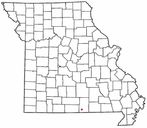
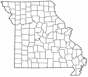
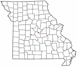
Crider is an unincorporated community in western Howell County, in the U.S. state of Missouri. Crider is approximately ten miles west of West Plains and about two miles northwest of Pottersville and is located on Missouri Route AD.
Cull is an unincorporated community in eastern Howell County, in the U.S. state of Missouri. The community is located on a county road south of U.S. Route 160 and is approximately nine miles east of West Plains, near the eastern border of the county. The community of Rover in Oregon County lies about two miles to the east.
Cureall is an unincorporated community in Howell County, in the U.S. state of Missouri.
Homeland is an unincorporated community in southwest Howell County, in the Ozarks of southern Missouri, United States. The community is located on U.S. Route 160, approximately four miles southwest of West Plains. Arrowhead Lakes on Spring Creek lie just to the southeast.
Horton is an unincorporated community in northwest Howell County, in the Ozarks of southern Missouri, United States. The community is located within the Mark Twain National Forest, west of Missouri Route AP and approximately one-half mile east of the Douglas - Howell county line. The Noblett Lake recreation area on Noblett Creek is just to the northwest in Douglas County.
Leota is an unincorporated community in southwestern Howell County, in the U.S. state of Missouri. The community is located on Missouri Route 142 and is approximately two miles north of the Missouri - Arkansas state line.

