Powhattan, Kansas

Last updated

Powhattan, Kansas
Powhattan Post Office.JPG
Powhattan Post Office (2009)
Brown County Kansas Incorporated and Unincorporated areas Powhattan Highlighted.svg
Location within Brown County and Kansas
Map of Brown Co, Ks, USA.png
Coordinates: 39°45′42″N95°38′02″W / 39.76167°N 95.63389°W / 39.76167; -95.63389 [1]
Country United States
State Kansas
County Brown
Founded1877
Incorporated 1887
Named for Powhatan
Area
[2]
  Total0.14 sq mi (0.35 km2)
  Land0.14 sq mi (0.35 km2)
  Water0.00 sq mi (0.00 km2)
Elevation
[1]
1,211 ft (369 m)
Population
 (2020) [3]
  Total69
  Density490/sq mi (200/km2)
Time zone UTC-6 (CST)
  Summer (DST) UTC-5 (CDT)
ZIP code
66527
Area code 785
FIPS code 20-57350
GNIS ID 2396265 [1]

Powhattan is a city in Brown County, Kansas, United States. [1] As of the 2020 census, the population of the city was 69. [3]

Contents

History

Powhattan was founded about 1877. [4] The city was named for the father of Pocahontas who resided in Jamestown, Virginia. It was originally a stagecoach station named Locknane. [5]

Geography

According to the United States Census Bureau, the city has a total area of 0.14 square miles (0.36 km2), all of it land. [6]

Demographics

Historical population
CensusPop.Note
1900 237
1910 216−8.9%
1920 24714.4%
1930 221−10.5%
1940 184−16.7%
1950 150−18.5%
1960 128−14.7%
1970 111−13.3%
1980 95−14.4%
1990 11116.8%
2000 91−18.0%
2010 77−15.4%
2020 69−10.4%
U.S. Decennial Census

2020 census

The 2020 United States census counted 69 people, 26 households, and 14 families in Powhattan. [7] [8] The population density was 503.6 per square mile (194.5/km2). There were 39 housing units at an average density of 284.7 per square mile (109.9/km2). [8] [9] The racial makeup was 68.12% (47) white or European American (68.12% non-Hispanic white), 2.9% (2) black or African-American, 10.14% (7) Native American or Alaska Native, 0.0% (0) Asian, 0.0% (0) Pacific Islander or Native Hawaiian, 4.35% (3) from other races, and 14.49% (10) from two or more races. [10] Hispanic or Latino of any race was 2.9% (2) of the population. [11]

Of the 26 households, 34.6% had children under the age of 18; 38.5% were married couples living together; 34.6% had a female householder with no spouse or partner present. 38.5% of households consisted of individuals and 19.2% had someone living alone who was 65 years of age or older. [8] The average household size was 2.3 and the average family size was 3.4. [12] The percent of those with a bachelor’s degree or higher was estimated to be 7.2% of the population. [13]

31.9% of the population was under the age of 18, 4.3% from 18 to 24, 15.9% from 25 to 44, 18.8% from 45 to 64, and 29.0% who were 65 years of age or older. The median age was 42.5 years. For every 100 females, there were 137.9 males. [8] For every 100 females ages 18 and older, there were 135.0 males. [8]

The 2016-2020 5-year American Community Survey estimates show that the median household income was $36,250 (with a margin of error of +/- $13,249) and the median family income was $38,333 (+/- $8,879). [14] Males had a median income of $23,750 (+/- $23,276) versus $28,438 (+/- $16,188) for females. The median income for those above 16 years old was $27,500 (+/- $13,090). [15] Approximately, 27.8% of families and 25.8% of the population were below the poverty line, including 55.2% of those under the age of 18 and 0.0% of those ages 65 or over. [16] [17]

2010 census

At the 2010 census there were 77 people in 30 households, including 20 families, in the city. The population density was 550.0 inhabitants per square mile (212.4/km2). There were 38 housing units at an average density of 271.4 per square mile (104.8/km2). The racial makup of the city was 90.9% White and 9.1% Native American. Hispanic or Latino of any race were 2.6%. [18]

Of the 30 households 33.3% had children under the age of 18 living with them, 63.3% were married couples living together, 3.3% had a female householder with no husband present, and 33.3% were non-families. 33.3% of households were one person and 23.3% were one person aged 65 or older. The average household size was 2.57 and the average family size was 3.30.

The median age was 34.8 years. 32.5% of residents were under the age of 18; 0.0% were between the ages of 18 and 24; 28.6% were from 25 to 44; 18.2% were from 45 to 64; and 20.8% were 65 or older. The gender makeup of the city was 40.3% male and 59.7% female.

2000 census

At the 2000 census there were 91 people in 41 households, including 25 families, in the city. The population density was 686.2 inhabitants per square mile (264.9/km2). There were 44 housing units at an average density of 331.8 per square mile (128.1/km2). The racial makup of the city was 90.11% White, 7.69% Native American, and 2.20% from two or more races. Hispanic or Latino of any race were 3.30%. [19]

Of the 41 households 26.8% had children under the age of 18 living with them, 51.2% were married couples living together, 4.9% had a female householder with no husband present, and 39.0% were non-families. 36.6% of households were one person and 29.3% were one person aged 65 or older. The average household size was 2.22 and the average family size was 2.88.

The age distribution was 22.0% under the age of 18, 12.1% from 18 to 24, 18.7% from 25 to 44, 22.0% from 45 to 64, and 25.3% 65 or older. The median age was 42 years. For every 100 females, there were 82.0 males. For every 100 females age 18 and over, there were 86.8 males.

The median household income was $21,500 and the median family income was $29,167. Males had a median income of $28,542 versus $16,250 for females. The per capita income for the city was $12,147. There were no families and 12.1% of the population living below the poverty line, including no under eighteens and none of those over 64.

Education

The community is served by South Brown County USD 430 public school district. [20]

There is a tribal Bureau of Indian Education (BIE)-affiliated school, Kickapoo Nation School.

Related Research Articles

<span class="mw-page-title-main">Moran, Kansas</span> City in Allen County, Kansas

Moran is a city in Allen County, Kansas, United States. As of the 2020 census, the population of the city was 466.

<span class="mw-page-title-main">Fulton, Kansas</span> City in Kansas, United States

Fulton is a city in Bourbon County, Kansas, United States. As of the 2020 census, the population of the city was 165.

<span class="mw-page-title-main">Morganville, Kansas</span> City in Clay County, Kansas

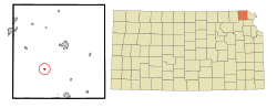
Morganville is a city in Clay County, Kansas, United States. As of the 2020 census, the population of the city was 180.

<span class="mw-page-title-main">McCune, Kansas</span> City in Crawford County, Kansas

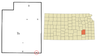
McCune is a city in Crawford County, Kansas, United States. As of the 2020 census, the population of the city was 370.

<span class="mw-page-title-main">Cimarron, Kansas</span> City in Gray County, Kansas

Cimarron is a city in and the county seat of Gray County, Kansas, United States. As of the 2020 census, the population of the city was 1,981. It is located along Highway 50.

<span class="mw-page-title-main">Montezuma, Kansas</span> City in Gray County, Kansas

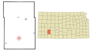
Montezuma is a city in Gray County, Kansas, United States. As of the 2020 census, the population of the city was 975.

<span class="mw-page-title-main">Fall River, Kansas</span> City in Greenwood County, Kansas

Fall River is a city in Greenwood County, Kansas, United States. As of the 2020 census, the population of the city was 131.

<span class="mw-page-title-main">Mayetta, Kansas</span> City in Jackson County, Kansas

Mayetta is a city in Jackson County, Kansas, United States. As of the 2020 census, the population is 348.

<span class="mw-page-title-main">Netawaka, Kansas</span> City in Jackson County, Kansas

Netawaka is a city in Jackson County, Kansas, United States. As of the 2020 census, the population of the city was 139.

<span class="mw-page-title-main">Mission Woods, Kansas</span> City in Kansas, United States

Mission Woods is a city in Johnson County, Kansas, United States, and part of the Kansas City Metropolitan Area. As of the 2020 census, the population of the city was 203.

<span class="mw-page-title-main">Norwich, Kansas</span> City in Kingman County, Kansas

Norwich is a city in Kingman County, Kansas, United States. As of the 2020 census, the population of the city was 444.

<span class="mw-page-title-main">Hartford, Kansas</span> City in Lyon County, Kansas

Hartford is a city in Lyon County, Kansas, United States. As of the 2020 census, the population of the city was 355.

<span class="mw-page-title-main">Plains, Kansas</span> City in Meade County, Kansas

Plains is a city in Meade County, Kansas, United States. As of the 2020 census, the population of the city was 1,037. It is located along U.S. Route 54 highway. It is notable for the width of its main street which is the widest in the United States at 155 feet 5 inches (47.37 m) across.

<span class="mw-page-title-main">Corning, Kansas</span> City in Nemaha County, Kansas

Corning is a city in Nemaha County, Kansas, United States. As of the 2020 census, the population of the city was 212.

<span class="mw-page-title-main">Havensville, Kansas</span> City in Pottawatomie County, Kansas

Havensville is a city in Pottawatomie County, Kansas, United States. As of the 2020 census, the population of the city was 119.

<span class="mw-page-title-main">Munden, Kansas</span> City in Republic County, Kansas

Munden is a city in Republic County, Kansas, United States. As of the 2020 census, the population of the city was 96.

<span class="mw-page-title-main">Ogden, Kansas</span> City in Riley County, Kansas

Ogden is a city in Riley County, Kansas, United States. As of the 2020 census, the population of the city was 1,661. It is located near Fort Riley between Manhattan and Junction City.

<span class="mw-page-title-main">Colwich, Kansas</span> City in Sedgwick County, Kansas

Colwich is a city in Sedgwick County, Kansas, United States, located northwest of Wichita. As of the 2020 census, the population of the city was 1,455.

<span class="mw-page-title-main">Johnson City, Kansas</span> City in Stanton County, Kansas

Johnson City is a city in and the county seat of Stanton County, Kansas, United States. As of the 2020 census, the population of the city was 1,464.

<span class="mw-page-title-main">Lebo, Kansas</span> City in Coffey County, Kansas

Lebo is a city in Coffey County, Kansas, United States. As of the 2020 census, the population of the city was 885.

References

  1. 1 2 3 4 U.S. Geological Survey Geographic Names Information System: Powhattan, Kansas
  2. "2019 U.S. Gazetteer Files". United States Census Bureau. Retrieved July 24, 2020.
  3. 1 2 "Profile of Powhattan, Kansas in 2020". United States Census Bureau. Archived from the original on July 10, 2022. Retrieved July 10, 2022.
  4. Kansas State Historical Society (1916). Biennial Report of the Board of Directors of the Kansas State Historical Society. Kansas State Printing Plant. pp.  150.
  5. Kansas Place-Names, John Rydjord, University of Oklahoma Press, 1972, p. 436 ISBN   0-8061-0994-7
  6. "US Gazetteer files 2010". United States Census Bureau. Archived from the original on January 25, 2012. Retrieved July 6, 2012.
  7. "US Census Bureau, Table P16: HOUSEHOLD TYPE". data.census.gov. Retrieved January 3, 2024.
  8. 1 2 3 4 5 "US Census Bureau, Table DP1: PROFILE OF GENERAL POPULATION AND HOUSING CHARACTERISTICS". data.census.gov. Retrieved January 3, 2024.
  9. Bureau, US Census. "Gazetteer Files". Census.gov. Retrieved December 30, 2023.
  10. "US Census Bureau, Table P1: RACE". data.census.gov. Retrieved January 3, 2024.
  11. "US Census Bureau, Table P2: HISPANIC OR LATINO, AND NOT HISPANIC OR LATINO BY RACE". data.census.gov. Retrieved January 3, 2024.
  12. "US Census Bureau, Table S1101: HOUSEHOLDS AND FAMILIES". data.census.gov. Retrieved January 3, 2024.
  13. "US Census Bureau, Table S1501: EDUCATIONAL ATTAINMENT". data.census.gov. Retrieved January 3, 2024.
  14. "US Census Bureau, Table S1903: MEDIAN INCOME IN THE PAST 12 MONTHS (IN 2020 INFLATION-ADJUSTED DOLLARS)". data.census.gov. Retrieved January 3, 2024.
  15. "US Census Bureau, Table S2001: EARNINGS IN THE PAST 12 MONTHS (IN 2020 INFLATION-ADJUSTED DOLLARS)". data.census.gov. Retrieved January 3, 2024.
  16. "US Census Bureau, Table S1701: POVERTY STATUS IN THE PAST 12 MONTHS". data.census.gov. Retrieved January 3, 2024.
  17. "US Census Bureau, Table S1702: POVERTY STATUS IN THE PAST 12 MONTHS OF FAMILIES". data.census.gov. Retrieved January 3, 2024.
  18. "U.S. Census website". United States Census Bureau . Retrieved July 6, 2012.
  19. "U.S. Census website". United States Census Bureau . Retrieved January 31, 2008.
  20. "USD 430 District Map" (PDF). Kansas Department of Transportation.