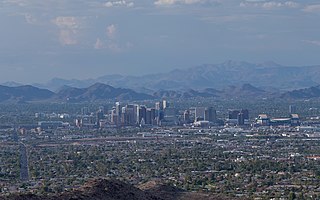
Proposed commuter rail in the Phoenix metropolitan area

Last updated

There have been various proposals to bring commuter rail service to the Phoenix metropolitan area since at least the 1980s. A 2008 government plan, updated in 2018, proposes four lines running at 30-minute headways during peak hours and 2-hour headways during off-peak hours.

Contents

The commuter rail system would be complementary to the Phoenix–Tucson passenger rail project planned by the Arizona Department of Transportation and Amtrak. [1] [2]

History

Daily rail service had existed until the 1960s between Phoenix, Glendale, and Wickenburg as well as Tempe and Mesa.

Contemporary discussion of commuter rail in Phoenix began with the "Hattie B." flood relief train of 1980, [3] [4] and was first widely promoted in 1991 by the Arizona Rail Passenger Association with the release of its Arizona Rail report. [5]

2008 proposal

The Maricopa Association of Governments (MAG) and the Arizona Department of Transportation are studying suburban commuter rail as a complement to light rail. [6] The MAG Commuter Rail Strategic Plan was released in March 2008. [7] [8]

In April 2008, a coalition of Arizona business and political leaders, including then-Governor Janet Napolitano, proposed a $42 billion state transit plan which would include commuter rail. [9] Commuter rail would run along upgraded existing freight rail lines, with stations every three to five miles (4.8 to 8.0 km). In Phoenix, as in other areas that have implemented commuter rail, track speeds would be increased, signals updated, and additional sidings and double-track added.

2018 proposal

Regional Commuter Rail System
2018 Proposal
BSicon CONTg.svg
BSicon CONTg.svg
Estrella Line Corridor
BSicon STR.svg
BSicon STR.svg
Grand Line Corridor
Buckeye
BSicon eACC.svg
BSicon eHSTACC.svg
Wickenburg
(later extension)
Buckeye East/Liberty
BSicon eHSTACC.svg
BSicon eHSTACC.svg
Wittmann
Goodyear Estrella
BSicon eHSTACC.svg
BSicon eHSTACC.svg
North Surprise/Sun City West
Goodyear Airport
BSicon eHSTACC.svg
BSicon eHSTACC.svg
Surprise
Avondale
BSicon eHSTACC.svg
BSicon eHSTACC.svg
El Mirage/Sun City/Youngstown
Tolleson
BSicon eHSTACC.svg
BSicon eHSTACC.svg
Peoria
West Phoenix
BSicon eHSTACC.svg
BSicon eHSTACC.svg
Glendale
BSicon KRWg+l.svg
BSicon KRWr.svg
BSicon eACC.svg
State Capital
BSicon eINTACC.svg
Phoenix Union Station
BSicon eACC.svg
Sky Harbor Airport/44th Street
BSicon eACC.svg
Tempe
Kyrene Line Corridor
BSicon KRW+l.svg
BSicon KRWgr.svg
Central Tempe
BSicon eHSTACC.svg
BSicon STR.svg
San Tan Line Corridor
South Tempe
BSicon eHSTACC.svg
BSicon eHSTACC.svg
Price/SR101
West Chandler
BSicon eHSTACC.svg
BSicon eHSTACC.svg
Mesa
Wild Horse Pass/I-10
BSicon exlACC.svg
BSicon KSTRe.svg
BSicon eHSTACC.svg
Gilbert
BSicon eHSTACC.svg
Gateway Airport/ASU Polytech
BSicon eHSTACC.svg
Queen Creek
BSicon eHSTACC.svg
San Tan Valley
(later extension)
BSicon eHSTACC.svg
Florence
(later extension)
BSicon CONTf.svg

In October 2018, MAG issued an update to the 2010 study. [2] This update removed the Chandler Corridor from a proposed commuter rail system, as it would have competed with San Tan Corridor Line for ridership. [10] The Kyrene Line Corridor was also extended from its 2010-proposed terminus in West Chandler. [10]

The 2018 update includes four rail corridors which would be operated with two services. [2] The Grand/Kyrene Line would utilize the Grand Line Corridor, traveling from Wittmann southeast towards Phoenix, and then continuing south on the Kyrene Line Corridor to Chandler, [2] traveling 53.8 miles (86.6 km) in 66–73 minutes. [10] The Estrella/San Tan Line would use the Estrella Line Corridor, traveling from Buckeye east into Phoenix, and then continuing southeast along the San Tan Line Corridor to Queen Creek, [2] traveling 61.4 miles (98.8 km) in 74–82 minutes. [10]

The lines would overlap at four central stations: State Capital, Phoenix, Sky Harbor Airport, and Tempe. Provisions for extensions would allow for an additional Grand Avenue Corridor station in Wickenburg, two additional stations on the San Tan Line Corridor in San Tan Valley and Florence, [2] and an extension of Estrella Line service to Arlington.

Services would run at 30-minute headways during peak hours and 2-hour headways during off-peak hours. [10] By the year 2040, the Grand/Kyrene Line would have 10,850 daily boardings and the Estrella/San Tan Line would have 10,125 daily boardings. [2]

The updated study estimated capital costs for rail systems using diesel multiple units (DMU) or push-pull trainsets (LHC). [2] Capital costs assumed that service would share existing tracks with freight service (operated by Union Pacific Railroad and BNSF Railway), except for the overlapping segment in Phoenix, where there would be two tracks. [2] All tracks would be certified for passenger trains to reach 80 miles per hour (130 km/h). [2] Costs were estimated at $2.566 billion for DMU service and $2.521 billion for LHC service. [2]

Lines

Grand Line Corridor

The Grand Line Corridor (formerly the Grand Avenue Corridor) is a 35-mile (56 km) line traveling from Union Station in Downtown Phoenix northwest to Wittmann. [10] The corridor utilizes the BNSF Railway's Phoenix Subdivision, which already has sidings for passing trains but lacks any signals. [10]

A trip by car from Union Station to Wittmann utilizing the parallel Grand Avenue (U.S. Route 60) is projected to take 120 minutes by 2040. [10] The population of the surrounding areas of the line – Phoenix, Glendale, Peoria, Youngtown, El Mirage, Surprise, Sun City, Sun City West, and Wittmann – is projected to grow by 46% between 2015 and 2040. In particular, the city of Surprise is forecasted to grow by 152%. [10]

The corridor will serve riders at various colleges and universities, including Arizona State University, Grand Canyon University, and Glendale Community College.

Estrella Line Corridor

The Estrella Line Corridor (formerly the Yuma West Corridor) is a 30-mile (48 km) line traveling from Union Station west to downtown Buckeye by way of the Union Pacific Railroad's Phoenix Subdivision. [10] The line was served by Amtrak's Sunset Limited until June 1996, when it was rerouted to a more direct route via Maricopa rather than of Phoenix. Because of this, signals are already installed on the line and the line is already certified for passenger trains to operate at speeds of up to 60 miles per hour (97 km/h). [10]

The population of the surrounding areas – Phoenix, Tolleson, Avondale, Goodyear, and Buckeye – is projected to grow by 63% between 2015 and 2040. In particular, Buckeye and Goodyear are forecasted to grow by 216% and 137%, respectively. [10]

The corridor will serve the Goodyear Spring Training Complex and Phoenix Goodyear Airport, as well as the Palo Verde Nuclear Generating Station should a western extension of the corridor be built to Arlington.

San Tan Line Corridor

The San Tan Line Corridor (formerly the Southeast Corridor) is a 41-mile (66 km) line traveling from Union Station southeast to San Tan Valley by way of Union Pacific's Phoenix Subdivision. [10] Like the Estrella Line Corridor, this corridor was formerly served by Amtrak until 1996 and is capable of handling passenger trains at up to 60 miles per hour (97 km/h). [10] The line is a single track with sidings for passing trains.

The population of the surrounding areas – Phoenix, Scottsdale, Tempe, Mesa, Chandler, Gilbert, Queen Creek, and the Salt River Pima-Maricopa Indian Community – is projected to grow by 47% between 2015 and 2040. In particular, Queen Creek is forecasted to grow by 101%. [10]

The corridor will serve airports at Sky Harbor and Mesa and the campuses of Arizona State University and East Valley Institute of Technology.

Kyrene Line Corridor

The Kyrene Line Corridor (formerly the Tempe Corridor) is a 18-mile (29 km) line from Union Station south to Wild Horse Pass Boulevard in the Gila River Indian Community by way of the Union Pacific Railroad's Chandler Industrial Lead . Like the San Tan Line and Estrella Line corridors, this corridor was formerly served by Amtrak until 1996. Signals are still present from Amtrak service and the line is currently a single track. [10]

The population of the surrounding areas – Phoenix, Scottsdale, Tempe, Guadalupe, Chandler, and the Gila River Indian Community is projected to grow by 45% between 2015 and 2040. The greatest population growth is forecasted for the city of Tempe at 50%. [10]

The line will serve Sky Harbor International Airport, the campuses of Arizona State University and the University of Phoenix, the Tempe Sports Complex, and the Wild Horse Pass Casino.

Phoenix Union Station

The 2010 and 2018 proposals call for a major expansion of the facilities at Phoenix Union Station. The station would have two island platforms for three through tracks and two additional island platforms for three termination tracks that would serve western service only. [10]

See also

Related Research Articles

<span class="mw-page-title-main">Maricopa County, Arizona</span> County in Arizona, United States

Maricopa County is in the south-central part of the U.S. state of Arizona. As of the 2020 census the population was 4,420,568, or about 62% of the state's total, making it the fourth-most populous county in the United States and the most populous county in Arizona, and making Arizona one of the nation's most centralized states. The county seat is Phoenix, the state capital and fifth-most populous city in the United States.

<span class="mw-page-title-main">Chandler, Arizona</span> City in Arizona, United States

Chandler is a city in Maricopa County, Arizona, United States, and a suburb in the Phoenix-Mesa-Chandler Metropolitan Statistical Area (MSA). It is bordered to the north and west by Tempe, to the north by Mesa, to the west by Phoenix, to the south by the Gila River Indian Community, and to the east by Gilbert. As of the 2020 census, the population of Chandler was 279,458, up from 236,123 at the 2010 census.

<span class="mw-page-title-main">Goodyear, Arizona</span> City in Arizona, United States

Goodyear is a city in Maricopa County, Arizona, United States. It is a suburb of Phoenix and at the 2020 census had a population of 95,294, up from 65,275 in 2010 and 18,911 in 2000. It was the third-fastest-growing city in Arizona between 1990 and 2000.

<span class="mw-page-title-main">Maricopa, Arizona</span> City in Arizona, United States

Maricopa is a city in the Gila River Valley in Pinal County, Arizona, United States. With 66,290 residents as of 2022, Maricopa is the largest incorporated municipality in Pinal County.

<span class="mw-page-title-main">Phoenix metropolitan area</span> Metropolitan area in Arizona, United States

The Phoenix metropolitan area, also known as the Valley of the Sun, the Salt River Valley, metro Phoenix, or The Valley, is the largest metropolitan statistical area in the Southwestern United States, with its largest principal city being the city of Phoenix. It includes much of central Arizona. The United States Office of Management and Budget designates the area as the Phoenix-Mesa-Chandler Metropolitan Statistical Area (MSA), defining it as Maricopa and Pinal counties. It anchors the Arizona Sun Corridor megaregion along with the second-most populous metropolitan area in the state, the Tucson metropolitan area. The gross domestic product of the Phoenix metropolitan area was $255 billion in 2018, 16th-largest amongst metro areas in the United States.

<i>Sunset Limited</i> Amtrak service between Los Angeles and New Orleans

The Sunset Limited is a long-distance passenger train operated by Amtrak on a 1,995-mile (3,211 km) route between New Orleans, Louisiana, and Los Angeles, California, with major stops in Houston, San Antonio, El Paso, and Tucson. Introduced in 1894 by the Southern Pacific Railroad, it is the oldest continuously operating named train in the United States.

<span class="mw-page-title-main">Ahwatukee, Phoenix</span> Urban village in Arizona, United States

Ahwatukee Foothills is an urban village of Phoenix, Arizona. Ahwatukee forms the southernmost portion of Phoenix, and is considered part of the East Valley region of the Phoenix metropolitan area.

<span class="mw-page-title-main">Arizona State Route 202</span> Freeway in the Phoenix metropolitan area in Arizona, United States

Arizona State Route 202 (SR 202) or Loop 202 (202L) is a semi-beltway circling the eastern and southern areas of the Phoenix metropolitan area in central Maricopa County, Arizona. It traverses the eastern end and the southern end of the city of Phoenix, in addition to the cities of Tempe, Mesa, Chandler, and Gilbert, and is a vital route in the metropolitan area freeway system. Loop 202 has three officially designated sections along its route; the Red Mountain Freeway, the SanTan Freeway, and the Congressman Ed Pastor Freeway, also known as the South Mountain Freeway. The Red Mountain Freeway runs from the Mini Stack Interchange with Interstate 10 (I-10) and State Route 51 (SR 51) in Phoenix to the SuperRedTan Interchange with U.S. Route 60 (US 60) in Mesa. The SanTan Freeway runs from there to an interchange with Interstate 10 (I-10) in Chandler. The Congressman Ed Pastor Freeway runs from there to I-10 in western Phoenix.

The Valley Metro Regional Public Transportation Authority, more popularly known as Valley Metro, is the unified public brand of the regional transit system for the Phoenix metropolitan area. Within the system, it is divided between Valley Metro Bus, which runs all bus operations, Valley Metro Rail, which is responsible for light rail and streetcar operations in the Valley. In 2022, the combined bus and rail system had a ridership of 33,944,600, or about 108,400 per weekday as of the second quarter of 2023.

<span class="mw-page-title-main">Union Station (Phoenix, Arizona)</span> Historic railway station

Phoenix Union Station is a former train station at 401 South 4th Avenue in downtown Phoenix, Arizona, United States. From 1971 to 1996 it was an Amtrak station. Until 1971, it was a railroad stop for the Santa Fe and Southern Pacific Railroads. Union Station was served by Amtrak's Los Angeles–New Orleans Sunset Limited and Los Angeles–Chicago Texas Eagle. The station is on the National Register of Historic Places.

<span class="mw-page-title-main">Interstate 10 in Arizona</span> Interstate highway in Arizona

In the U.S. state of Arizona, Interstate 10 (I‑10), the major east–west Interstate Highway in the United States Sun Belt, runs east from California, enters Arizona near the town of Ehrenberg and continues through Phoenix and Tucson and exits at the border with New Mexico near San Simon. The highway also runs through the cities of Casa Grande, Eloy, and Marana. Segments of the highway are referred to as either the Papago Freeway, Inner Loop, or Maricopa Freeway within the Phoenix area and the Pearl Harbor Memorial Highway outside metro Phoenix.

<span class="mw-page-title-main">Maricopa station</span> Train station in Maricopa, Pinal County, Arizona

Maricopa station is an Amtrak train station in Maricopa, Arizona, United States, serving Phoenix and central Arizona. The station accommodates travelers who use the combined Sunset Limited and Texas Eagle, which operates three times per week in each direction between Los Angeles and Chicago or New Orleans. Amtrak Thruway service is available between Maricopa station, Tempe station and Phoenix Sky Harbor International Airport.

<span class="mw-page-title-main">Valley Metro Rail</span> Light rail line connecting Phoenix and Mesa, Arizona

Valley Metro Rail is a 28.2-mile (45 km) light rail line serving the cities of Phoenix, Tempe, and Mesa in Arizona, USA. The network, which is part of the Valley Metro public transit system, began operations on December 27, 2008. In 2022, the system had a ridership of 9,108,600, or about 31,400 per weekday as of the second quarter of 2023.

<span class="mw-page-title-main">Tempe station (Arizona)</span> Amtrak station in Tempe, Arizona

Tempe station is a former train station in Tempe, Arizona. Previously, Amtrak's Sunset Limited and Texas Eagle trains stopped at the station, but they were shifted to a more southerly route in June 1996. However, an Amtrak Thruway shuttle route connects the station to the Maricopa station on the new routing.

The metropolitan area of Phoenix in the U.S. state of Arizona contains one of the nation's largest and fastest-growing freeway systems, with over 1,405 lane miles (2,261 km) as of 2005.

Kyrene School District is a K-8 school district that serves parts of Tempe, Chandler, Guadalupe, and Phoenix, Arizona, as well as portions of the Gila River Indian Community within Maricopa County. Kyrene School District operates a total of 26 schools, consisting of nineteen elementary schools, six middle schools and one online school. The District Office Administration Building of the Kyrene School District is located at 8700 S Kyrene Rd, Tempe, Arizona 85284.

Transportation in Phoenix, Arizona is primarily via private cars. Public transport is run under the brand Valley Metro, and consists of buses and a light rail system.

Many arterial roads in the Phoenix metropolitan area have the same name in multiple cities or towns. Some roads change names or route numbers across town borders, resulting in occasional confusion. For example, the road known as Apache Boulevard in Tempe continues east as Main Street in neighboring Mesa and then as Apache Trail in Apache Junction. Although Broadway Road maintains the same name through Goodyear, Avondale, Phoenix, Tempe, Mesa, and Apache Junction, each town uses a different reference point for address numbers.

<span class="mw-page-title-main">Arizona Sun Corridor</span> Megaregion in Arizona, United States

The Arizona Sun Corridor, shortened Sun Corridor, is a megaregion, or megapolitan area, in the southern area of the U.S. state of Arizona. The Sun Corridor is comparable to Indiana in both size and population. It is one of the fastest growing conurbations in the country and is speculated to double its population by 2040. The largest metropolitan areas are the Phoenix metropolitan area – Valley of the Sun, and the Tucson metropolitan area – The Old Pueblo. The regions' populace is nestled in the valley of a desert environment. Similar to Southern California, the urban area extends into Mexico, reaching the communities of Heroica Nogales and Agua Prieta.

The Phoenix Subdivision is a railroad line in the U.S. state of Arizona owned by the Union Pacific Railroad. The southeast end of the line connects to the Gila Subdivision near Eloy, runs northeast to Phoenix, and becomes the Roll Industrial Lead, running southwest before reconnecting to the Gila Subdivision at Wellton. As of 2010, eighty miles (130 km) of the line between Roll and Arlington are out of service and used for car storage.

References

  1. "Studies and Programs". Arizona Department of Transportation. Archived from the original on 4 March 2016. Retrieved 15 February 2016.
  2. 1 2 3 4 5 6 7 8 9 10 11 "MAG 2018: Regional Commuter Rail System Study Update, Executive Summary" (PDF). Maricopa Association of Governments. October 2018. Retrieved April 6, 2020.
  3. ""Hattie B" Commuter Train Helps 1980 Flood Situation". Arizona Rail Passenger Association. June 20, 1980. Archived from the original on July 9, 2010. Retrieved February 20, 2008.
  4. "Phoenix commuters loved the Hattie B., now it's time to consider more rail options". Phoenix Business Journal. December 30, 2005. Retrieved February 20, 2008.
  5. "The Proposed Arizona Rail System". Arizona Rail Passenger Association. Archived from the original on February 7, 2012.
  6. "All aboard for centennial". The Arizona Republic . February 11, 2007. Archived from the original on July 19, 2012. Retrieved February 20, 2008.
  7. "MAG Commuter Rail Strategic Plan". Maricopa Association of Governments. Archived from the original on March 6, 2008.
  8. Creno, Glen (February 29, 2008). "Phoenix, AZ: MAG Commuter Rail Study draft released". The Arizona Republic . Retrieved April 9, 2008.
  9. Creno, Glen; Benson, Matthew (April 8, 2008). "$42 billion proposed for state transit plan". The Arizona Republic . Retrieved April 9, 2008.
  10. 1 2 3 4 5 6 7 8 9 10 11 12 13 14 15 16 17 18 "2018 Regional Commuter Rail System Study Update" (PDF). Maricopa Association of Governments. May 2018. Retrieved April 6, 2020.