Liberty School was built in 1910 and is the oldest school in Arizona still in use.
 The "Old Spain House" (now known as the Nardini Manor) was built in 1886 and remodeled in 1912. It is located on 5601 S 195th Ave.
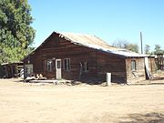 Old abandoned farm house on the Joshua L. Spain homestead.
 Liberty Methodist Church was built in 1903 and located on South Liberty School Road.
 Liberty Methodist Church Memorial Hall built in 1903.
Liberty, Arizona | |
|---|---|
 Liberty School (1910) | |
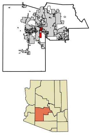
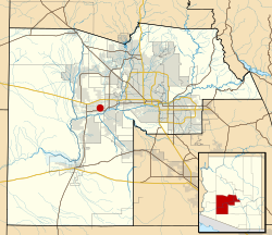 Location in Maricopa County and the state of Arizona | |
| Coordinates: 33°22′39″N112°29′13″W / 33.37750°N 112.48694°W | |
| Country | United States |
| State | Arizona |
| County | Maricopa |
| Elevation | 876 ft (267 m) |
| Time zone | UTC-7 (Mountain (MST)) |
| FIPS code | 04-40910 |
| GNIS feature ID | 6992 |
Liberty is a small populated place in Maricopa County, Arizona, United States. It is located about 30 miles (50 kilometers) west of Phoenix and about 6 miles (10 kilometers) southeast of Buckeye. Liberty is located at the intersection of South Jackrabbit Trail and West Baseline Road. It is located entirely within Block 3017, Block Group 3, Census Tract 506.01, Maricopa County, Arizona, which had a population of 63 at the 2000 census. [2]
Contents
- Notable person
- Images of Liberty
- Images of the historic structures in Liberty
- Historic Liberty Cemetery
- References
The original settlers named the location Altamount, the settlement soon became called Toothaker Place, after the first postmaster, Harriet Toothaker, who ran the post office out of her home. [1] When the post office was relocated in 1901, it was renamed Liberty, and with it the community. [3]
Liberty is home to the Liberty Elementary School District headquarters, although the district itself has expanded out to include much of the surrounding areas of Buckeye and Goodyear.
Liberty exists as a county island within the corporate boundaries of Buckeye. This precludes any possibility of incorporation for the community.