
Maricopa County is in the south-central part of the U.S. state of Arizona. As of the 2020 census the population was 4,420,568, or about 62% of the state's total, making it the fourth-most populous county in the United States and the most populous county in Arizona, and making Arizona one of the nation's most centralized states. The county seat is Phoenix, the state capital and fifth-most populous city in the United States.
Canyon Day is a census-designated place (CDP) in Gila County, Arizona, United States, on the Fort Apache Indian Reservation. The population was 1,209 at the 2010 census.

Gisela is an unincorporated community and census-designated place (CDP) in Gila County, Arizona, United States. The population was 570 at the 2010 census.

Peridot is an unincorporated community and census-designated place (CDP) in Gila and Graham counties in the U.S. state of Arizona. The population was 1,350 at the 2010 census.

Pine is an unincorporated community and census-designated place (CDP) in Gila County, Arizona, United States. The population was 1,963 at the 2010 census. Pine was established by four Mormon families in 1879.

San Carlos is a census-designated place (CDP) in Gila County, Arizona, United States. The population was 4,038 at the 2010 census, up from 3,716 in 2000.

Strawberry is an unincorporated community and census-designated place (CDP) in Gila County, Arizona, United States. The population was 961 at the 2010 census.

Young is an unincorporated community and census-designated place (CDP) in Gila County, Arizona, United States. The population was 588 as of the 2020 census.

New River is an unincorporated community and census-designated place (CDP) in Maricopa County, Arizona, United States. The population was 17,290 as of the 2020 census, up from 14,952 at the 2010 census.
Rio Verde is a master-planned community just east of Scottsdale, in Arizona. It is also a census-designated place (CDP) in Maricopa County, Arizona, United States. The population was 2,210 as of the 2020 census, up from 1,811 at the 2010 census.

Blackwater is a native village and census-designated place (CDP) on the Gila River Reservation in Pinal County, Arizona, United States. The population was 1,062 at the 2010 census, up from 504 in 2000.

Sacaton is a census-designated place (CDP) in Pinal County, Arizona, United States. The population was 3,254 at the 2020 census. It is the capital of the Gila River Indian Community.

Black Canyon City is an unincorporated community and census-designated place (CDP) in Yavapai County, Arizona, United States. The population was 2,837 at the 2010 census, up from 2,697 in 2000.
Whitefield is a census-designated place (CDP) and the main village in the town of Whitefield in Coos County, New Hampshire, United States. The population of the CDP was 1,460 at the 2020 census, out of 2,490 people in the entire town of Whitefield.

Aguila is an unincorporated community and census-designated place (CDP) in Maricopa County, Arizona, United States. It is located on U.S. Route 60, 25 miles (40 km) west of Wickenburg and 22 miles (35 km) northeast of Wenden. Major economic activities include cantaloupe farming and formerly included mining. It uses the same street numbering system as Phoenix. As of the 2020 census, the population of Aguila was 565, down from 798 in 2010.

Arlington is an unincorporated community and census-designated place (CDP) in Maricopa County, Arizona, United States, located 43 miles (69 km) west of downtown Phoenix on old U.S 80. It follows the street numbering system of Phoenix. As of the 2020 census, the population was 150, down from 194 at the 2010 census.

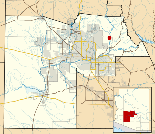
Komatke is a census-designated place in Maricopa County, Arizona, United States. The area currently comprising the census-designated place had a population of 1,013 at the 2020 census, up from 821 at the 2010 census. It is located within the Gila River Indian Community. Its name refers to the Sierra Estrella mountain range, which rises just to the southwest of Komatke.
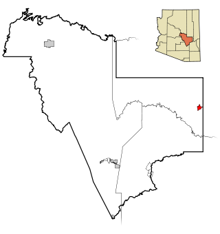
Roosevelt is a census-designated place (CDP) in Gila County, Arizona, United States. The population was 28 at the 2010 census.

Gila Crossing is a census-designated place (CDP) in Maricopa County, Arizona, United States, within the Gila River Indian Community south of Komatke. The population was 636 at the 2020 census.

Maricopa Colony is a census-designated place (CDP) in Maricopa County, Arizona, United States, located in the federally recognized Gila River Indian Community. The population was 854 at the 2020 census, up from 709 at the 2010 census. It is located on the southern side of the Phoenix metropolitan area, around Baseline Road and 83rd Avenue.


