Fountain Hills, Arizona

Last updated

Fountain Hills, Arizona
3 pump fountain 250px.png
The fountain of Fountain Hills can shoot water to a height of up to 560 feet (170 m).
Flag of Fountain Hills, Arizona.gif
FountainHillsaz seal.png
Motto: 
"All That Is Arizona" [1]
Maricopa County Arizona Incorporated and Unincorporated areas Fountain Hills Highlighted 0425300.svg
Location of Fountain Hills in Maricopa County, Arizona
USA Arizona location map.svg
Red pog.svg
Fountain Hills
Usa edcp location map.svg
Red pog.svg
Fountain Hills
Coordinates: 33°36′N111°43′W / 33.60°N 111.72°W / 33.60; -111.72
Country Flag of the United States (23px).png  United States
State Flag of Arizona.svg  Arizona
County Flag placeholder.svg Maricopa
Incorporated 1989
Government
   Mayor Ginny Dickey
Area
[2]
  Total20.37 sq mi (52.76 km2)
  Land20.28 sq mi (52.53 km2)
  Water0.09 sq mi (0.22 km2)
Elevation
[3]
1,798 ft (548 m)
Population
 (2020) [4]
  Total23,820
  Density1,174.38/sq mi (453.43/km2)
Time zone UTC-7 (MST (no DST))
ZIP codes
85268-85269
Area code 480
FIPS code 04-25300
GNIS feature ID2412647 [3]
Website www.fountainhillsaz.gov

Fountain Hills is a town in Maricopa County, Arizona, United States. Known for its impressive fountain, once the tallest in the world, it borders the Fort McDowell Yavapai Nation, Salt River Pima-Maricopa Indian Community, and Scottsdale. The population was 23,820 as of the 2020 census. [5] Between the 1990 and 2000 censuses it was the eighth-fastest-growing place among cities and towns in Arizona. The median value of an owner-occupied housing during the period 2016-2020 was estimated at $402,100. [6]

Contents

History

Before the development of Fountain Hills, the area was home to the Yavapai people, and petroglyphs can be found near the Dixie Mine in the northwest corner of the town along the mountains.

Two boys posing at the petroglyphs by the Dixie Mine, Fountain Hills, AZ Petroglyphpeople.jpg
Two boys posing at the petroglyphs by the Dixie Mine, Fountain Hills, AZ

In the early 20th century, the area that became Fountain Hills and the McDowell Mountain Regional Park was part of the Pemberton Ranch, [7] later renamed the P-Bar Ranch. Fountain Hills High School is built on the site of one of the P-Bar Ranch's buildings, and a plaque stands in the parking lot to commemorate this.

Fountain Hills was developed by C. V. Wood, president of McCulloch Oil, and was named after the towering man-made fountain in the center of town. [8] [9] The town was incorporated in 1989. [10]

Geography

Fountain Hills is in eastern Maricopa County, on the eastern edge of the Phoenix urbanized area. It is 31 miles (50 km) northeast of downtown Phoenix and sits on the east side of the south end of the McDowell Mountains. According to the U.S. Census Bureau, the town has a total area of 20.4 square miles (53 km2), of which 0.1 square miles (0.26 km2), or 0.42%, are water. The elevation is 1,520 feet (460 m) at the fountain, 500 feet (150 m) higher than in Phoenix. [11] The elevation reaches 3,190 feet (970 m) on the western border of the town, on a spur of the McDowell Mountains.

To the east of the town is the Verde River, a tributary to the Salt River. Inside the town there are many washes that run through Fountain Hills into the Verde River. Some of these washes include the Ashbrook, Balboa, Legend, and Colony Washes. During times of rain the washes flood with water and can sometimes block roads with their water. Signs mark several of the intersections of washes and major streets in the town.

To the southwest and northwest regions of Fountain Hills are the McDowell Mountains, a chain of extinct volcanic remnants. The highest mountains in the range are East End (4,067 ft (1,240 m)), McDowell Peak (4,034 ft (1,230 m)), and Thompson Peak (3,982 ft (1,214 m)), [12] all in neighboring Scottsdale.

Climate

The area has a large amount of sunshine year round due to its stable descending air and high pressure. According to the Köppen Climate Classification system, Fountain Hills has a hot desert climate, abbreviated "Bwh" on climate maps. [13]

Climate data for Fountain Hills, Arizona, 1991–2020 normals, extremes 1979–present
MonthJanFebMarAprMayJunJulAugSepOctNovDecYear
Record high °F (°C)82
(28)
91
(33)
101
(38)
107
(42)
114
(46)
121
(49)
125
(52)
118
(48)
115
(46)
107
(42)
95
(35)
84
(29)
125
(52)
Mean maximum °F (°C)75.6
(24.2)
80.4
(26.9)
88.6
(31.4)
97.4
(36.3)
103.9
(39.9)
110.9
(43.8)
112.6
(44.8)
111.4
(44.1)
107.7
(42.1)
100.5
(38.1)
87.5
(30.8)
76.5
(24.7)
114.0
(45.6)
Mean daily maximum °F (°C)63.9
(17.7)
67.4
(19.7)
73.9
(23.3)
82.0
(27.8)
91.0
(32.8)
100.6
(38.1)
103.0
(39.4)
101.9
(38.8)
97.1
(36.2)
86.6
(30.3)
73.7
(23.2)
63.0
(17.2)
83.7
(28.7)
Daily mean °F (°C)54.2
(12.3)
56.8
(13.8)
62.3
(16.8)
69.2
(20.7)
77.8
(25.4)
86.7
(30.4)
91.6
(33.1)
90.9
(32.7)
85.4
(29.7)
74.6
(23.7)
62.5
(16.9)
53.5
(11.9)
72.1
(22.3)
Mean daily minimum °F (°C)44.5
(6.9)
46.2
(7.9)
50.7
(10.4)
56.4
(13.6)
64.5
(18.1)
72.8
(22.7)
80.3
(26.8)
79.8
(26.6)
73.7
(23.2)
62.6
(17.0)
51.3
(10.7)
43.9
(6.6)
60.6
(15.9)
Mean minimum °F (°C)32.6
(0.3)
35.0
(1.7)
39.7
(4.3)
45.1
(7.3)
53.1
(11.7)
62.0
(16.7)
69.6
(20.9)
69.9
(21.1)
62.8
(17.1)
48.8
(9.3)
38.9
(3.8)
31.9
(−0.1)
29.8
(−1.2)
Record low °F (°C)23
(−5)
25
(−4)
30
(−1)
36
(2)
44
(7)
49
(9)
57
(14)
58
(14)
51
(11)
37
(3)
29
(−2)
24
(−4)
23
(−5)
Average precipitation inches (mm)1.41
(36)
1.33
(34)
1.28
(33)
0.33
(8.4)
0.23
(5.8)
0.14
(3.6)
0.80
(20)
1.33
(34)
0.81
(21)
0.63
(16)
0.74
(19)
1.15
(29)
10.18
(259)
Average precipitation days3.63.93.41.41.20.32.94.42.62.32.23.431.6
Source: NOAA [14] [15]

Demographics

Historical population
CensusPop.Note
1980 2,771
1990 10,030262.0%
2000 20,235101.7%
2010 22,48911.1%
2020 23,8205.9%
U.S. Decennial Census [16]

As of the census of 2020, there were 23,820 people in 11,918 households in the town. The population density was 1,113.8 inhabitants per square mile (430.0/km2). There were 13,167 housing units at an average density of 577.5 per square mile (223.0/km2). The ethnic makeup of the town was 94.1% White, 1.0% Black or African American, 0.6% Native American, 1.8% Asian, 0.1% Native Hawaiian and Other Pacific Islander, 1.1% from other races, and 1.4% from two or more races. Hispanic or Latino of any race make up 4.1% of the population.

There were 11,918 households, out of which 18.6% had children under the age of 18 living with them, 59.4% were married couples living together, 6.7% had a female householder with no husband present, and 31.1% were non-families. Householders living alone make up 25.7% of all households, and 11.5% had someone living alone who was 65 years of age or older. The average household size was 2.16 and the average family size was 2.56.

In the town, the population was spread out, with 14.4% under the age of 18, 85.6% 18 years and over, and 27.8% who were 65 years of age or older. The median age was 53.9 years. There were 47.8% males and 52.2% females.

According to the 2020 American Community Survey, the median income for a household in Fountain Hills for the period 2016-2020 was $85,200. [6]

The per capita income for the town was $59,791. About 3.3% of families and 4.6% of the population were below the poverty line, including 3.5% of those under age 18 and 3.6% of those age 65 or over.

Arts and culture

The Fountain

Fountain Hills has the world's fourth-tallest fountain, and the second tallest in the United States. It was built in 1970 in Zürich by Robert P. McCulloch, the year before the reconstruction of the London Bridge in Lake Havasu City, another of McCulloch's projects. The fountain sprays water for about 15 minutes every hour on the hour between 9am and 9pm. The plume rises from a concrete water-lily sculpture in the center of a large man-made lake. The fountain, driven by three 600 horsepower (450 kW) turbine pumps, sprays water at a rate of 7,000 US gallons (26,000 L; 5,800 imp gal) per minute through an 18-inch (460 mm) nozzle. With all three pumps under ideal conditions, the fountain reaches 560 feet (170 m) in height, [17] though in normal operation only two of the pumps are used, with a fountain height of around 300 feet (91 m). When built it was the world's tallest fountain, a record it held for over a decade. [18]

The Town of Fountain Hills has partnered with EarthCam [19] to bring live streaming views of its world-famous fountain. The live stream camera can be accessed on the Experience Fountain Hills website. [20] To help celebrate the fountain's 50th year, the town installed a new LED lighting system with four lights mounted directly under the fountain and six lights on the shore for a total of 10 lights to provide ample lighting and still meet the Dark Skies regulations. [21]

International Dark Sky Community

Lunar Eclipse over Fountain Park in Fountain Hills Red moon with purple spray.jpg
Lunar Eclipse over Fountain Park in Fountain Hills

In January 2018, the town of Fountain Hills was designated an International Dark Sky Community [21] by the International Dark Sky Association. [22] The town is one of only two International Dark Sky Communities located near a large metropolitan area. As of 2021, 34 communities in the world have earned the Community designation, among Dark Sky Reserves, Parks, and Sanctuaries. The Fountain Hills Dark Sky Association (FHDSA) worked with town council and town staff to change outdoor lighting and sign ordinances to address light pollution. This designation is a result of both geography and lighting ordinances. The community is shielded from the lights of the larger cities in the Phoenix metro region by the McDowell Mountains to the west. The Fort McDowell Yavapai Nation to the east, the Salt River Pima-Maricopa Indian Community to the south, and the McDowell Mountain Regional Park all help the town preserve its dark skies. The absence of street lights and the presence of only low-impact outdoor lighting creates an outstanding environment for stargazing. The Fountain Hills Dark Sky Association is currently working to develop a 15,000 square feet (1,400 m2) International Dark Sky Discovery Center that will include a Dark Sky Observatory, Hyperspace Planetarium, Inspiration Theater, and an Immersion Zone. [23] Fountain Hills was the home to Charles W. Juels' Fountain Hills Observatory ( 678 ), where 475 asteroids were discovered between 1999 and 2003, including 20898 Fountainhills. [24]

Events

The town hosts a number of events each year at Fountain Park, including three large art fairs: the Spring Fountain Festival of Fine Arts and Crafts and the Fall Fountain Festival of Fine Arts and Crafts, both presented by the Fountain Hills Chamber of Commerce. Each year, the town hosts a St. Patrick's Day celebration in which the town's fountain is dyed green. The Greening of the Fountain tradition began in 1979. Other signature events include a 4th of July celebration, an annual Music Fest, [25] Irish Fest, [26] and Concours in the Hills — a car show which featured over 1,000 vehicles and 50,000 attendees in February 2024. [27]

Arts

Fountain Hills is home to one of the largest public art collections in Arizona. The art collection, which features over 150 pieces, is part of a partnership between the Town of Fountains Hills and the Public Art Committee of the Fountain Hills Cultural and Civic Association. [28] Art is a significant part of the Town's heritage. The eight fountains along the Avenue of the Fountains were the beginning of the public art collection. Bronze sculptures and fountains with Community Profile themes ranging from the whimsical to the serious dot the streets and adorn the public buildings, plazas and parks. The collection also contains a wide variety of other art types and media, including paintings, stone, photography and metals. Residents and visitors are invited to wander the streets or take the "Art Walk" guided tour.

Fountain Hills Theater is a performing arts venue entering its 28th season and offering over 16 productions a year to local communities as well as performing an arts education year-round for youth.

Government

Fountain Hills has a council–manager system. The current mayor of Fountain Hills is Ginny Dickey, first elected in August 2018, and reelected in 2020 and 2022. The current Town Council consists of the mayor and six councilmembers. Councilmembers include Vice Mayor Brenda Kalivianakis, Gerry Friedel, Peggy McMahon, Sharron Grzybowski, Allen Skillicorn, and Hannah Toth. Councilmembers serve four-year terms, and the mayor serves a two-year term. The council selects a town manager, attorney, and magistrate. Rachael Goodwin has been the Town Manager since 2023.

The town contracts its law enforcement services with the Maricopa County Sheriff's Office.

The Fountain Hills Fire Department has two fire stations. Dave Ott is the fire chief.

Fountain Hills is in Arizona's 1st congressional district and Arizona's 3rd state legislative district.

Education

Fountain Hills Public Schools are part of the Fountain Hills Unified School District #98. The district provides education from pre-school through high school with Little Falcons Preschool, McDowell Mountain Elementary, Fountain Hills Middle School, and Fountain Hills High School. [29] The district has small class sizes at an average of 18:1, and it includes a special education program, Fountain Hills Virtual Academy, and a career and technical education program. [30]

Media

The Fountain Hills Times Independent [31] is the town's weekly newspaper. [32] The paper has a weekly circulation of about 3,000. [33]

Independent Newsmedia, Inc. is the parent company, and it also owns Valley Newspapers, a commercial printing plant located near Deer Valley Airport. The company also publishes community newspapers in Delaware, the Eastern Shore of Maryland, and Florida, and it owns a press in Delaware. The Times also publishes the Fountain Hills/Rio Verde Telephone Directory, Fountain Hills Community Guide, Fountain Hills HOME. [34]

Notable people

Sister cities

Fountain Hills has three sister cities , as designated by Sister Cities International : [35]

Related Research Articles

<span class="mw-page-title-main">Maricopa County, Arizona</span> County in Arizona, United States

Maricopa County is in the south-central part of the U.S. state of Arizona. As of the 2020 census the population was 4,420,568, or about 62% of the state's total, making it the fourth-most populous county in the United States and the most populous county in Arizona, and making Arizona one of the nation's most centralized states. The county seat is Phoenix, the state capital and fifth-most populous city in the United States.

<span class="mw-page-title-main">Yavapai County, Arizona</span> County in Arizona, United States

Yavapai County is near the center of the U.S. state of Arizona. As of the 2020 census, its population was 236,209, making it the fourth-most populous county in Arizona. The county seat is Prescott.

<span class="mw-page-title-main">Avondale, Arizona</span> City in Arizona, United States

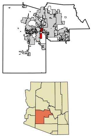
Avondale is a city in Maricopa County, Arizona, United States, adjacent to Phoenix. As of the 2020 census, the population of the city was 89,334, up from 76,238 in 2010 and 35,883 in 2000.

<span class="mw-page-title-main">Cave Creek, Arizona</span> Town in Maricopa County, Arizona

Cave Creek is a town in Maricopa County, Arizona, United States. It is part of the Phoenix metropolitan area. As of the 2020 census, the population of the town was 4,892.

<span class="mw-page-title-main">Peoria, Arizona</span> City in Arizona, United States

Peoria is a city in Maricopa and Yavapai counties in the U.S. state of Arizona. Most of the city is located in Maricopa County, while a portion of it in the north is in Yavapai County. It is a major suburb of Phoenix. As of the 2020 census, the population of Peoria was 190,985, up from 154,065 in 2010. It is the sixth-largest city in Arizona in land area and the ninth-largest in population. It was named after Peoria, Illinois. The word peoria is a corruption of the Miami-Illinois word for "prairie fire". It is the spring training home of the San Diego Padres and Seattle Mariners, who share the Peoria Sports Complex.

<span class="mw-page-title-main">Rio Verde, Arizona</span> CDP in Maricopa County, Arizona

Rio Verde is a master-planned community just east of Scottsdale, in Arizona. It is also a census-designated place (CDP) in Maricopa County, Arizona, United States, located in the far, far northeast area of the whole Phoenix Metropolitan Area. The population was 2,210 as of the 2020 census, up from 1,811 at the 2010 census.

<span class="mw-page-title-main">Scottsdale, Arizona</span> City in Arizona, United States

Scottsdale is a city in the eastern part of Maricopa County, Arizona, United States, and is part of the Phoenix metropolitan area. Named Scottsdale in 1894 after its founder Winfield Scott, a retired U.S. Army chaplain, the city was incorporated in 1951 with a population of 2,000. At the 2020 census, the population was 241,361, which had grown from 217,385 in 2010. Its slogan is "The West's Most Western Town". Over the past two decades, it has been one of the fastest growing cities in the United States.

Arizona's 1st congressional district is a congressional district located in the U.S. state of Arizona, covering northeastern Maricopa County. Before 2023, geographically, it was the eleventh-largest congressional district in the country and included much of the state outside the Phoenix and Tucson metropolitan areas. From 2013 through 2022, it also included the Navajo Nation, the Hopi reservation, and the Gila River Indian Community, with 25% of the population being Native American. At that time, the district had more Native Americans than any other congressional district in the United States. In the 2022 elections, David Schweikert was elected in the redefined district. It was one of 18 districts that would have voted for Joe Biden in the 2020 presidential election had they existed in their current configuration while being won or held by a Republican in 2022.

<span class="mw-page-title-main">McDowell Mountains</span> Mountain range in Arizona, United States

The McDowell Mountain Range is located about twenty miles north-east of downtown Phoenix, Arizona, and may be seen from most places throughout the city. The range is composed of miocene deposits left nearly five million years ago. The McDowells share borders with the cities of Fountain Hills, Scottsdale, and Maricopa County. The city of Scottsdale has made its share of the McDowells a preserve, and has set up a wide trail network in partnership with the McDowell Sonoran Conservancy. The McDowell Sonoran Conservancy was established in 1991. The highest peak in the McDowells is East End, at 4,069 feet (1,240 m). This mountain range also serves as a sacred marker to the Yavapai people. The boundaries of the range are generally defined by Saddleback Mountain in the South and Granite Mountain as the Northern boundary. The McDowells also comprise popular landmarks such as Pinnacle Peak and Tom's Thumb. Although technically a stand-alone, Mt. McDowell, not to be confused with McDowell Peak, is sometimes listed on maps as a part of the McDowell Mountains.

<span class="mw-page-title-main">Maricopa Association of Governments</span> Council of governments for greater Phoenix, United States

Maricopa Association of Governments (MAG) is a Council of Governments (COG) that serves as the regional agency for the greater Maricopa region in Arizona, United States. This includes the Phoenix area and the neighboring urbanized area in Pinal County, containing the Town of Florence and City of Maricopa. When MAG was formed in 1967, the elected officials recognized the need for long-range planning and policy development on a regional scale. They realized that many issues such as transportation, air quality and human services affected residents beyond the borders of their individual jurisdictions.

<span class="mw-page-title-main">Mount McDowell</span> Landform in Maricopa County, Arizona

Mount McDowell, more commonly referred to as Red Mountain, is located on the Salt River Pima-Maricopa Indian Reservation, just north of Mesa, Arizona. It is named after General Irvin McDowell, a Union officer in the Civil War. Its elevation is 2,832 feet (863 m). It is not the same landmark as the McDowell Peak, which is 11 miles (18 km) away to the northwest.

Fort McDowell may refer to:

The Fountain Hills Unified School District is a public school district in Maricopa County, Arizona, US, based in Fountain Hills, Arizona.

<span class="mw-page-title-main">Wickenburg High School</span> Public school in Arizona

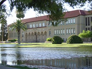
Wickenburg High School is a high school in Wickenburg, Arizona under the jurisdiction of the Wickenburg Unified School District. It is double-listed on the National Register of Historic Places in Arizona. The original Colonial Revival high school and annex were completed in 1925 and 1935, respectively. In 1934, the Works Progress Administration-built gymnasium was completed in a Moderne style. It is the town's only WPA building and the larger of two cast-in-place concrete structures in the town; it also is separately listed. The two buildings were put on the NRHP at the same time. In 1999, the high school moved to a new building.

Wickenburg Unified School District #9 (WUSD) is a school district headquartered in Wickenburg, Arizona.

<span class="mw-page-title-main">Fort McDowell Yavapai Nation</span> American Indian Reservation

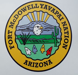
The Fort McDowell Yavapai Nation, formerly the Fort McDowell Mohave-Apache Community of the Fort McDowell Indian Reservation, is a federally recognized tribe and Indian reservation in Maricopa County, Arizona about 23 miles (37 km) northeast of Phoenix.

<span class="mw-page-title-main">Stoneman Military Trail</span> Supply road in Yapavai & Maricopa Counties, Arizona, 1870–1890

The Stoneman Road, an important supply road between Fort McDowell and Fort Whipple in Prescott between 1870 and 1890. It was an important conduit for the shipping of supplies from Fort Whipple in Prescott to Fort McDowell on what is today the Yavapai Reservation near Fountain Hills.

<span class="mw-page-title-main">Timeline of Arizona</span> Timeline of the history of Arizona

The following is a timeline of the history of the area which today comprises the U.S. state of Arizona. Situated in the desert southwest, for millennia the area was home to a series of Pre-Columbian peoples. By 1 AD, the dominant groups in the area were the Hohokam, the Mogollon, and the Ancestral Puebloans. The Hohokam dominated the center of the area which is now Arizona, the Mogollon the southeast, and the Puebloans the north and northeast. As these cultures disappeared between 1000 and 1400 AD, other Indian groups settled in Arizona. These tribes included the Navajo, Apache, Southern Paiute, Hopi, Yavapai, Akimel O'odham, and the Tohono O'odham.

References

  1. "Town of Fountain Hills, Arizona". Town of Fountain Hills, Arizona. Retrieved August 23, 2012.
  2. "2021 U.S. Gazetteer Files: Arizona". United States Census Bureau. Retrieved May 11, 2022.
  3. 1 2 U.S. Geological Survey Geographic Names Information System: Fountain Hills, Arizona
  4. "Fountain Hills town, Arizona: 2020 DEC Redistricting Data (PL 94-171)". U.S. Census Bureau. Retrieved May 11, 2022.
  5. "Quick Facts – 85268 U.S. Census Bureau". data.census.gov. Retrieved February 7, 2021.
  6. 1 2 "2020 U.S. Census American Community Survey 5-year estimates". QuickFacts. U.S. Census Bureau. Retrieved May 11, 2022.
  7. https://arizona.hometownlocator.com/maps/feature-map,ftc,2,fid,32778,n,pemberton%20ranch.cfm [ bare URL ]
  8. Arroyo Rodriguez, Nadine (April 18, 2014). "Did You Know: The Fountain Hills Namesake Is Among the World's Largest". KJZZ. Retrieved July 17, 2016.
  9. "Profile for Fountain Hills, Arizona, AZ". ePodunk. Archived from the original on February 10, 2013. Retrieved August 23, 2012.
  10. "Town of Fountain Hills, Arizona". Town of Fountain Hills, Arizona. Retrieved August 23, 2012.
  11. "About Fountain Hills | Fountain Hills, AZ - Official Website". www.fh.az.gov. Retrieved February 7, 2021.
  12. Elevations from U.S. Geological Survey 7.5-minute topographic maps: "U.S. Geological Survey: Fountain Hills AZ". ACME Mapper. Retrieved May 11, 2022.
  13. Climate Summary for Fountain Hills, Arizona
  14. "NOWData – NOAA Online Weather Data". National Oceanic and Atmospheric Administration . Retrieved November 19, 2022.
  15. "Summary of Monthly Normals 1991–2020". National Oceanic and Atmospheric Administration. Retrieved November 19, 2022.
  16. "Census of Population and Housing". Census.gov. Retrieved June 4, 2016.
  17. "The Fountain". Archived from the original on July 22, 2011. Retrieved October 26, 2011.
  18. "The Fountain (site disabled 2017-06-26)". Fountain Hills Guide. Retrieved August 23, 2012.
  19. "LIVE NOW! Fountain Hills Cam".
  20. "Fountain Hills Fountain".
  21. 1 2 "Fountain Hills Dark Sky Association". Fountain Hills Dark Sky Association. Retrieved January 7, 2021.
  22. "International Dark Sky Association". International Dark-Sky Association. Retrieved January 7, 2021.
  23. "Fountain Hills Dark Sky Association". Fountain Hills Dark Sky Association. Retrieved February 16, 2021.
  24. "JPL Small-Body Database Browser: 20898 Fountainhills (2000 WE147)" (January 24, 2018 last obs.). Jet Propulsion Laboratory . Retrieved November 21, 2021.
  25. "Special Events | Fountain Hills, AZ – Official Website". www.fh.az.gov. Retrieved February 10, 2021.
  26. "Irish Fountain Fest". www.experiencefountainhills.org. Retrieved February 24, 2023.
  27. "Home". concoursinthehills. Retrieved February 10, 2021.
  28. "Public Art | Fountain Hills, AZ – Official Website". www.fh.az.gov. Retrieved February 10, 2021.
  29. "Fountain Hills United School District #98". Fountain Hills United School District #98. Retrieved August 23, 2012.
  30. "Fountain Hills Unified School District". www.fountainhillsschools.org. Retrieved September 22, 2022.
  31. "Independent acquires 'Fountain Hills Times'". FHTimes. June 27, 2023. Retrieved June 27, 2023.
  32. "Fountain Hills Times". Fountain Hills Times. Retrieved August 23, 2012.
  33. "National Newspaper Association 2012 Better Newspaper Contest Winners" (PDF). National Newspaper Association. Retrieved August 23, 2012.
  34. "Independent Newsmedia". Independent News Media. Retrieved August 23, 2012.
  35. "Interactive City Directory". Sister Cities International. Archived from the original on August 26, 2016. Retrieved August 23, 2016.