| Providence, Ohio | |
|---|---|
| Ghost town | |
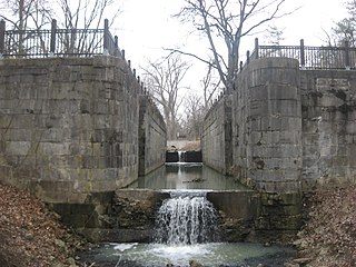
Lock #44 in Providence Metropark | |
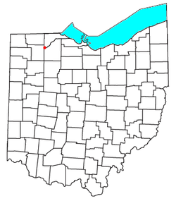 Location of Providence, Ohio | |
| Coordinates: 41°25′05″N83°52′20″W / 41.41806°N 83.87222°W Coordinates: 41°25′05″N83°52′20″W / 41.41806°N 83.87222°W | |
| Country | United States |
| State | Ohio |
| County | Lucas |
| Township | Providence |
| Time zone | Eastern (EST) (UTC-5) |
| • Summer (DST) | EDT (UTC-4) |

Providence is a ghost town on the north side of the Maumee River in southern Providence Township, Lucas County, Ohio, United States, about 24 miles (39 km) southwest of Toledo. After suffering a destructive fire and a cholera epidemic in mid-19th century, the village was abandoned. In this period, canal traffic had also fallen off.

A ghost town is an abandoned village, town, or city, usually one that contains substantial visible remains. A town often becomes a ghost town because the economic activity that supported it has failed, or due to natural or human-caused disasters such as floods, prolonged droughts, government actions, uncontrolled lawlessness, war, pollution, or nuclear disasters. The term can sometimes refer to cities, towns, and neighbourhoods that are still populated, but significantly less so than in past years; for example, those affected by high levels of unemployment and dereliction.

The Maumee River is a river running from northeastern Indiana into northwestern Ohio and Lake Erie in the United States. It is formed at the confluence of the St. Joseph and St. Marys rivers, where Fort Wayne, Indiana, has developed, and meanders northeastwardly for 137 miles (220 km) through an agricultural region of glacial moraines before flowing into the Maumee Bay of Lake Erie. The city of Toledo is located at the mouth of the Maumee. The Maumee was designated an Ohio State Scenic River on July 18, 1974. The Maumee watershed is Ohio’s breadbasket; it is two-thirds farmland, mostly corn and soybeans. It is the largest watershed of any of the rivers feeding the Great Lakes, and supplies five percent of Lake Erie’s water.

Providence Township is one of the eleven townships of Lucas County, Ohio, United States. The 2010 census found 3,361 people in the township.
Contents
The area is now maintained as Providence Metropark of Toledo, featuring numerous elements of the canal era, including a mule-drawn canal boat on a restored section of the Miami and Erie Canal, and an operating saw and gristmill.
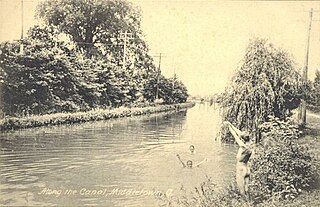
The Miami and Erie Canal was a 274-mile (441 km) canal that ran from Cincinnati to Toledo, Ohio, creating a water route between the Ohio River and Lake Erie. Construction on the canal began in 1825 and was completed in 1845 at a cost to the state government of $8,062,680.07. At its peak, it included 19 aqueducts, three guard locks, 103 canal locks, multiple feeder canals, and a few man-made water reservoirs. The canal climbed 395 feet (120 m) above Lake Erie and 513 feet (156 m) above the Ohio River to reach a topographical peak called the Loramie Summit, which extended 19 miles (31 km) between New Bremen, Ohio to lock 1-S in Lockington, north of Piqua, Ohio. Boats up to 80 feet long were towed along the canal by mules, horses, or oxen walking on a prepared towpath along the bank, at a rate of four to five miles per hour.