Pungoteague, Virginia

Last updated

Pungoteague, Virginia
Village general store, Pungoteague.jpg
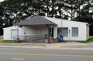
Village General Store in Pungoteague, July 2018
Accomack County Virginia incorporated and unincorporated areas Pungoteague highlighted.svg
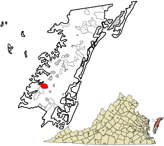
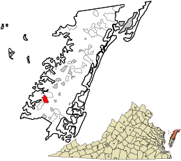
Location in Accomack County and the state of Virginia.
Coordinates: 37°37′44″N75°49′2″W / 37.62889°N 75.81722°W / 37.62889; -75.81722 [1]
CountryUnited States
State Virginia
County Accomack
Elevation
[1]
26 ft (8 m)
Population
 (2010)
  Total347
Time zone UTC−5 (Eastern (EST))
  Summer (DST) UTC−4 (EDT)
FIPS code 51-48776
GNIS feature ID2584905 [1]

Pungoteague is a census-designated place (CDP) in Accomack County, Virginia, United States. It was first listed as a CDP in 2010. [1] Per the 2020 census, the population was 346. [2]

Contents

The name itself is a derivative of the Native American term "Pungotekw," which means Sand Fly River and is the name used by the earliest inhabitants. [3]

In late summer of 1665, William Darby and two of his friends dared present a play at Cowle's Tavern. Entitled Ye Bear and Ye Cub, this drama is believed to have been the first theater performance of an English-language play in the American colonies. [3] [4]

Another notable local landmark is Saint George's Church. It is believed that the first meetings of the Pungoteague Episcopal congregation were held in 1636, with the church's first building being constructed from 1666 to 1676. The original frame church was replaced in 1736 by a brick structure in the Flemish-bond pattern. [3] It was added to the National Register of Historic Places in 1970. [5] Shepherd's Plain was added in 1982. [5]

In the mid-19th century, Pungoteague was a point along the stagecoach route between Wilmington, Delaware and Eastville, Virginia. [6]

Geography

Pungoteague post office, July 2018 USPO, Pungoteague (cropped).jpg
Pungoteague post office, July 2018

It lies at an elevation of 26 feet. [1]

Demographics

Historical population
CensusPop.Note
2010 347
2020 346−0.3%
U.S. Decennial Census [7]
2010 [8] 2020 [9]

2020 census

Pungoteague CDP, Virginia – Racial and ethnic composition
Note: the US Census treats Hispanic/Latino as an ethnic category. This table excludes Latinos from the racial categories and assigns them to a separate category. Hispanics/Latinos may be of any race.
Race / Ethnicity (NH = Non-Hispanic)Pop 2010 [8] Pop 2020 [9] % 2010% 2020
White alone (NH)21522161.96%63.87%
Black or African American alone (NH)1177433.72%21.39%
Native American or Alaska Native alone (NH)511.44%0.29%
Asian alone (NH)040.00%1.16%
Pacific Islander alone (NH)000.00%0.00%
Some Other Race alone (NH)010.00%0.29%
Mixed Race or Multi-Racial (NH)3180.86%5.20%
Hispanic or Latino (any race)7272.02%7.80%
Total347346100.00%100.00%

Related Research Articles

Sussex is a census-designated place (CDP) in and the county seat of Sussex County, Virginia, United States. The population as of the 2020 Census was 181.

<span class="mw-page-title-main">New Kent, Virginia</span> Census-designated place in Virginia, US

New Kent is a census-designated place (CDP) in and the county seat of New Kent County, Virginia, United States. The population as of the 2020 Census was 739.

<span class="mw-page-title-main">Deep Creek, Accomack County, Virginia</span> Census-designated place in Virginia, United States

Deep Creek is a census-designated place (CDP) in Accomack County, Virginia, United States. Per the 2020 census, the population was 94.

<span class="mw-page-title-main">Gargatha, Virginia</span> Census-designated place in Virginia, United States

Gargatha is a census-designated place (CDP) in Accomack County, Virginia, United States. Per the 2020 census, the population was 415.

<span class="mw-page-title-main">Greenbush, Virginia</span> Census-designated place in Virginia, United States

Greenbush is a census-designated place (CDP) in Accomack County, Virginia, United States. Per the 2020 census, the population was 224.

<span class="mw-page-title-main">Lee Mont, Virginia</span> Census-designated place in Virginia, United States

Lee Mont is a census-designated place (CDP) in Accomack County, Virginia, United States. Per the 2020 census, the population was 102.

<span class="mw-page-title-main">Mappsville, Virginia</span> Census-designated place in Virginia, United States

Mappsville is a census-designated place (CDP) in Accomack County, Virginia, United States. Per the 2020 census, the population was 311.

<span class="mw-page-title-main">Nelsonia, Virginia</span> Census-designated place in Virginia, United States

Nelsonia is a census-designated place (CDP) in Accomack County, Virginia, United States. Per the 2020 census, the population was 451.

<span class="mw-page-title-main">New Church, Virginia</span> Census-designated place in Virginia, United States

New Church is a census-designated place (CDP) in Accomack County, Virginia, United States. Per the 2020 census, the population was 256.

<span class="mw-page-title-main">Quinby, Virginia</span> Census-designated place in Virginia, United States

Quinby is a census-designated place (CDP) in Accomack County, Virginia, United States. It was first listed as a CDP in 2010. Per the 2020 census, the population was 285.

<span class="mw-page-title-main">Sanford, Virginia</span> Census-designated place in Virginia, United States

Sanford is a census-designated place (CDP) in Accomack County, Virginia, United States. It was first listed as a CDP in 2010. Per the 2020 census, the population was 168.

<span class="mw-page-title-main">Savageville, Virginia</span> Census-designated place in Virginia, United States

Savageville is a census-designated place (CDP) in Accomack County, Virginia, United States. It was first listed as a CDP in 2010. Per the 2020 census, the population was 175.

<span class="mw-page-title-main">Bayside, Accomack County, Virginia</span> Census-designated place in Accomack County, Virginia, United States

Bayside is a census-designated place (CDP) in Accomack County, Virginia, United States. Per the 2020 census, the population was 107.

<span class="mw-page-title-main">Bobtown, Virginia</span> Census-designated place in Virginia, United States

Bobtown is a census-designated place (CDP) in Accomack County, Virginia, United States. Per the 2020 census, the population was 267.

<span class="mw-page-title-main">Boston, Accomack County, Virginia</span> Census-designated place in Virginia, United States

Boston is a census-designated place (CDP) in Accomack County, Virginia, United States. Per the 2020 census, the population was 454.

<span class="mw-page-title-main">Pastoria, Virginia</span> Census-designated place in Virginia, United States

Pastoria is a census-designated place (CDP) in Accomack County, Virginia, United States. It was first listed as a CDP in 2010. Per the 2020 census, the population was 627.

<span class="mw-page-title-main">Savage Town, Virginia</span> Census-designated place in Virginia, United States

Savage Town is a census-designated place (CDP) in Accomack County, Virginia, United States. It was first listed as a CDP in 2010. Per the 2020 census, the population was 72.

<span class="mw-page-title-main">Whitesville, Virginia</span> Census-designated place in Virginia, United States

Whitesville is a census-designated place (CDP) in Accomack County, Virginia, United States. It was first listed as a CDP in 2010. As of the 2020 census, it had a population of 241.

<span class="mw-page-title-main">Makemie Park, Virginia</span> Census-designated place in Virginia, United States

Makemie Park is a census-designated place in Accomack County, Virginia. Per the 2020 census, the population was 138.

<span class="mw-page-title-main">Piney Mountain, Virginia</span> CDP in Virginia, United States

Piney Mountain is a census-designated place in Albemarle County, Virginia. The population as of the 2010 Census was 1,130.

References

  1. 1 2 3 4 5 "Pungoteague Census Designated Place". Geographic Names Information System . United States Geological Survey, United States Department of the Interior.
  2. "Pungoteague CDP, Virginia". United States Census Bureau . Retrieved December 25, 2022.
  3. 1 2 3 "Down Home". Co-opliving.com. Retrieved October 3, 2012.
  4. Londré, Felicia Hardison (1998). The history of North American theater : the United States, Canada, and Mexico : from pre-Columbian times to the present . New York: Continuum. p.  65. ISBN   9780826410795.
  5. 1 2 "National Register Information System". National Register of Historic Places . National Park Service. July 9, 2010.
  6. Smith, John Calvin (1847). The Illustrated Hand-book, a New Guide for travelers through the United States of America. New York City: Sherman & Smith. pp.  127–128.
  7. "Decennial Census by Decade". US Census Bureau.
  8. 1 2 "P2 Hispanic or Latino, and Not Hispanic or Latino by Race – 2010: DEC Redistricting Data (PL 94-171) - Pungoteague CDP, Virginia". United States Census Bureau .
  9. 1 2 "P2 Hispanic or Latino, and Not Hispanic or Latino by Race – 2020: DEC Redistricting Data (PL 94-171) - Pungoteague CDP, Virginia". United States Census Bureau .