
The Vaal River is the largest tributary of the Orange River in South Africa. The river has its source near Breyten in Mpumalanga province, east of Johannesburg and about 30 kilometres (19 mi) north of Ermelo and only about 240 kilometres (150 mi) from the Indian Ocean. It then flows westwards to its conjunction with the Orange River southwest of Kimberley in the Northern Cape. It is 1,120 kilometres (700 mi) long, and forms the border between Mpumalanga, Gauteng and North West Province on its north bank, and the Free State on its south.
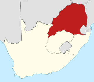
The Province of the Transvaal, commonly referred to as the Transvaal, was a province of South Africa from 1910 until 1994, when a new constitution subdivided it following the end of apartheid. The name "Transvaal" refers to the province's geographical location to the north of the Vaal River. Its capital was Pretoria, which was also the country's executive capital.

The Vaal Triangle is a triangular area formed by Vereeniging, Vanderbijlpark and Sasolburg about 60km south of Johannesburg, South Africa. The area forms a substantial urban complex. Meyerton, just north of Vereeniging, is also generally included in the complex, and residents of Sharpeville, Boipatong, Bophelong, the greater Sebokeng area, Heidelberg, Zamdela, Deneysville and Potchefstroom also generally tend to consider themselves to live in the Vaal Triangle. The area straddles the Vaal River and is a major industrial region, which is home to former Iron and Steel Corporation Iscor, now ArcelorMittal South Africa, and Sasol, the steel and petrochemical processing facilities.

The Vaal Dam in South Africa was constructed in 1938 and lies 77 km south of OR Tambo International Airport. The lake behind the dam wall has a surface area of about 320 square kilometres (120 sq mi) and is 47 meters deep. The Vaal Dam lies on the Vaal River, which is one of South Africa's strongest-flowing rivers. Other rivers flowing into the dam are the Wilge River, Klip River, Molspruit and Grootspruit. It has over 800 kilometres (500 mi) of shoreline and is South Africa's second biggest dam by area and the fourth largest by volume.

The N3 is a national route in South Africa that connects Johannesburg and Durban, respectively South Africa's largest and third-largest cities. Johannesburg is the financial and commercial heartland of South Africa, while Durban is South Africa's key port and one of the busiest ports in the Southern Hemisphere and is also a holiday destination. Durban is the port through which Johannesburg imports and exports most of its goods. As a result, the N3 is a very busy highway and has a high volume of traffic.

The N1 is a national route in South Africa that runs from Cape Town through Bloemfontein, Johannesburg, Pretoria and Polokwane to Beit Bridge on the border with Zimbabwe. It forms the first section of the famed Cape to Cairo Road.

Deneysville is a small town on the banks of the Vaal Dam in the Free State province of South Africa.
Villiers is a small town situated on the banks of the Vaal River next to the N3 highway in the Free State province of South Africa. It was founded in 1882 on the two farms Pearson Valley and Grootdraai owned by Lourens de Villiers.

The R23 is a provincial route in South Africa that links Benoni with Volksrust via Brakpan, Heidelberg and Standerton.

The R42 is a provincial route in South Africa that connects Vanderbijlpark with Bronkhorstspruit via Vereeniging, Heidelberg, Nigel and Delmas.

The R51 is a provincial route in South Africa that connects Bapsfontein with the N3 north of Villiers, via Springs, Nigel and Balfour.
The R54 is a provincial route in South Africa that connects Potchefstroom with Villiers via Vereeniging.

The R57 is a provincial route in South Africa that connects Vanderbijlpark with Phuthaditjhaba via Sasolburg, Heilbron and Reitz.

The R82 is a provincial route in South Africa that connects Johannesburg with Kroonstad via Vereeniging and Sasolburg. It starts just south of the M1 Johannesburg Municipal Highway's interchange with the N12 Southern Bypass, going south, meeting the R59, R54, R42 & R28 routes at Vereeniging before crossing the Vaal River into the Free State & proceeding to Kroonstad. It is an alternative, but longer route to the N1 National Route between Johannesburg & Kroonstad.

The N12 is a national route in South Africa which runs from George through Beaufort West, Kimberley, Klerksdorp and Johannesburg to eMalahleni.

The N8 is a national route in South Africa that connects Groblershoop with Maseru in Lesotho via Kimberley and Bloemfontein. It is maintained by the South African National Roads Agency.
The R505 is a Regional Route in South Africa. It connects Ottoshoop, North West Province in the north with Wesselsbron, Free State Province to the south.
The R546 is a Regional Route in South Africa that connects Kinross with Vrede via Evander and Standerton.
The R708 is a Regional Route in South Africa. The route begins at Jan Kempdorp, Northern Cape and ends outside Clocolan, Free State.
The R716 is a Regional Route in South Africa that connects Vanderbijlpark with the R26 between Villiers and Frankfort. It passes through Deneysville and Oranjeville.
