 | ||||
|---|---|---|---|---|
| Route information | ||||
| Maintained by GDRT | ||||
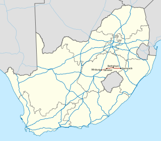
| Length | 42.6 km (26.5 mi) | |||
| Major junctions | ||||
| West end | ||||
| East end | ||||
| Location | ||||
| Country | South Africa | |||
| Highway system | ||||
| ||||
The R551 is a Regional Route in South Africa. [1]
| | ||||
|---|---|---|---|---|
| Route information | ||||
| Maintained by GDRT | ||||
| Length | 42.6 km (26.5 mi) | |||
| Major junctions | ||||
| West end | ||||
| East end | ||||
| Location | ||||
| Country | South Africa | |||
| Highway system | ||||
| ||||
The R551 is a Regional Route in South Africa. [1]
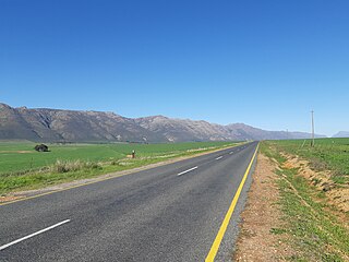
Its western terminus is the R553 in Evaton. From there it runs east to meet the R82 at a staggered junction in De Deur. It continues eastwards to form an interchange with the R59 highway at Meyerton. East of the town, it passes through the village of Henley on Klip then crosses the R557 before reaching its eastern terminus at an intersection with the R42 near Suikerbosrand Nature Reserve.

The R23 is a provincial route in South Africa that links Benoni with Volksrust via Brakpan, Heidelberg and Standerton.

The R26 is a provincial route in Free State, South Africa that connects Rouxville with Villiers via Zastron, Wepener, Ladybrand, Ficksburg, Bethlehem & Reitz.

The R34 is a long provincial route in South Africa that connects Vryburg with Richards Bay via Kroonstad and Newcastle. It passes through three provinces, North West, the Free State and KwaZulu-Natal.

The R37 is a provincial route in South Africa that connects Polokwane with Nelspruit (Mbombela) via Burgersfort and Lydenburg.

The R50 is a provincial route in South Africa that connects Pretoria with Standerton via Delmas and Leandra.

The R59 is a provincial route in South Africa that connects Hertzogville with Alberton via Bothaville, Parys and Vereeniging. The R59 is a freeway from the R57 Junction in Sasolburg until the N12 Reading Interchange in Alberton, signposted as the Sybrand van Niekerk Freeway.

The R63 is a tarred provincial route in South Africa that connects Calvinia with Komga via Carnarvon, Victoria West, Graaff-Reinet, Somerset East and King William's Town. It is cosigned with the N10 between Eastpoort and Cookhouse for 24 kilometres.

The R82 is a provincial route in South Africa that connects Johannesburg with Kroonstad via Vereeniging and Sasolburg. It starts just south of the M1 Johannesburg Municipal Highway's interchange with the N12 Southern Bypass, going south, meeting the R59, R54, R42 & R28 routes at Vereeniging before crossing the Vaal River into the Free State & proceeding to Kroonstad. It is an alternative, but longer route to the N1 National Route between Johannesburg & Kroonstad.
The R319 is a Regional Route in South Africa that connects L'Agulhas and Struisbaai in the south with the N2 near Swellendam via Bredasdorp.

The R353 is a Regional Route in South Africa that connects Leeu-Gamka with Brandvlei via Fraserburg and Williston.
The R362 is a Regional Route in South Africa that connects Strandfontein with the N7 at Klawer.
The R364 is a Regional Route in South Africa that connects Lamberts Bay to the R27 between Calvinia and Nieuwoudtville via Clanwilliam.
The R365 is a Regional Route in South Africa that connects Piketberg and Lamberts Bay.

The N12 is a national route in South Africa which runs from George through Beaufort West, Kimberley, Klerksdorp and Johannesburg to eMalahleni.
The N5 is a national route in South Africa that connects the N1 at Winburg with the N3 at Harrismith, via Senekal, Paul Roux and Bethlehem.

The N10 is a national route in South Africa connecting Gqeberha on the Eastern Cape coast with the Namibian border at Nakop, via Cradock, De Aar and Upington.

The N11 is a national route in South Africa which runs from the Botswana border at Groblersbrug, through Mokopane, Middelburg, Ermelo and Newcastle to end at the N3 just after Ladysmith.

The N14 is a national route in South Africa which runs from Springbok in the Northern Cape to Pretoria in Gauteng. It passes through Upington, Kuruman, Vryburg, Krugersdorp and Centurion. The section between Pretoria and Krugersdorp is maintained by the Gauteng Provincial government and is also designated the P158.

The N17 is a national route in South Africa which runs from Johannesburg to Oshoek (Ngwenya) on the border with Eswatini. It passes through Springs, Bethal and Ermelo.

The M4 is a long metropolitan route in the City of Cape Town Metropolitan Municipality in South Africa. It connects the Cape Town CBD with the Cape of Good Hope via Wynberg, Muizenberg and Fish Hoek. Originally, it was the main route connecting the Cape Town CBD with the Southern Suburbs. From the CBD to Kirstenhof, it is parallel to the M3 Freeway.
| | This South African road or road transport-related article is a stub. You can help Wikipedia by expanding it. |