R82 (South Africa)

Last updated

SA road R82.svg
Provincial route R82
Map of the R82 (South Africa).svg
Route information
Maintained by GDRT and FSDPRT
Length183 km (114 mi)
Major junctions
North endM1 ZAF jct blue.svgM68 ZAF jct.svg M1  / M68 in Johannesburg
Major intersectionsSA road R54.svgSA road R59.svg R54  / R59 in Vereeniging
SA road R28.svg R28 in Vereeniging
SA road R42.svg R42 in Vereeniging
SA road R57.svg R57 near Sasolburg
South endSA road R34.svg R34 near Kroonstad
Location
Country South Africa
Major cities Johannesburg, Vereeniging, Sasolburg, Kroonstad
Highway system
SA road R81.svg R81 SA road R101.svg R101

The R82 is a provincial route in South Africa that connects Johannesburg with Kroonstad via Vereeniging and Sasolburg. It starts just south of the M1 Johannesburg Municipal Highway's interchange with the N12 Southern Bypass (Uncle Charlie's Interchange), going south, meeting the R59, R54, R42 & R28 routes at Vereeniging before crossing the Vaal River into the Free State & proceeding to Kroonstad. It is an alternative, but longer route to the N1 National Route between Johannesburg & Kroonstad. [1]

Contents

Route

The R82 is an alternative route to the N1 National Highway from Johannesburg to Kroonstad, with the N1 highway being a shorter and more direct route by about 20 kilometres. Whereas the N1 has tollgates, the R82 is toll-free.

Gauteng

The R82 road begins in the southern suburbs of Johannesburg, at the southern end of the M1 Johannesburg Municipal Highway. It comes from Johannesburg Central in the north as the M1 and changes to the R82 designation just after meeting the N12 highway (Johannesburg Southern Bypass) at the Uncle Charlie's Interchange in Johannesburg South, near the Southgate suburb. At this interchange, only the N12 and the M1 have access to each other (N12 east to M1 north and M1 south to N12 west, with no direct access between the N12 and the R82).

At the next off-ramp with Columbine Avenue (M68) by Southgate Shopping Centre, the route stops being a highway and continues southwards as Vereeniging Road (2 lanes in each direction). It continues for 6 kilometres to meet the R554 route (Swartkoppies Road) from Alberton just south-west of Kibler Park and they are cosigned southwards for 800 metres up to the western terminus of the R550 route from Nigel (at a four-way-junction), where the R554 route becomes the road westwards towards Lenasia.

The R82 continues south for 11 kilometres, crossing into the Midvaal Local Municipality, to reach the town of Walkerville, where it meets the R557 route from Meyerton and they are cosigned for 3 kilometres southwards before the R557 route becomes the road westwards towards Kanana Park. The R82 continues for 22 kilometres southwards, through De Deur (where it meets the R551 route), entering the Emfuleni Local Municipality, to enter Vereeniging as Old Johannesburg Road, bypassing the suburb of Roshnee.

At the four-way-junction with the R54 route (Houtkop Road) near the Duncanville suburb, under the passing R59 Sybrand van Niekerk Freeway, the R82 becomes Voortrekker Street and is the main road southwards through Vereeniging Central. At Beaconsfield Avenue in Vereeniging Central, the R82 meets the south-eastern terminus of the R28 route from Sebokeng. At the 3rd junction afterwards (with Victoria Avenue), the R82 meets the R42 route from Vanderbijlpark and they become cosigned on the road eastwards from this junction. At the 2nd junction (with Mario Milani Drive), just after passing under the Vereeniging Railway, the R42 becomes the road northwards towards Three Rivers, leaving the R82 as the road eastwards. Right after this junction, the R82 crosses the Vaal River into the Free State.

Free State

The R82 crosses the Vaal River into the Metsimaholo Local Municipality as Problem Road. Right after crossing the Vaal River, the road turns southwards and continues for seven kilometres to Viljoensdrif, where it meets Ascot-On-Vaal Road from Vanderbijlpark, Gauteng and the R716 route to Deneysville (on the western banks of the Vaal Dam). [2]

The R82 continues southwards for twelve kilometres to the south-eastern area of Sasolburg (Coalbrook; east of the Zamdela constituency), where it meets the R57 route between Vanderbijlpark and Heilbron and a road linking eastwards to Deneysville (Vaal Dam). [2] After the Sasolburg area, the R82 crosses into the Ngwathe Local Municipality and continues south-west for fifty-eight kilometres, intersecting with the R723 route (co-signed for 2.7 kilometers), bypassing the town of Koppies, to reach an intersection with the R720 route. [2]

The R82 and the R720 are co-signed south-east for four kilometres, crossing the Renoster River, before the R82 becomes its own road south-west. [2] The R82 travels for fifty-two kilometres, through Heuningspruit, to end at an intersection with the R34 route north-east of Kroonstad (2 kilometres east of the R34's interchange with the N1 national route) in the Moqhaka Local Municipality. [2]

Related Research Articles

<span class="mw-page-title-main">N3 (South Africa)</span> National road in South Africa

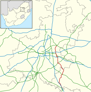
The N3 is a national route in South Africa that connects Johannesburg and Durban, respectively South Africa's largest and third-largest cities. Johannesburg is the financial and commercial heartland of South Africa, while Durban is South Africa's key port and one of the busiest ports in the Southern Hemisphere and is also a holiday destination. Durban is the port through which Johannesburg imports and exports most of its goods. As a result, the N3 is a very busy highway and has a high volume of traffic.

<span class="mw-page-title-main">N1 (South Africa)</span> National road in South Africa

The N1 is a national route in South Africa that runs from Cape Town through Bloemfontein, Johannesburg, Pretoria and Polokwane to Beit Bridge on the border with Zimbabwe. It forms the first section of the famed Cape to Cairo Road.

<span class="mw-page-title-main">R23 (South Africa)</span>

The R23 is a provincial route in South Africa that links Benoni with Volksrust via Brakpan, Heidelberg and Standerton.

<span class="mw-page-title-main">R28 (South Africa)</span>

The R28 is a provincial route in Gauteng, South Africa that connects Krugersdorp with Vereeniging via Randfontein. The R28 used to connect with Pretoria, but that section of the road is now part of the N14.

<span class="mw-page-title-main">R30 (South Africa)</span> Road in South Africa

The R30 is a provincial route in South Africa that connects Bloemfontein with Rustenburg via Brandfort, Welkom, Bothaville, Klerksdorp and Ventersdorp. The southern part of the route is tolled, as the R30 forms the first section of the ZR Mahabane Toll Route, with the Brandfort Toll Plaza found 10 kilometres north of its southern terminus junction with the N1 national route. The tolled portion ends at the junction with the R730.

<span class="mw-page-title-main">R34 (South Africa)</span> Road in South Africa

The R34 is a long provincial route in South Africa that connects Vryburg with Richards Bay via Kroonstad and Newcastle. It passes through three provinces, North West, the Free State and KwaZulu-Natal.

<span class="mw-page-title-main">R42 (South Africa)</span>

The R42 is a provincial route in South Africa that connects Vanderbijlpark with Bronkhorstspruit via Vereeniging, Heidelberg, Nigel and Delmas.

<span class="mw-page-title-main">R51 (South Africa)</span>

The R51 is a provincial route in South Africa that connects Bapsfontein with the N3 north of Villiers, via Springs, Nigel and Balfour.

<span class="mw-page-title-main">R54 (South Africa)</span>

The R54 is a provincial route in South Africa that connects Potchefstroom with Villiers via Vereeniging.

<span class="mw-page-title-main">R57 (South Africa)</span> Road in South Africa

The R57 is a provincial route in South Africa that connects Vanderbijlpark with Phuthaditjhaba via Sasolburg, Heilbron and Reitz.

<span class="mw-page-title-main">R59 (South Africa)</span> Road in South Africa

The R59 is a provincial route in South Africa that connects Hertzogville with Alberton via Bothaville, Parys and Vereeniging. The R59 is a freeway from the R57 Junction in Sasolburg until the N12 Reading Interchange in Alberton, signposted as the Sybrand van Niekerk Freeway.

<span class="mw-page-title-main">R76 (South Africa)</span> Road in South Africa

The R76 is a provincial route in Free State, South Africa that connects Orkney with Bethlehem via Kroonstad.

<span class="mw-page-title-main">N12 (South Africa)</span> National road in South Africa

The N12 is a national route in South Africa which runs from George through Beaufort West, Kimberley, Klerksdorp and Johannesburg to eMalahleni.

<span class="mw-page-title-main">N17 (South Africa)</span> National road in South Africa

The N17 is a national route in South Africa which runs from Johannesburg to Oshoek (Ngwenya) on the border with Eswatini. It passes through Springs, Bethal and Ermelo.

The R550 is a Regional Route in Gauteng, South Africa that connects Johannesburg South with Devon via Katlehong and Nigel.

The R553 is a Regional Route in Gauteng, South Africa that connects Johannesburg with Vanderbijlpark via Lenasia, Ennerdale, Evaton and Sebokeng. It is known as the Golden Highway for much of its length.

The R554 is a Regional Route in Gauteng, South Africa. The road connects the southern suburbs of Soweto with Springs on the East Rand via Lenasia, Alberton and Brakpan.

The R708 is a Regional Route in South Africa that connects Jan Kempdorp in the Northern Cape with Clocolan in the Free State via Christiana, Hertzogville, Bultfontein, Theunissen, Winburg and Marquard.

The R716 is a Regional Route in South Africa that connects Vanderbijlpark with the R26 between Villiers and Frankfort. It passes through Deneysville and Oranjeville.

The M68 is a short metropolitan route in the City of Johannesburg, South Africa. It connects the south-western part of Soweto with Mulbarton via Diepkloof, Southgate and Glenvista.

References

  1. "RDDA SOUTH AFRICAN NUMBERED ROUTE DESCRIPTION AND DESTINATION ANALYSIS". NATIONAL DEPARTMENT OF TRANSPORT. May 2012. Retrieved 25 March 2021.
  2. 1 2 3 4 5 Road atlas of South Africa. Internet Archive. London: New Holland. 1994. p. 45. ISBN   978-1-85368-393-0.{{cite book}}: CS1 maint: others (link)