M1 (Johannesburg)

Last updated

Joburg road M1.svg
Metropolitan route M1
M1 (Johannesburg)
Route information
Maintained by Johannesburg Roads Agency and GDRT
Length29.6 km (18.4 mi)
Existed1967–present
Major junctions
North endSA road N1 jct.svg N1 Western Bypass and SA road N3 jct.svg N3 Eastern Bypass near Buccleuch
Major intersectionsSA road R55.svg R55 Woodmead Drive
M60 ZAF jct.svg M60 Marlboro Drive
M40 ZAF jct.svg M40 Grayston Drive
M30 ZAF jct.svg M30 Corlett Drive
M31 ZAF jct.svg M31 Atholl-Oaklands Road
M20 ZAF jct.svg M20 Glenhove Road Extension
SA road R25.svg R25 11th Avenue (M1 Northbound only)
M16 ZAF jct.svg M16 Riviera Road
M31 ZAF jct.svg M31 Houghton Drive/Joe Slovo Drive (M1 Southbound Only)
M9 ZAF jct.svg M9 Oxford Road (M1 Northbound Only)
M27 ZAF jct.svg M27 Jan Smuts Avenue
M71 ZAF jct.svg M71 Empire Road
M10 ZAF jct.svg M10 Smit Street
Carr Street (M1 Northbound only)
M2 ZAF jct blue.svg M2 Village Road Selby and M2 Motorway
M2 ZAF jct blue.svg M2 Crown Interchange
M27 ZAF jct.svg M27 Booysens Road
M17 ZAF jct.svg M17 Xavier Road
SA road R553.svg R553 Golden Highway (M1 Southbound Only)
SA road N12 jct.svg N12 Uncle Charlies Interchange (M1 Southbound Only)
M68 ZAF jct.svg M68 Columbine Avenue
South endSA road R82.svg R82 in Meredale, Johannesburg
Location
Country South Africa
Highway system
 M2 ZAF jct blue.svg M2

The M1 De Villiers Graaff motorway is a metropolitan route and major freeway in the City of Johannesburg, South Africa. The highway connects the southern areas (including Booysens, Eldorado Park and Soweto) with the city centre and extends further north through Sandton into the Ben Schoeman Highway towards Pretoria. Construction began in 1962 and resulted in the demolition of many properties and houses including numerous historical Parktown Mansions. [1]

Contents

Route

The M1 officially starts at the M68 (Columbine Avenue) Interchange in Southgate, Johannesburg South, just east of the Southgate Shopping Centre and west of Mondeor. [2] :128 South of this interchange, it is designated as the R82 towards Walkerville and Vereeniging. The M1 begins by heading northwards from the M68 off-ramp to reach the Uncle Charlie's Interchange with the N12 highway (Southern Bypass) in Ridgeway (west southbound interchange only). [2] :128

The M1 as it passes between the east and west campuses of the University of the Witwatersrand. Origins Centre and M1 highway.jpg
The M1 as it passes between the east and west campuses of the University of the Witwatersrand.

It continues north-east towards the city centre as a freeway, passing Ormonde and Booysens, and meets the M2 highway (Francis Oberholzer Freeway) at the Crown Interchange (which is immediately south-west of the Johannesburg CBD). [2] :107 The M1 then proceeds north-north-east through the leafy northern suburbs of Johannesburg such as Parktown, and the industrial area separating Sandton and Alexandra. [2] :84

The M1 freeway southbound at the M30 Corlett Drive exit Dans les rues de Johannesburg 08.jpg
The M1 freeway southbound at the M30 Corlett Drive exit

The M1's northern terminus is at the Buccleuch Interchange, where it meets with the N1 (Western Bypass) and the N3 (Eastern Bypass) highways of Johannesburg and becomes the Ben Schoeman Highway (N1) to Pretoria. [2] :17

The part of the M1 in Sandton, between Corlett Drive and the Buccleuch Interchange is maintained by SANRAL. Signage and extra lanes have been upgraded in 2010 with the "Gauteng Freeway Improvement Project" (GFIP). The section between Corlett Drive and a portion south of the CBD is maintained by the Johannesburg Roads Agency (JRA) [3] with the remainder to the South also maintained by the provincial government.[ citation needed ] The northern section[ clarification needed ] maintained by the Gauteng Provincial Government is also designated the P206-1.

Speed limits, which are strictly enforced, change as one gets nearer to the centre of Johannesburg, from 100 km/h in the northern section, beginning at the Buccleuch interchange, finally dropping to 80 km/h near the city centre. South of the CBD, the speed limit again increases. Before an upgrade in 2012, the speed limit was 120 km/h on the provincial government maintained stretch in Sandton, dropping to 100 km/h as it ran through the Northern Suburbs of Johannesburg (from the start of the JRA maintained section before Corlett Drive). However, subsequent to rehabilitation work in 2012, the limit in the northern section was also dropped to 100 km/h.

History

Background

Aerial view from the north Johannesburg, Gauteng, South Africa (2417711025).jpg
Aerial view from the north

Both the M1 and M2 motorways have their beginnings in a 1948 traffic planning scheme developed by the Johannesburg City Council and examined by American traffic engineering consultant Lloyd B. Reid in 1954. [4] :577 Two 10-year plans examined among other things the idea of new urban motorways and improving existing highways. The plan called for two motorways, one running east–west along the southern CBD and the other running to north–south on the western side of the CBD. [4] :577 The plan was linked to national and provincial governments plan by the National Transport Commission for the Western and Eastern Bypasses, the future N1 and N3 in northern Johannesburg. [4] :577

The plan for the original motorway began in Bramley at Corlett Drive and headed south through Killarney and Parktown before cutting through the ridge between the University of the Witwatersrand and the Milner Park Agricultural Showgrounds and then over the Braamfontein railway yards through Newtown to the east–west interchange. [4] :578 From there it would cross Crown Mines land and head southwards past Robertsham to another proposed interchange and future Western Bypass (N12) before ending at the beginning of the Kimberley Road. [4] :577

Ground was broken for the new North-South Motorway on 28 May 1962 by Transport Minister Ben Schoeman, Administrator of the Transvaal, F.H. Odendaal and Johannesburg Mayor, Keith Flemming, just north of the Braamfontein Yards, site of the first bridge on the elevated motorway. [4] :579 The first section would be opened in the CBD in 1967 and rest of the motorway between 1972 and 1974. [4] :579

A two three-lane motorway was planned with large medians for breakdowns, elevated in the Central business district (CBD) as it crossed the Braamfontein railway yards and then became a double-decker motorway south through to an interchange near Westgate where it met the East-West Motorway (M2). [4] :578 The speed limit was set at between 80 km/h (50 mph) in the city, increased to 100 km/h (60 mph) and was set to reach 110 km/h (70 mph) the further one proceeded from the CBD. [4] :578

The motorway is named after the white South African opposition leader and United Party head, Sir De Villiers Graaff.

Construction

1956

An early long-term motorway plan was envisaged for a future Johannesburg. The first was a north–south motorway of 18.4 km stretching from Westgate just south of the Johannesburg CBD to connect up with the existing main Pretoria Road, 5.6 km outside the Johannesburg municipal boundary in the northern suburbs. [5] :328 The Westgate section would connect up with an east/west motorway running just south of the Johannesburg CBD. [5] :328 A third section involved the reconfiguration of roads to form an eastern CBD bypass connecting the north–south motorway with Saratoga Avenue. [5] :328

1958

Improvements began on Harrow Road (Joe Slovo Drive) to widen and deepen the road and included new bridges crossing over it at Joel Road, Alexandra Street and Barnato Street. [5] :328 Where Harrow Street met Louis Botha Avenue in Berea, this was to become an underpass of the latter. [5] :328 At the southern end of Harrow Road, a flyover would cross Saratoga Avenue and would eventually connect with the redesigned Siemert and Sivewright Roads. [5] :328

1959

Planning began for six-lane bridge that would have to cross the Braamfontein Railway Yard and would be part of the M1 motorway to connect the city with its northern and southern suburbs. [5] :328

1962

Construction finally began in 1962 on the Braamfontein Railway Bridge in Braamfontein required to connect the future M1 north and southern motorways. [5] :329 The Johannesburg City Engineer Department began its planning for the M1 motorway, that included a motorway from the Braamfontein Railway Bridge under construction, south to a future Westgate Interchange and included a double-decker section above Goch Street. [5] :329

The construction on the Sivewright Road / Berea Street and the Siemert Road / End Street reconfiguration, important to connecting the future eastern bypass connecting the M1 in the northern suburbs at the proposed Killarney interchange with the M2 East at the proposed Heidelberg Interchange, was nearing completion. [5] :329 Both road reconfigurations were situated in Doornfontein, east of the Johannesburg CBD.

1963

The Johannesburg City Engineer Department continued its engineering work on plans for Goch Street double-decker section of the future M1 North route. [5] :329 Planning also started on a future M1 South bridge and interchange at Xavier Street in Robertsham. [5] :329

1964

Johannesburg City Engineer Department's planning was completed on the Goch Street double-decker section on the future M1 northern route. The design called for a 1,100 m section made up of a 500m double-decker motorway and two 300m sections on either end of the main section. [5] :329

Planning begun on the M1 motorway, heading northwards, in Braamfontein to construct a cutting through what then was known as the University Ridge. [5] :329 This route would separate the Witwatersrand Agricultural Society grounds and the University of Witwatersrand. Also planned was a forty-metre bridge allowing Showground Road (now Enoch Sontonga Avenue) to cross the new motorway slightly south of the new cutting. [5] :329

Other essential road changes became important in accessing the planned motorways. Booysens Road was widened to become a dual carriageway to connect with the future M1 on its southern route. [5] :329 The Harrow Road (Joe Slovo Drive) scheme was completed. [5] :329 Work continued on the Berea-Sivewright motorway bypass works. [5] :329

1965-1966

On the M1 motorway northern route, contracts were awarded for work from Braamfontein through University Ridge to Rockridge Road in Parktown. As the motorway was to cross under Jan Smuts Avenue on this section, work was begun on an underpass. [5] :331 Work that had started on the eastern-bypass, the Berea-Sivewright Street section, was completed.

At the southern end of the M1 Goch Street double-decker section, work began on the Westgate Interchange that would connect the M1 and M2 motorways, but work was problematic when mine workings below the site became an issue. [5] :331

On the M1 southern section, work was begun on the Xavier Street Bridge and the Crown Gardens Interchange. [5] :331 While on the M1 northern section just past the end of the new Braamfontein Railway bridge, work started on the Smit Street Interchange in Braamfontein. [5] :331

1968

On the M1 North, the Goch Street double decker and its two ends, a connection to a future Westgate Interchange and Braamfontein Railway bridge, were completed. Kimberly Road reconfiguration was also completed and would connect the road to the M1 South at the southern end of the motorway on the latter's completion. Work on the Siemert Road / End Street route making up part of the eastern bypass was completed. Empire Road and Oxford Road's connections to the M1 northern route had been realigned and re-orientated.

1969

In March 1969, the 2.4 km West Street to Braamfontein connection begun on the remaining sections, costing R10.3 million of which the land cost R2 million, that would connect both the M1 and M2. [5] :331 During October 1969, the M1 northern motorway section from De Korte Street in Braamfontein to Sherbourne Avenue, Parktown was opened. [5] :332

1970

In February 1970 the Smit Street off-ramp, just north of Braamfontein Railway Bridge, opened connecting the M1 to Braamfontein. [5] :332 Project work on part of the eastern bypass to connect the M1 North with M2 east was completed on Siemert Road and End Street and was awaiting the completion of the Heidelberg Interchange. [5] :332

1971

In January 1971 construction started on the last section of the M1 northern motorway from Parktown to Bramley. [5] :332 Construction of the Crown Interchange on the M1/M2 was postponed when the tenders received were consider too expensive. [5] :332 Work began on improving the roads connecting to the M1 on Oxford Avenue, Corlett Drive and Jan Smuts Avenue in Rosebank. [5] :332

1972

More motorway on the M1 north was opened extending it from Parktown to Houghton when the 11th Avenue (R25) offramps were completed. [5] :332 The Crown Interchange tender on the M1/M2 was finally awarded and a completion date set for 1974. [5] :332 Heidelberg Interchange on the M2 eastern section was opened and connected the eastern CBD bypass to the M1 in the northern suburbs. [5] :332

1973

M1 in the northern suburbs was extended from Houghton's 11th Avenue (R25) offramp to Glenhove Road in Oaklands. [5] :332 Part of the Crown Interchange connecting to the Westgate Interchange was now open. [5] :332 Work on the M1 South from the Crown Interchange was under construction. [5] :332

1974

M1 in the northern suburbs was now completed to Bramley at Corlett Drive and connected the motorway and Johannesburg to the Provincial and National government's N1 Ben Schoeman Highway and Pretoria. [5] :333 The M1 South was finally connected to Kimberley Road (now the R553 Golden Highway) on 16 August 1974. [6] :349

Final cost

The final cost of the twelve-year M1 and M2 project was R85.5 million through the awarding of twenty-seven contracts. The Provincial and National government's contributed R21 million of the final cost while land acquisitions represented 19% of the final cost. The project moved 8.3 million cubic metres of land made up of 0.3 million cubic metres of rock, 8 million cubic metres of slime and earth. Eighty new bridges were constructed, and ten mine dumps moved. Seventy kilometres of drainage pipes were laid and 500,000 cubic metres of concreted poured.

Junctions list

MunicipalityLocationkmmiJunctionDestinationsNotes
Johannesburg Johannesburg South 0.00.01 - Columbine AveM68 ZAF jct.svg M68 Soweto, Southgate, Mondeor
1.40.02 - Uncle Charlie's InterchangeSA road N12 jct.svg N12 Southern BypassSouthbound exit and entry
2.00.04 - Golden HighwaySA road R553.svg R553 Southgate, Eldorado Park, LenasiaSouthbound exit and entry
3.80.05 - Xavier StreetM17 ZAF jct.svg M17 Ormonde, Robertsham, Ridgeway
5.40.07 - Booysens RoadM27 ZAF jct.svg M27 Booysens
7.90.09 - RoodepoortM2 ZAF jct blue.svg M2 West to Crown, City West, Mayfair, Roodepoort
Johannesburg CBD 8.50.010 - CityM2 ZAF jct blue.svg M2 EastNorthbound exit and entry
0.00.010C - CityM2 ZAF jct blue.svg M2 WestSouthbound exit and entry
10.10.011 - Carr StreetNewtown, Fordsburg, Johannesburg CBDNorthbound exit only, Southbound entrance
10.60.012 - Smit StreetM10 ZAF jct.svg M10 Braamfontein, Hillbrow, Johannesburg CBD
Parktown 11.50.013 - Empire RoadM71 ZAF jct.svg M71 Parktown, Braamfontein, HillbrowNorthbound exit only, Southbound entrance and exit
12.10.014A - Jan Smuts AvenueM27 ZAF jct.svg M27 Parktown
12.80.014B - St Andrews RoadParktownNorthbound entrance, Southbound exit
Forrest Town 13.20.015 - Oxford RoadM9 ZAF jct.svg M9 Forrest TownNorthbound exit, Southbound entrance
Houghton 15.00.016 - 1st AvenueM16 ZAF jct.svg M16 Houghton EstateSouthbound exit M31 ZAF jct.svg M31 Houghton Drive, Houghton
16.00.017 - Riviera RoadM16 ZAF jct.svg M16 Killarney, Houghton EstateNorthbound entrance, Southbound exit
16.00.017 - 11th AvenueSA road R25.svg R25 Riviera, Houghton EstateNorthbound exit, Southbound entrance
Melrose 16.40.019 - Glenhove RoadM20 ZAF jct.svg M20 Melrose, Oaklands
18.60.020 - Atholl / Oaklands RoadMelrose North, Abbottsford
Bramley 20.00.022 - Corlett DriveM30 ZAF jct.svg M30 Inanda, Melrose North, Bramley
Sandton 22.30.023 - Grayston DriveM40 ZAF jct.svg M40 Sandton, Atholl Gardens, Wynberg, Alexandra
24.50.026 - Marlboro DriveM60 ZAF jct.svg M60 Morningside, Sandown, Wendywood, Marlboro
27.60.029 - Woodmead DriveSA road R55.svg R55 Wendywood, Woodmead, Buccleuch
Buccleuch 29.20.0104A - Buccleuch InterchangeSA road N1 jct.svg N1 Western BypassNorthbound exit, Southbound entry
29.80.0104B - Buccleuch InterchangeSA road N3 jct.svg N3 Eastern BypassNorthbound exit, Southbound entry - M1 ends and route continues as the N1 Ben Schoeman Highway
1.000 mi = 1.609 km; 1.000 km = 0.621 mi

Traffic

The M1 Motorway, after it opened in 1974, was already carrying around 40,000 vehicles a day in each direction while near the central CBD area, 5,500 vehicles per hour were being recorded. [6] :349

Congestion

The M1 experiences significant traffic congestion during a typical rush hour. Several public transport systems, including bus rapid transit and the Gautrain railway system aim to alleviate some of the traffic on the M1.

See also

Related Research Articles

<span class="mw-page-title-main">Princes Motorway</span> Motorway in New South Wales, Australia

Princes Motorway is a 62-kilometre (39 mi) predominantly dual carriage untolled motorway that links Sydney to Wollongong and further south through the Illawarra region to Oak Flats. Part of the Australian Highway 1 network, the motorway is designated route M1.

<span class="mw-page-title-main">N1 Western Bypass (Johannesburg)</span> Road in South Africa

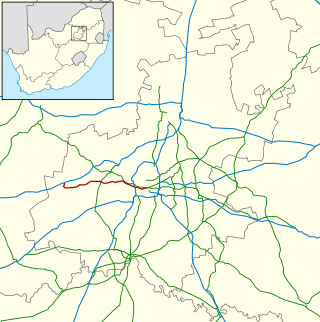
The Western Bypass is a section of the N1 and the Johannesburg Ring Road located in the city of Johannesburg, South Africa. Known at the time as the Concrete Highway, the freeway was initially opened in 1975 as a route to avoid the city centre of Johannesburg and to provide access to the western areas of the Witwatersrand. From the south, the Western Bypass begins at the Diepkloof Interchange in Soweto, where it splits from the N12 freeway and ends at the Buccleuch Interchange, where it merges with the N3 Eastern Bypass, M1 South and N1 Ben Schoeman freeways.

<span class="mw-page-title-main">Suburbs of Johannesburg</span>

The suburbs of Johannesburg are officially demarcated areas within the City of Johannesburg Metropolitan Municipality, South Africa. As in other Commonwealth countries, the term suburb refers to a "neighbourhood", although in South Africa most "suburbs" have legally recognised borders and often separate postal codes. The municipal functions for the area, such as municipal policing and social services, are still managed by the city government.

<span class="mw-page-title-main">R29 (South Africa)</span> Road in South Africa

The R29 is a provincial route in South Africa that connects Johannesburg with Leandra and Kinross via Germiston, Boksburg, Benoni and Springs. For much of its route it is named Main Reef Road. The R29 used to end near the Golela border post, however the section from Evander to Ermelo is now part of the N17 and the section from Ermelo to the Golela border post just after Pongola is now part of the N2.

<span class="mw-page-title-main">R41 (South Africa)</span> Road in South Africa

The R41 is a provincial route in Gauteng, South Africa, that connects Johannesburg with Randfontein via Roodepoort.

The M2 is a major highway and metropolitan route in Greater Johannesburg, South Africa. It is named the Francois Oberholzer Freeway. It runs just to the south of the Johannesburg Central Business District eastwards where it connects with the N3 and enters Germiston, ending near its CBD. The north–south M1 intersects with the M2 just to the south-west of the Johannesburg CBD.

<span class="mw-page-title-main">N4 (South Africa)</span> National road in South Africa

The N4 is a national route in South Africa that runs from Skilpadshek on the Botswana border, past Rustenburg, Pretoria, eMalahleni and Mbombela, to Komatipoort on the Mozambique border. The entire route is a toll road.

Sydney Bypass refers to a number of roads, existing and proposed, that motorists can use to avoid the congested approaches to the Sydney central business district (CBD). The main bypasses are:

State Highway 74 is a state highway in New Zealand servicing the eastern suburbs of Christchurch. Mostly two-lane, it is composed of limited-access expressways, with part of the highway as the Christchurch-Lyttelton Motorway, and connects the city to its port town of Lyttelton.

<span class="mw-page-title-main">Ben Schoeman Freeway</span> Road in South Africa

The Ben Schoeman Freeway or Ben Schoeman Highway is the main freeway between Johannesburg and Pretoria, and consists of portions of the M1, N1, and N14. Opened in 1968, it is named after former Minister of Transport Ben Schoeman, and is undoubtedly the busiest road in South Africa.

Jan Smuts Avenue is a major street in Johannesburg, South Africa. It begins in Randburg, and passes through important business areas like Rosebank. It passes the Johannesburg Zoo, Zoo Lake and Wits University before becoming Bertha Street, and the Nelson Mandela Bridge near the Johannesburg CBD. It has been described as "the most important road for a tourist" in Johannesburg. It forms part of Johannesburg's M27 route.

The M9 is a major metropolitan route in the City of Johannesburg, South Africa. Passing through the heart of the Witwatersrand, it connects the southern suburbs of Johannesburg via the centre of Johannesburg, with the northern suburbs and business centres of Rosebank and Sandton before ending in the outer northern suburbs.

M11 is a major metropolitan route in Greater Johannesburg, South Africa. Historically it was part of the main road between Johannesburg and Pretoria; it now runs through the central and north-eastern parts of the city from Bassonia, passing through Johannesburg CBD and Hillbrow, passing through numerous older suburbs, including Houghton and Orange Grove and the Alexandra Township as Louis Botha Avenue, before it becomes the Old Pretoria Road (R101) and continues to Midrand and Pretoria.

M27 is a major road in the City of Johannesburg, South Africa. A large part of the route is named Jan Smuts Avenue which is roughly 12 km long. It begins in the southern suburb of Booysens and heads northwards through the Johannesburg CBD and the northern suburbs of Randburg.

M16 is a metropolitan route in the Greater Johannesburg metropolitan area, South Africa. It begins in the north-western suburb of Greenside and heads eastwards through some of Johannesburg's northern suburbs and through Edenvale to end at the East Rand town of Kempton Park.

The M31 is a metropolitan route in the City of Johannesburg, South Africa. The road connects the southern suburbs of Alberton with Johannesburg's northern suburbs. The route's eastern bypass in the Johannesburg CBD connects the M2 motorway at the Heidelberg Interchange with M1 North motorway in Houghton and then the route follows the M1 motorway northwards until the M31 ends in Bramley.

M71 is a major metropolitan route in the City of Johannesburg, South Africa. Starting in the northern CBD, it connects the centre of Johannesburg with the northern suburbs before ending in the outer northern city of Midrand.

The M10 is a long metropolitan route in Greater Johannesburg, South Africa. It connects Lenasia with Johannesburg Central via Soweto.

The M18 is a long metropolitan route in Greater Johannesburg, South Africa. It connects Krugersdorp with Bruma via Constantia Kloof, Florida, Auckland Park, Braamfontein and Observatory.

The M20 is a short metropolitan route in the Greater Johannesburg metropolitan area, South Africa. It connects Randburg in the western part of Johannesburg with Edenvale in the east.

References

  1. "Heritage and History". The Parktown Association. Archived from the original on 22 December 2013. Retrieved 27 March 2016.
  2. 1 2 3 4 5 Street Guide Witwatersrand (8th ed.). MapStudio. 1996.
  3. "Missing drain covers may be crucial in probe".
  4. 1 2 3 4 5 6 7 8 9 Shorten, John R. (1970). The Johannesburg Saga. Johannesburg: John R. Shorten Pty Ltd. p. 1159.
  5. 1 2 3 4 5 6 7 8 9 10 11 12 13 14 15 16 17 18 19 20 21 22 23 24 25 26 27 28 29 30 31 32 33 34 35 36 "The Johannesburg City Engineer's Department - a century of dedication". Civil Engineering = Siviele Ingenieurswese. 28 (9): 325–335. September 1986 via Sabinet.
  6. 1 2 "Some highlights from the Municipalities". Civil Engineering = Siviele Ingenieurswese. 16 (11): 349. November 1974 via Sabinet.