
Perry County is a county located in the southeastern portion of the U.S. state of Missouri. As of the 2020 census, the population was 18,956. Its county seat is Perryville. The county was officially organized on November 16, 1820 from Ste. Genevieve County and was named after Oliver Hazard Perry, a naval hero of the War of 1812.

The Ouachita National Forest is a vast congressionally-designated National Forest that lies in the western portion of Arkansas and portions of extreme-eastern Oklahoma, USA.
The Ozark – St. Francis National Forest is a United States National Forest that is located in the state of Arkansas. It is composed of two separate forests, Ozark National Forest in the Ozark Mountains; and St. Francis National Forest on Crowley's Ridge. Each forest has distinct biological, topographical, and geological differences.

The Current River forms in the southeastern portion of the Ozarks of Missouri and becomes a 7th order stream as it flows southeasterly out of the Ozarks into northeastern Arkansas where it becomes a tributary of the Black River, which is a tributary of the White River, a tributary of the Mississippi River. The Current River is approximately 184 miles (296 km) long and drains about 2,641 square miles (6,840 km2) of land mostly in Missouri and a small portion of land in northeastern Arkansas. The headwaters of the Current River are nearly 900 feet (270 m) above sea level, while the mouth of the river lies around 280 feet (85 m) above sea level. The basin drains a rural area that is dominated by karst topography, underlain by dolomite and sandstone bedrock with a small area of igneous rock southeast of Eminence, Missouri. The annual daily mean discharge of the river near Doniphan, Missouri is 2,815 cubic feet (79.7 m3) per second. In 1964, over 134 mi (160 km) of the upper course of the river and its tributaries were federally protected as the Ozark National Scenic Riverways, the first national park in America to protect a river system.

De Soto National Forest, named for 16th-century Spanish explorer Hernando de Soto, is 518,587 acres of pine forests in southern Mississippi. It is one of the most important protected areas for the biological diversity of the Gulf Coast ecoregion of North America.
Summit Metro Parks is a Metroparks system serving the citizens of Summit County, Ohio by managing 14,000 acres (5,700 ha) in 16 developed parks, six conservation areas and more than 150 miles (240 km) of trails, with 22.4 miles (36.0 km) of the Ohio & Erie Canal Towpath Trail.

John A. Latsch State Park is a 1,654-acre (7 km2) state park of Minnesota, USA, on the Mississippi River, 12 miles (19 km) northwest of Winona. The park contains three steep bluffs rising 500 feet (150 m) above the river which are named Mount Faith, Mount Hope, and Mount Charity. The park is nearly undeveloped, with a small walk-in campground and only one trail. It functions primarily as a wayside on U.S. Route 61, which runs between the river and the base of the bluffs. Lock and Dam No. 5 is adjacent to the park.
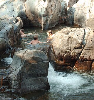
Johnson's Shut-Ins State Park is a public recreation area covering 8,781 acres (3,554 ha) on the East Fork Black River in Reynolds County, Missouri. The state park is jointly administered with adjoining Taum Sauk Mountain State Park, and together the two parks cover more than sixteen thousand acres in the St. Francois Mountains region of the Missouri Ozarks.
The James River is a 130-mile-long (210 km) river in southern Missouri. It flows from northeast Webster County until it is impounded into Table Rock Lake. It is part of the White River watershed. The river forms Lake Springfield and supplies drinking water for the city of Springfield.

The Mingo National Wildlife Refuge is a 21,676-acre (87.7-km2) National Wildlife Refuge located in northwestern Stoddard and southeastern Wayne counties in Missouri. Its southwesternmost portion lies on the shores of Lake Wappapello. Named after the Mingo tribe, it was established to preserve bottomland hardwoods and provide waterfowl and other migratory birds in the Mississippi Flyway with nesting, feeding, brooding, and resting habitat.
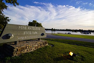
Pere Marquette State Park is an 8,050-acre (3,260 ha) protected area in southwestern Jersey County, Illinois, United States. It is located near the city of Grafton, Illinois, at the confluence of the Mississippi River and the Illinois River. The park is located on Illinois Route 100, which at this location is also part of both the Great River Road and the Meeting of the Great Rivers Scenic Byway. The park is operated and maintained by the Illinois Department of Natural Resources, and is Illinois' largest state park in area. The park is also part of the Confluence Greenway and is at the northwestern end of the 21.5-mile (34.6 km) Sam Vadalabene Bike Trail.

Washington State Park is a public recreation area covering 2,147 acres (869 ha) in Washington County in the central eastern part of the state of Missouri. It is located on Highway 21 about 14 miles (23 km) northeast of Potosi or 7 miles (11 km) southwest of De Soto on the eastern edge of the Ozarks. The state park is noted for its Native American rock carvings and for its finely crafted stonework from the 1930s.
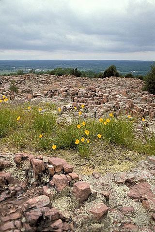
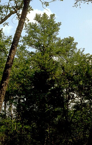
Hughes Mountain and the Hughes Mountain State Natural Area are located in southern Washington County, Missouri just south of the Big River and Highway M on Cedar Creek Road in the St. Francois Mountains range of The Ozarks. The mountain reaches an elevation of just over 1,200 feet, rising 430 feet above the Big River. The Hughes Mountain Natural Area of the Missouri Department of Conservation encompasses 462 acres (1.87 km2) of the mountain, including the rhyolite glade at its top.

August A. Busch Memorial Conservation Area is a 6,987-acre (28.28 km2) conservation area that is owned and managed by the Missouri Department of Conservation. Located in St. Charles County, Missouri, the land was purchased by the Department of Conservation with help from Alice Busch, the wife of August Anheuser Busch, Sr., in 1947 from the U.S. Government.

The Summer Lake Wildlife Area is a 29.6-square-mile (77 km2) wildlife refuge located on the northwestern edge of the Great Basin drainage in south-central Oregon. It is administered by the Oregon Department of Fish and Wildlife. The refuge is an important stop for waterfowl traveling along the Pacific Flyway during their spring and fall migrations. The Summer Lake Wildlife Area also provides habitat for shorebirds and other bird species as well as wide variety of mammals and several fish species. The Ana River supplies the water for the refuge wetlands.

The Columbia Bottom Conservation Area is a 4,256-acre (17.22 km2) conservation area located on the south side of the Missouri River at its confluence with the Mississippi River. The conservation area, which is located in eastern St. Louis County, Missouri, north of the city of St. Louis, is operated by the Missouri Department of Conservation. One key asset is 6.5-mile (10.5 km) of river frontage for boating, fishing, and birdwatching.

Seventy-Six was an unincorporated community in Brazeau Township in eastern Perry County, Missouri, United States. It was located fourteen miles east of Perryville, ninety miles south of Saint Louis, and lay directly on the Mississippi River.

The Brazeau Bottom is an alluvial floodplain, also called a 'flat', extending along the Mississippi River in Perry County, Missouri.

Grand Tower Island is a river island in the Mississippi River in the midwestern United States, within the state of Missouri on its border with the state of Illinois. Formed within recorded history by the movement of the river, it consists of a bulge-shaped piece of land between the river's primary channel and an oxbow lake. Land on the island is generally valuable for farming, especially when protected from flooding, while the lake has developed a reputation as a valuable sport-fishing location.

The Seventy-Six Conservation Area is located in eastern Perry County, Missouri at the end of Route D, approximately four miles northeast of Brazeau. The Missouri Conservation Department created this area in 1990 with the purchase of an 818-acre farm from a private landowner.


