Related Research Articles
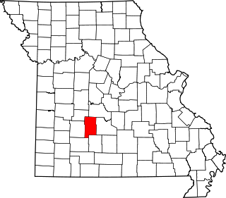
Dallas County is a county located in the U.S. state of Missouri. As of the 2010 census, the population was 17,071. Its county seat is Buffalo. The county was organized in 1842 as Niangua County and then renamed in 1844 for George M. Dallas, who served as Vice President under James K. Polk.

Tunas is an unincorporated community in northern Dallas County, Missouri, United States. It lies fourteen miles north of Buffalo on Route 73 and approximately seven miles east of Urbana on Route D. The town is located on Route 73, just southwest of the Little Niangua River. Tunas is part of the Springfield, Missouri Metropolitan Statistical Area.

Windyville is an unincorporated community in Dallas County, Missouri, United States. It is located approximately 10 miles northeast of Buffalo along Missouri routes K and MM. The Niangua River flows past to the south and east of the community. It is part of the Springfield, Missouri Metropolitan Statistical Area
Branch is an unincorporated community in southwestern Camden County, Missouri, United States. It is located on Route 73 one mile south of U.S. Route 54. Macks Creek is four miles to the northeast. Tunas is approximately four miles south on Route 73 in Dallas County.

Fruitland is an unincorporated community in Cape Girardeau County, Missouri, United States. It is located on U.S. Route 61, 5 mi (8.0 km) north of Jackson and just over one mile north of the intersection of U.S. 61 and Interstate 55.
McCracken is an unincorporated community in Christian County, in the U.S. state of Missouri. It is about 3.3 miles east of Ozark, Missouri.
Pembina is an unincorporated community in northern Christian County, in the U.S. state of Missouri. The community was located at the intersection of Missouri routes 125 and U, approximately 1.5 miles north of Linden and Finley Creek. The Pembina Cemetery is approximately one mile to the northwest, across Parched Corn Hollow in the center of Section 33.
Boyd was an unincorporated community in Dallas County, in the U.S. state of Missouri. The community was located approximately two miles west-southwest of Charity.
Charity is an unincorporated community in southern Dallas County, in the U.S. state of Missouri.
Foose is an unincorporated community in western Dallas County, in the U.S. state of Missouri. The community lies on Missouri Route EE, just west of U.S. Route 65, approximately seven miles south-southwest of Buffalo. The Dallas-Polk county line is two miles west along Route EE. The community is at an elevation of 1207 feet and Greasy Creek, a tributary of the Niangua River, drains the area to the east of Route 65.
Hico is an extinct town in Dallas County, in the U.S. state of Missouri. The community was located adjacent to the Niangua River, approximately two miles northeast of Spring Grove and six miles southeast of Buffalo. The Hico Bridge over the Niangua on County Road JJ-203 is approximately 1000 feet west of the Hico location.
Leadmine is an unincorporated community in northern Dallas County, in the U.S. state of Missouri. The community is located about 3.5 miles east of Tunas on Missouri Route E. The Lead Mines Conservation Area lies one-half mile to the east. It is approximately 50 miles north-northeast of Springfield.
Lindley Creek is a stream in Dallas, Hickory and Polk counties the U.S. state of Missouri. It is a tributary of the Pomme de Terre River.
Olive is an unincorporated community in southeastern Dallas County, in the U.S. state of Missouri.
Plad is an unincorporated community in northeast Dallas County, in the U.S. state of Missouri. The community is on Missouri Route 64 five miles east of Pumpkin Center and nine miles northeast of Buffalo. The headwaters of Jakes Creek arise just to the northwest of the community.
Shady Grove is an unincorporated community in southeast Dallas County, in the U.S. state of Missouri. The community was located on Route M, approximately five miles west of Conway. The Shady Grove School was just south of Route M, near the headwaters of Goose Creek.
Spring Grove is an unincorporated community in Dallas County, in the U.S. state of Missouri. The community is situated on Missouri Route H and the Niangua River flows past, about 1.5 miles to the east. Buffalo is approximately six miles to the north-northwest.
Thorpe is an unincorporated community in Dallas County, in the U.S. state of Missouri. The community lies just north of the Dallas-Webster county line, with Missouri Route W and the Niangua River passing about one mile to the east. The community lies approximately midway between Buffalo, eleven miles to the northwest and Marshfield, eleven miles to the southeast.
Tilden is an unincorporated community in Dallas County, in the U.S. state of Missouri. The community was on Missouri Route MM approximately two miles west of Windyville. The Niangua River flows past just over one mile to the south of the location.
Wood Hill is an unincorporated community in Dallas County, in the U.S. state of Missouri. The community is located on Missouri Route 64, approximately 1.5 miles east of Pumpkin Center and Missouri Route 73. Buffalo is seven miles south-southwest. The headwaters of the Little Niangua River arise just east of the location.
References
- ↑ U.S. Geological Survey Geographic Names Information System: Reynolds, Dallas County, Missouri
- ↑ Buffalo NW, MO, 7.5 Minute Topographic Quadrangle, USGS, 1951
- ↑ "Post Offices". Jim Forte Postal History. Retrieved 25 September 2016.
- ↑ "Dallas County Place Names, 1928–1945 (archived)". The State Historical Society of Missouri. Archived from the original on 15 September 2016. Retrieved 25 September 2016.
{{cite web}}: CS1 maint: bot: original URL status unknown (link)
Municipalities and communities of Dallas County, Missouri, United States | ||
|---|---|---|
| Cities |  | |
| Village | ||
| Townships | ||
| CDP | ||
| Other unincorporated communities | ||
| Ghost towns | ||
| Footnotes | ‡This populated place also has portions in an adjacent county or counties | |
37°38′19″N93°09′29″W / 37.63861°N 93.15806°W
| | This Dallas County, Missouri state location article is a stub. You can help Wikipedia by expanding it. |