River Clun, Shropshire

Last updated

River Clun
ClunBridge2c.jpg
The river flowing through the town of Clun, in which the historic packhorse bridge is still the only vehicle-carrying bridge.
EtymologyColun (British) [1]
Location
Country England, United Kingdom
Region West Midlands
CountyShropshire, Herefordshire
Cities Newcastle, Clun, Clunton, Clungunford
Physical characteristics
Source 
  location Anchor, Shropshire
Mouth Confluence with River Teme
  location
Leintwardine, Herefordshire
  coordinates
52°21′35″N2°52′43″W / 52.3598°N 2.8785°W / 52.3598; -2.8785
  elevation
119 m (390 ft)
Length45.84 [2] [3] [4]  km (28.48 mi)
Basin size300 [5]  km2 (120 sq mi)
Discharge 
  location Leintwardine
Basin features
Tributaries 
  left River Unk, River Kemp
  right River Redlake
Shropshire UK relief location map.jpg
Cyan pog.svg
source
Blue pog.svg
mouth
Map showing the source in Shropshire, and the mouth in Herefordshire of the River Clun

The River Clun runs mostly through Shropshire, England and joins the River Teme at Leintwardine, Herefordshire. The Clun Valley is part of the Shropshire Hills AONB (Area of Outstanding Natural Beauty). [6]

Contents

Course

The River Clun has its source near the hamlet of Anchor (in a marshy area near the public house), close to the border of Wales. [7] It flows east through the small town of Clun until Aston on Clun where it flows roughly southwards — the river flows around the north of Clunbury Hill. [8] The river enters the lower valley — which widens and has a flatter floor (an extensive flood plain). [9]

The Folly Brook joins the Clun at Newcastle, and the River Unk flows into the Clun near Clun Castle, whilst the River Kemp flows into the river at Oaker near Aston. Near the end of the river's course, the River Redlake joins at Jay. [8]

Just south of Broadward (a Site of Special Scientific Interest for a stretch south of Broadward Bridge) the river flows into Herefordshire where it joins the River Teme. [10]

Features

Many settlements along the course of the river incorporate the river's name, including Clun, and the villages of Newcastle-on-Clun, Clunton, Clunbury, Aston on Clun, and Clungunford. [1] In Clun, the historic Clun Bridge still takes the A488 road over the river. [11] A number of other historic crossings — bridges and fords — exist over the river, including Broadward Bridge. [12]

Ecology

The River Clun is an ideal habitat for otters, salmon, white-clawed crayfish, European bullhead, grayling and brook lamprey. [5] The river is also noted as a habitat for the freshwater pearl mussel. [13] The Clun and one of its tributaries, the Unk, have suffered pollution and sediment build up, undermining the mussel's habitat. [5] The catchment area of the river is mostly rural and produces beef, lamb, potatoes and maize. [14]

The Clun is one of only eleven watercourses in England that is home to the mussel [13] and one of three English rivers that has been designated a European Special Area of Conservation. [15]

A citizen science project, the River Clun Monitoring Group, has been established to monitor, and track changes in, the river's ecological condition. [16]

See also

Related Research Articles

An environmentally sensitive area (ESA) is a type of designation for an agricultural area which needs special protection because of its landscape, wildlife or historical value. The scheme was introduced in 1987. Originally it was administered by Ministry of Agriculture, Fisheries and Food, then the Rural Development Service for the United Kingdom Governments Department for Environment, Food and Rural Affairs, and currently Natural England following successive re-organisation of the departments. In 2005 the scheme was superseded by Environmental Stewardship and closed to new entrants. Existing agreements remain active until they expire, meaning the designation will remain active until 2014.

<span class="mw-page-title-main">River Teme</span> River in Wales and England

The River Teme rises in Mid Wales, south of Newtown, and flows southeast roughly forming the border between England and Wales for several miles through Knighton before entering England in the vicinity of Bucknell and continuing east to Ludlow in Shropshire. From there, it flows to the north of Tenbury Wells on the Shropshire/Worcestershire border on its way to join the River Severn south of Worcester. The whole of the River Teme was designated as an SSSI by English Nature in 1996.

<span class="mw-page-title-main">River Lugg</span> River in Radnorshire, Wales and Herefordshire, England

The River Lugg rises near Llangynllo in Radnorshire, Wales. It flows through the border town of Presteigne and then through Herefordshire, England, where it meets its main tributary, the River Arrow, to the south of Leominster. It flows into the River Wye downstream of Hereford at Mordiford, around 63 miles (101 km) from its source. Its name comes from a Welsh root, and means "bright stream".

<span class="mw-page-title-main">Clun</span> Human settlement in England

Clun is a town in south west Shropshire, England, and the Shropshire Hills Area of Outstanding Natural Beauty. The 2011 census recorded 680 people living in the town. Research by the Campaign for the Protection of Rural England suggests that Clun is one of the most tranquil locations in England.

<span class="mw-page-title-main">Clunbury</span> Human settlement in England

Clunbury is a village and civil parish in south Shropshire, England.

<span class="mw-page-title-main">Clungunford</span> Human settlement in England

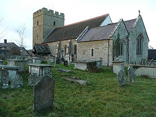
Clungunford is a village and civil parish in south Shropshire, England, located near the border with Herefordshire.

<span class="mw-page-title-main">Shropshire Hills National Landscape</span> Area of Outstanding Natural Beauty in England

The Shropshire Hills National Landscape is a designated Area of Outstanding Natural Beauty (AONB) in Shropshire, England. It is located in the south of the county, extending to its border with Wales. Designated in 1958, the area encompasses 802 square kilometres (310 sq mi) of land primarily in south-west Shropshire, taking its name from the upland region of the Shropshire Hills. The A49 road and Welsh Marches Railway Line bisect the area north–south, passing through or near Shrewsbury, Church Stretton, Craven Arms and Ludlow.

<span class="mw-page-title-main">River Vyrnwy</span> River in Powys, Wales and Shropshire, England

The River Vyrnwy flows through northern Powys, Wales, and Shropshire, England. The name derives from Severn, the river of which it is a tributary.

<span class="mw-page-title-main">Shropshire Hills</span> Upland area in Shropshire, West Midlands

The Shropshire Hills are a dissected upland area and one of the natural regions of England. They lie wholly within the county of Shropshire and encompass several distinctive and well-known landmarks, such as the Long Mynd, Wenlock Edge, The Wrekin and the Clees.

<span class="mw-page-title-main">Buckton and Coxall</span>

Buckton and Coxall is a civil parish in north Herefordshire, England.

<span class="mw-page-title-main">River Unk, Shropshire</span> River in Shropshire, England

The River Unk is a small river in Shropshire, England that runs for 9.7 miles (15.6 km) before flowing into the River Clun.

<span class="mw-page-title-main">River Onny</span> River in Shropshire, England

The River Onny is a river in Shropshire, England. It is a major tributary of the River Teme.

<span class="mw-page-title-main">Bicton, South Shropshire</span> Human settlement in England

Bicton is a hamlet in southwest Shropshire, England, one mile north of Clun. The short River Unk passes through the hamlet. In previous centuries it was a township in the Clun division of the hundred of Clun.

<span class="mw-page-title-main">Little Brampton</span> Human settlement in England

Little Brampton is a hamlet in south Shropshire, England.

<span class="mw-page-title-main">Broadward</span> Human settlement in England

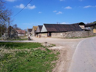
Broadward is a dispersed hamlet in south Shropshire, England, situated by the border with Herefordshire. It is in the civil parish of Clungunford, a village approximately 2 miles (3.2 km) to the north.

Heath is a dispersed hamlet in north Herefordshire, England.

<span class="mw-page-title-main">River Kemp</span> River in Shropshire, England

The River Kemp is a tributary of the River Clun which flows through Shropshire, England.

Bicton Castle was a motte and bailey dating from the 11th or 12th century in the hamlet of Bicton, southwest Shropshire, England. Only the ditch and outer bank remain as other parts have been dug away during gravel extraction. The short River Unk runs past it.

References

  1. 1 2 Ekwall, Eilert (1960). The concise Oxford dictionary of English place-names (4 ed.). Oxford: Clarendon Press. p. 113. ISBN   0-19-869103-3.
  2. "Clun - source to conf Folly Bk". environment.data.gov.uk. Environment Agency. Retrieved 10 April 2017.
  3. "Clun - conf Folly Bk to conf R Unk". environment.data.gov.uk. Environment Agency. Retrieved 10 April 2017.
  4. "Clun - conf R Unk to conf R Teme". environment.data.gov.uk. Environment Agency. Retrieved 10 April 2017.
  5. 1 2 3 "River Clun SSSI/SAC" (PDF). shropshirehillsaonb.co.uk. Atkins. 29 March 2012. p. 5. Retrieved 10 April 2017.
  6. "Map Shropshire Hills AONB". www.shropshirehillsaonb.co.uk. Retrieved 10 April 2017.
  7. "214" (Map). Llanidloes & Newtown. 1:50,000. Explorer. Ordnance Survey. 2015. ISBN   9780319244074.
  8. 1 2 "201" (Map). Knighton & Presteigne. 1:50,000. Explorer. Ordnance Survey. 2015. ISBN   9780319243947.
  9. "River Clun SSSI/SAC" (PDF). shropshirehillsaonb.co.uk. Atkins. 29 March 2012. p. 49. Retrieved 10 April 2017.
  10. "Magic Map Application Clun SAC". magic.defra.gov.uk. Retrieved 10 April 2017.
  11. "Clun Bridge closure after lorry crash". BBC News. 24 March 2014. Retrieved 10 April 2017.
  12. Historic England. "Broadward Bridge (Grade II) (1054983)". National Heritage List for England . Retrieved 10 April 2017.
  13. 1 2 Starkey, Jerome (10 April 2017). "Fight to save prized pearl mussels". The Times. No. 72193. p. 21. ISSN   0140-0460.
  14. "Clun River - Summary". environment.data.gov.uk. Environment Agency. Retrieved 10 April 2017.
  15. "River Clun Recovery Project | shropshirehillsaonb.co.uk". www.shropshirehillsaonb.co.uk. Retrieved 10 April 2017.
  16. Robertson, Dominic (1 September 2022). "Citizen scientists leading water testing charge on county river". www.shropshirestar.com. Retrieved 19 May 2024.

Commons-logo.svg Media related to River Clun at Wikimedia Commons