Rizal, Cagayan

Last updated
Rizal
Malaueg
Municipality of Rizal
Mount. Annaguan Sunset.JPG
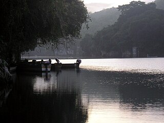
Sunset in the Mount. Annaguan
Flag of Rizal, Cagayan.png
Rizal Cagayan.png
Motto(s): 
Tanu napakesan nonta nasiksikan
Rise Up Malaueg
Ph locator cagayan rizal.png
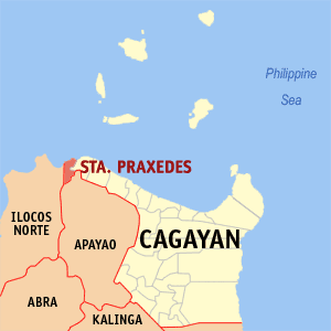
Map of Cagayan with Rizal highlighted
OpenStreetMap
Rizal, Cagayan
Philippines location map (square).svg
Red pog.svg
Rizal
Location within the Philippines
Coordinates: 17°50′52″N121°20′42″E / 17.8478°N 121.345°E / 17.8478; 121.345
Country Philippines
Region Cagayan Valley
Province Cagayan
District 2nd district
Founded 1522
Named for José Rizal
Barangays 29 (see Barangays)
Government
[1]
  Type Sangguniang Bayan
   Mayor Atty. Joel A. Ruma
   Vice Mayor Atty. Brenda B. Ruma
   Representative Baby Aline Vargas-Alfonso
   Electorate 12,937 voters (2022)
Area
[2]
  Total124.40 km2 (48.03 sq mi)
Elevation
179 m (587 ft)
Highest elevation
847 m (2,779 ft)
Lowest elevation
36 m (118 ft)
Population
 (2020 census) [3]
  Total19,077
  Density150/km2 (400/sq mi)
   Households
4,485
Economy
   Income class 5th municipal income class
   Poverty incidence
32.16
% (2018) [4]
   Revenue 105.3 million (2020)
   Assets 133.7 million (2020)
   Expenditure 90.38 million (2020)
   Liabilities 25.45 million (2020)
Service provider
  ElectricityCagayan 1 Electric Cooperative (CAGELCO 1)
Time zone UTC+8 (PST)
ZIP code
3526
PSGC
IDD : area code +63(0)78
Native languages Malaueg
Ibanag
Itawis
Ilocano
Atta
Tagalog
Website www.rizal-cagayan.gov.ph

Rizal, officially the Municipality of Rizal, is a 5th class municipality in the province of Cagayan, Philippines. According to the 2020 census, it has a population of 19,077 people. [3]

Contents

Rizal, being on the border of Cagayan and Apayao provinces, has a cool climate similar to Baguio's. It attracts excursionists and vacationists anytime, especially in summer.

Rizal is home to Cagayan's legendary figures – Biuag and Malana – who were said to have fought their epic battle for supremacy over the hand of the beautiful "Maguinganay" by swapping volleys of uprooted trees and live cattle. Their hangouts, two high mountains and a steep trail called "escolta" from where they uprooted trees to hurl at one another, can still be seen in Malaueg (Rizal).

Local crops are corn, rice and tobacco. It is known before of its specie[ clarification needed ] as "Matalag", which means men and women alike to go for its aroma and suaveness. Its bananas and mangoes have become a good source of revenue.

History

Spanish regime

Malaueg church Malaueg church, Rizal, Philippines.jpg
Malaueg church

The incorporation of the town was dated early 1500s during the Spanish era in the Philippines. At that time, the town was called "Malaueg", from the word "ueg" that means creek or river. [5] The name was used until 1903 when the town was renamed in the honor of the Philippine National Hero Dr. José Rizal.

During the Spanish regime, the town was said to be the rest spots of the Spanish Authorities, friars and some locals, because of its cool environmental climate. Malaueg people build the largest stone convents for the friars, some nipa hut houses for Spanish Authorities and some ordinary houses for the locals. Malaueg became a center of Christianity next to Nueva Segovia after the Malaueg Church was built.

In 1607 the area was the site of Caquenga's Revolt. With the creation of the Nueva Segovia diocese in 1595 in the Cagayan Valley, Catholic missionaries from Europe began flooding into the region to convert the indigenous inhabitants to the Catholic faith. Per the Dominican account, Pagulayan, the chief of Nalfotan, had tried contacting Catholic missionaries for years. Fray Pedro then accepted the invitation and went to Nalfotan to visit Pagulayan and the Malaueg people. To his astonishment, he found a church erected and the people waiting to adopt the religion. However, Caquenga, an indigenous animist leader, or priestess, apprehended the coming of the friar. Christianity posed a threat to her indigenous animism, and Catholic missionaries and Spanish officials worked continuously to eradicate animism. In response to this threat against her spiritual beliefs, she gathered a group of followers and they revolted against the priest. [6]

American period

During the American occupation of the Philippines, the town of Malaueg was also a favorite spot for the Americans. During the Spanish–American War, the town was almost destroyed when the soldiers used its towering mountains to hide their ammunition and dug some trenches. The Authorities were very protective of the condition of the church during war.

The town before had two municipalities, namely: Mauanan and Malaueg. The barrios on the western and northern part belonged to the municipality of Malaueg, while the barrios on the eastern part belonged to the municipality of Mauanan, where the seat of two municipal governments was established (Philippine Commission; Act nos. 943,944, 1903). Act no. 2390 changed the names of the municipalities of Santo Nino and Mauanan.

The names of the municipalities of Santo Nino and Mauanan were changed to Faire and Rizal respectively. Mauanan was named Rizal in the year 1914 and the sitios of Lattut, Capacuaan and Macatal were annexed from Rippang in 1933, under executive Order No. 690 dated March 28, 1935.

Japanese occupation

During the Japanese occupation of the Philippines in World War II, the town was largely destroyed in bombing attacks. The town also became one of the centers of resistance in the Philippines because of its forested areas that served as a hideout.

Post-independence

On December 3, 2008, elected mayor Raul dela Cruz sustained bullet wounds to the body and died while being taken to hospital in Tuguegarao. [7]

Geography

Rizal is located north-west of Tuguegarao City, which is 104 kilometres (65 mi) from the city. The place is hilly and mountainous. The poblacion is located on a plateau. The neighbouring barangays are situated on the slopes of hills and some are located along the banks of Matalag River.

The total land area of Rizal is 32,586.671 hectares (80,523.42 acres), of which 1000 hectares are built-up areas; 5545.0 hectares are agricultural land; 267.5 hectares for water bodies; 8375.1 hectares are open grassland; 207.0 hectares for roads and streets; 4.0 hectares for eco-tourism and 17,178.07 hectares (42,447.9 acres) are forest zones.

Mountains

The Sinicking National Park has the height of 801 metres (2,628 ft) and the highest elevation between the town's Poblacion and barangay Gaddangao is 1,004 metres (3,294 ft). The entrance to the town is very similar to the Kennon Road of Baguio.

Barangays

Rizal is politically subdivided into 29 barangays. Each barangay consists of puroks while some have sitios.

  • Anagguan
  • Anurturu
  • Anungu
  • Baluncanag
  • Batu
  • Cambabangan
  • Capacuan
  • Dunggan
  • Duyun
  • Gaddangao
  • Gaggabutan East
  • Illuru Norte
  • Lattut
  • Linno (Villa Cruz)
  • Liuan
  • Mabbang
  • Mauanan
  • Masi (Zinundungan)
  • Minanga
  • Nanauatan
  • Nanungaran
  • Pasingan
  • Poblacion
  • San Juan (Zinundungan)
  • Sinicking
  • Battut
  • Bural (Zinundungan)
  • Gaggabutan West
  • Illuru Sur

Figures stands for the list of barangays and the elevation of each.

Climate

Climate data for Rizal, Cagayan
MonthJanFebMarAprMayJunJulAugSepOctNovDecYear
Mean daily maximum °C (°F)25
(77)
26
(79)
29
(84)
31
(88)
31
(88)
31
(88)
30
(86)
30
(86)
30
(86)
28
(82)
27
(81)
25
(77)
29
(84)
Mean daily minimum °C (°F)20
(68)
20
(68)
21
(70)
23
(73)
24
(75)
25
(77)
25
(77)
25
(77)
24
(75)
23
(73)
23
(73)
21
(70)
23
(73)
Average precipitation mm (inches)133
(5.2)
87
(3.4)
68
(2.7)
44
(1.7)
127
(5.0)
134
(5.3)
160
(6.3)
162
(6.4)
134
(5.3)
192
(7.6)
194
(7.6)
260
(10.2)
1,695
(66.7)
Average rainy days18.113.313.311.819.720.922.822.820.316.618.421.7219.7
Source: Meteoblue [8]

Demographics

Population census of Rizal
YearPop.±% p.a.
1903 3,686    
1918 4,791+1.76%
1939 5,880+0.98%
1948 5,749−0.25%
1960 7,423+2.15%
1970 10,460+3.49%
1975 11,362+1.67%
1980 11,449+0.15%
YearPop.±% p.a.
1990 12,478+0.86%
1995 13,901+2.04%
2000 14,929+1.54%
2007 16,791+1.63%
2010 18,592+3.78%
2015 17,994−0.62%
2020 19,077+1.16%
Source: Philippine Statistics Authority [9] [10] [11] [12]

In the 2020 census, the population of Rizal, Cagayan, was 19,077 people, [3] with a density of 150 inhabitants per square kilometre or 390 inhabitants per square mile.

The local languages are Malaueg and Ilocano.

Economy

Government

Local government

The modernized Spanish era town hall (circa 1572 when it was first built) Malouegtownhall.JPG
The modernized Spanish era town hall (circa 1572 when it was first built)

Rizal, belonging to the second legislative district of the province of Cagayan, is governed by a mayor designated as its local chief executive and by a municipal council as its legislative body in accordance with the Local Government Code. The mayor, vice mayor, and the councilors are elected directly by the people through an election which is being held every three years.

Elected officials

Members of the Municipal Council
(2019–2022) [20]
PositionName
CongressmanSamantha Louise V. Alfonso
MayorBrenda B. Ruma
Vice-MayorJoel A. Ruma
CouncilorsRoberto F. Talay
Johnas A. Ruma
Pastor C. Ligas Jr.
Orlando I. Palattao
Leo M. Favor
Graciano A. Simon
Bryan B. Ruma
Ireneo Bernard D. Aday

Education

The Schools Division of Cagayan governs the town's public education system. [21] The division office is a field office of the DepEd in Cagayan Valley region. [22] The office governs the public and private elementary and public and private high schools throughout the municipality.

Tourism

A Hibiscus flower in Rizal Malaueggumamela.JPG
A Hibiscus flower in Rizal

The tourism development includes the Alsung Cave, the Sinicking National Park and Mount Annaguan forest reservations that will serve as the home for the rare species exclusively found in the area.

San Raimundo de Peñafort Church
The church, also known as Malaueg Church, was built in 1597. It was under the patronage of St. Raymond of Penyafort. The Dominican fathers accepted the ecclesiastical administration of this town on April 26, 1590. The cornerstone was laid November 26, 1597. The church and the convent have been destroyed and rebuilt four times. A site visited by Roman Catholic pilgrims, believed to show luck to the people in the certain town.
Mount Annaguan
The highest peak of the town that can view some places of the province of Cagayan.

Infrastructure

The Cagayan–Apayao Road connects Rizal and nearby Conner to the neighboring towns of Tuao, Piat, Solana and Tuguegarao City. The 50 kilometres (31 mi) road from Tuao to Rizal is rough and can take up to one-half-hours. It will take another half-hour ride from Tuguegarao to Tuao.

The provincial road was opened in 1951. From 1951 to 1986, one had to cross the Matalag River with a ferry boat made out of bamboos and drum. The ferry boat loaded only one jeep or bus at a time. Traveling to Rizal from Tuao to Tuguegarao or vice versa in those days was slow and tiresome because it took the ferry boat almost an hour to ferry its load to and from the other side of the river. Vehicles were ferried on a first-come, first-served basis.

The roads to the town are along the edge of the mountain, having hairpin turns and in other barangays, the road is at the edge of the Matalag River and some are at the middle of the fields.

The following bus lines serve Rizal:

Related Research Articles

<span class="mw-page-title-main">Palanan</span> Municipality in Isabela, Philippines

Palanan, officially the Municipality of Palanan, is a 1st class municipality in the province of Isabela, Philippines. It also served as the final capital of the First Philippine Republic from 1900 until the capture of President Emilio Aguinaldo by the Americans during the Philippine-American War in 1901. According to the 2020 census, it has a population of 17,684 people.

<span class="mw-page-title-main">Sanchez-Mira</span> Municipality in Cagayan, Philippines

Sanchez Mira, officially the Municipality of Sanchez Mira, is a 3rd class municipality in the province of Cagayan, Philippines. According to the 2020 census, it has a population of 26,164 people.

<span class="mw-page-title-main">Claveria, Cagayan</span> Municipality in Cagayan, Philippines

Claveria, officially the Municipality of Claveria, is a 3rd class municipality in the province of Cagayan, Philippines. According to the 2020 census, it has a population of 31,900 people.

<span class="mw-page-title-main">Bagabag, Nueva Vizcaya</span> Municipality in Nueva Vizcaya, Philippines

Bagabag, officially the Municipality of Bagabag, is a 2nd class municipality in the province of Nueva Vizcaya, Philippines. According to the 2020 census, it has a population of 37,985 people.

<span class="mw-page-title-main">Alcala, Cagayan</span> Municipality in Cagayan, Philippines

Alcala, officially the Municipality of Alcala, is a 3rd class municipality in the province of Cagayan, Philippines. According to the 2020 census, it has a population of 41,295 people.

<span class="mw-page-title-main">Amulung</span> Municipality in Cagayan, Philippines

Amulung, officially the Municipality of Amulung, is a 2nd class municipality in the province of Cagayan, Philippines. According to the 2020 census, it has a population of 50,336 people.

<span class="mw-page-title-main">Abulug</span> Municipality in Cagayan, Philippines

Abulug, officially the Municipality of Abulug, is a 3rd class municipality in the province of Cagayan, Philippines. According to the 2020 census, it has a population of 34,579 people.

<span class="mw-page-title-main">Buguey</span> Municipality in Cagayan, Philippines

Buguey, officially the Municipality of Buguey, is a 3rd class municipality in the province of Cagayan, Philippines. According to the 2020 census, it has a population of 32,148 people.

<span class="mw-page-title-main">Enrile, Cagayan</span> Municipality in Cagayan, Philippines

Enrile, officially the Municipality of Enrile, is a 3rd class municipality in the province of Cagayan, Philippines. According to the 2020 census, it has a population of 36,705 people.

<span class="mw-page-title-main">Gattaran</span> Municipality in Cagayan, Philippines

Gattaran, officially the Municipality of Gattaran, is a 1st class municipality in the province of Cagayan, Philippines. According to the 2020 census, it has a population of 58,874 people.

<span class="mw-page-title-main">Gonzaga, Cagayan</span> Municipality in Cagayan, Philippines

Gonzaga, officially the Municipality of Gonzaga, is a 1st class municipality in the province of Cagayan, Philippines. According to the 2020 census, it has a population of 41,680 people.

<span class="mw-page-title-main">Lasam</span> Municipality in Cagayan, Philippines

Lasam, officially the Municipality of Lasam, is a third class municipality in the province of Cagayan, Philippines. According to the 2020 census, it has a population of 41,225 people.

<span class="mw-page-title-main">Pamplona, Cagayan</span> Municipality in Cagayan, Philippines

Pamplona, officially the Municipality of Pamplona, is a 4th class municipality in the province of Cagayan, Philippines. According to the 2020 census, it has a population of 24,781 people.

<span class="mw-page-title-main">Peñablanca</span> Municipality in Cagayan, Philippines

Peñablanca, officially the Municipality of Peñablanca, is a 1st class municipality in the province of Cagayan, Philippines. According to the 2020 census, it has a population of 50,300 people.

<span class="mw-page-title-main">Santa Praxedes, Cagayan</span> Municipality in Cagayan, Philippines

Santa Praxedes, officially the Municipality of Santa Praxedes, is a 5th class municipality in the province of Cagayan, Philippines. According to the 2020 census, it has a population of 4,434 people.

<span class="mw-page-title-main">Solana, Cagayan</span> Municipality in Cagayan, Philippines

Solana, officially the Municipality of Solana, is a 1st class municipality in the province of Cagayan, Philippines. According to the 2020 census, it has a population of 88,445 people.

<span class="mw-page-title-main">Tuao</span> Municipality in Cagayan, Philippines

Tuao, officially the Municipality of Tuao, is a 1st class municipality in the province of Cagayan, Philippines. According to the 2020 census, it has a population of 63,970 people.

<span class="mw-page-title-main">Alicia, Isabela</span> Municipality in Isabela, Philippines

Alicia, officially the Municipality of Alicia, is a 1st class municipality in the province of Isabela, Philippines. According to the 2020 census, it has a population of 73,874 people.

<span class="mw-page-title-main">Divilacan</span> Municipality in Isabela, Philippines

Divilacan, officially the Municipality of Divilacan, is a 2nd class municipality in the province of Isabela, Philippines. According to the 2020 census, it has a population of 5,827 people.

<span class="mw-page-title-main">Ramon, Isabela</span> Municipality in Isabela, Philippines

Ramon, officially the Municipality of Ramon, is a 2nd class municipality in the province of Isabela, Philippines. According to the 2020 census, it has a population of 56,523 people.

References

  1. Municipality of Rizal | (DILG)
  2. "2015 Census of Population, Report No. 3 – Population, Land Area, and Population Density" (PDF). Philippine Statistics Authority. Quezon City, Philippines. August 2016. ISSN   0117-1453. Archived (PDF) from the original on May 25, 2021. Retrieved July 16, 2021.
  3. 1 2 3 Census of Population (2020). "Region II (Cagayan Valley)". Total Population by Province, City, Municipality and Barangay. Philippine Statistics Authority . Retrieved 8 July 2021.
  4. "PSA Releases the 2018 Municipal and City Level Poverty Estimates". Philippine Statistics Authority. 15 December 2021. Retrieved 22 January 2022.
  5. Salgado, Pedro. "Itawis Missions in Cagayan Province". Cagayan Valley and Easter Cordillera: 1581-1898, Volume I. Rex Publishing. p. 294.
  6. Fluckiger, "Caquenga."
  7. "Philippines Top Stories: Politics, Environment, Education, Trending | Inquirer.net".
  8. "Rizal, Cagayan: Average Temperatures and Rainfall". Meteoblue. Retrieved 15 December 2018.
  9. Census of Population (2015). "Region II (Cagayan Valley)". Total Population by Province, City, Municipality and Barangay. Philippine Statistics Authority . Retrieved 20 June 2016.
  10. Census of Population and Housing (2010). "Region II (Cagayan Valley)" (PDF). Total Population by Province, City, Municipality and Barangay. National Statistics Office . Retrieved 29 June 2016.
  11. Censuses of Population (1903–2007). "Region II (Cagayan Valley)". Table 1. Population Enumerated in Various Censuses by Province/Highly Urbanized City: 1903 to 2007. National Statistics Office.{{cite encyclopedia}}: CS1 maint: numeric names: authors list (link)
  12. "Province of Cagayan". Municipality Population Data. Local Water Utilities Administration Research Division. Retrieved 17 December 2016.
  13. "Poverty incidence (PI):". Philippine Statistics Authority. Retrieved December 28, 2020.
  14. "Estimation of Local Poverty in the Philippines" (PDF). Philippine Statistics Authority. 29 November 2005.
  15. "2003 City and Municipal Level Poverty Estimates" (PDF). Philippine Statistics Authority. 23 March 2009.
  16. "City and Municipal Level Poverty Estimates; 2006 and 2009" (PDF). Philippine Statistics Authority. 3 August 2012.
  17. "2012 Municipal and City Level Poverty Estimates" (PDF). Philippine Statistics Authority. 31 May 2016.
  18. "Municipal and City Level Small Area Poverty Estimates; 2009, 2012 and 2015". Philippine Statistics Authority. 10 July 2019.
  19. "PSA Releases the 2018 Municipal and City Level Poverty Estimates". Philippine Statistics Authority. 15 December 2021. Retrieved 22 January 2022.
  20. "2019 National and Local Elections" (PDF). Commission on Elections. Retrieved March 10, 2022.
  21. "History of DepED SDO Cagayan". DepED SDO Cagayan | Official Website of DepED SDO Cagayan. Retrieved March 13, 2022.
  22. "DEPED REGIONAL OFFICE NO. 02". DepED RO2 | The official website of DepED Regional Office No. 02.