Robe, Yancowinna County

Last updated

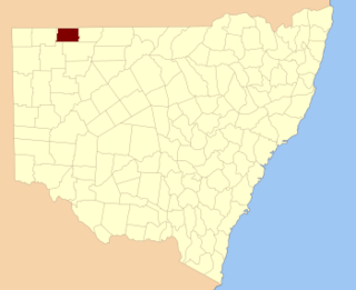
Robe, Yancowinna County is a civil parish of Yancowinna County in Far Western New South Wales. The parish is located near Purnamoota north of Broken Hill. [1]

Civil parish Territorial designation and lowest tier of local government in England

In England, a civil parish is a type of administrative parish used for local government, they are a territorial designation which is the lowest tier of local government below districts and counties, or their combined form, the unitary authority. Civil parishes can trace their origin to the ancient system of ecclesiastical parishes which historically played a role in both civil and ecclesiastical administration; civil and religious parishes were formally split into two types in the 19th century and are now entirely separate. The unit was devised and rolled out across England in the 1860s.

Yancowinna County Cadastral in New South Wales, Australia

Yancowinna County is one of the 141 Cadastral divisions of New South Wales.

New South Wales State of Australia

New South Wales is a state on the east coast of Australia. It borders Queensland to the north, Victoria to the south, and South Australia to the west. Its coast borders the Tasman Sea to the east. The Australian Capital Territory is an enclave within the state. New South Wales' state capital is Sydney, which is also Australia's most populous city. In September 2018, the population of New South Wales was over 8 million, making it Australia's most populous state. Just under two-thirds of the state's population, 5.1 million, live in the Greater Sydney area. Inhabitants of New South Wales are referred to as New South Welshmen.

The parish takes its name from Mount Robe a peak in the Barrier Range located at 31º 39' 24.26" S 141º 19' 35.81" E. and has a Altitude of 459.66m. [2]

Altitude or height is defined based on the context in which it is used. As a general definition, altitude is a distance measurement, usually in the vertical or "up" direction, between a reference datum and a point or object. The reference datum also often varies according to the context. Although the term altitude is commonly used to mean the height above sea level of a location, in geography the term elevation is often preferred for this usage.


Related Research Articles

Sebastopol is a city on the Crimean peninsula.

Lands administrative divisions of New South Wales Wikimedia list article

The lands administrative divisions of New South Wales refers to the 141 counties within the Colony of New South Wales, that later became the Australian state of New South Wales.

Lands administrative divisions of Australia

Lands administrative divisions of Australia are the cadastral divisions of Australia for the purposes of identification of land to ensure security of land ownership. Most states term these divisions as counties, parishes, hundreds, and other terms. The eastern states of Queensland, New South Wales, Victoria and Tasmania were divided into counties and parishes in the 19th century, although the Tasmanian counties were renamed land districts in the 20th century. Parts of South Australia (south-east) and Western Australia (south-west) were similarly divided into counties, and there were also five counties in a small part of the Northern Territory. However South Australia has subdivisions of hundreds instead of parishes, along with the Northern Territory, which was part of South Australia when the hundreds were proclaimed. There were also formerly hundreds in Tasmania. There have been at least 600 counties, 544 hundreds and at least 15,692 parishes in Australia, but there are none of these units for most of the sparsely inhabited central and western parts of the country.

Parish of Mount King

Mount King, New South Wales is a civil parish of Poole County in far North West New South Wales, located at.

Albert Parish located at 32°00'54.0"S 141°08'29.0"E is a remote rural locality, and cadastral Parish of Yancowinna County, far western New South Wales. The parish is on the Barrier Highway midway between Broken Hill, New South Wales and Cockburn on the South Australian border.

Neible Parish, New South Wales is a civil parish of Napier County, a county located in central western New South Wales.

Binnaway Parish, New South Wales New South Wales, Australia

Binnaway Parish is a civil Parish of Napier County, New South Wales, located on the Castlereagh River in central western New South Wales.

Parish of Buckinbah

Buckinbah Parish is a civil parish of Gordon County, New South Wales, a Cadastral divisions of New South Wales.

Maffra, New South Wales Parish of Cowper County, New South Wales, Australia

Maffra Parish, New South Wales is a Bounded locality of Bourke Shire and a civil Parish of Cowper County, New South Wales, a cadasteral division of central New South Wales.

Parish of Donalroe

Donalroe Parish in Cobar Shire is a civil parish of Rankin County,; a Cadastral division of New South Wales.

Gundabooka, Yanda New South Wales, Australia

Gundabooka Parish is a civil parish, of Yanda County, a cadasteral division of New South Wales; a Cadastral division of New South Wales.

Parish of Cullamulcha

Cullamulcha, New South Wales is a civil Parish, of the County of Delalah, a cadasteral division of New South Wales.

Parish of Thoulcanna

Thoulcanna, New South Wales is a remote civil Parish, of the County of Delalah, a cadasteral division of New South Wales.

Parish of Border

Border, New South Wales is a remote civil Parish, of the County of Delalah a cadasteral division of New South Wales.

Mount Jack, New South Wales

Mount Jack parish is a civil parish of Killara County, located in Central Darling Shire, New South Wales.

Wallarunga is a rural locality and ghost town located at -32.031799316 and 141.317901611 about 10 Kilometers south west of Broken Hill, New South Wales.

Purnamoota is a rural locality, cattle station and ghost town of the Unincorporated Far West and a civil parish of Yancowinna County, and is located about 23 Kilometers North of Broken Hill, New South Wales.

Burns, New South Wales is a village in the Unincorporated Far West of New South Wales.

Yancowinna County is a rural locality in Unincorporated Far West and a civil parish of Yancowinna County in far western New South Wales.

References

  1. Map of the County of Yancowinna, Western Division N.S.W., Land District of Willyama / compiled, drawn & printed at the Department of Lands, Sydney, N.S.W .
  2. Mount Robe, New South Wales.