Royal Center, Indiana

Last updated

Town of Royal Center
Carnegie P4200002.jpg
Royal Center Carnegie Library, 203 North Chicago St.
Cass County Indiana Incorporated and Unincorporated areas Royal Center Highlighted 1866222.svg
Location of Royal Center in Cass County, Indiana.
Coordinates: 40°51′50″N86°29′59″W / 40.86389°N 86.49972°W / 40.86389; -86.49972
Country United States
State Indiana
County Cass
Township Boone
Area
[1]
  Total0.57 sq mi (1.48 km2)
  Land0.57 sq mi (1.48 km2)
  Water0.00 sq mi (0.00 km2)
Elevation
[2]
735 ft (224 m)
Population
 (2020)
  Total802
  Density1,404.55/sq mi (542.67/km2)
Time zone UTC-5 (Eastern (EST))
  Summer (DST) UTC-4 (EDT)
ZIP code
46978
Area code 574
FIPS code 18-66222 [3]
GNIS feature ID2396892 [2]

Royal Center is a town in Boone Township, Cass County, Indiana, United States. The population was 861 at the 2010 census.

Contents

History

Royal Center had its start in the year 1846 by the building of the Pittsburgh, Cincinnati, Chicago and St. Louis Railroad through that territory. [4] [5] It was supposedly named after a place in New York. [6]

Geography

According to the 2010 census, Royal Center has a total area of 0.6 square miles (1.55 km2), all land. [7] Royal Center is the fourth-largest town by population in Cass County, and the third-largest town by land area.

Demographics

Historical population
CensusPop.Note
1870 306
1880 39930.4%
1890 52732.1%
1900 65724.7%
1910 90938.4%
1920 900−1.0%
1930 777−13.7%
1940 86511.3%
1950 8761.3%
1960 96610.3%
1970 9872.2%
1980 908−8.0%
1990 859−5.4%
2000 832−3.1%
2010 8613.5%
2020 802−6.9%
U.S. Decennial Census [8]

2010 census

As of the census [9] of 2010, there were 861 people, 342 households, and 234 families living in the town. The population density was 1,435.0 inhabitants per square mile (554.1/km2). There were 374 housing units at an average density of 623.3 per square mile (240.7/km2). The racial makeup of the town was 97.4% White, 0.8% African American, 0.3% Native American, 0.5% Asian, and 0.9% from two or more races. Hispanic or Latino of any race were 1.3% of the population.

There were 342 households, of which 37.4% had children under the age of 18 living with them, 50.0% were married couples living together, 13.2% had a female householder with no husband present, 5.3% had a male householder with no wife present, and 31.6% were non-families. 27.8% of all households were made up of individuals, and 12.5% had someone living alone who was 65 years of age or older. The average household size was 2.52 and the average family size was 3.06.

The median age in the town was 38 years. 27.3% of residents were under the age of 18; 8.3% were between the ages of 18 and 24; 25.1% were from 25 to 44; 24.1% were from 45 to 64; and 15.4% were 65 years of age or older. The gender makeup of the town was 49.9% male and 50.1% female.

2000 census

As of the census [3] of 2000, there were 832 people, 330 households, and 235 families living in the town. The population density was 1,660.5 inhabitants per square mile (641.1/km2). There were 348 housing units at an average density of 694.5 per square mile (268.1/km2). The racial makeup of the town was 99.04% White, 0.24% Native American, 0.24% from other races, and 0.48% from two or more races. Hispanic or Latino of any race were 0.36% of the population.

There were 330 households, out of which 31.5% had children under the age of 18 living with them, 56.4% were married couples living together, 10.6% had a female householder with no husband present, and 28.5% were non-families. 25.5% of all households were made up of individuals, and 15.5% had someone living alone who was 65 years of age or older. The average household size was 2.52 and the average family size was 3.01.

In the town, the population was spread out, with 26.7% under the age of 18, 7.9% from 18 to 24, 25.7% from 25 to 44, 19.4% from 45 to 64, and 20.3% who were 65 years of age or older. The median age was 39 years. For every 100 females, there were 93.0 males. For every 100 females age 18 and over, there were 91.2 males.

The median income for a household in the town was $40,625, and the median income for a family was $52,167. Males had a median income of $33,833 versus $19,792 for females. The per capita income for the town was $17,440. About 2.8% of families and 4.7% of the population were below the poverty line, including 7.1% of those under age 18 and 1.3% of those age 65 or over.

Education

Education in Royal Center is currently centered on the Pioneer Regional School Corporation. A small school in an agricultural community, it has proven to be an academic leader and resource for the community.

The Pioneer Regional School Corporation consists of five townships, four of which are in Cass County-Boone, Harrison, Jefferson, and Noble-and one in White County-Cass township. The corporation has in it 153 square miles (400 km2) and includes the communities of Lucerne, Headlee, Lake Cicott, and Royal Center. The only existing and occupied building eliminated during the reorganization process was the school at Lucerne, which was closed in 1966 when the Jr.-Sr. High School building was completed and occupied. The corporation also has one elementary building, which, along with Pioneer Junior-Senior High School, is located in Royal Center.

Notable People

Related Research Articles

<span class="mw-page-title-main">Galveston, Indiana</span> Town in Indiana, United States

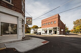
Galveston is a town in Jackson Township, Cass County, Indiana, approximately 7 miles northwest of downtown Kokomo. The population was 1,311 at the 2010 United States Census.

<span class="mw-page-title-main">Onward, Indiana</span> Town in Indiana, United States

Onward is a town in Tipton Township, Cass County, Indiana, United States. The population was 100 at the 2010 census.

<span class="mw-page-title-main">Walton, Indiana</span> Town in Indiana, United States

Walton is a town in Tipton Township, Cass County, Indiana, United States. The population was 1,049 at the 2010 census.

<span class="mw-page-title-main">Milltown, Indiana</span> Town in Indiana, United States

Milltown is a town in Whiskey Run Township in Crawford County, Indiana and in Blue River and Spencer townships in Harrison County. The population was 818 at the time of the 2010 census.

<span class="mw-page-title-main">Westport, Indiana</span> Town in Indiana, United States

Westport is a town located in Sand Creek Township, Decatur County, Indiana. The population was 1,379 at the 2010 census. A covered bridge, built in 1880, is located about 1.5 miles east of town.

<span class="mw-page-title-main">Ashley, Indiana</span> Town in Indiana, United States

Ashley is a town in Indiana located on the border of Smithfield Township, DeKalb County and Steuben Township, Steuben County. The population was 983 at the 2010 census.

<span class="mw-page-title-main">Newberry, Indiana</span> Town in Indiana, United States

Newberry is a town in Cass Township, Greene County, Indiana, United States. The population was 193 at the 2010 census. It is part of the Bloomington, Indiana Metropolitan Statistical Area.

<span class="mw-page-title-main">Andrews, Indiana</span> Town in Indiana, United States

Andrews is a town in Dallas Township, Huntington County, Indiana, United States. The population was 1,048 at the 2020 census.

<span class="mw-page-title-main">Edgewood, Indiana</span> Town in Indiana, United States

Edgewood is a town in Anderson Township, Madison County, Indiana, United States. It is part of the Indianapolis–Carmel–Anderson metropolitan statistical area. The population was 2,053 at the 2020 census.

<span class="mw-page-title-main">Markleville, Indiana</span> Town in Indiana, United States

Markleville is a town in Adams Township, Madison County, Indiana, United States. It is part of the Indianapolis–Carmel–Anderson metropolitan statistical area. The population was 484 at the 2020 census.

<span class="mw-page-title-main">Crane, Indiana</span> Town in Indiana, United States

Crane is a town in Perry Township, Martin County, in the U.S. state of Indiana. The population was 166 at the 2020 census. The community is adjacent to the Naval Surface Warfare Center Crane Division.

<span class="mw-page-title-main">Bunker Hill, Indiana</span> Town in Indiana, United States

Bunker Hill is a town in Pipe Creek Township, Miami County, in the U.S. state of Indiana. The population was 814 at the 2020 census, down from 888 in 2010.

<span class="mw-page-title-main">Macy, Indiana</span> Town in Indiana, United States

Macy is a town in Allen Township, Miami County, in the U.S. state of Indiana. The population was 199 at the 2020 census.

<span class="mw-page-title-main">Bethany, Indiana</span> Town in Indiana, United States

Bethany is a town in Clay Township, Morgan County, in the U.S. state of Indiana. The population was 95 at the 2020 census.

<span class="mw-page-title-main">Paragon, Indiana</span> Town in Indiana, United States

Paragon is a town in Ray Township, Morgan County, in the U.S. state of Indiana. The population was 556 at the 2020 census, down from 659 in 2010.

<span class="mw-page-title-main">Mason Township, Cass County, Michigan</span> Civil township in Michigan, United States

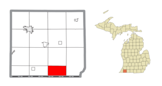
Mason Township is a civil township of Cass County in the U.S. state of Michigan. The population was 2,841 at the 2020 census.

<span class="mw-page-title-main">Milton Township, Cass County, Michigan</span> Civil township in Michigan, United States

Milton Township is a civil township of Cass County in the U.S. state of Michigan. The population was 3,128 at the 2020 census.

<span class="mw-page-title-main">Alvo, Nebraska</span> Village in Nebraska, United States

Alvo is a village in Cass County, Nebraska, United States. The population was 115 at the 2020 census.

<span class="mw-page-title-main">Manley, Nebraska</span> Village in Nebraska, United States

Manley is a village in Cass County, Nebraska, United States. The population was 167 at the 2020 census.

<span class="mw-page-title-main">Meridian Hills, Indiana</span> Town in Indiana, United States

Meridian Hills is a town in Washington Township, Marion County, Indiana, about 8 miles (13 km) north of downtown Indianapolis. It had a population of 1,774 at the 2020 census, up from 1,616 in 2010.

References

  1. "2020 U.S. Gazetteer Files". United States Census Bureau. Retrieved March 16, 2022.
  2. 1 2 U.S. Geological Survey Geographic Names Information System: Royal Center, Indiana
  3. 1 2 "U.S. Census website". United States Census Bureau . Retrieved January 31, 2008.
  4. Helm, Thomas B. (1878). History of Cass County, Indiana. Kingman Bros. pp.  34.
  5. Powell, Jehu Z. (1913). History of Cass County Indiana: From Its Earliest Settlement to the Present Time. Lewis Publishing Company. pp.  502.
  6. Baker, Ronald L. (October 1995). From Needmore to Prosperity: Hoosier Place Names in Folklore and History . Indiana University Press. p.  287. ISBN   978-0-253-32866-3. The name is for Royal Center, New York.
  7. "G001 - Geographic Identifiers - 2010 Census Summary File 1". United States Census Bureau. Archived from the original on February 13, 2020. Retrieved July 25, 2015.
  8. "Census of Population and Housing". Census.gov. Retrieved June 4, 2015.
  9. "U.S. Census website". United States Census Bureau . Retrieved December 11, 2012.