Walton, Indiana

Last updated

Town of Walton
Waltons water tower.jpg
Former Walton Water Tower
Cass County Indiana Incorporated and Unincorporated areas Walton Highlighted 1879964.svg
Location of Walton in Cass County, Indiana.
Coordinates: 40°39′44″N86°14′51″W / 40.66222°N 86.24750°W / 40.66222; -86.24750
Country United States
State Indiana
County Cass
Township Tipton
Area
[1]
  Total0.43 sq mi (1.11 km2)
  Land0.43 sq mi (1.11 km2)
  Water0.00 sq mi (0.00 km2)
Elevation
[2]
771 ft (235 m)
Population
 (2020)
  Total962
  Density2,247.66/sq mi (868.64/km2)
Time zone UTC-5 (Eastern (EST))
  Summer (DST) UTC-4 (EDT)
ZIP code
46994
Area code 574
FIPS code 18-79964 [3]
GNIS feature ID2397720 [2]

Walton is a town in Tipton Township, Cass County, Indiana, United States. The population was 1,049 at the 2010 census.

Contents

History

Walton had its start in the year 1852 by the building of the railroad through that territory. [4] It was named for its founder Gilbert W. Wall. [5] The Walton post office was established in 1856. [6]

Geography

According to the 2010 census, Walton has a total area of 0.43 square miles (1.11 km2), all land. [7]

Demographics

Historical population
CensusPop.Note
1880 453
1890 4693.5%
1900 4986.2%
1910 57916.3%
1920 71323.1%
1930 685−3.9%
1940 7103.6%
1950 83717.9%
1960 1,07928.9%
1970 1,054−2.3%
1980 1,20214.0%
1990 1,053−12.4%
2000 1,0691.5%
2010 1,049−1.9%
2020 962−8.3%
U.S. Decennial Census [8]

2010 census

As of the census [9] of 2010, there were 1,049 people, 408 households, and 284 families living in the town. The population density was 2,439.5 inhabitants per square mile (941.9/km2). There were 449 housing units at an average density of 1,044.2 per square mile (403.2/km2). The racial makeup of the town was 93.2% White, 0.3% African American, 0.1% Native American, 0.3% Asian, 4.5% from other races, and 1.6% from two or more races. Hispanic or Latino of any race were 9.5% of the population.

There were 408 households, of which 38.2% had children under the age of 18 living with them, 51.0% were married couples living together, 12.5% had a female householder with no husband present, 6.1% had a male householder with no wife present, and 30.4% were non-families. 27.5% of all households were made up of individuals, and 13.9% had someone living alone who was 65 years of age or older. The average household size was 2.57 and the average family size was 3.11.

The median age in the town was 36.4 years. 27.5% of residents were under the age of 18; 8.7% were between the ages of 18 and 24; 25.2% were from 25 to 44; 23.6% were from 45 to 64; and 15% were 65 years of age or older. The gender makeup of the town was 46.6% male and 53.4% female.

2000 census

As of the census [3] of 2000, there were 1,069 people, 413 households, and 301 families living in the town. The population density was 2,477.8 inhabitants per square mile (956.7/km2). There were 438 housing units at an average density of 1,015.2 per square mile (392.0/km2). The racial makeup of the town was 92.42% White, 0.19% African American, 0.75% Native American, 0.09% Asian, 5.89% from other races, and 0.65% from two or more races. Hispanic or Latino of any race were 10.66% of the population.

There were 413 households, out of which 34.6% had children under the age of 18 living with them, 57.9% were married couples living together, 11.6% had a female householder with no husband present, and 26.9% were non-families. 24.5% of all households were made up of individuals, and 11.1% had someone living alone who was 65 years of age or older. The average household size was 2.59 and the average family size was 3.08.

In the town, the population was spread out, with 28.2% under the age of 18, 7.8% from 18 to 24, 28.3% from 25 to 44, 22.9% from 45 to 64, and 12.9% who were 65 years of age or older. The median age was 36 years. For every 100 females, there were 89.9 males. For every 100 females age 18 and over, there were 82.0 males.

The median income for a household in the town was $41,429, and the median income for a family was $49,167. Males had a median income of $30,750 versus $23,846 for females. The per capita income for the town was $19,087. About 2.9% of families and 6.0% of the population were below the poverty line, including 5.8% of those under age 18 and 5.4% of those age 65 or over.

Education

Lewis Cass High School is located near Walton, and is a part of the Southeastern School Corporation.

Lewis Cass High School competes in the Three Rivers Conference for all athletics. It left the Mid-Indiana Conference in the 2015–2016 school year to join the Hoosier Conference when the Mid-Indiana Conference dissolved, then left the Hoosier Conference to replace Tippecanoe Valley.

Related Research Articles

<span class="mw-page-title-main">Millport, Alabama</span> Town in Alabama, United States

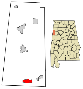
Millport is a town in Lamar County, Alabama, United States. It incorporated in 1887. At the 2010 census the population was 1,049, down from 1,160 in 2000. After its incorporation from 1890 to 1900, it was the largest town in Lamar County, losing the distinction to Sulligent. Since 1940, it has been the 3rd largest town.

<span class="mw-page-title-main">Galveston, Indiana</span> Town in Indiana, United States

Galveston is a town in Jackson Township, Cass County, Indiana, approximately 7 miles northwest of downtown Kokomo. The population was 1,311 at the 2010 United States Census.

<span class="mw-page-title-main">Royal Center, Indiana</span> Town in Indiana, United States

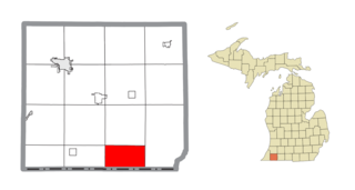
Royal Center is a town in Boone Township, Cass County, Indiana, United States. The population was 861 at the 2010 census.

<span class="mw-page-title-main">St. Paul, Indiana</span> Town in Indiana, United States

St. Paul or Saint Paul is a small town on the border of Decatur and Shelby counties in the U.S. state of Indiana. The population was 1,031 at the 2010 census.

<span class="mw-page-title-main">Daleville, Indiana</span> Town in Indiana, United States

Daleville is a town in Salem Township, Delaware County, Indiana, United States. The population was 1,651 at the 2020 census. It is part of the Muncie, IN Metropolitan Statistical Area.

<span class="mw-page-title-main">Holland, Indiana</span> Town in Indiana, United States

Holland is a town in Cass Township, Dubois County, in the U.S. state of Indiana. The population was 626 at the 2010 census. It is part of the Jasper Micropolitan Statistical Area.

<span class="mw-page-title-main">Newberry, Indiana</span> Town in Indiana, United States

Newberry is a town in Cass Township, Greene County, Indiana, United States. The population was 193 at the 2010 census. It is part of the Bloomington, Indiana Metropolitan Statistical Area.

<span class="mw-page-title-main">Wilkinson, Indiana</span> Town in Indiana, United States

Wilkinson is a town in Brown Township, Hancock County, Indiana, United States. The population was 449 at the 2010 census.

<span class="mw-page-title-main">Etna Green, Indiana</span> Town in Indiana, United States

Etna Green is a town in Etna Township, Kosciusko County, in the U.S. state of Indiana. The population was 586 at the 2010 census.

<span class="mw-page-title-main">Southport, Indiana</span> City in Indiana, United States

Southport is an excluded city in Marion County, Indiana, United States. The population was 2,123 at the 2020 census, up from 1,712 in 2010.

<span class="mw-page-title-main">Macy, Indiana</span> Town in Indiana, United States

Macy is a town in Allen Township, Miami County, in the U.S. state of Indiana. The population was 199 at the 2020 census.

<span class="mw-page-title-main">Paragon, Indiana</span> Town in Indiana, United States

Paragon is a town in Ray Township, Morgan County, in the U.S. state of Indiana. The population was 556 at the 2020 census, down from 659 in 2010.

<span class="mw-page-title-main">Sunman, Indiana</span> Town in Indiana, United States

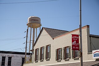
Sunman is a town in Adams Township, Ripley County, in the U.S. state of Indiana. The population was 1,049 at the 2010 census.

<span class="mw-page-title-main">Hudson, Indiana</span> Town in Indiana, United States

Hudson is a town in Salem and Steuben townships, Steuben County, in the U.S. state of Indiana. The population was 518 at the 2010 census.

<span class="mw-page-title-main">Anita, Iowa</span> City in Iowa, United States

Anita is a city in Cass County, Iowa, United States, platted in 1869 and incorporated in 1875. The population was 963 at the 2020 census. Lake Anita State Park is located just outside the town.

<span class="mw-page-title-main">Mason Township, Cass County, Michigan</span> Civil township in Michigan, United States

Mason Township is a civil township of Cass County in the U.S. state of Michigan. The population was 2,841 at the 2020 census.

<span class="mw-page-title-main">Harrisonville, Missouri</span> City in Missouri, United States

Harrisonville is a city in Cass County, Missouri, United States. The population was 10,121 at the 2020 census. It is the county seat of Cass County. It is part of the Kansas City metropolitan area.

<span class="mw-page-title-main">Cedar Creek, Nebraska</span> Village in Nebraska, United States

Cedar Creek is a village in Cass County, Nebraska, United States. The population was 465 at the 2020 census.

<span class="mw-page-title-main">North Boston, New York</span> Census-designated place in New York, United States

North Boston is a hamlet and census-designated place (CDP) in the town of Boston in Erie County, New York, United States. As of the 2010 census, the CDP population was 2,521. It is part of the Buffalo–Niagara Falls Metropolitan Statistical Area.

<span class="mw-page-title-main">Harwood, North Dakota</span> City in North Dakota, United States

Harwood is a city in Cass County, North Dakota, United States. The population was 794 at the 2020 census. It has become a bedroom community of the nearby Fargo-Moorhead area. Harwood was founded in 1881.

References

  1. "2020 U.S. Gazetteer Files". United States Census Bureau. Retrieved March 16, 2022.
  2. 1 2 U.S. Geological Survey Geographic Names Information System: Walton, Indiana
  3. 1 2 "U.S. Census website". United States Census Bureau . Retrieved January 31, 2008.
  4. Powell, Jehu Z. (1913). History of Cass County Indiana: From Its Earliest Settlement to the Present Time. Lewis Publishing Company. p. 694.
  5. Helm, Thomas B. (1878). History of Cass County, Indiana. Kingman Bros. p. 43.
  6. "Cass County". Jim Forte Postal History. Retrieved August 29, 2014.
  7. "G001 - Geographic Identifiers - 2010 Census Summary File 1". United States Census Bureau. Archived from the original on February 13, 2020. Retrieved July 25, 2015.
  8. "Census of Population and Housing". Census.gov. Retrieved June 4, 2015.
  9. "U.S. Census website". United States Census Bureau . Retrieved December 11, 2012.