Rush Hill, Missouri

Last updated

Rush Hill, Missouri
Audrain County Missouri Incorporated and Unincorporated areas Rush Hill Highlighted.svg
Location of Rush Hill, Missouri
Coordinates: 39°12′37″N91°43′29″W / 39.21028°N 91.72472°W / 39.21028; -91.72472
Country United States
State Missouri
County Audrain
Area
[1]
  Total0.18 sq mi (0.47 km2)
  Land0.18 sq mi (0.46 km2)
  Water0.00 sq mi (0.00 km2)
Elevation
[2]
787 ft (240 m)
Population
 (2020)
  Total103
  Density572.22/sq mi (221.53/km2)
Time zone UTC-6 (Central (CST))
  Summer (DST) UTC-5 (CDT)
ZIP code
65280
Area code 573
FIPS code 29-63560 [3]
GNIS feature ID2399142 [2]

Rush Hill is a village in Audrain County, Missouri, United States. The population was 151 at the 2010 census.

Contents

History

Rush Hill was platted in 1881. [4] The village's name is an amalgamation of the surnames of its founders, Reusch and Hill. [5] A post office has been in operation at Rush Hill since 1881. [6]

Post office in Rush Hill, Missouri, at corner of Third and Center streets. Rush Hill, Missouri.jpg
Post office in Rush Hill, Missouri, at corner of Third and Center streets.

Geography

According to the United States Census Bureau, the village has a total area of 0.18 square miles (0.47 km2), all land. [7]

Demographics

Historical population
CensusPop.Note
1890 210
1900 181−13.8%
1910 168−7.2%
1920 146−13.1%
1930 1492.1%
1940 136−8.7%
1950 127−6.6%
1960 1323.9%
1970 15114.4%
1980 140−7.3%
1990 121−13.6%
2000 1307.4%
2010 15116.2%
2020 103−31.8%
U.S. Decennial Census [8]

2010 census

As of the census [9] of 2010, there were 151 people, 60 households, and 39 families residing in the village. The population density was 838.9 inhabitants per square mile (323.9/km2). There were 69 housing units at an average density of 383.3 per square mile (148.0/km2). The racial makeup of the village was 96.0% White and 4.0% from two or more races. Hispanic or Latino of any race were 4.0% of the population.

There were 60 households, of which 31.7% had children under the age of 18 living with them, 48.3% were married couples living together, 10.0% had a female householder with no husband present, 6.7% had a male householder with no wife present, and 35.0% were non-families. 31.7% of all households were made up of individuals, and 6.6% had someone living alone who was 65 years of age or older. The average household size was 2.52 and the average family size was 3.10.

The median age in the village was 33.3 years. 35.1% of residents were under the age of 18; 4.7% were between the ages of 18 and 24; 21.3% were from 25 to 44; 27.8% were from 45 to 64; and 11.3% were 65 years of age or older. The gender makeup of the village was 51.7% male and 48.3% female.

2000 census

As of the census [3] of 2000, there were 130 people, 53 households, and 40 families residing in the village. The population density was 737.8 inhabitants per square mile (284.9/km2). There were 60 housing units at an average density of 340.5 per square mile (131.5/km2). The racial makeup of the village was 100% White.

There were 53 households, out of which 34.0% had children under the age of 18 living with them, 60.4% were married couples living together, 7.5% had a female householder with no husband present, and 24.5% were non-families. 20.8% of all households were made up of individuals, and 13.2% had someone living alone who was 65 years of age or older. The average household size was 2.45 and the average family size was 2.80.

In the village, the population was spread out, with 27.7% under the age of 18, 5.4% from 18 to 24, 23.8% from 25 to 44, 23.1% from 45 to 64, and 20.0% who were 65 years of age or older. The median age was 40 years. For every 100 females, there were 113.1 males. For every 100 females age 18 and over, there were 91.8 males.

The median income for a household in the village was $26,250, and the median income for a family was $33,750. Males had a median income of $33,333 versus $21,250 for females. The per capita income for the village was $14,523. There were 5.0% of families and 11.5% of the population living below the poverty line, including 28.0% of under eighteens and 6.9% of those over 64.

Related Research Articles

<span class="mw-page-title-main">Benton City, Missouri</span> Village in Missouri, United States

Benton City is a village in Audrain County, Missouri, United States. The population was 104 at the 2010 census.

<span class="mw-page-title-main">Farber, Missouri</span> City in Missouri, United States

Farber is a city in Audrain County, Missouri, United States. The population was 322 at the 2010 census.

<span class="mw-page-title-main">Laddonia, Missouri</span> City in Missouri, United States

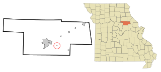
Laddonia is a city in Audrain County, Missouri, United States. The population was 502 at the 2020 census.

<span class="mw-page-title-main">Martinsburg, Missouri</span> City in Missouri, United States

Martinsburg is a city in Audrain County, Missouri, United States. The population was 304 at the 2010 census.

<span class="mw-page-title-main">Vandiver, Missouri</span> Village in Missouri, United States

Vandiver is a village in Audrain County, Missouri, United States. As of the 2010 census, the village population was 77.

<span class="mw-page-title-main">Cedar Hill Lakes, Missouri</span> Village in Missouri, United States

Cedar Hill Lakes is a village in Jefferson County, Missouri, United States. The population was 203 at the 2020 census.

<span class="mw-page-title-main">Bakersfield, Missouri</span> Village in Missouri, United States

Bakersfield is a village in southeastern Ozark County in the Ozarks of southern Missouri, United States. The population was 186 at the 2020 census.

<span class="mw-page-title-main">Curryville, Missouri</span> City in Missouri, United States

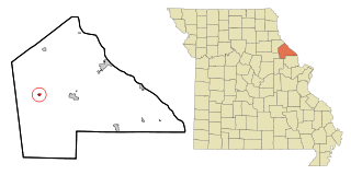
Curryville is a city in western Pike County, Missouri, United States. The population was 225 at the 2010 census.

<span class="mw-page-title-main">Clifton Hill, Missouri</span> City in Missouri, United States

Clifton Hill is a city in Randolph County, Missouri, United States. The population was 114 at the 2010 census.

<span class="mw-page-title-main">Park Hills, Missouri</span> City in Missouri, United States

Park Hills is a city in St. Francois County, Missouri, United States. The population was 8,587 at the 2020 census.

<span class="mw-page-title-main">Country Life Acres, Missouri</span> Village in Missouri, United States

Country Life Acres is a village in St. Louis County, Missouri, United States. The population was 72 at the 2020 census.

<span class="mw-page-title-main">Glen Echo Park, Missouri</span> Former Village in Missouri, United States

Glen Echo Park was a village in St. Louis County, Missouri, United States. The population was 122 at the 2020 census. The community took its name from the nearby Glen Echo Country Club.

<span class="mw-page-title-main">Mackenzie, Missouri</span> Village in Missouri, United States

Mackenzie is an unincorporated community in St. Louis County, Missouri, United States. The population was 134 at the 2010 census.

<span class="mw-page-title-main">Marlborough, Missouri</span> Village in Missouri, United States

Marlborough is a village in St. Louis County, Missouri, United States. The population was 2,179 at the 2010 census.

<span class="mw-page-title-main">Pasadena Park, Missouri</span> Village in Missouri, United States

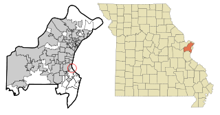
Pasadena Park is a village in St. Louis County, Missouri, United States. The population was 470 at the 2010 census. It is part of the Normandy School District, and is distinct from the city of Pasadena Hills.

<span class="mw-page-title-main">Sycamore Hills, Missouri</span> Village in Missouri, United States

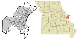
Sycamore Hills is a village in St. Louis County, Missouri, United States. The population is 560 at the 2020 census.

<span class="mw-page-title-main">Velda Village Hills, Missouri</span> City in Missouri, United States

Velda Village Hills is a city in northeastern St. Louis County, Missouri, United States. The population was 1,055 at the 2010 census.

<span class="mw-page-title-main">Baldwin Park, Missouri</span> Village in Missouri, United States

Baldwin Park is a village in Cass County, Missouri, United States. The population was 92 at the 2010 census. It is part of the Kansas City metropolitan area.

<span class="mw-page-title-main">Hanley Hills, Missouri</span> Village in Missouri, United States

Hanley Hills is a village in St. Louis County, Missouri, United States. The population was 2,101 at the 2010 census.

<span class="mw-page-title-main">Vandalia, Missouri</span> City in Missouri, United States

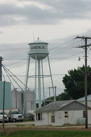
Vandalia is a city in northeastern Audrain and extending into southeastern Ralls Counties in the U.S. state of Missouri. The population was 3,553 at the 2020 census, which includes about 1,000 prisoners incarcerated at the prison located within the city limits.

References

  1. "ArcGIS REST Services Directory". United States Census Bureau. Retrieved August 28, 2022.
  2. 1 2 U.S. Geological Survey Geographic Names Information System: Rush Hill, Missouri
  3. 1 2 "U.S. Census website". United States Census Bureau . Retrieved January 31, 2008.
  4. "Audrain County Place Names, 1928-1945 (archived)". The State Historical Society of Missouri. Archived from the original on June 24, 2016. Retrieved August 30, 2016.{{cite web}}: CS1 maint: bot: original URL status unknown (link)
  5. Eaton, David Wolfe (1916). How Missouri Counties, Towns and Streams Were Named. The State Historical Society of Missouri. pp.  204.
  6. "Post Offices". Jim Forte Postal History. Retrieved August 27, 2016.
  7. "US Gazetteer files 2010". United States Census Bureau. Archived from the original on January 25, 2012. Retrieved July 8, 2012.
  8. "Census of Population and Housing". Census.gov. Retrieved June 4, 2015.
  9. "U.S. Census website". United States Census Bureau . Retrieved July 8, 2012.