
Richmond is a city in western Contra Costa County, California, United States. The city was incorporated on August 7, 1905 and has a city council. Located in the East Bay region of the San Francisco Bay Area, Richmond borders the cities of San Pablo, Albany, El Cerrito and Pinole in addition to the unincorporated communities of North Richmond, Hasford Heights, Kensington, El Sobrante, Bayview-Montalvin Manor, Tara Hills, and East Richmond Heights, and for a short distance San Francisco on Red Rock Island in the San Francisco Bay. Richmond is one of two cities, the other being San Rafael, California, that sits on the shores of San Francisco Bay and San Pablo Bay simultaneously.

San Pablo Bay is a tidal estuary that forms the northern extension of San Francisco Bay in the East Bay and North Bay regions of the San Francisco Bay Area in northern California.
The Richmond Progressive Alliance (RPA) is a community/political group in Richmond, western Contra Costa County, California, United States. Its mission is to unite the left regardless of political party and was founded by Gayle McGlaughlin and Marylyn Langlois.
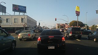
23rd Street is a major north-south trunk street in Richmond and San Pablo, California flanked by many Latino-oriented businesses.
Winehaven was a winery and town in Richmond, California, that held the title of "world's largest winery" for 12 years (1907–1919). It later became a fuel depot for the United States Navy.
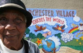
Parchester Village is a planned majority African-American village in northwestern Richmond, California that was the first in the state to sell to blacks.
The Richmond City Council is the governing body for the city of Richmond, California. The council consists of the Mayor of Richmond and six other city council members, one designated Vice Mayor. The council members are all elected from the whole city; no members are elected by district or ward. The council members are elected to four-year terms, as opposed to the previous six-year terms. They are not all elected at once. The council members meet every first and third Tuesday of the month and, if necessary, hold special meetings on the remaining Tuesdays. Presently the entire city council is Democratic.
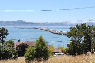
Point Isabel is a small promontory on the eastern shore of San Francisco Bay in the Richmond Annex neighborhood of Richmond, USA. It can be reached at the west terminus of Central Ave. from Richmond / El Cerrito.

Brickyard Cove is an upscale waterfront neighborhood in Richmond, California.
The Richmond Greenway is a pedestrian and bicycle path in Richmond, California.
Castro Cove is an embayment of the San Pablo Bay in Richmond, California between Point San Pablo and the confluence of Wildcat Creek into Castro Creek.

Point San Pablo Harbor is a marina and small community at the far end of Point San Pablo in San Pablo Bay, within Richmond, in Contra Costa County, California. It is located at 1900 Stenmark Drive, Richmond CA 94801.
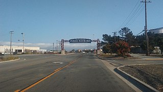
Point Potrero is a point in San Pablo Bay forming a cape and hugging the Potrero Hills in Richmond, California.
Point Molate Beach Park is a city-owned park in Richmond, California, accessible only via a narrow road from the Richmond-San Rafael Bridge toll plaza exit "Western Drive", and separate from the rest of the city. The park is adjacent to the present day ghost town of Winehaven.

Point Molate Naval Fuel Depot is a decommissioned United States Navy fueling station on the western shore of Richmond, California on San Francisco Bay. It has undergone years of litigation and debate as to its redevelopment with proposals ranging from a billion dollar casino project, parkland, housing, and other mixed uses.
Point Molate may refer to:

The Potrero Hills also known as the Potrero Ridge and Point Molate Hills is a chaparral and forested escarpment that crests northwest to southeast along the San Pablo Peninsula in Richmond, California.
Red Rock Cove is an embayment on San Pablo Bay in Richmond, California. It is a cove named after Red Rock Island and lays along Point Molate Beach Park.
Castro Point is a cape in western Richmond, California, United States.
The Richmond Long Wharf is a major tanker terminal and port facility in Richmond, California.
This page is based on this
Wikipedia article Text is available under the
CC BY-SA 4.0 license; additional terms may apply.
Images, videos and audio are available under their respective licenses.