Sandusky South, Ohio

Last updated
Sandusky South, Ohio
OHMap-doton-Sandusky South.png
Location of Sandusky South, Ohio
Detailed map of Sandusky South, Ohio.png
Detailed map of Sandusky South
Coordinates: 41°24′55″N82°41′13″W / 41.41528°N 82.68694°W / 41.41528; -82.68694
Country United States
State Ohio
County Erie
Township Perkins
Area
  Total4.3 sq mi (11.1 km2)
  Land4.3 sq mi (11.0 km2)
  Water0.0 sq mi (0.1 km2)
Elevation
[1]
610 ft (190 m)
Population
 (2000)
  Total6,599
  Density1,546.9/sq mi (597.3/km2)
Time zone UTC-5 (Eastern (EST))
  Summer (DST) UTC-4 (EDT)
FIPS code 39-70422 [2]
GNIS feature ID2393223 [1]

Sandusky South is an census-designated place in Perkins Township, Erie County, Ohio, United States. The population was 6,599 at the 2000 census. It was not delineated as a CDP for the 2010 census. It is part of the Sandusky, Ohio Metropolitan Statistical Area.

Contents

Geography

Sandusky South consists of developed land south of the city limits of Sandusky.

Demographics

As of the census [2] of 2000, there were 6,599 people, 2,224 households, and 1,643 families residing in the CDP. The population density was 1,546.9 inhabitants per square mile (597.3/km2). There were 2,341 housing units at an average density of 548.8 per square mile (211.9/km2). The racial makeup of the CDP was 88.07% White, 9.49% African American, 0.20% Native American, 0.62% Asian, 0.20% from other races, and 1.42% from two or more races. Hispanic or Latino of any race were 1.15% of the population.

There were 2,224 households, out of which 32.2% had children under the age of 18 living with them, 60.8% were married couples living together, 9.7% had a female householder with no husband present, and 26.1% were non-families. 23.5% of all households were made up of individuals, and 12.0% had someone living alone who was 65 years of age or older. The average household size was 2.56 and the average family size was 3.02.

In the CDP the population was spread out, with 22.2% under the age of 18, 5.5% from 18 to 24, 22.6% from 25 to 44, 24.4% from 45 to 64, and 25.2% who were 65 years of age or older. The median age was 45 years. For every 100 females, there were 117.1 males. For every 100 females age 18 and over, there were 123.4 males.

The median income for a household in the CDP was $51,217, and the median income for a family was $61,738. Males had a median income of $45,781 versus $25,444 for females. The per capita income for the CDP was $23,192. About 2.2% of families and 4.0% of the population were below the poverty line, including 2.7% of those under age 18 and 2.5% of those age 65 or over.

Related Research Articles

<span class="mw-page-title-main">Day Heights, Ohio</span> Census-designated place in Ohio, United States

Day Heights is a census-designated place (CDP) in Clermont County, Ohio, United States. The population was 2,625 at the 2020 census.

<span class="mw-page-title-main">Fairview Lanes, Ohio</span> Unincorporated community and Census-designated place in Ohio, United States

Fairview Lanes is an unincorporated community in Perkins Township, Erie County, Ohio, United States. The area was delineated as a census-designated place (CDP) for the 2000 census, at which time its population was 1,015. The area was not a CDP for the 2010 census. It is part of the Sandusky, Ohio Metropolitan Statistical Area.

<span class="mw-page-title-main">Dillonvale, Hamilton County, Ohio</span> Census-designated place in Ohio, United States

Dillonvale is a census-designated place (CDP) in Sycamore Township, Hamilton County, Ohio, United States. The population was 3,436 at the 2020 census.

<span class="mw-page-title-main">Kenwood, Ohio</span> Census-designated place in Ohio, United States

Kenwood is a census-designated place (CDP) in Sycamore Township, Hamilton County, Ohio, United States. The population was 7,570 at the 2020 census. It is a major shopping destination for the Cincinnati area, featuring properties such as Kenwood Towne Centre and The Kenwood Collection.

<span class="mw-page-title-main">Eaton Estates, Ohio</span> Census-designated place in Ohio, United States

Eaton Estates is an unincorporated community and census-designated place (CDP) in Lorain County, Ohio, United States. The population was 1,155 at the 2020 census.

<span class="mw-page-title-main">North Zanesville, Ohio</span> CDP in Ohio, United States

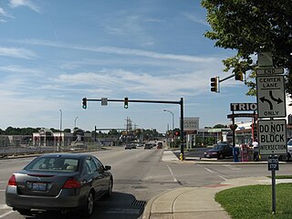
North Zanesville is a census-designated place (CDP) in Muskingum County, Ohio, United States, just north of the city of Zanesville, along the Muskingum River. The population was 3,116 at the 2020 census.

<span class="mw-page-title-main">Pleasant Grove, Ohio</span> CDP in Ohio, United States

Pleasant Grove is a census-designated place (CDP) in Muskingum County, Ohio, United States. The population was 1,726 at the 2020 census.

<span class="mw-page-title-main">Logan Elm Village, Ohio</span> CDP in Ohio, United States

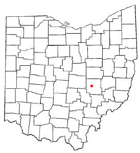
Logan Elm Village is a census-designated place (CDP) in Pickaway County, Ohio, United States, near the site of the Logan Elm. The population was 1,062 at the 2000 census.

<span class="mw-page-title-main">North Fork Village, Ohio</span> Former CDP in Ohio, United States

North Fork Village is an unincorporated community and former census-designated place (CDP) in Ross County, Ohio, United States. The population was 1,726 at the 2000 census. It was not delineated as a CDP for the 2010 census.

<span class="mw-page-title-main">Ballville, Ohio</span> CDP in Ohio, United States

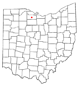
Ballville is a census-designated place (CDP) in Sandusky County, Ohio, United States, adjacent to Fremont. The population was 3,823 at the 2020 census.

<span class="mw-page-title-main">Stony Prairie, Ohio</span> CDP in Ohio, United States

Stony Prairie is a census-designated place (CDP) in Sandusky County, Ohio, United States. The population was 1,218 at the 2020 census.

<span class="mw-page-title-main">Perry Heights, Ohio</span> Census-designated place in Ohio, United States

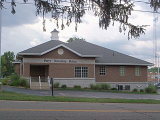
Perry Heights is a census-designated place in Stark County, Ohio, United States. The population was 8,391 at the 2020 census. It is part of the Canton–Massillon metropolitan area.

<span class="mw-page-title-main">Montrose-Ghent, Ohio</span> CDP in Ohio, United States

Montrose-Ghent is a census-designated place (CDP) in Summit County, Ohio, United States, composed of the unincorporated communities of Montrose and Ghent. The population was 5,254 at the 2020 census. It is part of the Akron Metropolitan Statistical Area.

<span class="mw-page-title-main">Bolindale, Ohio</span> Census-designated place in Ohio, United States

Bolindale is an unincorporated community and census-designated place in southern Howland Township, Trumbull County, Ohio, United States. The population was 1,921 at the 2020 census. It is part of the Youngstown–Warren metropolitan area.

<span class="mw-page-title-main">Churchill, Ohio</span> Census-designated place in Ohio, United States

Churchill is a census-designated place in Liberty Township, Trumbull County, Ohio, United States. The population was 2,176 at the 2020 census. It is part of Youngstown–Warren metropolitan area. The community was named for a hilltop church near the original townsite.

<span class="mw-page-title-main">Maplewood Park, Ohio</span> Census-designated place in Ohio, United States

Maplewood Park is an unincorporated community and census-designated place in southern Hubbard Township, Trumbull County, Ohio, United States. The population was 243 at the 2020 census. It is part of the Youngstown–Warren metropolitan area.

<span class="mw-page-title-main">South Canal, Ohio</span> Census-designated place in Ohio, United States

South Canal is an unincorporated community and census-designated place in western Newton Township, Trumbull County, Ohio, United States. The population was 1,101 at the 2020 census. It is part of the Youngstown–Warren metropolitan area.

<span class="mw-page-title-main">Five Points, Warren County, Ohio</span> CDP in Ohio, United States

Five Points is a census-designated place (CDP) in Clearcreek Township, Warren County, Ohio, United States. The population was 2,247 at the 2020 census.

Eagle Mountain is a former census-designated place (CDP) in Tarrant County, Texas, United States. The population was 6,599 at the 2000 census. It is now a part of the city of Saginaw.

<span class="mw-page-title-main">Loveland Park, Ohio</span> Census-designated place in Ohio, United States

Loveland Park is a census-designated place (CDP) located in Symmes Township, Hamilton County and Deerfield Township, Warren County, in the southwestern part of the U.S. state of Ohio. The CDP is named after the city of Loveland. The population was 1,737 at the 2020 census.

References

  1. 1 2 U.S. Geological Survey Geographic Names Information System: Sandusky South, Ohio
  2. 1 2 "U.S. Census website". United States Census Bureau . Retrieved 2008-01-31.