Seal, Kent

Last updated

Seal
The Kentish Yeoman, Seal - geograph.org.uk - 908231.jpg
A view along Seal High Street
Kent UK location map.svg
Red pog.svg
Seal
Location within Kent
Population2,556 (2011 Census)
OS grid reference TQ549567
Civil parish
  • Seal
District
Shire county
Region
Country England
Sovereign state United Kingdom
Post town SEVENOAKS
Postcode district TN15
Dialling code 01732
Police Kent
Fire Kent
Ambulance South East Coast
UK Parliament
List of places
UK
England
Kent
51°17′18″N0°13′20″E / 51.2882°N 0.2223°E / 51.2882; 0.2223

Seal is a village and civil parish in the Sevenoaks district of Kent, England. The parish is located in the valley between the North Downs and the Greensand ridge, and to the north-east of the town of Sevenoaks in West Kent.

Contents

History

In early documents the name of the village is often given as 'Sele', 'Sale', 'Zela' or 'La Sela'. Until recently it was thought to come from the French word 'salle' meaning a hall but there is no evidence to support this. Etymologists suggest that the name of the village could have come from the Anglo-Saxon word 'sole' or 'sol' meaning a 'muddy slough, wallowing place' or a 'muddy pond that overflows'. Seal still has a pond at the fork at the bottom of Park Lane which tends to overflow at the present day. Another possibility is Anglo-Saxon sēale = "group of sallow trees". [1]

St Peter and St Paul's church St. Peter and St. Paul, the parish church of Seal - geograph.org.uk - 940391.jpg
St Peter and St Paul's church

Seal's church, the oldest parts of which date from the 13th Century, is dedicated to St Peter and St Paul and is a grade I listed building. [2] The ecclesiastical parish only became separate from Kemsing in 1874, although there may well have been a Saxon church on the site of the present building. Visitors to the church, which is normally open during the day, can pick up a free guide leaflet pointing out features of interest. There are more details on the church website, and a page for family historians with some records of burials and baptisms at the church (not complete) and information about where to find others.

Today, the ecclesiastical parish boundary meanders north of the village along the Guzzlebrook stream and extends south through the village, bounded on the eastern side by Watery Lane, Seal Chart, and Ash Platt Road to the west. It follows the course of Park Lane, Chance Wood, Grove Road, through Godden Green, bounded at the south by the junction of Bitchet Green Road at Fawke Common. [3]

Seal was recorded in the Domesday Book in 1086.

Geography

The main village lies on the A25 road and has merged with the built-up area of Sevenoaks.

The parish includes the separate smaller settlements of Underriver, Stone Street, Godden Green and Bitchet Green.

Village facilities

Seal retains a village library which is operated by Kent County Council; the library offers telecottage services.

There are three community halls in the village; Seal Pavilion, Seal Village Hall, and Seal Church Hall.

Along the High Street there are a variety of shops, businesses, and restaurants.

There is only one pub now in Seal. "The Five Bells" in Church Street is managed by Shepherd Neame Brewery and is open every day. The name for the pub comes from the fact that there were originally five bells installed in the belltower at St Peter & St Paul's Church, given its close proximity to the church (there are now six bells installed in the belltower).

Seal Recreation Ground (locally known as the Rec) lies to the west of the village and offers public amenity space for sports and leisure activities. During the summer months various events are held on the Rec, such as the SealFest Music Festival day and Big Lunch events.

Seal Village has a stretch of land running alongside the Rec which was left in trust to the villagers for allotment gardens that are also used by surrounding villagers. [4]

Public transport

There are several bus routes that connect Seal with surrounding villages and towns. The Arriva 308 bus connects the village with Sevenoaks station, Bat & Ball, Borough Green, Meopham and Gravesend. The Arriva 452 bus connects the village with Kemsing, Sevenoaks station, and Dunton Green. An extended service of this route is operated by Go Coach on Saturdays. There are also some infrequent bus services, such as the Go Coach 404, connecting Seal to Shipbourne, Plaxtol, Ivy Hatch (for Ightham Mote), Stone Street, Kippington, Ide Hill, and Edenbridge. There are currently no buses serving Seal on Sundays or public holidays, also there are no direct buses to Otford. The closest railway stations to the village are at Bat & Ball and Kemsing.

Notable people

Nearest settlements

Related Research Articles

<span class="mw-page-title-main">Cudham</span> Human settlement in England

Cudham is a village in Greater London, England, located within the London Borough of Bromley and beyond London's urban sprawl. It is located on the Greater London border with Kent, bordering the Sevenoaks District. Cudham lies south of Orpington and north west of Sevenoaks. It is located 15.9 miles (25.6 km) south-southeast of Charing Cross.

<span class="mw-page-title-main">Sevenoaks</span> Market town and civil parish in western Kent, England

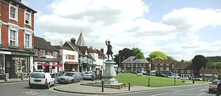
Sevenoaks is a town in Kent with a population of 29,506 situated south-east of London, England. Also classified as a civil parish, Sevenoaks is served by a commuter main line railway into London. Sevenoaks is 21 miles (34 km) from Charing Cross, the traditional centre of London. It is the principal town of the Sevenoaks district, followed by Swanley and Edenbridge.

<span class="mw-page-title-main">Otford</span> Human settlement in England

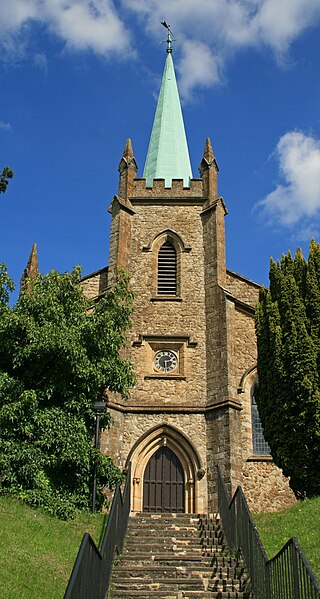
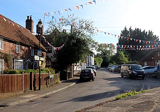
Otford is a village and civil parish in the Sevenoaks District of Kent, England. It lies on the River Darent, 3 miles (5 km) north of Sevenoaks. Otford's four churches are the Anglican Church of St Bartholomew in the village centre, the Otford Methodist Church, the Most Holy Trinity Roman Catholic Church, and the Otford Evangelical Church. By the village pond, also a roundabout, there are pubs, cafes and shops. The village has three schools, Otford Primary School, St Michael's Prep School, and Russell House.

<span class="mw-page-title-main">Westerham</span> Town and civil parish in Kent, England

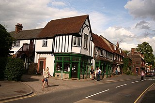
Westerham is a town and civil parish in the Sevenoaks District of Kent, England. It is located 3.4 miles east of Oxted and 6 miles west of Sevenoaks, adjacent to the Kent border with both Greater London and Surrey. It is recorded as early as the 9th century, and was mentioned in the Domesday Book in a Norman form, Oistreham. Hām is Old English for a village or homestead, and so Westerham means a westerly homestead. The River Darent flows through the town, and formerly powered three watermills.

<span class="mw-page-title-main">Dunton Green</span> Human settlement in England

Dunton Green is a small village and civil parish in the Sevenoaks District of Kent, England. It lies in the valley of the River Darent, 3 miles (4.8 km) north of the town of Sevenoaks. Dunton Green is designated as being part of the Kent Downs area of outstanding natural beauty, due to its proximity to the North Downs. The original ecclesiastical church parish of Dunton Green was part of Otford parish. The former parish church was dedicated to St John the Divine.

<span class="mw-page-title-main">Kemsing</span> Human settlement in England

Kemsing is a village and civil parish in the Sevenoaks district of Kent, England. The parish lies on the scarp face of the North Downs, 20 miles south east of Central London and 4 miles (6 km) north east of Sevenoaks. Also in the parish there are the hamlets of Heaverham, 1 mile (2 km) to the east and Noah's Ark 0.5 miles (1 km) to the south. The population of the civil parish in 2001 was 4,014 persons, increasing to a population of 4,218 at the 2011 Census.

<span class="mw-page-title-main">Swanley</span> Human settlement in England

Swanley is a town and civil parish in the Sevenoaks District of Kent, England, 16 miles (26 km) southeast of central London, adjacent to the Greater London boundary and within the M25 motorway periphery. The population at the 2021 census was 17,826.

<span class="mw-page-title-main">West Kingsdown</span> Human settlement in England

West Kingsdown is a village and civil parish in the Sevenoaks district of Kent, England, on the A20 5 miles (8 km) southeast of Swanley, 5.5 miles (9 km) northeast of Sevenoaks and 22.5 miles (36.2 km) from London.

<span class="mw-page-title-main">Hartley, Sevenoaks</span> Human settlement in England

Hartley is a village and civil parish in the Sevenoaks district of Kent, England. It is located 7 miles (11 km) south west of Gravesend and the same distance south east of Dartford.

<span class="mw-page-title-main">Shiplake</span> Human settlement in England

Shiplake consists of three settlements: Shiplake, Shiplake Cross and Lower Shiplake. Together these villages form a civil parish situated beside the River Thames 2 miles (3 km) south of Henley-on-Thames, Oxfordshire, England. The river forms the parish boundary to the east and south, and also the county boundary between Oxfordshire and Berkshire. The villages have two discrete centres separated by agricultural land. The 2011 Census records the parish population as 1,954 and containing 679 homes. The A4155 main road linking Henley with Reading, Berkshire passes through the parish.

<span class="mw-page-title-main">Sevenoaks (UK Parliament constituency)</span>

Sevenoaks is a constituency represented in the House of Commons of the UK Parliament since 2019 by Laura Trott, a Conservative.

<span class="mw-page-title-main">St Mary Cray</span> Human settlement in England

St Mary Cray is an area of South East London, England, within the London Borough of Bromley. Historically it was a market town in the county of Kent. It is located north of Orpington, and 13 miles (21 km) south-east of Charing Cross.

<span class="mw-page-title-main">Hextable</span> Human settlement in England

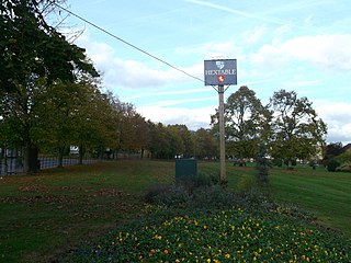
Hextable is a village and civil parish in the Sevenoaks District of Kent, England. It lies 2 miles (3.2 km) north of Swanley and 4 miles (6.4 km) south of Dartford.

<span class="mw-page-title-main">Swanley Village</span> Human settlement in England

Swanley Village is a village in the Sevenoaks District of Kent, England. It is located 1 mile north east of Swanley & 4.7 miles south west of Dartford.

<span class="mw-page-title-main">Riverhead, Kent</span> Human settlement in England

Riverhead is a northern village part of the urban area of Sevenoaks in the district of the same name in Kent, England and is also a civil parish. The parish had a population in 2001 of 1821, increasing to 2,634 at the 2011 Census.

<span class="mw-page-title-main">Hever, Kent</span> Human settlement in England

Hever village is a village and civil parish in the Sevenoaks District of Kent, England. The parish is located on the River Eden, a tributary of the River Medway, east of Edenbridge. It is 5 miles (8 km) by 1-mile (1.6 km) in extent, and 3,062 acres (12.39 km2) in area. The parish includes the villages of Four Elms, Hever itself, and Markbeech, and has a population of 1,136, increasing to 1,231 at the 2011 Census.

<span class="mw-page-title-main">Chelsfield</span> Human settlement in England

Chelsfield is an area in south-east London, England, within the London Borough of Bromley and, prior to 1965, in the historic county of Kent. It lies south of Goddington, west of Well Hill, north of Pratt's Bottom and east of Green Street Green. The area is split into two distinct areas – the historic 'village' section, and the newer development by the train station.

Godden Green is a hamlet 1 mile (2 km) east of Sevenoaks in Kent, England. It is within the civil parish of Seal, in Sevenoaks District, on the eastern edge of Knole Park. There is a large green, and a Shepherd Neame public house, the Buck's Head. The village is in the ecclesiastical parish of St Peter and St Paul, Seal, the parish extends southward and is bounded by Bitchet Green Road at Fawke Common.

<span class="mw-page-title-main">Go-Coach</span>

Go-Coachhire Limited, trading as Go-Coach, is a bus operator running a total of 40 bus services across Kent and Sussex. The majority of these services are operated on behalf of Kent County Council from their depot in Swanley.

References

  1. 'Seal: The History of a Parish' by Jean Fox, David Williams and Peter Mountfield, published by Philimores in 2007, gives comprehensive coverage of the village's history.
  2. Historic England. "CHURCH OF ST PETER AND ST PAUL (1243497)". National Heritage List for England . Retrieved 10 August 2014.
  3. "Seal: St Peter & St Paul, Seal - Kent | Diocese of Rochester". Achurchnearyou.com. 24 February 2014. Retrieved 27 July 2016.
  4. "Seal Village Allotments" . Retrieved 18 August 2020.
  5. Banks, Scott (30 November 2020). "Sevenoaks' Emma Corrin shares pictures from behind the scenes at The Crown". KentLive. Retrieved 23 December 2020.
  6. 1 2 Matthew, H. C. G.; Harrison, B., eds. (23 September 2004), "The Oxford Dictionary of National Biography", The Oxford Dictionary of National Biography, Oxford: Oxford University Press, pp. ref:odnb/74452, doi:10.1093/ref:odnb/74452 , retrieved 20 February 2023