TN postcode area

Last updated

Template:Attached KML/TN postcode area
KML is from Wikidata
Tunbridge Wells
United Kingdom adm location map.svg
Red pog.svg
TN
Coordinates: 51°05′06″N0°26′20″E / 51.085°N 0.439°E / 51.085; 0.439
CountryUnited Kingdom
Postcode area
TN
Postcode area name
Tunbridge Wells
Post towns 24
Postcode districts 40
Postcode sectors128
Postcodes (live)22,620
Postcodes (total)32,534
Statistics as at May 2020 [1]

The TN postcode area, also known as the Tunbridge Wells postcode area, [2] is a group of 40 postcode districts in England, within 24 post towns. These cover south and west Kent (including Royal Tunbridge Wells, Tonbridge, Ashford, Sevenoaks, Westerham, Cranbrook, Edenbridge, New Romney, Romney Marsh and Tenterden) and northern and eastern East Sussex (including Hastings, Battle, Bexhill-on-Sea, Crowborough, Etchingham, Hartfield, Heathfield, Mayfield, Robertsbridge, Rye, St Leonards-on-Sea, Uckfield, Wadhurst and Winchelsea), plus very small parts of Surrey and the London Borough of Bromley.

Contents

Mail for this area is sorted at the Royal Mail Sorting Office in Rochester, which also sorts all mail from the adjoining ME postcode area.

Coverage

The approximate coverage of the postcode districts:

Postcode district Post town CoverageLocal authority area(s)
TN1TUNBRIDGE WELLS Tunbridge Wells (town centre) Tunbridge Wells [3]
TN2TUNBRIDGE WELLS Royal Tunbridge Wells (south and east), Pembury Tunbridge Wells
TN2WADHURST non-geographic [4] [5]
TN3TUNBRIDGE WELLS Langton Green, Groombridge, Frant, Speldhurst, Lamberhurst Tunbridge Wells, Wealden
TN4TUNBRIDGE WELLS Royal Tunbridge Wells (north), Rusthall, Southborough Tunbridge Wells
TN5WADHURST Wadhurst, Ticehurst, Tidebrook, Stonegate Rother, Wealden
TN6CROWBOROUGHBlack Hill, Boars Head, Burnt Oak, Castle Hill, Friars Gate, Mark Cross, Rotherfield, St Johns, Stone Cross, Town RowWealden
TN7HARTFIELDColeman's Hatch, Hartfield Wealden
TN8EDENBRIDGE Crockham Hill, Edenbridge Sevenoaks, Tandridge
TN9TONBRIDGE Tonbridge (town centre and south) Tonbridge and Malling
TN10TONBRIDGE Tonbridge (north including Higham Wood)Tonbridge and Malling
TN11TONBRIDGE Penshurst, Hildenborough, Hadlow, Tudeley Sevenoaks, Tonbridge and Malling, Tunbridge Wells
TN12TONBRIDGE Paddock Wood, Staplehurst, Brenchley, Horsmonden, Marden, East Peckham Maidstone, Tonbridge and Malling, Tunbridge Wells
TN13SEVENOAKS Sevenoaks, Riverhead, Dunton Green Sevenoaks
TN14SEVENOAKS Cudham, Knockholt, Shoreham, Otford, Hazelwood Bromley, Sevenoaks
TN15SEVENOAKS Kemsing, Ightham, Plaxtol, Wrotham, Sevenoaks Weald, Borough Green Sevenoaks, Tonbridge and Malling
TN16WESTERHAM Westerham, Biggin Hill, Berry's Green, Tatsfield Bromley, Sevenoaks, Tandridge
TN17CRANBROOK Cranbrook, Goudhurst, Sissinghurst, Benenden, Frittenden Ashford, Tunbridge Wells
TN18CRANBROOK Hawkhurst, Sandhurst Tunbridge Wells
TN19ETCHINGHAM Etchingham, Burwash Rother
TN20MAYFIELD Five Ashes Wealden
TN21HEATHFIELD Heathfield, Broad Oak, Horam, Cross in Hand Rother, Wealden
TN22UCKFIELD Buxted, Isfield, Maresfield, Nutley, Uckfield Wealden
TN23ASHFORD Ashford (town centre), Kingsnorth, Singleton Ashford
TN24ASHFORD Willesborough, Kennington, Boughton Aluph, Goat LeesAshford
TN25ASHFORD Challock, Wye, Stowting, Brook Ashford, Folkestone and Hythe
TN26ASHFORD Bethersden, Hamstreet, Shadoxhurst, Woodchurch Ashford
TN27ASHFORD Headcorn, Biddenden Ashford, Maidstone
TN28NEW ROMNEY New Romney, Greatstone-on-Sea, Littlestone-on-Sea Folkestone and Hythe
TN29ROMNEY MARSH Lydd Folkestone and Hythe
TN30TENTERDEN Tenterden, Wittersham Ashford
TN31RYE Rye, Camber, Northiam Rother
TN32ROBERTSBRIDGE Robertsbridge, Mountfield, Bodiam, Brightling Rother
TN33BATTLE Battle Rother, Wealden
TN34HASTINGS Hastings town centre Hastings
TN35HASTINGSHastings, Pett, Guestling, Westfield Hastings, Rother
TN36WINCHELSEA Winchelsea, Icklesham Rother
TN37ST. LEONARDS-ON-SEA St Leonards-on-Sea Hastings
TN38ST. LEONARDS-ON-SEASt Leonards-on-Sea, Silverhill, Wishing Tree, North Hastings, Bulverhythe Hastings
TN39BEXHILL-ON-SEA Bexhill-on-Sea, Cooden Rother
TN40BEXHILL-ON-SEABexhill-on-Sea, PebshamRother

Delivery offices

Main delivery offices are in Ashford, Bexhill, Biggin Hill, Cranbrook, Crowborough, Edenbridge, Heathfield, New Romney, Rye, Sevenoaks, St Leonards, Tenterden, Tonbridge, Tunbridge Wells and Uckfield. Scale Payment Delivery Offices are in Post Offices of Appledore, Bethersden, Brabourne Lees, Charing, Egerton, Etchingham, Headcorn, Marden, Robertsbridge, Smarden, Staplehurst and Woodchurch. [6]

Map

Template:Attached KML/TN postcode area
KML is from Wikidata
TN postcode area map, showing postcode districts in red and post towns in grey text, with links to nearby BN, BR, CR, CT, DA, ME, RH and SE postcode areas. TN postcode area map.svg
TN postcode area map, showing postcode districts in red and post towns in grey text, with links to nearby BN, BR, CR, CT, DA, ME, RH and SE postcode areas.

See also

Related Research Articles

<span class="mw-page-title-main">Wealden District</span> District in East Sussex, England

Wealden is a local government district in East Sussex, England. Its council is based in Hailsham, the district's largest town. The district also includes the towns of Crowborough, Polegate and Uckfield, along with numerous villages and surrounding rural areas. The district's name comes from the Weald, the landscape and ancient woodland which occupies much of the centre and north of the area.

<span class="mw-page-title-main">Oxted line</span> National Rail line in southern England

The Oxted line is a railway in southern England and part of the Southern franchise. The railway splits into two branches towards the south and has direct trains throughout to London termini.

The RM postcode area, also known as the Romford postcode area, is a group of twenty postcode districts in south-east England, within nine post towns. These cover parts of eastern Greater London and south-west Essex. Inward mail for the area is sorted, along with mail for the E and IG postcode areas, at the Romford Mail Centre.

The IG postcode area, also known as the Ilford postcode area, is a group of eleven postcode districts in England, within six post towns. These cover parts of eastern Greater London and south-west Essex.

The WC postcode area, also known as the London WC postcode area, is a group of postcode districts in central London, England. The area covered is of high density development, and includes parts of the City of Westminster and the London Boroughs of Camden and Islington, plus a very small part of the City of London.

The CR postcode area, also known as the Croydon postcode area, is a group of eight postcode districts in England, within ten post towns. These cover parts of southern Greater London and north-east Surrey.

The BR postcode area, also known as the Bromley postcode area, is a group of eight postcode districts in England, within seven post towns. These cover part of south-eastern Greater London, as well as a small part of north-west Kent.

The TW postcode area, also known as the Twickenham postcode area, is a group of twenty postcode districts in south-east England, within thirteen post towns. These cover parts of south-west London and north-west Surrey, plus a very small part of Berkshire.

<span class="mw-page-title-main">Hastings line</span> Railway line in Kent and East Sussex, England

The Hastings line is a secondary railway line in Kent and East Sussex, England, linking Hastings with the main town of Tunbridge Wells, and London via Tonbridge and Sevenoaks. Although primarily carrying passengers, the railway also serves a gypsum mine which is a source of freight traffic. Southeastern Trains operates passenger trains on the line, and it is one of their busiest lines.

The DA postcode area, also known as the Dartford postcode area, is a group of eighteen postcode districts in England, within eleven post towns. These cover parts of south-east London and north-west Kent.

<span class="mw-page-title-main">Bidborough</span> Human settlement in England

Bidborough is a village and civil parish in the borough of Tunbridge Wells in Kent, England, north of Royal Tunbridge Wells and south of Tonbridge. According to the 2001 census it had a population of 958, increasing to 1,163 at the 2011 Census.

The HA postcode area, also known as the Harrow postcode area, is a group of ten postcode districts in England, within seven post towns. These cover part of northwest London, plus a very small part of south Hertfordshire.

The EH postcode area, also known as the Edinburgh postcode area, is a group of 55 postcode districts for post towns: Armadale, Balerno, Bathgate, Bo'ness, Bonnyrigg, Broxburn, Currie, Dalkeith, Dunbar, East Linton, Edinburgh, Gorebridge, Gullane, Haddington, Heriot, Humbie, Innerleithen, Juniper Green, Kirkliston, Kirknewton, Lasswade, Linlithgow, Livingston, Loanhead, Longniddry, Musselburgh, Newbridge, North Berwick, Ormiston, Pathhead, Peebles, Penicuik, Prestonpans, Rosewell, Roslin, South Queensferry, Tranent, Walkerburn, West Calder and West Linton in Scotland.

The GU postcode area, also known as the Guildford postcode area, is a group of 38 postcode districts in South East England, within 24 post towns. These cover west Surrey, north-east Hampshire, northwestern West Sussex and a small part of south-east Berkshire.

The WD postcode area, also known as the Watford postcode area, is a group of eleven postcode districts in south-east England, within seven post towns. These cover south-west Hertfordshire, plus very small parts of Buckinghamshire and Greater London.

The AL postcode area, also known as the St Albans postcode area, is a group of ten postcode districts in England, within five post towns. These cover central Hertfordshire, including St Albans, Harpenden, Welwyn, Welwyn Garden City and Hatfield.

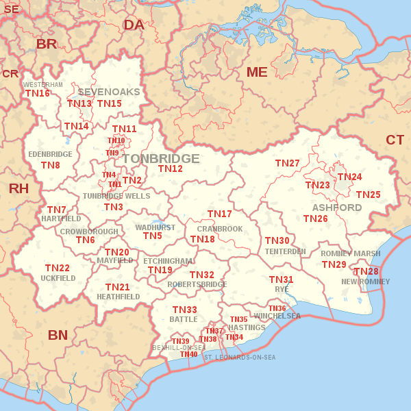
The ME postcode area, also known as the Rochester postcode area, is a group of 20 postcode districts in South East England, within 11 post towns. These cover north central Kent, including the Medway unitary authority and the borough of Swale, plus parts of the boroughs of Maidstone, Tonbridge and Malling, and Gravesham. The letters in the postcode are derived from the name of the Medway conurbation.

The TA postcode area, also known as the Taunton postcode area, is a group of 24 postcode districts in South West England, within 19 post towns. These cover western Somerset, plus very small parts of Dorset and Devon.

References

As of this edit, this article uses content from "Mapping data and geographic information from Ordnance Survey" , which is licensed in a way that permits reuse under the Creative Commons Attribution-ShareAlike 3.0 Unported License, but not under the GFDL. All relevant terms must be followed.

  1. "ONS Postcode Directory Version Notes" (ZIP). National Statistics Postcode Products. Office for National Statistics. May 2020. Table 2. Retrieved 19 June 2020. Coordinates from mean of unit postcode points, "Code-Point Open". OS OpenData. Ordnance Survey. February 2012. Retrieved 21 April 2012.
  2. Royal Mail, Address Management Guide, (2004)
  3. Local authority data obtained from OS OpenData Code-Point Open. Contains Ordnance Survey data © Crown copyright and database right 2010 and contains Royal Mail data © Royal Mail copyright and database right 2010, under licence. Local authorities only listed for postcode districts having at least 5% of their postcodes from that authority, to exclude erroneous, fringe and non-geographical cases.
  4. "Non Geographic Codes" (PDF). Royal Mail Address Management Unit. July 2012. Archived from the original (PDF) on 16 September 2012. Retrieved 25 October 2012.
  5. "New sectors and localities to 19 October 2012" (PDF). Royal Mail Address Management Unit. 19 October 2012. Archived from the original (PDF) on 13 May 2013. Retrieved 25 October 2012.
  6. "List of UK Delivery Offices (based on a Freedom of Information request". WhatDoTheyKnow. Royal Mail Group Limited. 10 February 2009.