Settlement hierarchy

Last updated

A settlement hierarchy is a way of arranging settlements into a hierarchy based upon their size. The term is used by landscape historians and in the National Curriculum [1] for England. The term is also used in the planning system for the UK and for some other countries such as Ireland, India, and Switzerland. The term was used without comment by the geographer Brian Roberts in 1972. [2]

Contents

Overview

In Europe, centuries-old settlements were surrounded by farmland and tended not to be wider than 30 minutes' walk from one end to the other, with wealthier people monopolising the "town centre", and poorer people living on the town's outskirts or nearby countryside (the "sphere of influence"). With the advent of decentralization technologies (e.g., bicycles, trains, cars, etc.), American settlements reversed this trend before reaching their saturation point, with vast farmlands managed by homesteads located dozens of miles away from the nearest settlement; lower-income communities occupied the "centre" as the middle-income and upper-income migrated into suburbia. This created a phenomenon known as urban decay.

A settlement's population size, its geographic area, its status,[ clarification needed ] and the availability of services can all affect this hierarchy. Position in a settlement hierarchy can also depend on the sphere of influence. This is how far people will travel to use the services in the settlement: if people travel further the town becomes more important and ranks higher in the settlement hierarchy.

A collection of the most widely accepted units of measuring a settlement's size is as follows: [3] [4]

Isolated Dwelling < Hamlet < Village < Small Town < Large Town < City < Conurbation [5]

Problems with concept of a settlement hierarchy

Using the title of a settlement can be misleading in the absence of any widely accepted definition. For example, city status in the United Kingdom historically arose from its place in the ecclesiastic hierarchy. (In modern times, city status is awarded for secular reasons but without reference to size.) Thus, some cathedral cities in England (e.g., Ely, Cambridgeshire) have a much smaller populations than some towns (e.g., Luton). In some parts of the United States, the distinction between town and city is a matter of a decision by local government to incorporate. In addition, there is no agreement as to the number of levels in the hierarchy or what they should be called. Many terms used to describe settlements (e.g., village) have no legal definition, or may have contradictory legal definitions in different jurisdictions.

Hierarchy and status

Position in an accepted settlement hierarchy can imply status, [6] which in turn reinforces the position of the settlement in the hierarchy. Status can derive from being the residence of a King or high-ranking member of the nobility or from being the location of a major religious establishment. A formal hierarchy of settlements, known as a multiple estate, appears to have been common in 10th-century England. [7] The centre of an estate (often called a "caput") could be supported by subsidiary settlements, which were sometimes given specialised roles. For example, a Saxon royal estate might be supported by settlements specialising in the production of cheese or barley or maintaining flocks of sheep. [8]

Example of a settlement hierarchy

The following settlement hierarchy is adapted from the work of Konstantinos Apostolos Doxiadis for the actual current world situation as of 2010, as opposed to Doxiadis' idealized settlement hierarchy for the year 2100 that he outlined in his 1968 book Ekistics . As an example population criteria for each category of settlement might be different depending on context.

In this example, a roadhouse is at the lowest level while the ecumenopolis is at the top with the greatest number of residents: [9]

Extreme density: more than one billion residents

High density: more than one million residents

At this density, the settlement's population, spheres of influence, and gross domestic product tends to exceed that of most countries with lesser density. The need for administrative divisions, public transportation, public infrastructure and other government public services is critically essential for the sustainable growth and continued prosperity of its citizens. High income jobs and non-essential luxury services are abundant (e.g. car dealerships, brain surgery centers, airports, financing, computer stores, coffee shops, etc.) as these cannot be sustained by lesser density. Medium income exceeds national average. The first city in recorded history to reach a population of one million residents was Ancient Rome in 133 B.C. During the Second Industrial Revolution, London, England reached the mark in 1810 and New York City, United States made it in 1875.

The main type at this level is the

Larger types at this level would be:

Upper medium density: quarter million to one million residents

At this density, there is ready access to more specialized advanced services (e.g. doctors, mechanics, colleges, etc.) due to economies of scale and economies of agglomeration.

Lower medium density: 100,000 to 250,000 residents

At this density, there is ready access to less specialized services but residents may need to travel to a larger city in some circumstances.

Low density: 1,000 to 100,000 residents

Less than one hundred thousand residents. Common "city features" and third place services such as clinics, pharmacy, bank, supermarket, police station, fire station, schools, residential neighborhoods, restaurant, etc. become less available as size reduces. Density may be sufficient to support local commercial areas which may include a "Main Street" or a shopping mall.

Minuscule density: Less than 1,000

Less than one thousand residents. At this number, settlements are too small or scattered to be considered "urban", and services within these settlements (if any) are generally limited to bare essentials: e.g., church, grocery store, post office, etc. Throughout most of human history, very few settlements could support a population greater than 150 people.[ citation needed ]

Settlement hierarchy by country

Settlement hierarchy in the English planning system

The position of a settlement in the hierarchy is intended to inform decisions about new developments, such as housing. Rather than define the hierarchy by population, an alternative way to construct the hierarchy is based on the services that are available within each settlement. Settlements are described as "level 1", "level 2", etc. rather than using terms such as village or town. [12] The Government planning statement (PPS3) does not specifically mention "settlement hierarchies", but talks about the availability of services to small rural settlements. The term is used a number of times in the guidance for preparing evidence for planning decisions; a settlement hierarchy starts with an isolated dwelling, then hamlet, then village, town, city then a conurbation.

Settlement hierarchy in the German planning system

The German planning system is based on the Central Place Theory developed by Walter Christaller in the 1930s and first applied in the Nazi Era, especially in Poland. Every settlement is categorized by function: highly central cities Oberzentrum  [ de ] (e.g. Hamburg, with speciality clinics for tropical diseases), middle central cities Mittelzentrum  [ de ] (for periodic functions[ clarification needed ] e.g. Homburg (Saar) with major schools (starting at 5th grade)) and basic central towns Grundzentrum  [ de ]/Unterzentrum (e.g. Illingen with basic doctors[ clarification needed ] and Supermarket). The number of inhabitants is less important: thus a city such as Kaiserslautern (100,000 people) can be a highly specialized city, because it is a centre for the surrounding rural area.

It[ clarification needed ] is used at the federal level for the regional planning system of states and planning regions for the "State Development Programmes" (Landesentwicklungsprogramm [de]) and the "Regional Spatial Structure Plans" (Regionaler Raumordnungsplan [de]). These are political plans to achieve goals such as equivalent living standards (Gleichwertige Lebensverhältnisse [de]) in rural and urban areas in all of Germany, east and west.

Overiew of categories

By size categorization

By socio-political categorization

See also

Related Research Articles

<span class="mw-page-title-main">Suburb</span> Human settlement within a metropolitan area

A suburb is an area within a metropolitan area which often contains most of the area's economic activity, which may include commercial and mixed-use. A suburb can exist either as part of a larger city/urban area or as a separate political entity. The name describes an area that is either more or less densely populated than an inner city. In many metropolitan areas suburbs rise in population during the day and are where most jobs are located; being major commercial and job hubs, many suburbs also exist as separate residential communities within commuting distance of a larger city. Suburbs can have their own political or legal jurisdiction, especially in the United States, but this is not always the case, especially in the United Kingdom, where most suburbs are located within the administrative boundaries of cities. In most English-speaking countries, suburban areas are defined in contrast to central city or inner city areas, but in Australian English and South African English, suburb has become largely synonymous with what is called a "neighborhood" in the U.S., but it is used in contrast with inner city areas.

<span class="mw-page-title-main">Town</span> Type of human settlement

A town is a type of a human settlement. Towns are generally larger than villages and smaller than cities, though the criteria to distinguish between them vary considerably in different parts of the world.

<span class="mw-page-title-main">Municipalities of Finland</span> Local level of administration in Finland

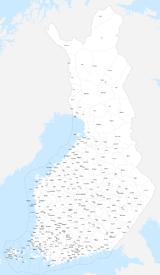
The municipalities represent the local level of administration in Finland and act as the fundamental, self-governing administrative units of the country. The entire country is incorporated into municipalities and legally, all municipalities are equal, although certain municipalities are called cities or towns. Municipalities have the right to levy a flat percentual income tax, which is between 16 and 22 percent, and they provide two thirds of public services. Municipalities control many community services, such as schools, health care and the water supply, and local streets. They do not maintain highways, set laws or keep police forces, which are responsibilities of the central government.

<span class="mw-page-title-main">Conurbation</span> Group of settlements linked by continuous urban area

A conurbation is a region comprising a number of metropolises, cities, large towns, and other urban areas which, through population growth and physical expansion, have merged to form one continuous urban or industrially developed area. In most cases, a conurbation is a polycentric urbanised area in which transportation has developed to link areas. They create a single urban labour market or travel to work area.

<span class="mw-page-title-main">Hamlet (place)</span> Small human settlement in a rural area

A hamlet is a human settlement that is smaller than a town or village. This is often simply an informal description of a smaller settlement or possibly a subdivision or satellite entity to a larger settlement.

<span class="mw-page-title-main">Constantinos Apostolou Doxiadis</span> Greek architect (1913–1975)

Constantinos A. Doxiadis, often cited as C. A. Doxiadis, was a Greek architect and urban planner. During the 1960s, he was the lead architect and planner of Islamabad, which was to serve as the new capital city of Pakistan. He was later known as the father of ekistics, which concerns the multi-aspect science of human settlements.

<span class="mw-page-title-main">Urban area</span> Human settlement with high population density and infrastructure of built environment

An urban area, built-up area or urban agglomeration is a human settlement with a high population density and an infrastructure of built environment. This is the core of a metropolitan statistical area in the United States, if it contains a population of more than 50,000.

<span class="mw-page-title-main">Central place theory</span> Geographical theory of spatial distribution of cities

Central place theory is an urban geographical theory that seeks to explain the number, size and range of market services in a commercial system or human settlements in a residential system. It was introduced in 1933 to explain the spatial distribution of cities across the landscape. The theory was first analyzed by German geographer Walter Christaller, who asserted that settlements simply functioned as 'central places' providing economic services to surrounding areas. Christaller explained that a large number of small settlements will be situated relatively close to one another for efficiency, and because people don't want to travel far for everyday needs, like getting bread from a bakery. But people would travel further for more expensive and infrequent purchases or specialized goods and services which would be located in larger settlements that are farther apart.

<span class="mw-page-title-main">Ecumenopolis</span> Hypothetical planet-spanning city

Ecumenopolis is the hypothetical concept of a planetwide city.

An urban area or tätort in Sweden has a minimum of 200 inhabitants and may be a city, town or larger village. It is a purely statistical concept, not defined by any municipal or county boundaries. Larger urban areas synonymous with cities or towns for statistical purposes have a minimum of 10,000 inhabitants. The same statistical definition is also used for urban areas in the other Nordic countries.

<span class="mw-page-title-main">Ekistics</span> Science of human settlements

Ekistics is the science of human settlements including regional, city, community planning and dwelling design. Its major incentive was the emergence of increasingly large and complex conurbations, tending even to a worldwide city. The study involves every kind of human settlement, with particular attention to geography, ecology, human psychology, anthropology, culture, politics, and occasionally aesthetics.

<span class="mw-page-title-main">Greater London Built-up Area</span> Conurbation in south-east England

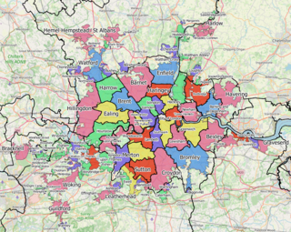
The Greater London Built-up Area, or Greater London Urban Area, is a conurbation in south-east England that constitutes the continuous urban sprawl of London, and includes surrounding adjacent urban towns as defined by the Office for National Statistics. It is the largest urban area in the United Kingdom with a population of 9,787,426 in 2011.

<span class="mw-page-title-main">Megalopolis</span> Grouping of neighbouring metropolises

A megalopolis or a supercity, also called a megaregion, is a group of metropolitan areas which are perceived as a continuous urban area through common systems of transport, economy, resources, ecology, and so on. They are integrated enough that coordinating policy is valuable, although the constituent metropolises keep their individual identities. The megalopolis concept has become highly influential as it introduced a new, larger scale thinking about urban patterns and growth.

<span class="mw-page-title-main">Human settlement</span> Community of any size, in which people live

In geography, statistics and archaeology, a settlement, locality or populated place is a community of people living in a particular place. The complexity of a settlement can range from a minuscule number of dwellings grouped together to the largest of cities with surrounding urbanized areas. Settlements may include hamlets, villages, towns and cities. A settlement may have known historical properties such as the date or era in which it was first settled, or first settled by particular people. The process of settlement involves human migration.

A merger, consolidation or amalgamation, in a political or administrative sense, is the combination of two or more political or administrative entities, such as municipalities, counties, districts, etc., into a single entity. This term is used when the process occurs within a sovereign entity.

References

  1. "Geography, Year 8: Unit 9 Shopping – past, present and future". Archived from the original on 26 December 2005.
  2. B. K. Roberts, Village plans in County Durham, (Medieval Archaeology, Volume XVI, 1972)
  3. Tarrant, J. R. (April 1968). "A Note concerning the Definition of Groups of Settlements for a Central Place Hierarchy". Economic Geography. 44 (2): 144–151. doi:10.2307/143311. ISSN   0013-0095. JSTOR   143311.
  4. "Hierarchy of Settlements | Geography Revision" . Retrieved 14 June 2023.
  5. "Settlement Hierarchy: Definition & Categories". study.com. Retrieved 19 June 2023.
  6. Michael Aston, Interpreting the Landscape (Routledge, reprinted 1998, page 44)
  7. Andrew Reynolds, Later Anglo-Saxon England (Tempus, paperback edition 2002, page 81)
  8. Della Hooke, The Landscape of Anglo-Saxon England (Leicester University Press, reprinted 2001, page 52)
  9. Doxiadis, Konstantinos Ekistics 1968
  10. 1 2 Stamenovic, Pavle; Predic, Dunja & Eres, Davor (2015). "Transparency of Scale: Geographical Information Program (Google Earth) and the View from Beyond". In Vaništa Lazarević, Eva; Vukmirović, Milena; Krstić-Furundžić, Aleksandra & Đukić, Aleksandra (eds.). Keeping Up with Technologies to Improve Places. Newcastle upon Tyne: Cambridge Scholars Publishing. p. 44. ISBN   978-1-4438-7739-8. Archived from the original on 6 November 2021. Retrieved 21 May 2020.
  11. Gribbin, Caitlyn (31 August 2019). "I spent the night in Australia's smallest town. Here's what I saw". ABC News. Archived from the original on 7 September 2021. Retrieved 6 November 2021.
  12. "EERA planning map" (PDF). East of England Regional Assembly. Archived from the original (PDF) on 2 December 2007.