Seymour, Illinois

Last updated

Seymour
Seymour, IL.jpg
Seymour, Illinois Post Office and Grain Elevator.
USA Illinois location map.svg
Red pog.svg
Seymour
Coordinates: 40°06′25″N88°25′37″W / 40.106809°N 88.427071°W / 40.106809; -88.427071
Country United States
State Illinois
County Champaign
Township Scott
Area
[1]
  Total0.09 sq mi (0.67 km2)
  Land0.09 sq mi (0.2 km2)
  Water0.00 sq mi (0.0 km2)
Elevation
[2]
712 ft (217 m)
Population
 (2020)
  Total317
  Density3,500/sq mi (470/km2)
Time zone Central
ZIP code
61875
Area code 217
FIPS code 17-68809
GNIS feature ID 2628560

Seymour is a census-designated place in Champaign County, Illinois, United States. At the 2020 census it had a population of 317. It is part of Mahomet-Seymour Community Unit School District No. 3.

Contents

Geography

Seymour is located at 40°06′25″N88°25′37″W / 40.106809°N 88.427071°W / 40.106809; -88.427071 (40.1069769, -88.4267245). [3] It is located in Scott Township, Champaign County, Illinois. According to the 2021 census gazetteer files, Seymour has a total area of 0.09 square miles (0.23 km2), all land. [1]

Demographics

As of the 2020 census [4] there were 317 people, 41 households, and 30 families residing in the CDP. The population density was 3,408.60 inhabitants per square mile (1,316.07/km2). There were 122 housing units at an average density of 1,311.83 per square mile (506.50/km2). The racial makeup of the CDP was 93.38% White, 1.26% African American, 1.26% from other races, and 4.10% from two or more races. Hispanic or Latino of any race were 0.95% of the population.

There were 41 households, out of which 43.9% had children under the age of 18 living with them, 73.17% were married couples living together, none had a female householder with no husband present, and 26.83% were non-families. 26.83% of all households were made up of individuals, and none had someone living alone who was 65 years of age or older. The average household size was 4.07 and the average family size was 3.54.

The CDP's age distribution consisted of 18.6% under the age of 18, 17.9% from 18 to 24, 20% from 25 to 44, 35.8% from 45 to 64, and 7.6% who were 65 years of age or older. The median age was 40.3 years. For every 100 females, there were 61.1 males. For every 100 females age 18 and over, there were 59.5 males.

The median income for a household in the CDP was $105,893, and the median income for a family was $133,000. Males had a median income of $36,429 versus $42,143 for females. The per capita income for the CDP was $37,757. No families and 8.3% of the population were below the poverty line, including none of those under age 18 and 0.0% of those age 65 or over.

Historical population
CensusPop.Note
2010 303
2020 3174.6%
U.S. Decennial Census [5]

Notable person

Related Research Articles

Kaibab is an unincorporated community and census-designated place (CDP) in Mohave County, Arizona, United States. It is within the Kaibab Indian Reservation. The population of the CDP was 140 at the 2020 census.

<span class="mw-page-title-main">Homestead Base, Florida</span> Census-designated place in Florida, United States

Homestead Base is a census-designated place (CDP) in Miami-Dade County, Florida, United States. The population was 999 at the 2020 census. The CDP comprises the extent of Homestead Air Reserve Base plus some surrounding land.

<span class="mw-page-title-main">Crooked Lake Park, Florida</span> Census-designated place in Florida, United States

Crooked Lake Park is a census-designated place (CDP) in Polk County, Florida, United States. The population was 1,682 at the 2000 census. It is part of the Lakeland–Winter Haven Metropolitan Statistical Area.

<span class="mw-page-title-main">Bondville, Illinois</span> Village in Illinois, United States

Bondville is a village in Champaign County, Illinois, United States. The population was 388 at the 2020 census.

<span class="mw-page-title-main">Broadlands, Illinois</span> Village in Illinois, United States

Broadlands is a village in Champaign County, Illinois, along the East Branch of the Embarras River. The population was 316 at the 2020 census. Originally owned by the Sullivant family, Broadlands was, at over 70,000 acres (280 km2), one of the world's largest farms in the late 1860s. Broadlands was sold to John T. Alexander in 1866, and it was broken up upon his death in 1876 to pay his creditors.

<span class="mw-page-title-main">Lake of the Woods, Illinois</span> Census-designated place in Illinois, United States

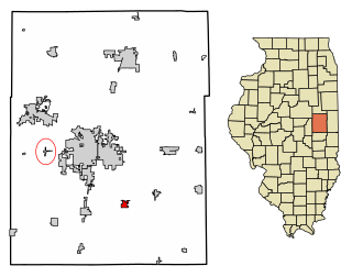
Lake of the Woods is a census-designated place (CDP) in Champaign County, Illinois, United States. The population was 2403 at the 2020 census. Lake of the Woods is in Mahomet Township and mostly surrounded by the northeast part of the village of Mahomet.

<span class="mw-page-title-main">Longview, Illinois</span> Village in Illinois, United States

Longview is a village in Champaign County, Illinois, United States. The population was 112 at the 2020 census.

<span class="mw-page-title-main">Ludlow, Illinois</span> Village in Illinois, United States

Ludlow is a village in Champaign County, Illinois, United States. The population was 308 at the 2020 census.

<span class="mw-page-title-main">Mahomet, Illinois</span> Village in Illinois, United States

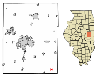
Mahomet is a village in Champaign County, Illinois, United States. The population was 9,434 at the 2020 census. Mahomet is located approximately 10 miles northwest of Champaign at the junction of Interstate 74 and IL 47.

<span class="mw-page-title-main">Philo, Illinois</span> Village in Illinois, United States

Philo is a village about nine miles south of Urbana in Champaign County, Illinois, United States. The population was 1,392 at the 2020 census.

<span class="mw-page-title-main">Savoy, Illinois</span> Village in Illinois, United States

Savoy is a village in Champaign County, Illinois, United States. The population was 8,857 at the 2020 census.

<span class="mw-page-title-main">Kingstown, Maryland</span> CDP in Maryland, United States

Kingstown is a census-designated place (CDP) in Queen Anne's County, Maryland, United States. The population was 1,644 at the 2000 census.

Mount Gretna Heights is an unincorporated community and census-designated place (CDP) in Lebanon County, Pennsylvania, United States, adjacent to the borough of Mount Gretna. The population was 323 at the 2010 census.

<span class="mw-page-title-main">Browns Lake, Wisconsin</span> CDP in Wisconsin, United States

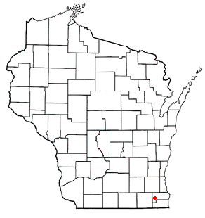
Browns Lake is a census-designated place (CDP) in Racine County, Wisconsin around a lake of the same name. The population was 1,879 at the 2020 census. It is politically a part of the town of Burlington, along with Bohners Lake.

Seymour is a census-designated place (CDP) in Eau Claire County, Wisconsin, United States. The population was 1,418 at the 2010 census. It is located within the town of Seymour and is part of the Eau Claire urban area.

<span class="mw-page-title-main">Ixonia (CDP), Wisconsin</span> Census-designated place in Wisconsin, United States

Ixonia is a census-designated place (CDP) in the town of Ixonia, Jefferson County, Wisconsin, United States. The population was 2,367 at the 2020 census.

West Union is an unincorporated census-designated place located in York Township in the southeast corner of Clark County, Illinois, on Illinois Route 1. Its postal zip code is 62477. As of the 2020 census, its population was 271.

<span class="mw-page-title-main">Mahomet Township, Champaign County, Illinois</span> Township in Illinois, United States

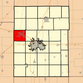
Mahomet Township is a township in Champaign County, Illinois, USA. As of the 2020 census, its population was 13,697 and it contained 5,391 housing units.

Penfield is an unincorporated census-designated place in Compromise Township, Champaign County, Illinois, United States. Its population was 151 at the 2020 census.

Langleyville is an unincorporated census-designated place in Christian County, Illinois, United States. As of the 2020 census, it had a population of 391.

References

  1. 1 2 Bureau, US Census. "Gazetteer Files". Census.gov. Retrieved June 29, 2022.
  2. "US Board on Geographic Names". United States Geological Survey. October 25, 2007. Retrieved January 31, 2008.
  3. "US Gazetteer files: 2010, 2000, and 1990". United States Census Bureau. February 12, 2011. Retrieved April 23, 2011.
  4. "Explore Census Data". data.census.gov. Retrieved June 28, 2022.
  5. "Census of Population and Housing". Census.gov. Retrieved June 4, 2016.