The Union Transportation Trail is a 9-mile (14 km) rail trail situated in western Monmouth County, New Jersey. It extends from Hornerstown, New Jersey, to the Assunpink Wildlife Management Area.

Hornerstown is an unincorporated community located within Upper Freehold Township in Monmouth County, New Jersey, United States. Hornerstown is located near Cream Ridge and uses the 08514 ZIP code.

Prospertown is an unincorporated community located within the New Jersey townships of Jackson and Plumsted in Ocean County and Upper Freehold in Monmouth County. The community is home to Prospertown Lake and is adjacent to Six Flags Great Adventure, both located on County Route 537. The center of the community is located at the intersection of CR 537, Hawkin Road, and Emleys Hill Road. Most of the area consists of pine forests but there are some homes along the roads in the area.
Ashby Creek is a tributary of Doctors Creek in Upper Freehold Township, Monmouth County, New Jersey, in the United States. It runs for 4.2 miles (6.8 km) from the area near Wrightsville and empties into Doctors Creek southeast of Allentown.

Ackors Corner is an unincorporated community located within Hopewell Township in Mercer County, New Jersey, United States. The settlement is located at the intersection of Bear Tavern Road / Trenton-Harbourton Road, Pennington-Harbourton Road and Pleasant Valley Road. It is named for the Ackors family which owned land near the current intersection. Small residences and farmland make up the area surrounding Ackors Corner but the area rises in elevation from east to west as one approaches Baldpate Mountain, part of the Sourland Mountain range.

New Canton is an unincorporated community located along the border of Robbinsville Township in Mercer County and Upper Freehold Township in Monmouth County, New Jersey, United States. The area was once known as Cabbagetown and has been settled since the 18th century. The settlement is located at the intersection of Old York Road and New Canton-Stone Tavern Road just north of Interstate 195's interchange 8. The Upper Freehold side of the area contains farmland and new housing developments while the Robbinsville side features new commercial warehouse buildings including an Amazon.com Fulfillment Center opened in July 2014.

New Sharon is an unincorporated community located along the border of Robbinsville Township in Mercer County and Upper Freehold Township in Monmouth County, New Jersey, United States. Old York Road passes through the center of the community.
Lawrence Station is an unincorporated community located within Lawrence Township in Mercer County, New Jersey, United States. The settlement is named for a former railroad station on the Pennsylvania Railroad's New York Division line, now a part of the Northeast Corridor. Today, some wooded areas and buildings from the time of the station remain but more townhouse developments, cultural centers, and industrial facilities are located along the main road through the area, Lawrence Station Road.
Bowne is an unincorporated community located at the intersection of the boundaries of Delaware, East Amwell and West Amwell townships in Hunterdon County, New Jersey, United States.

Bergerville is an unincorporated community located within Howell Township in Monmouth County, New Jersey, United States. The area was originally developed as a resort bungalow community in the first half of the 20th century.
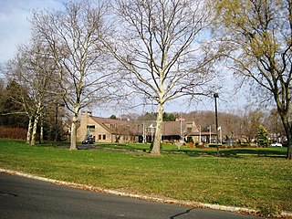
Crawford Corners or Crawfords Corner is an unincorporated community located within Holmdel Township in Monmouth County, New Jersey, United States. The settlement is located at the intersection of Holmdel Road and Crawfords Corners Road in the hilly northern portion of the township. The settlement is located about one-half mile (0.80 km) from Crawford Hill, the highest point in Monmouth County. The area also includes the township's town hall, police department, and high school in addition to a New Jersey State Police barracks and the PNC Bank Arts Center off the Garden State Parkway. These buildings and landmarks comprise the eastern section of the settlement, homes and heavily treed lands are located on the west side of Holmdel Road, and Holmdel Park makes up the southern portion of the area.

Ely is an unincorporated community located within Millstone Township in Monmouth County, New Jersey, United States. The settlement is named for the Ely family that owned property in the area and operated the Charleston Springs hotel. Today, the settlement is located along Stage Coach Road, County Route 524, in the eastern portion of the township. Most of the area consists of large single-family homes though some farmland and the township-owned Brandywine Soccer Complex are located in the near the settlement.

Freneau is an unincorporated community located within Matawan in Monmouth County, New Jersey, United States. It is named for Philip Freneau (1752–1832), a poet during the American Revolutionary War. The community is located along New Jersey Route 79 in the southern portion of Matawan and was formerly served by the Monmouth County Agricultural Railroad.

Kirbys Mills is an unincorporated community located within Upper Freehold Township in Monmouth County, New Jersey, United States. Centered near the intersection of Burlington Path Road and Holmes Mill Road, the area consists of housing developments and small farms.

Navesink Beach is an unincorporated community located within Sea Bright in Monmouth County, New Jersey, United States. It is one of the four main built-up areas of Sea Bright and is the northernmost settled area of the borough. Navesink Beach is a former stop on the New Jersey Southern Railroad. The Sea Bright–Monmouth Beach Seawall passes through the neighborhood and Normandie.

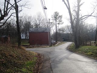
Nelsonville is an unincorporated community located within Upper Freehold Township in Monmouth County, New Jersey, United States. The settlement is located on County Route 526 between Allentown and Imlaystown where it intersects the former Pemberton and Hightstown Railroad. The site was the location of the Newell post office established in 1883. The area was originally known as Imlaystown Station as it was the closest spot to the eponymous town along the railroad. In 1887, the area was renamed to Nelsonville for the local postmaster, Charles Nelson. Other industries in the area at the time included a wagon shop and a cider mill. Today, several agricultural and light industries surround the settlement in addition to some single-family homes. The right-of-way of the former railroad is being reconstructed as the Union Transportation Trail.

Normandie is an unincorporated community located within Sea Bright in Monmouth County, New Jersey, United States. The community is one of the four main built-up areas of Sea Bright and is a former stop on the New Jersey Southern Railroad. It is located along Route 36 between the CR 520 drawbridge to Rumson and Sandy Hook on a narrow strip of land between the Shrewsbury River and the Atlantic Ocean. The Sea Bright–Monmouth Beach Seawall passes through the neighborhood and Navesink Beach.

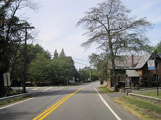
Shrewsbury is an unincorporated community located within Upper Freehold Township in Monmouth County, New Jersey, United States. The settlement is located along County Route 524 at what was once a grade crossing with the Pemberton and Hightstown Railroad with an associated rail station. Since the removal of the railroad, the right-of-way has become a part of the Union Transportation Trail. Besides the trail, the area is made up of mostly farmland with some agricultural-related businesses and single-family homes nearby.

Spring Mill is an unincorporated community located within Upper Freehold Township in Monmouth County, New Jersey, United States. The settlement is located along County Route 524 between Hamilton Township and Allentown on a commercialized segment of the road originally built as New Jersey Route 37. A vestige of the state construction remains along the road through a wide right-of-way and a bridge crossing Doctor's Creek stating that it was constructed by the state in 1940 for State Highway Route 37.
Stone Church is an unincorporated community located in Middletown Township in Monmouth County, New Jersey, United States, within the census-designated place of Navesink. The settlement is located at the intersection of Valley Road and Locust Avenue, Navesink Avenue, and Monmouth Avenue. In the center of the community, the historic All Saint's Memorial Episcopal Church built in 1864 sits at the main intersection. The remainder of the area consists of single-family houses and forests on the slopes of nearby Mount Mitchill.


