County Route 571 is a county highway in the U.S. state of New Jersey. The highway extends 43.96 miles (70.75 km) from Route 37 in Toms River Township to Route 27 in Princeton. Though it is designated a north–south county route by the New Jersey Department of Transportation (NJDOT), it is signed both as north–south and east–west inconsistently.
County Route 539 is a county highway in the U.S. state of New Jersey. The highway extends 54.32 miles (87.42 km) from Main Street in Tuckerton to CR 535 in Cranbury Township. Much of the two-lane route passes through isolated areas of the Pine Barrens and the eastern end of the Fort Dix entity of Joint Base McGuire–Dix–Lakehurst. In these stretches, the route has a speed limit of 55 miles per hour (89 km/h), one of the few two-lane roads in the state to carry a 55 mph limit. CR 539 passes through three boroughs: Tuckerton, Allentown, and Hightstown. Other than those boroughs, the route travels mainly through rural townships.
County Route 534 is a county highway in the U.S. state of New Jersey. The highway extends 22.86 miles (36.79 km) from Cooper Street on the border of Woodbury and Deptford Township to Indian Mills Road in Shamong Township.
County Route 528 is a county highway in the U.S. state of New Jersey. The highway is designated 39.89 miles (64.20 km) from Farnsworth Avenue in Bordentown to Ocean Avenue in Mantoloking. The eastern end of the highway sustained extensive damage in 2012 when an inlet opened between Barnegat Bay and the Atlantic Ocean during Hurricane Sandy, scouring away the road east of the Mantoloking Bridge. The bridge and Route 35 intersection fully reopened in February 2013.

Parkway Pines is an unincorporated community located along the border of Howell Township in Monmouth County and Brick Township in Ocean County, in New Jersey, United States. The Howell area of this community is called Ramtown.

Holmeson is an unincorporated community located within Millstone Township in Monmouth County, New Jersey, United States. As it is located along County Route 537 through which the Monmouth–Ocean county line runs down the center, portions of the community are also located in Jackson Township. Owing to its location near Interstate 195 and Six Flags Great Adventure, the community is mostly made up of gas stations, restaurants, and small businesses though the Jackson Premium Outlets occupies land just south of the community.

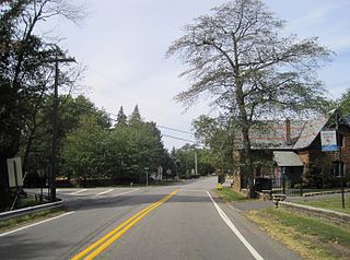
Tennent is an unincorporated community located within Manalapan Township in Monmouth County, New Jersey, United States. Considered to be the historic center of Manalapan Township, Tennent is home to the Old Tennent Church and Old Tennent Cemetery. William Tennent served as pastor at the church for over 40 years. Tennent was also the center of a historic community of African Americans dating back to the early nineteenth century. The location of Tennent is located at the modern intersection of County Route 522 and Tennent Road and is near the limits of Monmouth Battlefield State Park.

Siloam is an unincorporated community located within Freehold Township in Monmouth County, New Jersey, United States. Siloam was once the site of a school serving a district in the township until 1936. County Route 527 passes through the center of Siloam. Exit 21 on Interstate 195 provides access to Siloam from the south. Except around the center of the settlement at the junction of CR 527 and Ely Harmony Road, the area consists of forests comprising the northernmost reaches of the Pine Barrens. The homes in the area are smaller in size and are found only along the aforementioned roads.

Georgia is an unincorporated community located within Freehold Township in Monmouth County, New Jersey, United States. Exit 22 on Interstate 195 provides access to Georgia via Jackson Mills Road. There is also a road in the area called Georgia Road, leading to Turkey Swamp Park. Georgia sits at the northern reaches of the Pine Barrens and numerous housing developments are located north and east of the settlement.

Hornerstown is an unincorporated community located within Upper Freehold Township in Monmouth County, New Jersey, United States. Hornerstown is located near Cream Ridge and uses the 08514 ZIP code.

Scobeyville is an unincorporated community located within Colts Neck Township in Monmouth County, New Jersey, United States. The settlement is named for the Scobey family which has inhabited the township since the 1700s. The site housed a one-room schoolhouse, a post office, and a general store. It was known for good fishing on the Yellow Brook which has its basin in Scobyville.

East Long Branch is an unincorporated community and neighborhood located within Long Branch in Monmouth County, New Jersey, United States. It is located in the northern portion of the city along the Atlantic Ocean coastline. Major roads through the area include Joline Avenue and Ocean Boulevard, both of which are parts of New Jersey Route 36. Homes consisting of single-family houses and condominiums are located throughout the area and the county-maintained Seven Presidents Park is located within East Long Branch.

New Canton is an unincorporated community located along the border of Robbinsville Township in Mercer County and Upper Freehold Township in Monmouth County, New Jersey, United States. The area was once known as Cabbagetown and has been settled since the 18th century. The settlement is located at the intersection of Old York Road and New Canton-Stone Tavern Road just north of Interstate 195's interchange 8. The Upper Freehold side of the area contains farmland and new housing developments while the Robbinsville side features new commercial warehouse buildings including an Amazon.com Fulfillment Center opened in July 2014.

Burlington Heights is an unincorporated community located within Freehold Township in Monmouth County, New Jersey, United States. The community was created in the early 1960s and originally consisted of 112 homes of mixed styles designed by Peter Petillo and Associates of Freehold. It is located along Colts Neck Road on the east side of the township, near New Jersey Route 18 and the Colts Neck municipal line.

Charleston Springs is an unincorporated community located within Millstone Township in Monmouth County, New Jersey, United States. Stage Coach Road, also designated County Route 524, is the main road that runs through the settlement, with Ely Harmony Road as the intersecting road defining the locality. The Manalapan Brook runs to the west of the center of Charleston Springs and CR 537 runs to the south of the area. The Monmouth County-owned Charleston Springs Golf Course is located one mile (1.6 km) northeast of the center of Charleston Springs on CR 527.

Freewood Acres is an unincorporated community located within Howell Township in Monmouth County, New Jersey, United States. The area is made up of mostly single-story homes arranged along a street grid in the northern reaches of the Pine Barrens. U.S. Route 9 runs through the center of the community just north of its interchange with Interstate 195. The Land O'Pines Elementary School and Manasquan Reservoir County Park exist to the east of the community. It became the center of the Kalmyk American community in the latter part of the 20th century.

Galilee is an unincorporated community located within Monmouth Beach in Monmouth County, New Jersey, United States. The area is named for the Biblical city of Galilee and was founded as a fishing village. Located at the northern extent of Monmouth Beach, it is located along the peninsula where it begins to greatly narrow between the Shrewsbury River and the Atlantic Ocean. Single family homes typically make up the ocean side of the peninsula while condominiums and a marina are located on the river side. The Sea Bright–Monmouth Beach Seawall passes through the community and continues to neighboring Sea Bright.

Oceanic is an unincorporated community located within Rumson in Monmouth County, New Jersey, United States. Located on the north side of the borough, Oceanic contains most of Rumson's commercial businesses mainly along Bingham Avenue and River Road. Bingham Avenue connects directly to the Oceanic Bridge over the Navesink River to the Middletown Township community of Locust Point.
Stone Church is an unincorporated community located in Middletown Township in Monmouth County, New Jersey, United States, within the census-designated place of Navesink. The settlement is located at the intersection of Valley Road and Locust Avenue, Navesink Avenue, and Monmouth Avenue. In the center of the community, the historic All Saint's Memorial Episcopal Church built in 1864 sits at the main intersection. The remainder of the area consists of single-family houses and forests on the slopes of nearby Mount Mitchill.
Chambers Corner or Chambers Corners is an unincorporated community located within Springfield Township in Burlington County, New Jersey, United States. The intersection defining the community is the junction of Monmouth Road and U.S. Route 206. Juliustown Road runs to the south of the settlement and terminates at CR 537. Except for some stores and businesses that line US 206 and some single-family homes along CR 537, the area is mostly made up of farmland.


