Shelby, Montana

Last updated

Shelby, Montana
Shelby Montana Downtown.jpg
Downtown Shelby
Toole County Montana Incorporated and Unincorporated areas Shelby Highlighted.svg
Location of Shelby, Montana
Coordinates: 48°30′26″N111°51′37″W / 48.50722°N 111.86028°W / 48.50722; -111.86028
Country United States
State Montana
County Toole
Area
[1]
  Total5.96 sq mi (15.43 km2)
  Land5.78 sq mi (14.97 km2)
  Water0.17 sq mi (0.45 km2)
Elevation
3,297 ft (1,005 m)
Population
 (2020)
  Total3,169
  Density548.08/sq mi (211.63/km2)
Time zone UTC-7 (Mountain (MST))
  Summer (DST) UTC-6 (MDT)
ZIP code
59474
Area code 406
FIPS code 30-67450
GNIS feature ID0776465
Website shelbymt.com

Shelby is a city in and the county seat of Toole County, Montana, United States. [2] The population was 3,169 at the 2020 census. [3]

Contents

History

Toole County Courthouse Toole County Courthouse.jpg
Toole County Courthouse

Shelby was named in honor of Peter O. Shelby, General Manager of the Montana Central Railway. [4] A railroad station was established here about 1892, at the junction of the Great Northern Railway and the Great Falls & Canada Railway.

On July 4, 1923, the town hosted a heavyweight boxing match between Jack Dempsey and Tommy Gibbons for the undisputed world Heavyweight boxing championship title. [5] This event almost bankrupted the town of Shelby. [6]

In the early 2000s the town hosted a dog camp that made national news. [7] [8] It was named Camp Collie and helped mistreated dogs.

Welker Farms, an agricultural operation known for its popular social media channels, is located near Shelby.. [9]

The Well Done Foundation, which plugs orphaned and abandoned oil wells, opened a visitors' center in Shelby in 2020. [10]

Geography

Shelby is near the Marias River and also Aloe Lake.

According to the United States Census Bureau, the city has a total area of 6.18 square miles (16.01 km2), of which 6.03 square miles (15.62 km2) is land and 0.15 square miles (0.39 km2) is water. [11]

Climate

Shelby has four distinct seasons, and is considered an arid climate. Long, severe winters give way to springlike weather anywhere from March to May. Summers can be dry and hot, and the area is prone to lightning, hail, and severe thunderstorms during the summer months. [12] Fall weather is often unpredictable, with snow falling during October some years, and temperatures well into the 60s °F (10s °C) stretching until the end of November on other years. Due to the city's location just off of the Rocky Mountain Front, wind is a constant.

Climate data is sparse. A weather station operated in the town from the late 1990s shows slightly higher temperatures than nearby towns such as Cut Bank.

Climate data for Shelby, Montana, 1991–2020 normals, extremes 1950–present
MonthJanFebMarAprMayJunJulAugSepOctNovDecYear
Record high °F (°C)69
(21)
69
(21)
78
(26)
86
(30)
91
(33)
97
(36)
102
(39)
103
(39)
96
(36)
89
(32)
74
(23)
65
(18)
103
(39)
Mean maximum °F (°C)55.3
(12.9)
55.9
(13.3)
64.4
(18.0)
74.3
(23.5)
83.8
(28.8)
88.9
(31.6)
96.2
(35.7)
95.7
(35.4)
89.9
(32.2)
78.2
(25.7)
64.6
(18.1)
54.1
(12.3)
96.4
(35.8)
Mean daily maximum °F (°C)31.4
(−0.3)
35.5
(1.9)
43.9
(6.6)
54.2
(12.3)
64.4
(18.0)
72.6
(22.6)
82.2
(27.9)
82.2
(27.9)
70.9
(21.6)
56.2
(13.4)
42.0
(5.6)
33.1
(0.6)
55.7
(13.2)
Daily mean °F (°C)18.8
(−7.3)
22.6
(−5.2)
31.2
(−0.4)
41.3
(5.2)
51.2
(10.7)
59.3
(15.2)
66.8
(19.3)
65.8
(18.8)
55.7
(13.2)
42.6
(5.9)
29.8
(−1.2)
21.1
(−6.1)
42.2
(5.7)
Mean daily minimum °F (°C)6.1
(−14.4)
9.9
(−12.3)
18.4
(−7.6)
28.4
(−2.0)
38.0
(3.3)
46.0
(7.8)
51.5
(10.8)
49.3
(9.6)
40.5
(4.7)
29.0
(−1.7)
17.6
(−8.0)
9.1
(−12.7)
28.7
(−1.9)
Mean minimum °F (°C)−21.6
(−29.8)
−13.8
(−25.4)
−5.7
(−20.9)
13.0
(−10.6)
23.4
(−4.8)
35.1
(1.7)
42.0
(5.6)
38.5
(3.6)
26.9
(−2.8)
10.0
(−12.2)
−5.7
(−20.9)
−16.8
(−27.1)
−28.4
(−33.6)
Record low °F (°C)−44
(−42)
−37
(−38)
−37
(−38)
−9
(−23)
12
(−11)
30
(−1)
36
(2)
30
(−1)
16
(−9)
−12
(−24)
−31
(−35)
−36
(−38)
−44
(−42)
Average precipitation inches (mm)0.46
(12)
0.36
(9.1)
0.63
(16)
1.34
(34)
1.77
(45)
2.85
(72)
1.14
(29)
0.85
(22)
1.01
(26)
0.74
(19)
0.52
(13)
0.46
(12)
12.13
(309.1)
Average snowfall inches (cm)7.3
(19)
5.8
(15)
6.9
(18)
4.1
(10)
1.9
(4.8)
0.0
(0.0)
0.0
(0.0)
0.0
(0.0)
0.5
(1.3)
1.4
(3.6)
5.5
(14)
5.5
(14)
38.9
(99.7)
Average precipitation days (≥ 0.01 in)5.15.46.07.39.311.15.85.76.15.44.65.277.0
Average snowy days (≥ 0.1 in)4.24.13.11.80.50.00.00.00.10.72.63.720.8
Source 1: NOAA [13]
Source 2: National Weather Service [14]

Demographics

Historical population
CensusPop.Note
1920 537
1930 2,004273.2%
1940 2,53826.6%
1950 3,05820.5%
1960 4,01731.4%
1970 3,111−22.6%
1980 3,1421.0%
1990 2,763−12.1%
2000 3,21616.4%
2010 3,3765.0%
2020 3,169−6.1%
U.S. Decennial Census [15] [3]

2010 census

At the 2010 census there were 3,376 people in 1,245 households, including 717 families, in the city. The population density was 559.9 inhabitants per square mile (216.2/km2). There were 1,371 housing units at an average density of 227.4 per square mile (87.8/km2). The racial makeup of the city was 89.5% White, 0.8% African American, 6.5% Native American, 0.5% Asian, 0.8% from other races, and 1.9% from two or more races. Hispanic or Latino of any race were 3.0%. [16]

Of the 1,245 households 28.3% had children under the age of 18 living with them, 43.8% were married couples living together, 9.2% had a female householder with no husband present, 4.7% had a male householder with no wife present, and 42.4% were non-families. 37.4% of households were one person and 14% were one person aged 65 or older. The average household size was 2.17 and the average family size was 2.84.

The median age was 40.3 years. 18.9% of residents were under the age of 18; 8.3% were between the ages of 18 and 24; 29.3% were from 25 to 44; 29.9% were from 45 to 64; and 13.6% were 65 or older. The gender makeup of the city was 58.3% male and 41.7% female.

2000 census

At the 2000 census there were 3,216 people in 1,196 households, including 735 families, in the City of Shelby. The population density was 1,018.8 inhabitants per square mile (393.4/km2). There were 1,349 housing units at an average density of 427.3 per square mile (165.0/km2). The racial makeup of the city was 92.48% White, 0.25% African American, 4.17% Native American, 0.40% Asian, 0.25% from other races, and 2.46% from two or more races. Hispanic or Latino of any race were 1.24%. [17]

Of the 1,196 households 30.9% had children under 18 living with them, 50.8% were married couples living together, 7.5% had a female householder with no husband present, and 38.5% were non-families. 35.5% of households were one person and 16.1% were one person aged 65 or older. The average household size was 2.34 and the average family size was 3.07.

The age distribution was 24.0% under the age of 18, 7.2% from 18 to 24, 29.5% from 25 to 44, 22.9% from 45 to 64, and 16.4% 65 or older. The median age was 39 years. For every 100 females there were 107.4 males. For every 100 females age 18 and over, there were 108.9 males.

The median household income was $29,219 and the median family income was $41,046. Males had a median income of $27,634 versus $19,444 for females. The per capita income for the city was $15,071. About 6.1% of families and 8.6% of the population were below the poverty line, including 8.8% of those under age 18 and 7.5% of those age 65 or over.

Education

Shelby Public Schools educates students from kindergarten through 12th grade. [18] In the 2021-2022 school year, Shelby High School had 112 students enrolled. [19] The school's team name is the Coyotes. [20]

Toole County Library is a public library in Shelby. [21]

Media

The Shelby Promoter is the newspaper for Shelby. It is printed weekly and also offers an e-edition. [22]

Two radio stations are licensed in Shelby. KSEN AM 1150 and KZIN-FM 96.7 are both owned by Townsquare Media. [23] [24]

Infrastructure

Shelby's Amtrak station Shelby Amtrak.JPG
Shelby's Amtrak station

Amtrak, the national passenger rail system, provides daily service to Shelby (both east and west), operating its Empire Builder from Chicago to Seattle and Portland, Oregon.

Shelby is at the intersection of Interstate 15 and U.S. Route 2.

Northern Transit Interlocal, local bus transportation system. Provides transportation to Great Falls & Kalispell.

NTI Transit Facility - Shelby, Montana NTI Transit Facility - Shelby Montana.jpg
NTI Transit Facility - Shelby, Montana

Shelby Airport is a county-owned airport two miles north of town. [25] The nearest commercial airport is Great Falls International Airport, 86 miles (138 km) south.

Notable people

Related Research Articles

<span class="mw-page-title-main">Toole County, Montana</span> County in Montana, United States

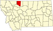
Toole County is a county in the northern portion of the U.S. state of Montana. As of the 2020 census, the population was 4,971. Its county seat is Shelby. The county was established in 1914 from parts of Hill County and Teton County and was named after Joseph Toole, the first and fourth governor of Montana. Its northern boundary is the Canada–United States border south of Alberta.

<span class="mw-page-title-main">Pondera County, Montana</span> County in Montana, United States

Pondera County is a county in the U.S. state of Montana. As of the 2020 census, the population was 5,898. Its county seat is Conrad.

<span class="mw-page-title-main">Calera, Alabama</span> City in Alabama, United States

Calera is a city in Shelby and Chilton counties in the U.S. state of Alabama. It is the location of the Shelby County Airport.

<span class="mw-page-title-main">Pelham, Alabama</span> City in Alabama, United States

Pelham is a city in Shelby County, Alabama, United States. It incorporated in July 1964 and is a suburb located in the Birmingham metropolitan area, Alabama which was home to over 1.1 million residents as of the 2020 census. At the 2000 census the population was 14,369, and has grown to 24,318 by the 2020 census, nearly doubling. It was named for Confederate Civil War officer John Pelham.

<span class="mw-page-title-main">Shelbyville, Indiana</span> City in Indiana, United States

Shelbyville is a city in Addison Township, Shelby County, in the U.S. state of Indiana and is the county seat. The population was 20,067 as of the 2020 census.

<span class="mw-page-title-main">Harlan, Iowa</span> City in Iowa, United States

Harlan is a city in Shelby County, Iowa, along the West Nishnabotna River. The population was 4,893 at the time of the 2020 census. It is the county seat of Shelby County.

<span class="mw-page-title-main">Savannah, Missouri</span> City in Missouri, United States

Savannah is a city and county seat of Andrew County, Missouri, United States. The population was 5,069 at the 2020 census.

<span class="mw-page-title-main">Shelbina, Missouri</span> City in Missouri, United States

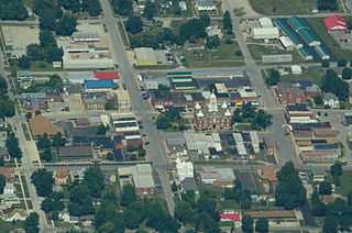
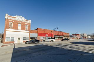
Shelbina is a city in southern Shelby County, Missouri, United States. The population was 1,613 at the 2020 census.

<span class="mw-page-title-main">Townsend, Montana</span> City in Montana, United States

Townsend is a city in and the county seat of Broadwater County, Montana, United States. The population was 1,787 at the 2020 census.

<span class="mw-page-title-main">Red Lodge, Montana</span> City in Carbon County, Montana, United States

Red Lodge is a city and county seat of Carbon County, Montana, United States. As of the 2020 census, the population of the city was 2,257.

<span class="mw-page-title-main">Jordan, Montana</span> Town in Montana, United States

Jordan is a town in and the county seat of Garfield County, Montana, United States. The population was 356 at the 2020 census. It is Garfield County's only incorporated community.

<span class="mw-page-title-main">Browning, Montana</span> Former town in Montana, United States

Browning is a former town in Glacier County, Montana, United States. It is the headquarters for the Blackfeet Indian Reservation and was the only incorporated town on the Reservation. The population was 1,018 at the 2020 census.

<span class="mw-page-title-main">Ryegate, Montana</span> Town in Montana, United States

Ryegate is a town in, and the county seat of, Golden Valley County, Montana, United States. The population was 223 at the 2020 census. Ryegate is situated on the north bank of the Musselshell River.

<span class="mw-page-title-main">Gildford, Montana</span> Census-designated place in Montana, United States

Gildford is an unincorporated community and census-designated place (CDP) in Hill County, Montana, United States. The population was 179 at the 2010 census.

<span class="mw-page-title-main">Chester, Montana</span> Town in Montana, United States

Chester is a town in and the county seat of Liberty County, Montana, United States. The population was 847 at the time of both the 2010 and 2020 U.S. Census.

<span class="mw-page-title-main">Columbus, Montana</span> Town in Montana, United States

Columbus is a town in and the county seat of Stillwater County, Montana, United States. The population was 1,857 at the 2020 census.

<span class="mw-page-title-main">Big Timber, Montana</span> City in Montana, United States

Big Timber is a city in, and the county seat of Sweet Grass County, Montana, United States. The population was 1,650 at the 2020 census.

<span class="mw-page-title-main">Sunburst, Montana</span> Town in Montana, United States

Sunburst is a town in Toole County, Montana, United States. The population was 333 in the 2020 census.

<span class="mw-page-title-main">Polson, Montana</span> Town in Montana, United States

Polson is a city in Lake County, Montana, United States, on the southern shore of Flathead Lake. It is also on the Flathead Indian Reservation. The population was 5,148 at the 2020 census. It is the county seat of Lake County. In 1898 the city was named after pioneer rancher David Polson. It was incorporated in 1910.

<span class="mw-page-title-main">Shelby, Iowa</span> City in Iowa, United States

Shelby is a city in Pottawattamie and Shelby counties in the U.S. state of Iowa. The population was 727 at the time of the 2020 census.

References

  1. "ArcGIS REST Services Directory". United States Census Bureau. Retrieved September 5, 2022.
  2. "Find a County". National Association of Counties. Retrieved June 7, 2011.
  3. 1 2 "U.S. Census website". United States Census Bureau . Retrieved November 2, 2021.
  4. "Shelby". Montana Place Names Companion. Montana Historical Society. Retrieved April 9, 2021.
  5. "BoxRec: Event".
  6. "Dempsey versus Gibbons on July 4, 1923".
  7. "Collie-ing all dog lovers! Help still needed at Camp Collie in Shelby".
  8. "Camp Collie survivor receives Purple Paw".
  9. Flamnini, Diego. "9 American Farming Channels to Follow on YouTube". Farms.com.
  10. Patterson, Jeremy (November 4, 2020). "Well-Done Foundation uses latest technology to cap abandoned wells". Shelby Promoter. Retrieved September 15, 2021.
  11. "US Gazetteer files 2010". United States Census Bureau. Archived from the original on January 25, 2012. Retrieved December 18, 2012.
  12. "SHELBY, MONTANA - Climate Summary".
  13. "U.S. Climate Normals Quick Access – Station: Shelby, MT". National Oceanic and Atmospheric Administration. Retrieved December 31, 2022.
  14. "NOAA Online Weather Data – NWS Great Falls". National Weather Service. Retrieved December 31, 2022.
  15. "Census of Population and Housing". Census.gov. Retrieved June 4, 2015.
  16. "U.S. Census website". United States Census Bureau . Retrieved December 18, 2012.
  17. "U.S. Census website". United States Census Bureau . Retrieved January 31, 2008.
  18. "Shelby Public Schools". Shelby Public Schools. Retrieved April 13, 2021.
  19. "Shelby High School". National Center for Education Statistics. Retrieved October 25, 2023.
  20. "Member Schools". Montana High School Association. Retrieved April 19, 2021.
  21. "Toole County Library". Toole County Library. Retrieved April 13, 2021.
  22. "Our Latest e-Edition". Cut Bank Pioneer Press. Retrieved August 31, 2023.
  23. "KSEN". FCC. Retrieved October 25, 2023.
  24. "KZIN-FM". FCC. Retrieved October 25, 2023.
  25. "SBX (KSBX) Shelby". FAA. Retrieved October 25, 2023.
  26. Any knowledge that might be useful: Leroy Hood - Scientific American Retrieved 2017-07-28.