Hamilton, Montana

Last updated

Hamilton
Hamilton MT Main Street.jpg
Downtown Hamilton
Ravalli County Montana Incorporated and Unincorporated areas Hamilton Highlighted.svg
Location of Hamilton, Montana
Coordinates: 46°14′54″N114°9′35″W / 46.24833°N 114.15972°W / 46.24833; -114.15972
CountryUnited States
State Montana
County Ravalli
Government
  MayorDominic A Farrenkopf [1]
Area
[2]
  Total2.60 sq mi (6.73 km2)
  Land2.54 sq mi (6.58 km2)
  Water0.06 sq mi (0.15 km2)
Elevation
[3]
3,570 ft (1,090 m)
Population
 (2020)
  Total4,659
  Density1,832.81/sq mi (707.68/km2)
Time zone UTC−7 (Mountain (MST))
  Summer (DST) UTC−6 (MDT)
ZIP code
59840
Area code 406
FIPS code 30-33775
GNIS feature ID0784496 [3]
Website www.cityofhamilton.net

Hamilton is a city that serves as the county seat of Ravalli County, Montana, United States. [4] The population was 4,659 at the 2020 census. [5]

Contents

History

Daly Mansion in Hamilton Hamilton MT Daly Mansion 2.jpg
Daly Mansion in Hamilton

Hamilton was founded by copper king Marcus Daly in the late 19th century. [6] It was named for J.W. Hamilton, who provided the right-of-way to the railroad. [7] Daly is said to have wanted to begin business in the then county seat of Grantsdale, but was denied the opportunity. He supposedly founded Hamilton out of his own pocket as a reaction to being rebuffed at Grantsdale.

In the summer of 2000, Hamilton made international headlines when forest fires throughout the Bitterroot Valley filled the area with smoke and prompted the evacuation of many residents. President Clinton declared a state of emergency in the area and dispatched National Guard troops to assist with fighting the fires.

Geography and climate

Hamilton is located at 46°14′54″N114°9′35″W / 46.24833°N 114.15972°W / 46.24833; -114.15972 (46.248412, -114.159852). [8]

According to the United States Census Bureau, the city has a total area of 2.57 square miles (6.66 km2), of which 2.53 square miles (6.55 km2) is land and 0.04 square miles (0.10 km2) is water. [9]

According to the Köppen climate classification, Hamilton has a humid continental climate.

Climate data for Hamilton, Montana (1981–2010)
MonthJanFebMarAprMayJunJulAugSepOctNovDecYear
Mean daily maximum °F (°C)36.7
(2.6)
41.8
(5.4)
51.4
(10.8)
59.1
(15.1)
67.6
(19.8)
75.2
(24.0)
85.1
(29.5)
83.7
(28.7)
72.8
(22.7)
59.3
(15.2)
44.2
(6.8)
34.0
(1.1)
59.2
(15.1)
Mean daily minimum °F (°C)18.8
(−7.3)
20.7
(−6.3)
26.9
(−2.8)
32.7
(0.4)
39.5
(4.2)
45.6
(7.6)
50.2
(10.1)
48.6
(9.2)
40.8
(4.9)
31.8
(−0.1)
24.3
(−4.3)
16.8
(−8.4)
33.1
(0.6)
Average precipitation inches (mm)0.88
(22)
0.86
(22)
0.97
(25)
0.99
(25)
1.67
(42)
1.61
(41)
0.99
(25)
1.06
(27)
1.01
(26)
0.76
(19)
1.19
(30)
1.17
(30)
13.17
(335)
Average snowfall inches (cm)3.0
(7.6)
3.2
(8.1)
1.5
(3.8)
0.3
(0.76)
0.2
(0.51)
0.0
(0.0)
0.0
(0.0)
0.0
(0.0)
0.0
(0.0)
0.1
(0.25)
2.3
(5.8)
3.5
(8.9)
14.3
(36)
Source: NOAA [10]

Demographics

Historical population
CensusPop.Note
1880 50
1900 1,257
1910 2,24078.2%
1920 1,700−24.1%
1930 1,8398.2%
1940 2,33226.8%
1950 2,67814.8%
1960 2,475−7.6%
1970 2,4991.0%
1980 2,6616.5%
1990 2,7372.9%
2000 3,70535.4%
2010 4,34817.4%
2020 4,6597.2%
U.S. Decennial Census [11] [5]

2010 census

As of the census [12] of 2010, there were 4,348 people, 2,175 households, and 1,006 families living in the city. The population density was 1,718.6 inhabitants per square mile (663.6/km2). There were 2,456 housing units at an average density of 970.8 per square mile (374.8/km2). The racial makeup of the city was 95.0% White, 0.3% African American, 0.6% Native American, 1.4% Asian, 0.2% from other races, and 2.5% from two or more races. Hispanic or Latino of any race were 3.1% of the population.

There were 2,175 households, of which 23.6% had children under the age of 18 living with them, 30.6% were married couples living together, 11.7% had a female householder with no husband present, 3.9% had a male householder with no wife present, and 53.7% were non-families. 47.0% of all households were made up of individuals, and 22.8% had someone living alone who was 65 years of age or older. The average household size was 1.92 and the average family size was 2.72.

The median age in the city was 43 years. 20.1% of residents were under the age of 18; 7.4% were between the ages of 18 and 24; 24.4% were from 25 to 44; 23.4% were from 45 to 64; and 24.7% were 65 years of age or older. The gender makeup of the city was 46.6% male and 53.4% female.

2000 census

As of the census [13] of 2000, there were 3,705 people, 1,772 households, and 855 families living in the city. The population density was 1,603.6 inhabitants per square mile (619.2/km2). There were 1,915 housing units at an average density of 828.8 per square mile (320.0/km2). The racial makeup of the city was 96.22% White, 0.11% African American, 0.89% Native American, 0.78% Asian, 0.22% from other races, and 1.78% from two or more races. Hispanic or Latino of any race were 1.65% of the population.

There were 1,772 households, out of which 22.3% had children under the age of 18 living with them, 36.3% were married couples living together, 9.5% had a female householder with no husband present, and 51.7% were non-families. 47.6% of all households were made up of individuals, and 24.9% had someone living alone who was 65 years of age or older. The average household size was 1.95 and the average family size was 2.81.

In the city, the population was spread out, with 20.2% under the age of 18, 6.8% from 18 to 24, 24.0% from 25 to 44, 20.6% from 45 to 64, and 28.3% who were 65 years of age or older. The median age was 44 years. For every 100 females, there were 82.2 males. For every 100 females age 18 and over, there were 74.9 males.

The median income for a household in the city was $22,013, and the median income for a family was $30,665. Males had a median income of $25,795 versus $22,138 for females. The per capita income for the city was $14,689. About 14.3% of families and 17.8% of the population were below the poverty line, including 28.4% of those under age 18 and 15.3% of those age 65 or over.

Economy

Hamilton is, as of 2004, home to two microbiological research and production facilities: the government-run Rocky Mountain Laboratories, and a branch of the Corixa Corporation (bought in the late 1990s from Ribi ImmunoChem Research, Inc.). The Corixa Corporation was bought by GlaxoSmithKline in 2005. NIAID (National Institute of Allergy and Infectious Diseases) completed construction of a Biosafety Level 4 biohazard laboratory as part of the Rocky Mountain Laboratories (RML) facility in 2008. This facility has begun operations using highly-pathogenic organisms including the Lentivirus family of viruses. [14]

Hamilton had one of the last remaining Kmart stores in the United States, which was the only remaining one in the state of Montana and the entire Mountain time zone. [15] However, plans to close the Kmart store were announced in January 2022, with its final day of business conducted on March 6, 2022. [16]

Government

Dominic Farrenkopf became Mayor in 2018. [1] Hamilton's City Council has three Wards with two representatives from each Ward. [17]

Arts and culture

The Ravalli County Museum, founded in 1955, is located in the former Ravalli County Courthouse and focuses on county history, natural history and art. [18] The Daly Mansion, home of Marcus Daly, offers tours. This luxurious mansion has over 50 rooms, 26 acres of lawns, and several outbuildings. [19]

Being located in the dramatically scenic Bitterroot Valley Hamilton is a great place for outdoor activity. Nature hikes and wildlife viewing opportunities are boundless. River Park and Skalkaho Bend offer trails in town. [20]

A large skatepark, Circle 13, is at Claudia Driscoll Park. [21] It is one of the skateparks built by Montana Pool Service, a project founded by Jeff Ament. [22]

The 700-seat Hamilton Performing Arts Center at Hamilton High School is home for the annual Bitterroot Performing Arts Series, produced by the Bitterroot Performing Arts Council, as well as other school and public productions throughout the year.

Infrastructure

Hamilton is located directly on U.S. Route 93. It is intersected by Montana Secondary Highway 269.

Ravalli County Airport is a public use airport 1 mile east of town. [23]

Daly Hospital, part of Bitterroot Health, provides healthcare service in Hamilton. [24]

Education

The Bitterroot Public Library serves the town of Hamilton. It was one of the 17 Carnegie libraries built in Montana. [28]

Media

Hamilton's newspaper is the Ravalli Republic. [29] It is a daily broadsheet offered as print or e-edition as well as having online news.

Five radio stations are licensed in Hamilton: KBAZ [30] with mainstream rock, KHKM [31] with adult hits, KLYQ [32] is news/talk, KMZO [33] is a religious channel, and KUFN [34] public radio.

Notable people

Related Research Articles

<span class="mw-page-title-main">Ravalli County, Montana</span> County in Montana, United States

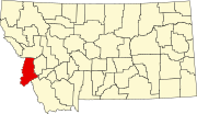
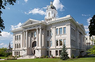
Ravalli County is a county in the southwestern part of the U.S. state of Montana. As of the 2020 census, the population was 44,174. Its county seat is Hamilton.

<span class="mw-page-title-main">Missoula County, Montana</span> County in Montana, United States

Missoula County is located in the State of Montana. As of the 2020 census, the population was 117,922, making it Montana's third-most populous county. Its county seat and largest city is Missoula. The county was founded in 1860.

<span class="mw-page-title-main">Lake County, Montana</span> County in Montana, United States

Lake County is a county located in the northwest part of the U.S. state of Montana. As of the 2020 census, the population was 31,134. Its county seat is Polson.

<span class="mw-page-title-main">Jefferson County, Montana</span> County in Montana, United States

Jefferson County is a county in Montana, United States. As of the 2020 census, the population was 12,085. Its county seat is Boulder. The county was created in 1865 and named for President Thomas Jefferson.

<span class="mw-page-title-main">Granite County, Montana</span> County in Montana, United States

Granite County is a county located in the U.S. state of Montana. As of the 2020 census, the population was 3,309. Its county seat is Philipsburg. The county was founded in 1893, and was named for a mountain which contains the Granite Mountain silver mine.

<span class="mw-page-title-main">Deer Lodge County, Montana</span> County in Montana, United States

Deer Lodge County is a county in the U.S. state of Montana. As of the 2020 census, the population was 9,421. It forms a consolidated city-county government with its county seat of Anaconda. The county was established in 1865.

<span class="mw-page-title-main">Broadwater County, Montana</span> County in Montana, United States

Broadwater County is a county in the U.S. state of Montana. As of the 2020 census, the population was 6,774. Its county seat is Townsend. The county was named for Charles Arthur Broadwater, a noted Montana railroad, real estate, and banking magnate.

<span class="mw-page-title-main">Beaverhead County, Montana</span> County in Montana, United States

Beaverhead County is the largest county by area in the U.S. state of Montana. As of the 2020 census, the population was 9,371. Its county seat is Dillon. The county was founded in 1865.

<span class="mw-page-title-main">Idaho County, Idaho</span> County in Idaho, United States

Idaho County is a county in the U.S. state of Idaho, and the largest by area in the state. As of the 2020 census, the population was 16,541. The county seat is Grangeville. Previous county seats of the area were Florence (1864–68), Washington (1868–75), and Mount Idaho (1875–1902).

<span class="mw-page-title-main">Belgrade, Montana</span> City in Montana, United States

Belgrade is a city in Gallatin County, Montana, United States. The population was 10,460 at the 2020 census. Belgrade is part of the Bozeman, MT Micropolitan Statistical Area. It is the most populous city in Montana that is not a county seat.

<span class="mw-page-title-main">Ravalli, Montana</span> Place in Montana, United States

Ravalli is an unincorporated community in Lake County, Montana, United States. The population was 76 at the 2010 census, down from 119 in 2000. For statistical purposes, the United States Census Bureau has defined Ravalli as a census-designated place (CDP). In the early 1900s, the Pablo-Allard herd in Ravalli was said to be the largest collection of the bison remaining in the U.S. and played a critical role in the conservation of bison.

<span class="mw-page-title-main">Lolo, Montana</span> CDP in Montana, United States

Lolo is a census-designated place (CDP) in Missoula County, Montana, United States. It is part of the Missoula Metropolitan Statistical Area. The population was 4,399 at the 2020 census, an increase from its population of 3,892 in 2010. It is home to Travelers' Rest State Park, a site where Lewis and Clark camped in 1805 and again in 1806.

<span class="mw-page-title-main">Darby, Montana</span> Town in Montana, United States

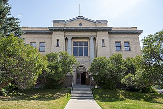
Darby is a town in Ravalli County, Montana, United States. The population was 783 at the 2020 census. Darby is located near the southwestern border of Montana and Idaho, along the Continental Divide.

<span class="mw-page-title-main">Florence, Montana</span> Census-designated place in Montana, United States

Florence is a census-designated place (CDP) in Ravalli County, Montana. County Line Rd is on the northern edge of the city limits dividing it from Missoula County, Montana. The population was 821 at the 2020 census.

<span class="mw-page-title-main">Stevensville, Montana</span> Town in Montana, United States

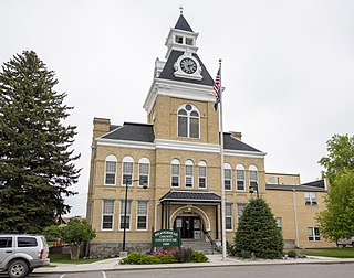
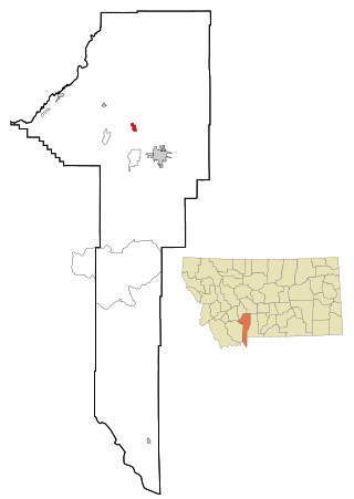
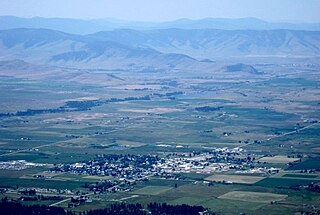
Stevensville is a town in Ravalli County, Montana, United States. The population was 2,002 at the 2020 census.

<span class="mw-page-title-main">Victor, Montana</span> Census-designated place in Montana, United States

Victor is a census-designated place (CDP) in Ravalli County, Montana, United States. The population was 745 at the 2010 census.

<span class="mw-page-title-main">Columbus, Montana</span> Town in Montana, United States

Columbus is a town in and the county seat of Stillwater County, Montana, United States. The population was 1,857 at the 2020 census.

<span class="mw-page-title-main">Arlee, Montana</span> Census-designated place in Montana, United States

Arlee is an unincorporated community and census-designated place (CDP) in Lake County, Montana, United States. The population was 636 at the 2010 census. It is named after Alee, a Salish chief. The chief's name has no "r", as the Salish alphabet has no letter "r".

<span class="mw-page-title-main">Polson, Montana</span> Town in Montana, United States

Polson is a city in Lake County, Montana, United States, on the southern shore of Flathead Lake. It is also on the Flathead Indian Reservation. The population was 5,148 at the 2020 census. It is the county seat of Lake County. In 1898 the city was named after pioneer rancher David Polson. It was incorporated in 1910.

<span class="mw-page-title-main">Ronan, Montana</span> City in Montana, United States

Ronan is a city in Lake County, Montana, United States. It is on the Flathead Indian Reservation. The population was 1,955 at the 2020 census.

References

  1. 1 2 "HAMILTON, MONTANA". City of Hamilton. City of Hamilton. Retrieved August 25, 2023.
  2. "ArcGIS REST Services Directory". United States Census Bureau. Retrieved September 5, 2022.
  3. 1 2 U.S. Geological Survey Geographic Names Information System: Hamilton, Montana
  4. "Find a County". National Association of Counties. Retrieved June 7, 2011.
  5. 1 2 "U.S. Census website". United States Census Bureau . Retrieved November 2, 2021.
  6. "Hamilton". Montana Place Names Companion. Montana Historical Society. Retrieved April 5, 2021.
  7. "Profile for Hamilton, Montana". ePodunk. Archived from the original on June 9, 2011. Retrieved May 28, 2010.
  8. "US Gazetteer files: 2010, 2000, and 1990". United States Census Bureau. February 12, 2011. Retrieved April 23, 2011.
  9. "US Gazetteer files 2010". United States Census Bureau. Archived from the original on January 25, 2012. Retrieved December 18, 2012.
  10. "NOWData - NOAA Online Weather Data". National Oceanic and Atmospheric Administration . Retrieved May 5, 2013.
  11. "Census of Population and Housing". Census.gov. Retrieved June 4, 2015.
  12. "U.S. Census website". United States Census Bureau . Retrieved December 18, 2012.
  13. "U.S. Census website". United States Census Bureau . Retrieved January 31, 2008.
  14. "Rocky Mountain Laboratories, NIAID, NIH". NIH. Archived from the original on October 3, 2012. Retrieved September 24, 2012.
  15. "Kmart".
  16. "Hamilton Kmart to close in early March". January 10, 2022.
  17. "City of Hamilton - City Council". City of Hamilton. City of Hamilton. Retrieved August 8, 2015.
  18. "home page". Ravalli County Museum & Historical Society. Retrieved August 26, 2023.
  19. "The Preservation of a Beautiful History". Daly Mansion. Retrieved August 26, 2023.
  20. "River Park & Trail". City of Hamilton. Retrieved August 26, 2023.
  21. Miller, Katie. "Hamilton Skate Park Officially a Reality". KPAX. Retrieved August 26, 2023.
  22. "home page". Montana Pool Service. Retrieved August 26, 2023.
  23. FAA Airport Form 5010 for HRF PDF . Federal Aviation Administration. Effective August 10, 2023
  24. "home page". Bitterroot Health. Retrieved August 26, 2023.
  25. Bitterroot College Program
  26. Montana University System’s Board of Regents Approve Re-branding of Montana’s Two-Year Colleges and Programs of Higher Education, As Part of the Montana University System’s College!NOW Initiative, Helena, Montana: Montana University System Office of the Commissioner of Higher Education, May 25, 2012
  27. Montana Renames Technical Colleges, Inside Higher Ed , July 13, 2012
  28. "Bitterroot Public Library". Bitterroot Public Library. Retrieved April 12, 2021.
  29. "News". Ravalli Republic. Retrieved August 26, 2023.
  30. "KBAZ Hamilton, MT". FCC. Retrieved August 26, 2023.
  31. "KHKM Hamilton, MT". FCC. Retrieved August 26, 2023.
  32. "KLYQ Hamilton, MT". FCC. Retrieved August 26, 2023.
  33. "KMZO Hamilton, MT". FCC. Retrieved August 26, 2023.
  34. "KUFN Hamilton, MT". FCC. Retrieved August 26, 2023.
  35. Yardley, William (November 20, 2014). "Willy Burgdorfer, Who Found Bacteria That Cause Lyme Disease, is Dead at 89". The New York Times.
  36. Aguilar, John (March 15, 2010). "Chapter 9: Damaged". Daily Camera . Archived from the original on November 3, 2018. Retrieved August 2, 2021.
  37. "Myers, Henry Lee". Biographical Directory of the United States Congress. Retrieved August 26, 2023.
  38. Feinberg, Scott (November 22, 2021). "Next Big Thing: Suzanna Son on Her Breakout Role Opposite Simon Rex in 'Red Rocket'". The Hollywood Reporter. Retrieved March 13, 2022.